Last updated: May 2020
Walk Map | Download walk as PDF
This highly scenic walk, which is one of my personal favourites, explores the steep valley of the Frome, one of Bristol’s main rivers. Starting in the historic village of Stapleton, the route follows the popular riverside walkway through Eastville Park, Snuff Mills and Oldbury Court Estate until it reaches the picturesque village of Frenchay, which retains a lot of rural charm. On the return journey, the route takes in some of the quieter lanes that run up and down the sides of the valley.
This is a long walk, and there are two pleasant shorter circuits that you can complete if you don’t feel like doing the whole thing:
- Short Route 1 visits historic Stapleton Village and the attractive stretch of the river through Eastville Park with its former boating lake.
- Short Route 2 is the scenic highlight of the longer route, incorporating a circuit around pretty Frenchay Village. Optional extensions are available to Frenchay Moor and Cleeve Bridge.
Useful Information
Terrain: Hilly.
Ground: Paved and unpaved. Some areas include steps and may be soft underfoot.
Key Attractions: Stapleton Village, Eastville Park, Stapleton Glen, Snuff Mills, Oldbury Court Estate, Frenchay Village
Refreshments: Food and drink available at the White Lion, at the rough half way point of the walk in Frenchay Village. The Masons Arms in Stapleton can be reached by means of a short detour towards the end of the walk. Snacks and drinks are sometimes available in kiosks at Snuff Mills and Oldbury Court.
Starting point: Bell Hill, Stapleton
Getting there: Accessible by bus routes to Yate or Fishponds / Downend running via Stapleton Village. On-street parking available in a large lay-by on Bell Hill, on approach to the church.
| Approx. Time | Approx. Distance | |
| Long route | 4 hours | 6.8 miles |
| Short route 1 | 1 hour | 1.7 miles |
| Short route 2 | 1 hour | 2.1 miles |
The Route
Walkers completing the long route or short route 1 should start at the layby on Bell Hill. Bell Hill is a main road leading from Junction 2 of the M32 up to the village of Stapleton.
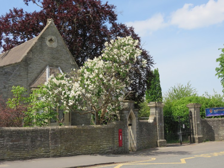
From this position, our first landmark is plainly visible. Holy Trinity Church is one of Bristol’s finest suburban churches. Its graceful spire marks the gateway to the historic Stapleton village. We will get a closer look at it later on.

Climb the hill towards the church. After passing the first couple of houses, take the narrow footpath that leads off to the left near the bus stop (1).
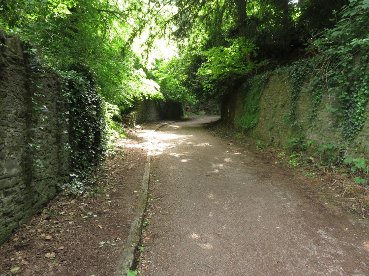
The narrow footpath leads between high stone walls through an intriguing tunnel. This initial detour is well worth it for the unusual views it affords.
At a crossroads of footpaths, take the turning to the left.
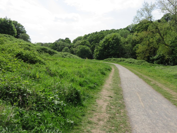
You will emerge in the wildflower meadows of Barkleys Hill. You are very close to the M32 Motorway here but, apart from the noise, you wouldn’t know it. The ridge of Purdown (see Walk Twenty-One ‘Stoke Park and Purdown’) rises beyond the trees on the far side of the meadow, along with its iconic ringed telecommunications mast that can be seen from many vantage points in Bristol. The footpath through the meadow is named Raja Rammohun Roy Walk (after the noted Indian reformer, who died in Stapleton in 1833 – you can visit his statue in Walk One ‘Introduction to Bristol’ and his tomb in Walk Eight ‘Bedminster, Totterdown and Arno’s Vale’).

Reaching the road (Barkleys Hill), bear left to rejoin Bell Hill below the layby where you started. Cross the road and walk down the hill, crossing the end of Averay Road at the traffic lights, until you are standing on Stapleton Road underneath the M32 viaduct.
You have reached your first bridge over the River Frome (2). Downstream of this point, storm waters are redirected into a drainage tunnel leading to the Avon Gorge, while a reduced River Frome runs through concrete channels and culverts, surfacing briefly in St. Paul’s (see Walk Three ‘The Eastern Arc’) before disappearing under Bristol City Centre to drain into the city docks (see Walk Two ‘The City Docks’). Upstream of here, however, the river valley retains much of its natural beauty despite bring surrounded by suburbs and villages. This is the stretch of the river that you will now be following.
Cross the bridge and turn left along the shared pedestrian/cycle path that runs alongside the river.
You are now within Eastville Park, one of Bristol’s major Victorian parks. The park has suffered significant indignities over the years in the name of progress: at one time a dramatic railway viaduct, known as the thirteen arches, crossed the Frome Valley near to this point, but it was demolished to make way for the M32 (not all traces of the old branch line have been erased, though – see Walk Eleven ‘Easton and Eastville’). Despite the changes, however, the park still makes a huge contribution to life in this part of Bristol.
The first stretch of the river as it passes through the park traces a quiet course between an embankment on the right and the Colston’s Field Allotments across the river to the left. Soon you will arrive at Eastville Park Lake.
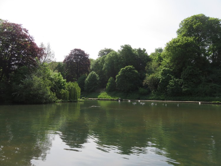
A former boating lake, Eastville Park Lake remains a tranquil beauty spot that is popular with ducks, swans, anglers and dog walkers.
Stick to the left hand side of the lake, passing the remains of the boathouse.
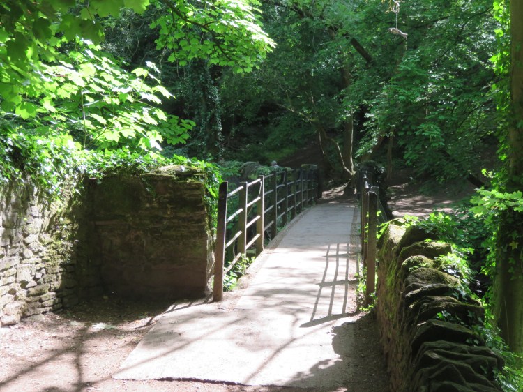
Beyond the lake, the path continues to hug the river, passing the first of several weirs you will see on this walk. Soon you will reach your next river crossing, a narrow footbridge with low railings.
Cross the footbridge and follow the river path to the right, emerging on the narrow lane of Wickham Glen.
If you are following Short Route 1, turn left at this point and then left again onto the leafy gloom of Colston Hill. Climbing gradually between high stone walls, you will eventually emerge in Stapleton on a tiny village green behind Holy Trinity Church.Continue straight on to return to Bell Hill and complete the walk.
Wickham Glen is part of a network of ancient lanes that converge on Wickham Bridge, an old stone river crossing at the heart of Stapleton Glen. Long since closed to traffic, the area now exudes rural quiet and charm.
Turn right onto Wickham Glen and cross Wickham Bridge (3). Continue straight on into Wickham Hill.
A quiet, overgrown lane lit by gas lamps, Wickham Hill maintains a timeless rural feel. Don’t miss the cluster of historic buildings at Wickham Court on the right. At the top of the lane, a row of picturesque cottages mark the junction with Blackberry Hill.

Cross Blackberry Hill and make your way back down to the bottom of the valley, reaching the Frome Bridge (4).
Frome Bridge is an important crossing point on the modern road from Stapleton to the centre of Fishponds. Cross the bridge, noting the creeper-covered charm of Frome Place on the left.
Turn right into River View.
Quaint cottages line this small road, one of which used to serve as a chapel and still has decorative windows. Watch out for traffic, though, as this is also the main access to the Snuff Mills car park. Amenities in the car park include public toilets and a refreshment stand that sells snacks, ice cream, hot drinks and soft drinks.
Continue straight on to through the car park to reach Snuff Mills park and the riverside walkway.
Snuff Mills is popular with young families and dog walkers, and is never short of visitors at the weekend. As you make your way along the path, look out for weirs and, of course, the former mill that gives the park its name.

The attractive, steep-sided Frome Valley is lined with rocky crags and trees. As you meander through the park with the river to your right, the valley opens out somewhat until you reach a pinch point leading to a footbridge.
Said to be a haunted spot, this is the Halfpenny Bridge (5). These days, it’s too busy to feel very spooky.
Cross the Halfpenny Bridge and turn left to continue following the river, which is now to your left.
You are now in Oldbury Court Estate, a large park which follows the east side of the valley. We will visit the open, recreational areas at the top of the valley later in this walk; for now, continue to follow the river.

The popular riverside walkway continues as the river meanders through the bottom of the valley. Shortly after passing a further weir, you will reach a major junction in the footpath where a smaller stream joins the Frome from the right (6). This is where we are joined by Short Route 2.
If you are following Short Route 2, start at Oldbury Court Estate car park (9), just off Oldbury Court Road, Fishponds. Take the main path that leads into the park from the Oldbury Court Road entrance. You will pass a children’s playground where there are also toilets and a small refreshment stand. At the far end of the playground, turn right and then left to descend into the valley through an arboretum area containing a number of fine specimen trees. At the bottom of the hill you will reach the River Frome (6). Turn right and follow the river path, keeping the river to your left.
Our next goal is the village of Frenchay, which sits on the side of the valley a little further upstream.
Continue following the riverside walkway with the river to your left.
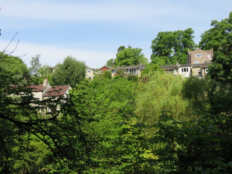
After a while, you will begin to see buildings descending the hillside on the far side of the river. The riverside walkway becomes a little more informal at this point and, as it climbs up past a particularly brisk stretch of the river, it can often get muddy underfoot.
Continue following the path, looking out for slippery rocks and boggy patches. At length, a flight of steps will bring you out at the foot of Frenchay Road next to Frenchay Bridge.
Frenchay Bridge (7) is an arched stone river crossing that is now closed to traffic. A plaque on the north side of the bridge reads “built by subscription 1788”. Keep an eye out for kingfishers and other wildlife.
Cross the river and then turn right onto Frenchay Hill.
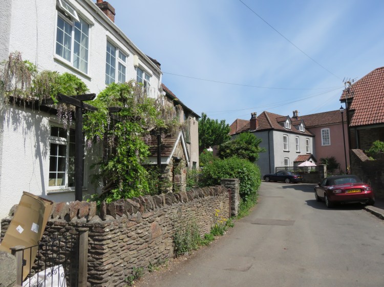
Frenchay Village is the picturesque highlight of this walk from a built environment perspective. As you climb Frenchay Hill you will have plenty of time to absorb its unspoiled village charm. Every cottage is different and there is an air of peacefulness about the place.
Frenchay route extensions
If you would like to extend your stay in Frenchay, there are two optional extensions to the route available here.
Close to the bottom of Frenchay Hill, turn right into Chapel Lane. Proceed straight on through the pedestrian gate onto a broad grassy path separated from the river by a paddock. At the far end of the paddock, either:
-
-
- Turn left through another gate onto Frenchay Moor, an area of land managed by the National Trust. Climb up towards the copse for views back towards the Frome Valley and Frenchay Village. Walk along the left hand side of the copse. About half way along, turn left and cross two fields to reach Beckspool Road close to the top of Frenchay Hill (7A); or
- Alternatively, continue along the river path through the woods. Shortly you will reach Cleeve Bridge, an imposing stone bridge that carries the road from Frenchay to Downend. Climb up to the road, head to the bridge and cross it to obtain an interesting view of the historic Cleeve Mill. Head to the left, climbing Cleeve Road, and soon you will reach the top of Frenchay Moor with an ivy-covered former dovecote opposite. Turn left along Beckspool Road; then
- At the top of Frenchay Hill (7A), bear right, continuing to follow Beckspool Road. Passing grand Georgian buildings facing out over Frenchay Common, you will soon reach Frenchay Parish Church. Turn left into the church driveway and continue straight on past the churchyard, turning right onto Church Road to rejoin the main circuit (8).
- Turn left through another gate onto Frenchay Moor, an area of land managed by the National Trust. Climb up towards the copse for views back towards the Frome Valley and Frenchay Village. Walk along the left hand side of the copse. About half way along, turn left and cross two fields to reach Beckspool Road close to the top of Frenchay Hill (7A); or
-
Walkers sticking to the main route should continue climbing Frenchay Hill.
Making your way up the hill, noting various glimpsed views between the buildings to either side, you will emerge from the built-up area next to a red telephone box that has been converted to a library of sorts.
Take the path on the left next to the former telephone box to reach Church Road.
Church Road leads you along the edge of the village, with the beautifully kept Frenchay Common to the right. Note the parish church with its large graveyard (8) (the Frenchay route extensions rejoin the main route at this point). Continue straight on until the road jinks round to the left into Westbourne Terrace.

At the end of Westbourne Terrace, turn right past the White Lion, a substantial public house on The Common.
The White Lion is the main pub for Frenchay Village. At about the half way point of this walk, it’s an inviting for a drink or a hot meal.
At the end of the road, turn left onto Pearce’s Hill.
Pearce’s Hill will lead you back down into the valley, returning you to Frenchay Bridge (7).
Cross back over bridge and take the footpath leading off to the right: not the riverside walkway, but the wider track that climbs the hill.
You have now returned to Oldbury Court Estate. As you climb back up the side of the valley through sycamore and beech trees, the woodland begins to thin out until you emerge in the open area of the estate. The house, Oldbury Court, is long gone, but the extensive grounds are popular with local people and now serve as the main park for the suburb of Fishponds.
After bridging a stream which tumbles down a gulley surrounded by trees, you will reach a fork in the path.

Take the left fork and go straight on to reach the Oldbury Court Estate car park (9). Short Route 2 finishes here.
Toilets and refreshments are available next to the children’s playground nearby if needed. Otherwise, turn left into Oldbury Court Road, leaving the park for the moment.
The remainder of this walk concerns the return journey to Stapleton, but we will be taking a different route to avoid retracing our footsteps and to explore a few more interesting lanes. To begin with, however, we must first strike out into the residential streets of Fishponds.
Oldbury Court Road is an ordinary street of red brick council houses. After a while you will pass, on the right, a more recent development of new homes on part of the site of the historic St. Matthias’ College.
Before long you will pass the remaining buildings of the college itself, previously part of the University of the West of England but most recently used as a school.
Turn right after the college into Elfin Road.
Elfin Road offers a pleasant terrace of Edwardian houses. Further buildings of the college border the road to the right.
At the end of Elfin Road, turn right into College Road, and follow it along the back of the college. Bear left, passing another turning for the new housing estate, until you reach the sharp left turn for Glaisdale Road.
You will find yourself next to a pleasant paddock that is often occupied by a horse (10). To the left hand side of the paddock you will find a footpath signed for Frome Valley / Snuff Mills.
Take the footpath, passing between the paddock and a high stone wall concealing a row of modern garages.

This quiet by-way will take you gradually back down into the Frome Valley. You will return to the bottom of the valley next to the Halfpenny Bridge (5), on the boundary between Oldbury Court Estate and Snuff Mills.
Cross the Halfpenny Bridge once again, but instead of turning left into Snuff Mills, go straight on onto a track that climbs back up the far side of the valley.
The track, partially as steps, winds its way up the side of the valley, offering views back down into Snuff Mills. On the way, you will pass a strange hole in the ground at the foot of a cliff to the right that shows signs of quarrying. On reaching the top of the valley, after following an earthen path alongside a housing estate for a short while, you will emerge on Ham Lane, close to the main estate road, Sheldrake Drive.
Turn left onto Ham Lane, which quickly becomes a rugged wooded track.
After a few moments, Ham Lane becomes a road again and you will pass an odd mix of cottages set well back to the right, with an eclectic mix of garages fronting the lane.
You are now back on the edge of Stapleton village, approaching the main road. There’s one brief extra detour to be had before we return to the main road for the time being.
As Ham Lane joins the main road, make a hard left, so that you double back into Brook Lane.
Another quiet backwater, Brook Lane leads past a few secluded houses until it terminates at the top of a footpath. Descending the footpath you will emerge back on the main road at a mini roundabout. Note the grand entrance to Stoke Park, opposite (11).
At the mini roundabout, cross the top of Broom Hill to reach Park Road, the main road into Stapleton village. After a short distance, turn left into Brinkworthy Road.
Alternative return route
I do recommend following the rest of the main route for the best perspective on the Frome Valley, but if you are tired of climbing up and down the valley side then you can complete the walk more quickly by continuing to follow Park Road instead of turning into Brinkworthy Road.
After passing a petrol station, you will begin to see an interesting mix of Georgian and other period properties. This is the heart of Stapleton village, where the properties to the left occupy a view-commanding position at the top of the Frome Valley. Although busy, the road is architecturally diverse enough to remain interesting until you have made your way back to Holy Trinity Church.
Also on Park Road, the Mason’s Arms is the local pub for Stapleton, offering drinks and food.
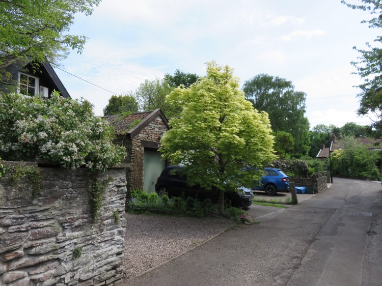
Brinkworthy Road is a pleasant, leafy cul-de-sac that descends back into the valley past stone houses.
At the end of the road, turn right into Hedgemead View and immediately left onto a paved lane that descends further into the valley.
School Lane is a pleasant way to return to the bottom of the valley. You will emerge at the bottom of Broom Hill, next to the Frome Bridge (4), which you crossed earlier.
Cross Frome Bridge once again and make your way up Blackberry Hill, climbing past Frome Terrace until you see a cycle path on the right. Take the cycle path, leaving the road behind you.
You will find yourself back in Stapleton Glen, in a pleasant meadow area that leads back towards Wickham Bridge, following the River Frome once more.
At the end of the meadow, turn right onto Wickham Hill, returning to Wickham Bridge (3). Cross the bridge and follow Wickham Glen around to the right, passing the turning for Eastville Park that you emerged from earlier. Reaching a wooded junction, turn left onto Colston Hill.
Colston Hill is a leafy lane bounded by tall stone retaining walls. Now closed to traffic, disused pavements, the remains of lamp posts and fragments of old stone structures give the place a lost in time feel.
After a climb, you will emerge back in Stapleton on a tiny village green area to the rear of Holy Trinity Church, where a few houses enjoy a pleasant sense of seclusion just a stone’s throw from the main road. Keep an eye out for gas lamps on the side turnings.
Continue straight on to reach Bell Hill.
You can now have a closer look at the graceful lines of Holy Trinity Church. On the left, you will pass the imposing gates of Colston’s Collegiate School, which lies within generous grounds overlooking the river.
Continue down Bell Hill to return to the layby and complete Walk Twenty.
Coming Up
Walk Twenty-One ‘Stoke Park and Purdown’ will take us across to the other side of the M32, where the historic landscape of Stoke Park and Purdown is rich in woodlands and hidden monuments.
