Last updated: November 2020
Walk Map | Download walk as PDF
Portishead may not have the most exciting reputation, but it is a town with a lot to offer for visitors. Situated on the Severn Estuary coast, Portishead boasts a traditional high street, the Lake Grounds (a large coastal recreation ground), an open air pool, a coast path running all the way to Clevedon, a wetland nature reserve and an enormous marina surrounded by attractive modern houses and flats.
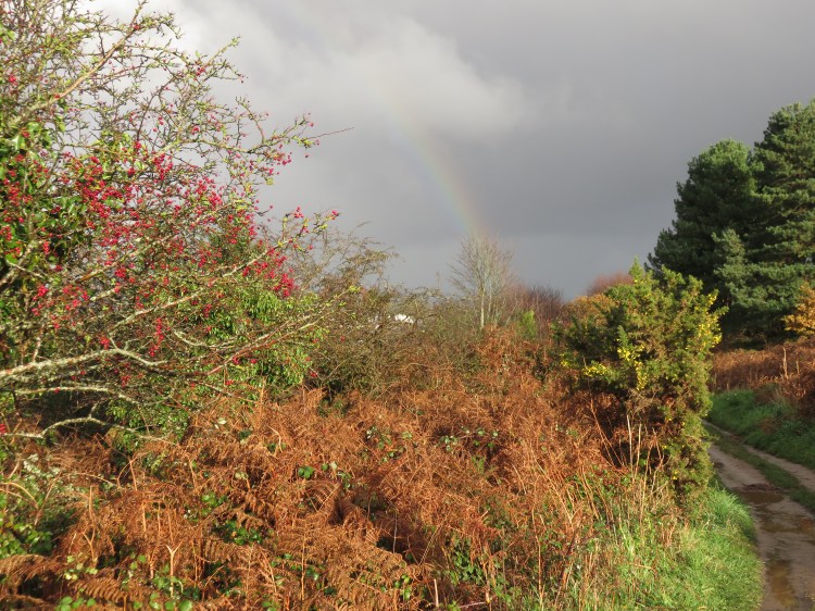
This walk follows the coast path towards Clevedon from the Lake Grounds to Redcliffe Bay, following Portishead’s attractive stony shore. It is a walk of many faces, featuring wide grassy spaces, woodland glades, stretches of rocky foreshore and also the Black Nore Point lighthouse. Great views of the Severn Estuary and south Wales can be found throughout, sometimes open and sometimes framed by trees. Unlike most of my walks this is a there-and-back-again route, rather than a circuit, but that does mean that you can do as much or as little of it as you like. There is also a shorter route available that skips the long grassy section at the beginning of the route.
Intrepid walkers can continue towards Clevedon or connect back towards Walk Twenty-Six ‘Portbury Wharf and Portishead Marina’.
Useful Information
Terrain: Undulating, including some steps and rocky stretches.
Ground: Largely unpaved. The path is uneven in places and can get muddy after wet weather.
Key Attractions: Lake Grounds, Severn Estuary, Kilkenny Fields, Portishead coast path and foreshore, Black Nore Point lighthouse.
Refreshments: Café at the lake grounds and pub near the start of the route.
Starting point: Esplanade Road, Portishead (long route); Ashdown Road, Portishead (short route).
Getting there: Both starting points offer free car parking. Nearby Nore Road is served by buses running from Bristol Bus Station.
| Approx. Time | Approx. Distance | |
| Short route | 1 hour 30 mins (round trip) | 2.3 miles (round trip) |
| Long route | 2 hours 15 mins (round trip) | 3.8 miles (round trip) |
The Route
The long route starts on Esplanade Road close to the western end of Lake Road, where you will also find the public toilets (1) (a 20p fee is payable).
Short Route
Families with young children may wish to walk a shorter route that focuses on the more adventurous parts of the walk.
Start at the top of Ashdown Road, an ordinary residential street with impressive views across the Severn Estuary. Walk down the road and continue straight on down a steep little footpath to join the main route at Sugar Loaf Beach (4).
You are on the edge of the Lake Grounds, a very popular recreation ground that offers space for sports, a children’s play area, a café and, of course, the lakes themselves, where you can sometimes find a few ducks and geese.
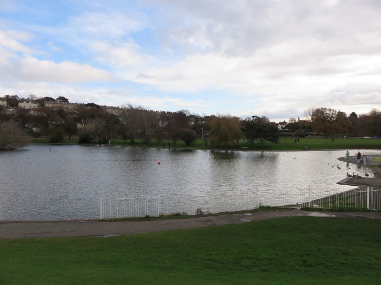
The Lakeside Café is a classic seaside type café offering basic but satisfying meals and, of course, ice cream.
Esplanade Road serves as Portishead’s seafront, although it lacks the buildings and buzz you would usually expect from a seaside town. Instead, it sits between the Lake Grounds and an area of saltmarsh bordering the Severn Estuary with its panoramic views of Wales. Battery Point, with its small black lighthouse, can be seen at the northern end, where you will also find Portishead Open Air Pool. Esplanade Road is a great place to park up and eat a sandwich while taking in the view.
Further walking available
By walking north along Esplanade Road you can reach Battery Point, from which you can connect to Walk Twenty-Six ‘Portbury Wharf and Portishead Marina’ via its Battery Point Route Extension.
Begin the main walk by heading south along Esplanade Road, going straight on to leave the Lake Grounds via the hill of Beach Road West.
At the foot of Beach Road West, a short row of houses looks directly out over the saltmarsh. They have an enviable position, but must take a battering when the wind is strong up the estuary.
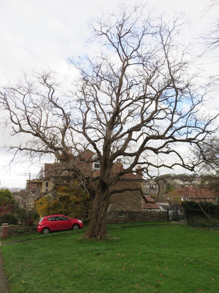
Climb Beach Road West until you reach a small green space on the left with an ancient thorny tree (2). Turn right onto a track leading to a small car park.
The car park (which can get muddy) marks the start of the Portishead Coast Path. The path begins here as a wide grassy sward sometimes known as Kilkenny Fields.
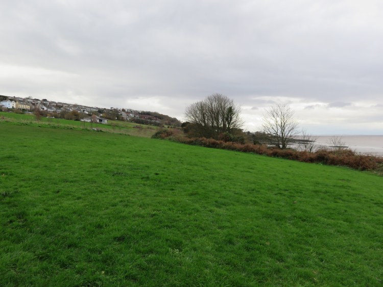
Follow the lower edge of the fields.
The elevated position here offers fine views of the estuary in both directions; the houses above Nore Road rise to the left.
A local landmark in this area is the Windmill pub, which sits about half way up the hill on the left.
The Windmill pub is the main opportunity for a drink or a sit-down meal along this route. The views of the estuary from its large picture window are unparallelled.
Follow the path through an area of scrub below the Windmill.
You will cross a wooden bridge over a narrow stream that runs briskly down through a gulley (3), next to the first of many access routes down to the stony shore that you will pass on this walk.
After crossing the bridge you will emerge into another open area, passing a stand of pine trees.

This open area used to be a golf course. The path continues alongside it for some time, passing through bracken. Views of the estuary can be had in both directions, including upstream towards the Severn bridges.
At the far end of the open area, follow the path as it winds through trees, before reaching a paved section of path next to Sugar Loaf Beach (4).
Sugar Loaf Beach is home to Portishead Yacht and Sailing Club. A variety of small boats are stored to the landward side of the path, while a long slipway provides access down the beach to the water. As the beach gets muddier, the rocks alongside the slipway become good hiding spots for mini-beasts in between the tides.

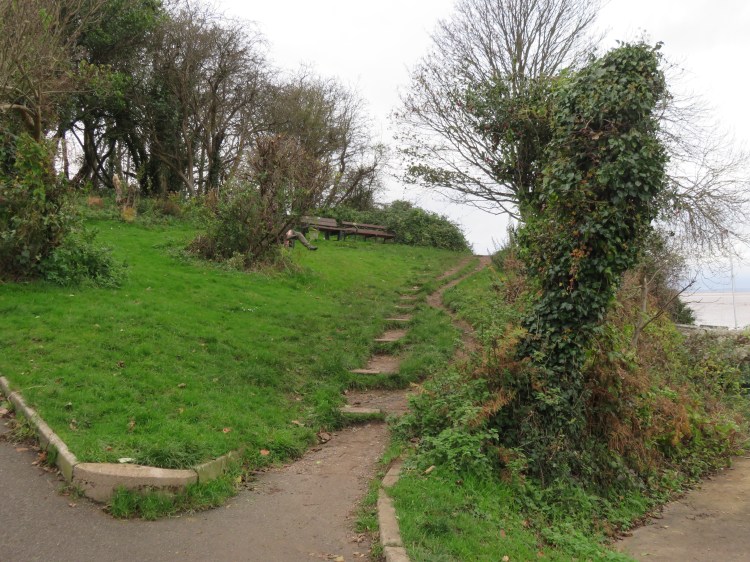
Just past the slipway, bear right up a flight of steps to continue along the coast path.
The next section of the coast path undulates through scrub and more open areas, passing the backs of houses on Riverleaze.
After a while the path splits in two (5); you can take either route. The upper route can get overgrown, while the lower route will have you picking your way over the rocks.
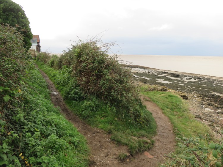
You will reach a beachfront property called Nore Park Cottage (6), which has an enviable position directly overlooking the estuary.
Climb the narrow steps up over the rocks in front of Nore Park Cottage to continue along the coast path.
Beyond the cottage, the path takes on a more elevated position and the top of a lighthouse will come into view. You will reach another fork in the path (7).
Be sure to take the right fork this time.

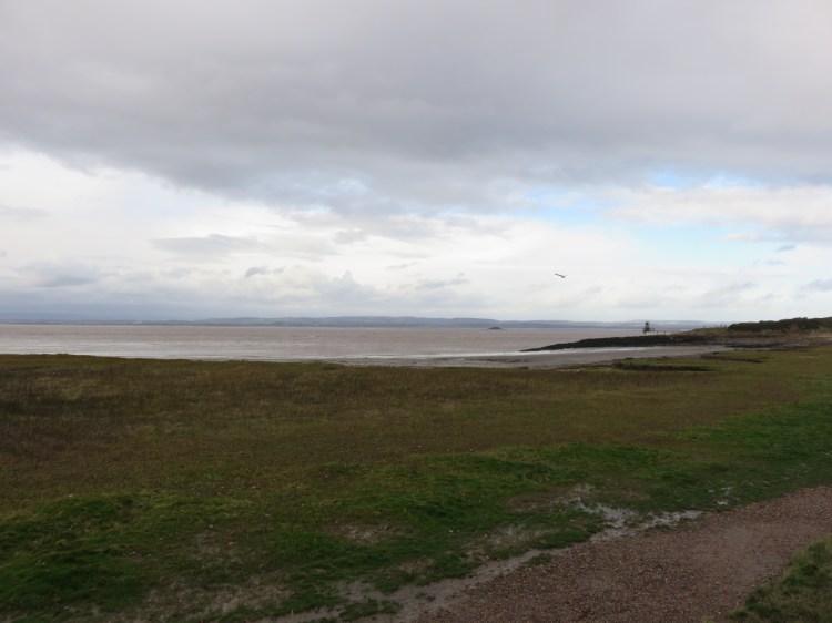
You will find yourself on a rocky area at the edge of the shore – beware the ground can be uneven underfoot. You will quickly approach the Black Nore Point lighthouse.
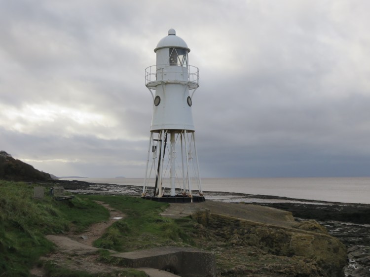
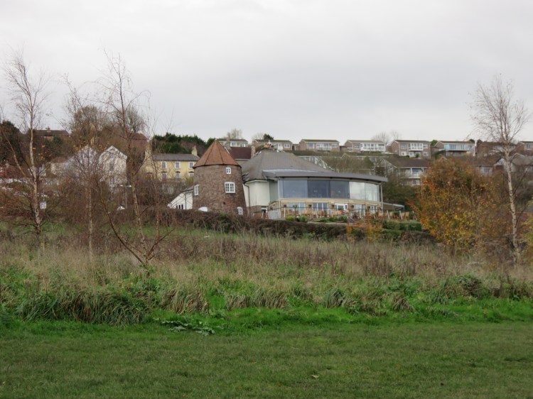
The bench here is a good place to pause for a rest and the stony shore is easily accessible. The slipway here is another good place to look for sea creatures or skim stones. If you cast your eyes inland, you will see the imposing buildings of the former National Nautical School (8), now converted to apartments.
Follow the path around the head of the stony beach and continue along the coast.
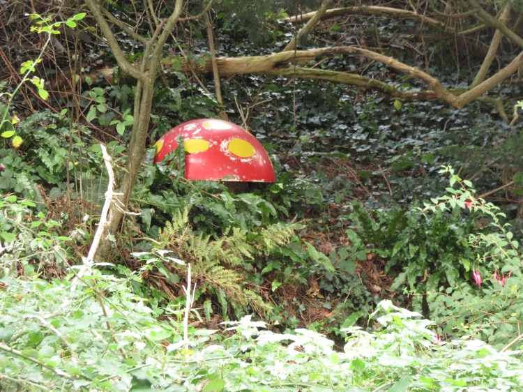
The next stretch of the coast path is undulating and wooded in character, passing the backs of houses and a fuel pipeline. You will also pass the remains of a fantasy garden that used to be full of woodland characters.
You will soon enter a lovely grove of beech trees (9).

Beyond the beech grove, a National Trust sign will announce your arrival at Redcliffe Bay. The wooded path continues past the backs of more houses.
Stick to the outermost coast path.
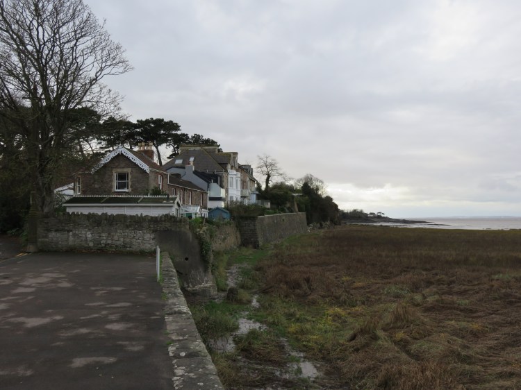
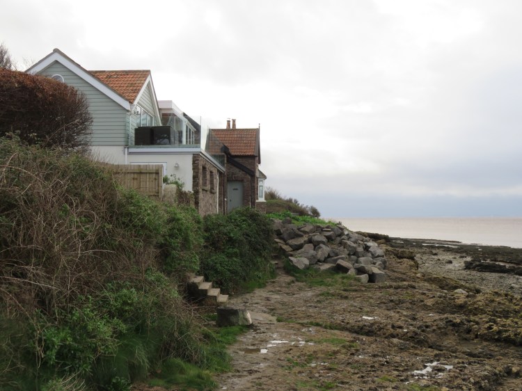
Eventually you will emerge from the scrub into a green area alongside Hillside Road, where the lucky owners of the front-line houses benefit from the views straight out over the estuary. Some have added balconies and turrets to capitalise on their location.

Follow the green area to its end point (10).
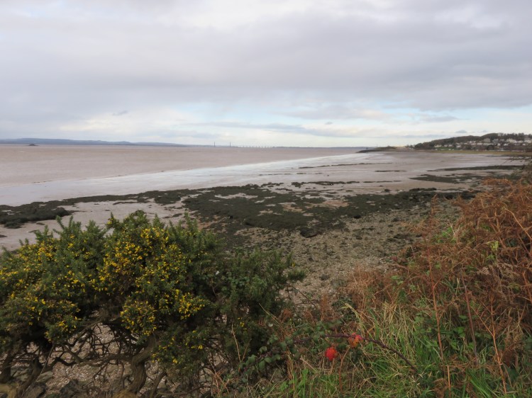
Our outbound route ends by a bench looking out over the estuary at the far end of the green space, which is an ideal spot for a rest or a sandwich. From here you can see down the Bristol Channel to the islands of Steepholm and Flatholm.

Further walking available
From the end of the green space you can pick up the coast path again, although it can get overgrown during the summer. Following the coast path you will pass a large aviation fuel storage facility and then follow open coastal land all the way to Walton-in-Gordano. You can even continue all the way to Clevedon, or stop at the secluded stony cove at Layde Bay which offers distant views of Clevedon pier.
To return to the start and complete Walk Twenty-Seven, simply retrace your steps along the coast path, not forgetting to turn off at Sugar Loaf Beach (4) if you are walking the short route.
Coming Up
In Walk Twenty-Eight ‘Chewton Keynsham’ we will go for a short stroll in the lower part of the Chew Valley that is ideal for a winter afternoon, taking in the river, pretty village buildings and a small historic part of Keynsham itself.
