Last updated: June 2020
Walk Map | Download walk as PDF
Walk Twenty-Five is all about the three major open spaces that lie just to the west of Bristol: Ashton Court Estate, historic home of the Smyth family, whose gardens, rolling parkland and mature woodland have been used by Bristol families for many years; Leigh Woods, which has provided for family forest adventures for just as long; and the majestic Avon Gorge itself, which separates genteel Clifton from this equally well-heeled part of the North Somerset countryside.
This walk does not explore these spaces in exhaustive detail; there is much more to be found through your own explorations, but this walk is an effective ‘primer’ for all three places, connecting them together in a satisfying and scenic circuit. As such, this walk is also concerned with the connections between the three spaces, and also features parts of historic Bower Ashton and the spacious and leafy residential district of Leigh Woods ‘village’.
Useful Information
Terrain: Hilly, with one major climb.
Ground: Largely unpaved. Some areas include steps and may be soft underfoot. Unfortunately there is no accessible alternative route available.
Key Attractions: Ashton Court Estate, Avon Gorge, Leigh Woods.
Refreshments: Café available at Ashton Court Estate; pub at Ashton Road.
Starting point: Ashton Court Estate, Mansion House car park, Kennel Lodge Road.
Getting there: Buses to Portishead serve nearby Bower Ashton, disembarking at the junction of Brunel Way and Clanage Road. Pay and display car parking available at the starting point. If full, Ashton Court Estate has other car parks, with the Church Lodge car park at Ashton Road being nearest.
Approx. Time: 3 hours 30 minutes
Approx. Distance: 5 miles
The Route
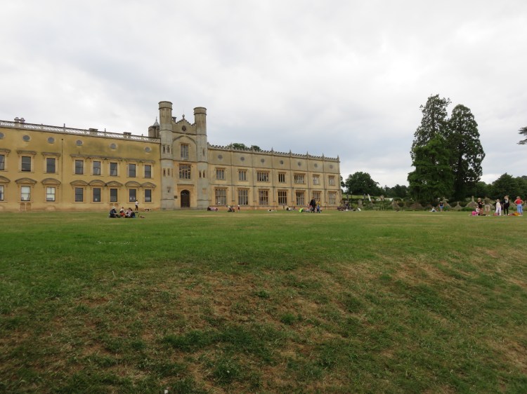
Our walk begins on the roadway just below the Mansion House car park at Ashton Court Estate. There has been a mansion at Ashton Court for centuries, and the estate was home to the Smyth family until the 1940s. Much of the estate lies within North Somerset, but it has been owned by Bristol City Council since the 1950s, who, despite it being a costly liability for many years now, maintain the estate for the benefit of Bristol’s citizens.
The mansion stands close to the car park. The Stables Courtyard is the first area you will come to and is home to a café and useful toilets.
The Courtyard Café at Ashton Court is one of two main opportunities to obtain refreshments on this walk.
Begin the walk by taking the track just below the Stables Courtyard, entering the formal gardens at the main lawn below the mansion.

Ashton Court mansion stands at a view-commanding position at the base of the Avon Gorge. The lawn area provides a lovely view south towards Dundry hill, with the parish church of St. Michael visible on the skyline.
Turn left down the pretty herbaceous border next to the lawn to reach the main garden footpath, at which point turn right (1).
The main footpath below the lawn is bounded by a Ha-Ha, or ditch, historically used to keep livestock on the estate from straying into the formal gardens.
After leaving the lawn you will descend a few steps past a second garden area containing a number of impressive redwood trees.
Take the steps on the right, half way along this area, to take a closer look (2).
Ascending to a higher level, you can get up close and personal to these remarkable trees. There is also a pond at the centre of the area containing nice plants, although not set up very well for amphibians.
Walk around this area to a point overlooking the rose garden. Descend another short flight of steps to access it (3).

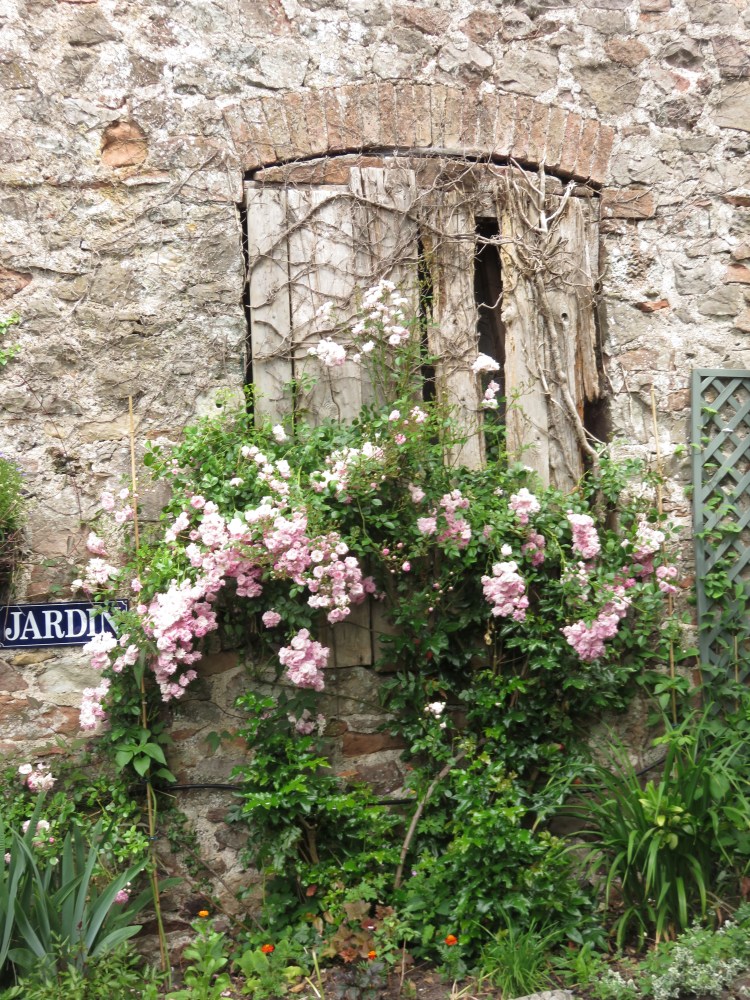
The pretty rose garden, at its best in the summer, has a distinct colour scheme in pinks and whites. Climbing roses arch invitingly over the entrances.
Follow the path around the back of the rose garden, climbing to a higher level at the far end for the best view. Return to the main path at the exit from the formal gardens (4).
You will emerge on a track at the edge of a small woodland called the Ice House Plantation.
Follow the track through the woods.
Compared to the formal gardens, the woods have a wild, untended feel. They also seem to be home to the estate’s compost heap, which is a less attractive feature. However, on the right, look out for the ice house itself, a stone arch leading to a gloomy half-subterranean chamber where things could be kept cool before the days of electric refrigeration.
When the track emerges again from the woods, bear left and follow the grass around the edge of the trees until you pass through a gate into the lower edge of the estate. Trace a course roughly straight on across the grass, keeping to the left of the narrow patch of trees and scrub ahead of you.
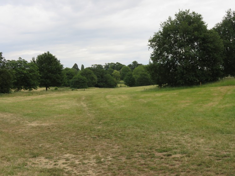
You will cross a pleasant open area, one of the quiet parts of the estate. Glimpses of the mansion can be seen on the left. At the midway point, you will pass what looks like an old sheep dip (5).
At length you will reach a recently constructed cycle path next to a band of trees.
Turn right and follow the cycle path. It will lead you to out of the estate onto Ashton Road via the Church Lodge car park entrance (6).
On Ashton Road you will find the only pub on this circuit, The Ashton. The pub has had mixed fortunes in recent years, having been a Harvester for many years and then being damaged by fire. At present the pub is running as an independent business again.
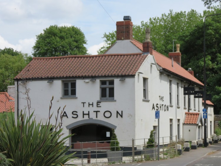
The Ashton is the second and final of the two main opportunities to get a drink or something to eat on this circuit.
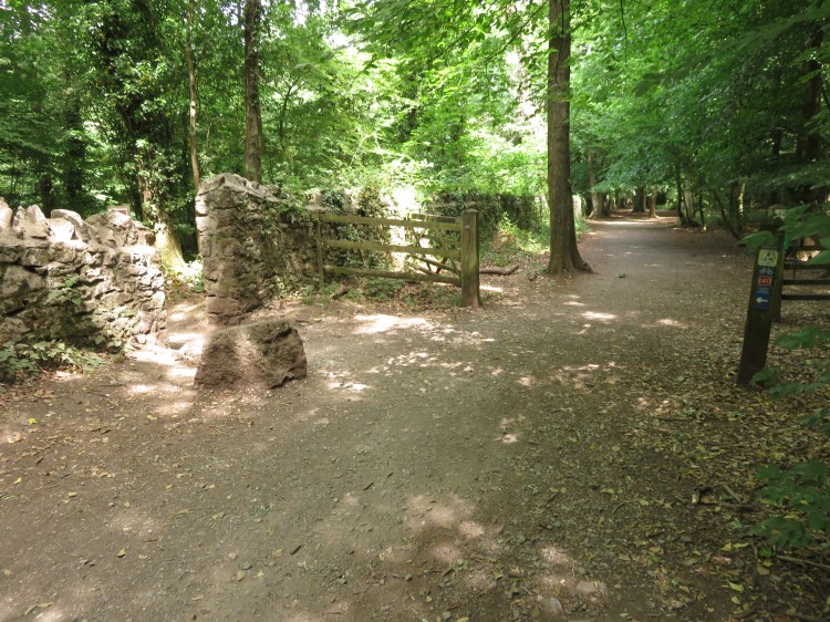
Look for an archway in the stone wall just beyond the Ashton (7). Take this public footpath.
You are on a public footpath that links Ashton Road with the quiet lanes of Bower Ashton. On the left, don’t miss the city boundary marker dated 1951. You will emerge in a flat area to the rear of the pleasant playing fields of Ashton Park School.
Follow the path alongside the playing field railings. At the far side of the field, continue along the more enclosed stretch of the footpath to emerge on Parklands Road (8). Turn right to head towards the city.
Parklands Road is part of the conservation area at Bower Ashton, a tiny hamlet on the outskirts of Bristol. A picturesque backwater lined with characterful cottages and genteel detached houses, it’s a peaceful spot with a rural feel, just yards from some of the busiest roads in the city.
When you reach a junction, bear left onto Courtlands Lane to join the main road, Clanage Road, at the junction with Kennel Lodge Road.
Clanage Road is border country, where the main A369 to Portishead makes its escape from the city.
Cross Clanage Road at the traffic lights and take the cycle path just beyond them on the right.
This is the Festival Way, a fairly recent creation that has greatly improved pedestrian and cycle access between Ashton Court Estate and central Bristol.
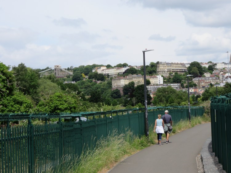
At first, the cycle path runs around the edge of The Clanage, which is the home of Bedminster Cricket Club. There are good views to be had over the Clanage to the terraces of Clifton and the Clifton Suspension Bridge (see Walk Five ‘Introduction to Clifton’ and Walk Six ‘The Clifton Hillside’).
Joining a narrow lane, turn left to continue towards the city (11).

You will soon cross an old stone railway bridge. The bridge crosses the Portishead railway line, which currently provides freight only services to Royal Portbury Dock. It is hoped that the line will reopen to passengers in the next few years. To the south side of the bridge, the remains of the old platforms of Ashton Gate railway station are still visible under the overgrowth.
Follow the cycle path round to the left.
The Festival Way continues between the White City allotments with their pleasant orchard (left) and a future redevelopment site known as the Ashton sidings (right). The area is popular with skateboarders and BMX riders, who have fashioned improvised ramps to test their skills. The terraces of Clifton draw closer.
You will arrive under the concrete viaduct of Brunel Way next to a popular pump track (12). Turn right and then left so that you skirt the perimeter of an open grassy area and approach the River Avon.
You are now in part of the landscape setting for the Cumberland Basin road system, a spaghetti of concrete bridges and ramps built in the 1960s to ease traffic flows into the city from the southwest. Laid out by the noted landscape architect Dame Sylvia Crowe, the trees and other landscaping soften the impact of the roads on the green edge of Bristol.
Make your way to the riverbank, where the Ashton Avenue bridge crosses to Spike Island. Staying on this side of the river, bear left along the waterfront cycle path.
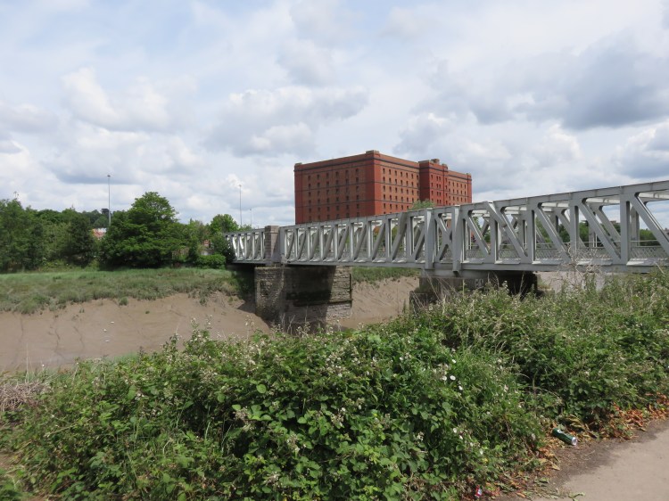
The Ashton Avenue Bridge is the immediate predecessor of the Cumberland Basin road system; originally a remarkable double decker swing bridge, it carried the main road on the upper level and the Bristol Harbour Railway on the lower level. These days the bridge is used solely by pedestrians, cyclists and local guided buses.
On the far side of the water you can see the distinctive bonded warehouses of the Cumberland Basin (see Walk Two ‘The City Docks’).
Follow the cycle path, passing under Brunel Way once again. Bear right with the river.
You are now following the Ashton to Pill Path, heading directly towards the Clifton Suspension Bridge.
After a short while you will climb to the level of another railway bridge (13) and drop down again. Continue straight on and follow the path into the Avon Gorge.
The dramatic Avon Gorge defines the western edge of Bristol, and has served over the years to prevent the suburban sprawl found in every other direction. Thanks to the Gorge and the presence of large estates such as Ashton Court and Leigh Woods beyond, it is possible to pass directly from the city centre into the North Somerset countryside.
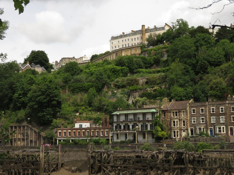
Your view across the water continues to evolve as you follow the path. At first you can see the Northern Entrance Lock for the Cumberland Basin and the Plimsoll Swing Bridge that carries the main road over it. You can also see the eclectic terraces of Hotwell Road (including the low-slung Georgian Colonnade, last surviving fragment of the Hotwells spa) and the battered and buttressed façade of the lower station of the Clifton Rocks Railway (see Walk Six ‘The Clifton Hillside’). Behind the terraced houses, below the imposing Avon Gorge Hotel, some interesting terraced gardens climb the side of the gorge.
Follow the path until you pass under the Clifton Suspension Bridge.
Below the suspension bridge the path weaves and undulates invitingly, and signs warn of the danger of falling rocks. The Portishead railway line passes through a tunnel above you; the sloping rocks next to it are a popular target for tagging.

Continue along the path and take the first proper left, where a broad footpath passes under the single arch of a stone railway viaduct (14), roughly opposite the junction of Hotwell Road, Bridge Valley Road and the Portway on the far side of the river.
The cycle route along the river can be followed all the way to the village of Pill, from which further cycle routes continue to Portishead, Shirehampton and Avonmouth. However, we are going to turn inland at this point to make our climb up through Leigh Woods to the top of the gorge.
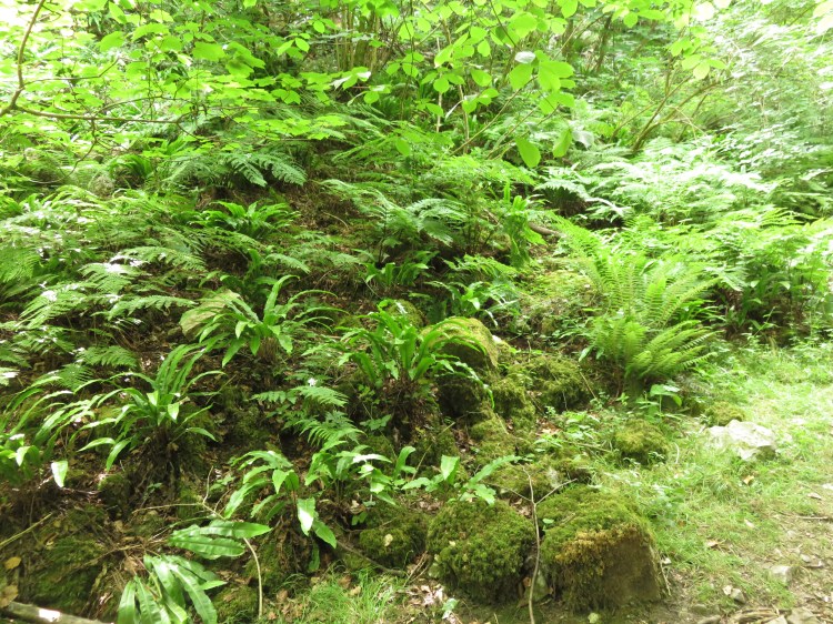
You will enter Leigh Woods through the beautiful Nightingale Valley, a steep gulley that climbs next to a cliff on the left; it is best experienced on a sunny day so that the dappled sun lights your way as you climb through the trees.
At around the mid-way point (15) there is a lovely fernery, and then the path becomes stepped for a short while.
The route up through Nightingale Valley ends at a junction of paths next to a pair of wooden gates, divided by a wooden fence, at the North Road entrance to Leigh Woods (16). This is an important waypoint on this walk that we will return to later.
Leigh Woods route extension
Optionally, you can take a detour at this point to see some more of Leigh Woods and a unique view of the Clifton Suspension Bridge.
To take the detour, take the path on the right before you go out through the North Road gates. Reaching an open grassy area, keep to the right hand side so that you walk roughly parallel to Nightingale Valley.
You will soon reach the remaining earthworks of an Iron Age hill fort, nestled among the trees.
Keeping the hill fort to your left, you will soon reach a view point which offers one of the best views of the Clifton Suspension Bridge and the Clifton Observatory.
When you’re done, return via the same route to the North Road gates (16).
To continue along the main walk you will be following a cycle route through the woods. Unfortunately it is on the other side of the wooden fence.
Leave Leigh Woods via the first wooden gate onto North Road, then immediately re-enter it via the second gate so that you are on the cycle path.
You will now be following the blue route through Leigh Woods, which is marked by a mix of wooden way markers and more standard cycle path signs.
Follow the blue route as it climbs up to the left. Watch out for mountain bikers using the nearby trails. You will soon emerge at the end of Valley Road next to a picnic area (17).
Leigh Woods is jointly managed by the National Trust and the Forestry Commission. This area is the National Trust hub on the site and includes a picnic area and a composting toilet.
Take the track to the left of the picnic area, still following the cycle route.
After a short while the path runs alongside a straight stone wall on the parish boundary between Abbots Leigh and Long Ashton.
Turn left at a gap in the wall next to a wooden gate (18), which is signed as a link to National Cycle Route 41.
The next section of the cycle path charts a fairly direct route through a light and airy section of Leigh Woods containing beech and sweet chestnut trees. After a while, a bright meadow converges from the left, letting more light in between the trees. Watch out for mountain bikers again as you go.
Stay on the main path, passing the meadow, until you emerge on the main paved driveway to the Leigh Woods car park (19).
The main driveway is notable for its dramatic avenue of copper beech trees.
There is a great deal more to explore in Leigh Woods, but you will have to discover it in your own time. On another visit, you may like to try one of the waymarked trails from the main car park; try following the rest of cycle route as it heads back down to the bottom of the Avon Gorge at the far end of Leigh Woods; or stay inland to discover the pleasant valley known as Paradise Bottom. For this walk, however, it is time to start heading back towards civilisation.
Turn left along the path next to the main driveway, heading away from the woods. At about the half way point, next to a smart new house, turn left through a field gate, following a public footpath (20).
You have entered the bright meadow that you saw as you were walking through the woods earlier. During the summer it is rich with varied grasses and other wildflowers.
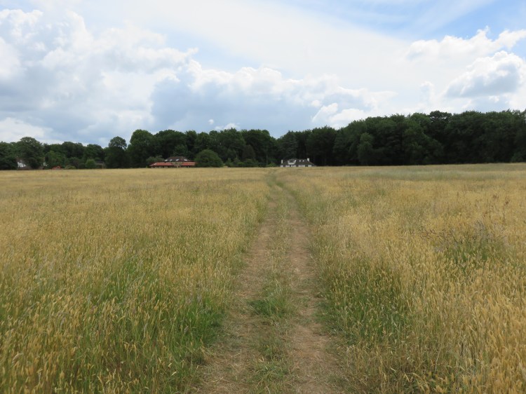
Follow the path diagonally across the field to the right, making for a white rendered house at the far side. Exit the field via a stile (21). Go straight on along the lane beyond to come out on Abbots Leigh Road.
Abbots Leigh Road is the main A369 from Bristol to Portishead, serving the villages of Abbots Leigh, Pill and Easton-in-Gordano.
Turn left along Abbots Leigh Road, then take the second left, North Road.
Before returning to Ashton Court Estate, we are going to take a brief detour through the ‘village’ of Leigh Woods, which is really more like an outpost of Clifton across the Avon Gorge. The area is one of the leafiest neighbourhoods around, and includes a number of substantial detached houses.
You will recall North Road from the gate that we passed earlier. It is a popular place for people visiting this part of Leigh Woods to park.
Follow North Road as it winds past the edge of the woods.
Soon, at the bottom of a dip, you will pass the North Road gates to Leigh Woods that you used earlier (16).
After you have climbed out of the dip, you will pass the turning for Church Road and will then reach a flatter stretch lined with a row of attractive, tall pine trees.
At the corner of North Road and Vicarage Road, Pulham House (22) is a grand property that used to be the home of the University of Bristol’s botanic garden (the gardens have since moved to Stoke Bishop – see Walk Twenty-Four ‘Stoke Bishop and Sneyd Park’). The house is a private property now, but parts of an ornate rock garden can still be seen just inside the entrance.
Turn right into Vicarage Road and follow it to its junction with Church Road.
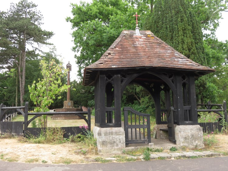
You will pass the church of St. Mary the Virgin (23). The church is set back from the Vicarage Road and hidden among the trees, but its traditional lychgate dominates the junction.
Continue down Church Road to emerge on Bridge Road. Turn right to approach the junction with Abbots Leigh Road and Rownham Hill.
Bridge Road is the connection between the main A369 and the Clifton Suspension Bridge.
Reaching the traffic lights, cross Bridge Road and Rownham Hill to approach the Clifton Lodge of Ashton Court Estate, which is in front of you. Step through the archway to re-enter Ashton Court Estate.
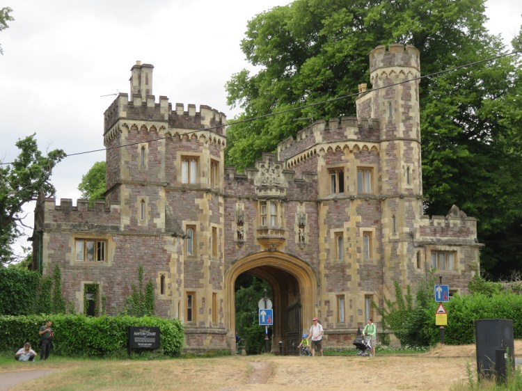
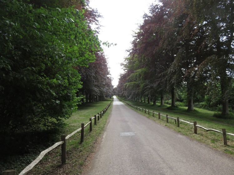
You will find yourself at the end of a long avenue of lime trees.
Follow the driveway through the avenue of lime trees until you reach a junction with the access road to the Clifton Lodge car park on the right. Turn left instead, passing a narrow band of woodland, and step through a gate on the left (25) to enter the Red Deer Park.
There is more to discover in Ashton Court Estate, including other deer parks, several pleasant woodlands, a golf course, some extremely popular mountain bike trails and even a miniature railway, but you will have to find them in your own time. For now, we are going to head fairly directly back to the Mansion House car park.
Follow the main track down through the deer park. Look out for deer, although you will probably only see them from a distance.
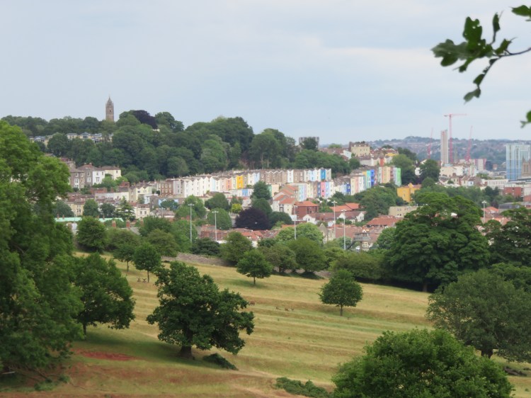
As you descend through the deer park, a panorama of south Bristol will emerge, centred on Ashton Gate Stadium. After a while, you will also be able to see the colourful terraces of Clifton Wood and Cabot Tower on Brandon Hill.
Exiting the deer park via a second gate (26), follow the last stretch of path down the hill and then bear right to return to the Mansion House car park and complete Walk Twenty-Five.
Coming Up
In Walk Twenty-Six ‘Portbury Wharf and Portishead Marina’ I will be making the first of a few forays beyond Bristol in search of other places that combine the urban and the wild. Combining the wetland nature reserve of Portbury Wharf with the slick modern development around Portishead Marina, the walk will reveal a place of tremendous contrasts.
