Last updated: July 2020
Walk Map | Download walk as PDF
Wartime bombing and post-war road planning didn’t do many favours for the eastern parts of Bristol City Centre, which you may have observed when attempting the second half of Walk Two ‘The City Docks’. However, there remain some interesting survivors amidst the concrete jungle, and this in combination with a great deal of regeneration in recent years has meant that there are interesting walking routes to be found.
This walk, while not covering a huge area, is an exceptionally wiggly route in places, designed to take in as many of the interesting features as possible. The walk actively challenges the barrier created by Bond Street South and Temple Way – for many Bristolians, a wall that they simply never breach – crossing it in several locations to reveal some of the historic places and routes that lie behind it.
Some of the areas you are about to visit are on the edgy side. Whilst you’re most unlikely to come to any harm, if in doubt take someone with you.
Useful Information
Terrain: Largely flat, some gentle climbs.
Ground: Paved.
Key Attractions: The Centre Promenade, Colston Hall, Hippodrome, Floating Harbour, Queen Square, St. Mary Redcliffe church, Bristol Temple Meads station, Temple Gardens, Old Market, Cabot Circus shops, Broadmead shops.
Refreshments: Pubs available at various points en route. Food available at some of these pubs and also a wide range of food options in the Broadmead and Cabot Circus area.
Starting point: Centre Promenade
Getting there: Widely accessibly on foot or by bus. 20 minutes’ walk from Temple Meads Station. Multi-storey car parks at Berkeley Place, Trenchard Street, Harbourside, Prince Street, Queen Charlotte Street, Nelson Street and Rupert Street.
Approx. Time: 2 hours 30 minutes
Approx. Distance: 4.5 miles
The Route
Like all of the walks in this section, this one starts amidst the hustle and bustle of the Centre Promenade, overlooking the Floating Harbour. See Walk One ‘Introduction to Bristol’ for more information about this important central space.
Exit the Centre Promenade to the southeast, via Broad Quay, reaching a junction. Cross the road to reach Thunderbolt Square (1).
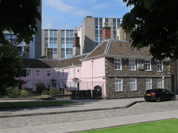
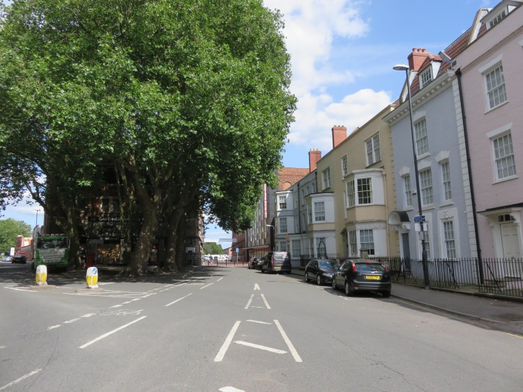
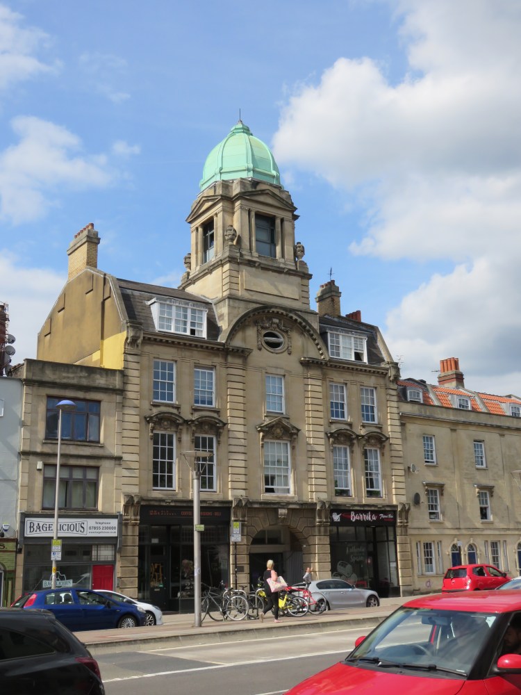
Thunderbolt Square is a landscaped area that replaced a roundabout left over from the days when a dual carriageway ran diagonally through Queen Square. From this location you can clearly see the gap left in the corner of Queen Square by the demolitions for the dual carriageway (since removed) back in the 1930s. Also don’t miss the Merchants’ Almshouses at the end of King Street, a quaint historic survivor in post-war surroundings.
Walk through Thunderbolt Square to reach Queen Square.
Queen Square, a fine Georgian residential layout now used primarily for offices, is home to the fine equestrian statue of King William III by Rysbrach.
Cross Queen Square diagonally to reach Bell Avenue (2).
The pub on the right is the ‘Hole in the Wall’, said to have provided inspiration for the fictitious Spyglass Tavern in Robert Louis Stevenson’s ‘Treasure Island’.
The Hole in the Wall is a good place to start or finish your walk with a drink.
Cross the end of The Grove and walk along the right hand side of Redcliffe Bascule Bridge.
Redcliffe Bascule Bridge was built in the late 1930s as part of the dual carriageway project. It carries the end of Redcliffe Way, a leftover from that period. The bridge is designed to lift open, but is seldom seen to do so these days.
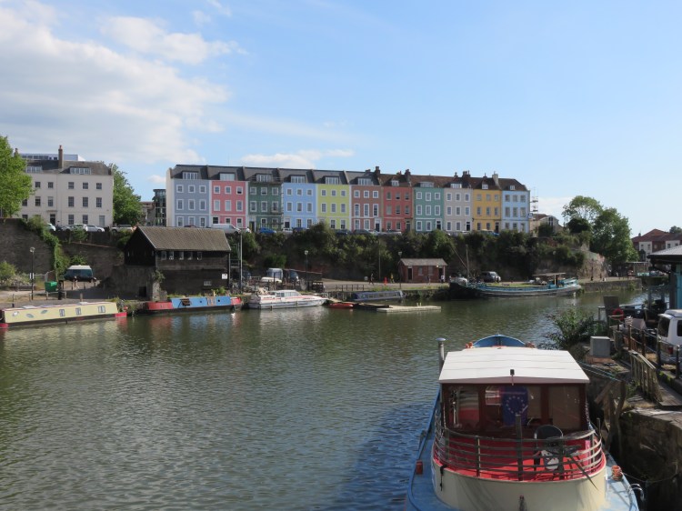
As you cross the Floating Harbour, you will have a fine view of the Georgian terrace of Redcliffe Parade, the church spire of St. Mary Redcliffe and the historic warehouses on Redcliff Backs.
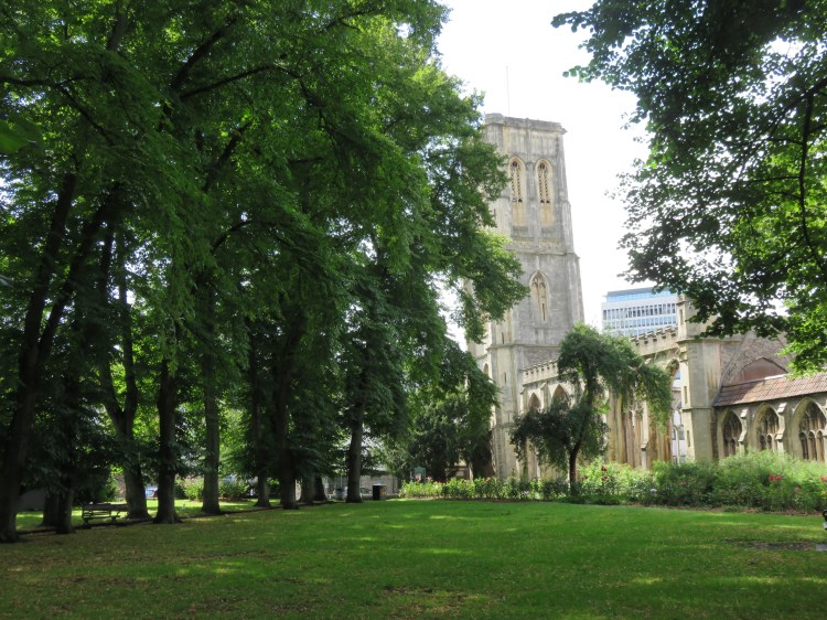
You will approach a roundabout in front of St. Mary Redcliffe church. Bear right towards the church.
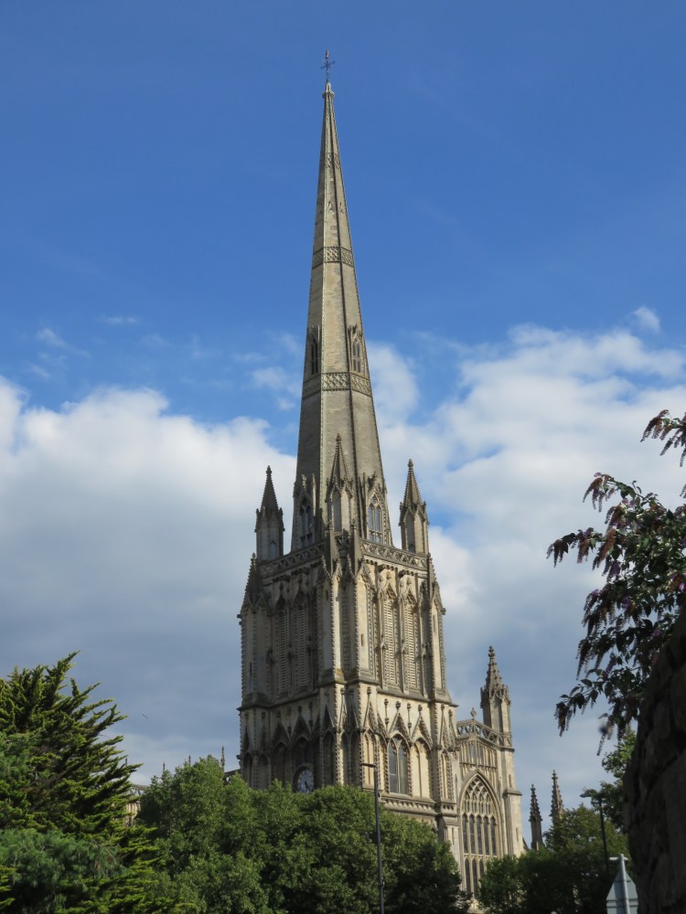
The beautiful St. Mary Redcliffe church has an exceptionally fine spire, which until very recently was still the tallest building in Bristol. Visitors to Bristol sometimes mistakenly assume that St. Mary Redcliffe is actually the cathedral.
The green space on the right as you pass the roundabout is the Friends’ Burial Ground (3), which has Quaker associations. At the rear of the space is a small cave that was once a hermitage. This small opening is an offshoot of a much larger network of caves that runs under this area (see Walk Two ‘The City Docks’). The Redcliffe area takes its name from the red sandstone that you can see in this and other places nearby.
Cross the bottom of Redcliff Hill at the zebra crossings. Bear right and climb the stone steps to reach the upper pavement next to St. Mary Redcliffe churchyard (or take the lower pavement if you prefer). Continue to the next corner and then turn left into Colston Parade (4).
Much of south Redcliffe, a Georgian residential area, was lost to post-war development with the construction of tall blocks of flats. Colston Parade is a rare survivor, protecting the historic feel and tranquil character of St. Mary Redcliffe churchyard.
About half way along on the right you will find Fry’s House of Mercy, the second of the many almshouses that you will pass on this walk.

Opposite, in the churchyard, don’t miss the fragment of tramline that protrudes from the grass. The tramline was thrown to this position during the Bristol Blitz when a high explosive bomb hit Redcliff Hill, and has remained here ever since as a reminder of how close the historic church came to destruction.
At the far end of Colston Parade, turn left through the gates to explore the churchyard. If the gates are shut or you wish to avoid the steps at the other end, go down cobbled Pump Lane instead to rejoin the main route at Redcliffe Way (5).
The Ship, at the corner of Colston Parade, Pump Lane and Ship Lane, is an historic pub that is popular with residents of the nearby council flats.
The churchyard is a peaceful spot despite its close proximity to the dual carriageway of Redcliff Hill. A lovely avenue of trees runs through the middle, which is lined with daffodils in the spring. You can also visit the church itself if it is open, via the south porch which opens out onto the churchyard.
Leave the churchyard via the gate at the far corner and descend the steps to return to Redcliff Hill. Turn right along Redcliffe Way, passing the front of the church, until you reach the bottom of Pump Lane (5).
Stone walls at the bottom of Pump Lane enclose an area of raised ground that is now a hotel car park. This was once a rail yard, part of the Bristol Harbour Railway, which ran along a viaduct from Temple Meads Station before disappearing into a tunnel that runs under St. Mary Redcliffe churchyard. The tunnel is still there, and the western end of it can be seen from Lower Guinea Street on Walk Two ‘The City Docks’.
The odd little building on the far side of Redcliffe Way is a combination of two historic structures. The house at the back was the birthplace of the boy poet Thomas Chatterton. The more distinguished façade at the front is all that remains of his school house, moved back to its present location when historic Pile Street was widened to form Redcliffe Way.
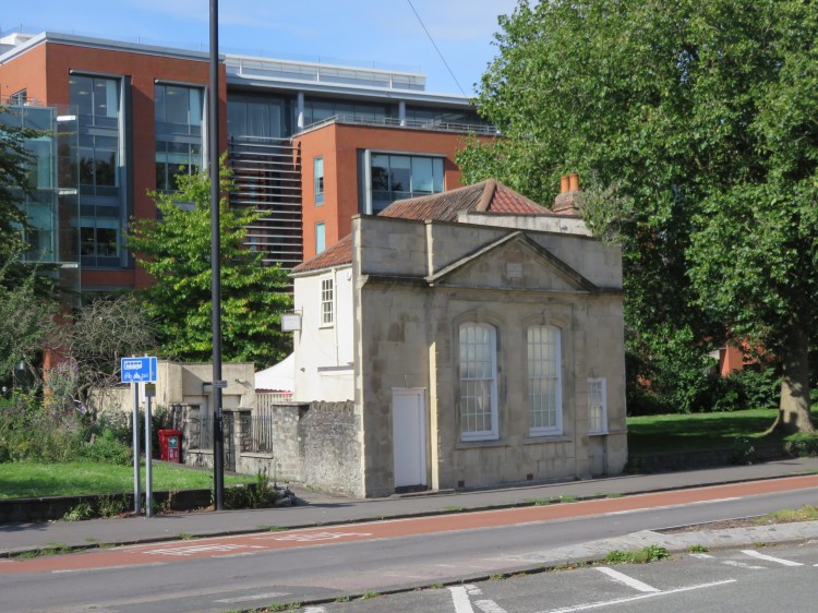
Thomas Chatterton’s house is now in use as Chatterton’s Café.
Cross Redcliffe Way and take the footpath through the green space around Chatterton’s house. Exit at the back onto the Brunel Mile, cycle path, which runs along Portwall Lane, then turn right.
The Brunel Mile is a shared pedestrian and cycle path that connects Bristol Temple Meads station with Harbourside and with the Centre Promenade via Queen Square. Paved in a distinctive mix of stone, it gives a feeling of ‘following the yellow brick road’.
Portwall Lane is named after the Portwall, a part of the city’s historic fortifications that once ran along this route. A mix of modern and historic buildings line the north side. The south side is largely vacant land, but this may all change if proposals to downgrade Redcliffe Way and redevelop the area around St. Mary Redcliffe go ahead.
Keep following the Brunel Mile as it crosses an open area in front of 100 Temple Street (a council office) and continues as Portwall Lane East, running between two derelict hotels.
The derelict buildings to either side of Portwall Lane East are set to be redeveloped in the near future. The gap between the buildings was once home to another part of the railway viaduct that connected the Bristol Harbour Railway with Bristol Temple Meads station, a fragment of which survived here until quite recently.
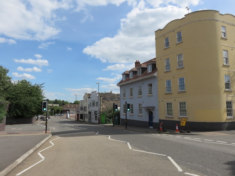
At the end of Portwall Lane East, use the traffic lights to cross the main road (6), which in its new layout (following the removal of a major roundabout) may be called Temple Gate or possibly Temple Way – it’s not currently clear. Turn right along Temple Gate.
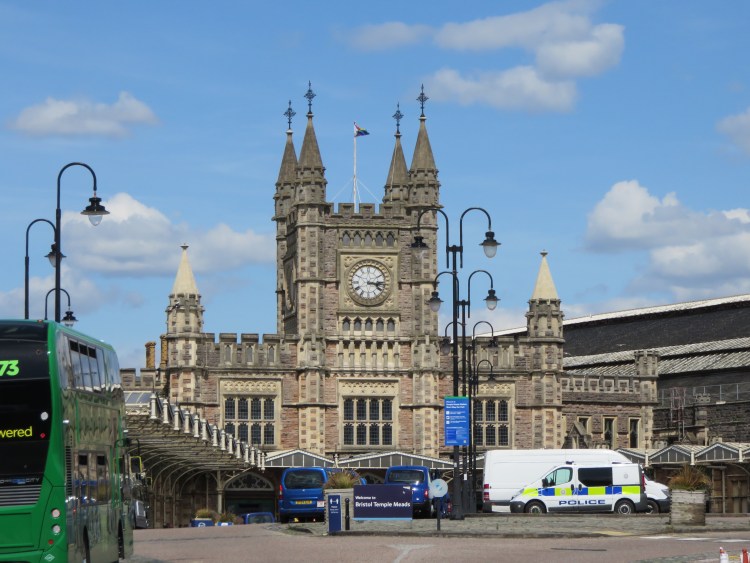
You will quickly arrive at the famous Temple Meads Station. Temple Meads is an exceptionally fine Victorian station complex in an area of the city centre that is otherwise dominated by cars and modern office blocks. The building to the left as you face the main entrance, Brunel’s Passenger Shed, is the oldest, being the original passenger terminus for the Great Western Railway, prior to the construction of the present curved station building in front of you. Separate to the main complex, on the Lower Station Approach to the right, you will find the very fine Bristol & Exeter House, historic headquarters of the Bristol and Exeter Railway.
Climb the Station Approach. Enter the ticket hall and then bear left, following signs to exit the station complex on Friary, a road at the edge of the Temple Quay office development. Continue straight on along Isambard Walk (7).
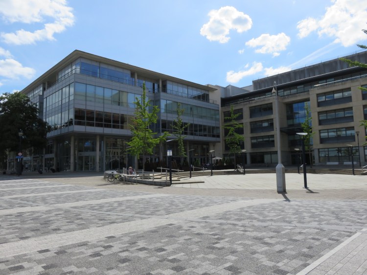
Isambard Walk, which is home to a few shops, leads to the heart of the Temple Quay development, The Square, where you will be surrounded by interesting modern buildings. Temple Quay was developed in the 1990s and is home to a number of financial institutions and Government services. Developed with corporate interests firmly in mind, the space is sterile, but at least it’s tidy.
The Knights Templar in The Square provides another opportunity to pause for a drink and is also a good choice for a cheap and cheerful meal.
Bear left along Temple Back East. At the next junction take a brief detour onto Rivergate.
Like Portwall Lane earlier, Rivergate follows the line of the Portwall. The first seating unit contains a glass inspection window, through which you can look down on some of the Portwall stonework preserved below (8).
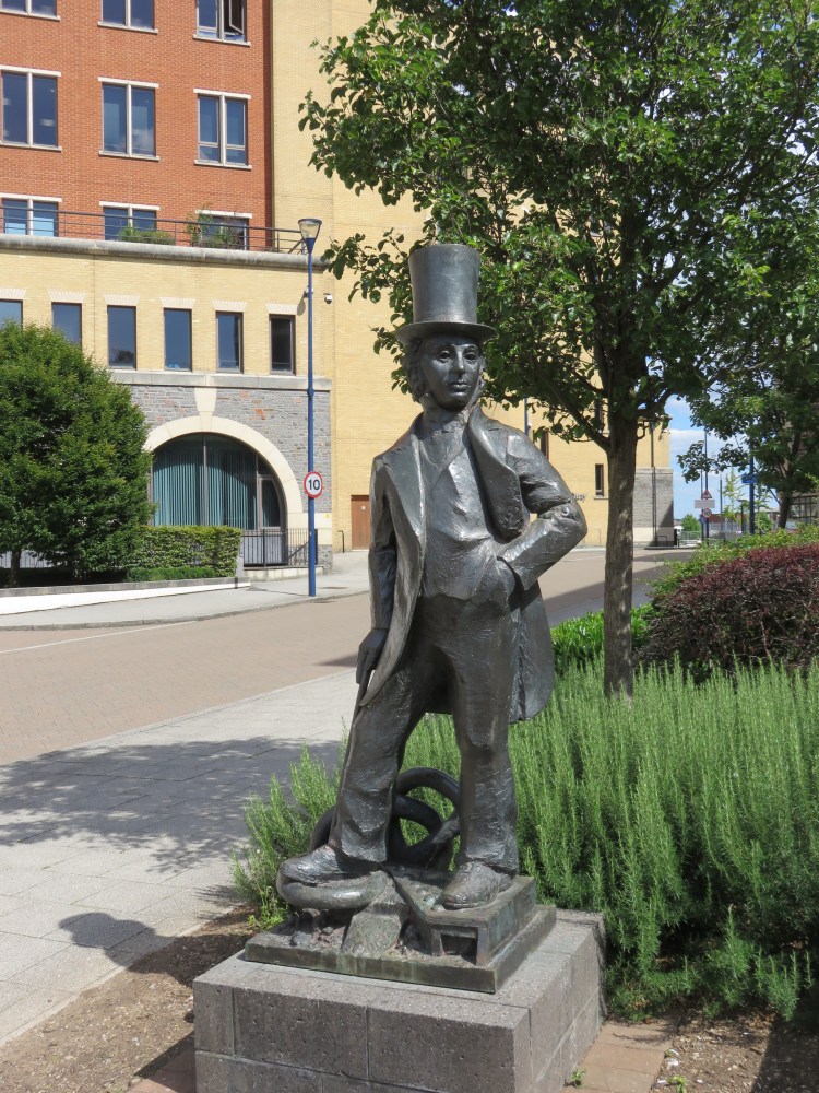
Return to Temple Back East and turn left. Passing an interesting but slightly amateurish statue of Isambard Kingdom Brunel, cross the main road, Temple Way. Head for Tower Street, which is a short distance down Temple Way to the left. Turn right onto Tower Street.
A few short steps along what’s left of Tower Street will reveal the reason for this brief detour back into central Redcliffe: ahead of you lie the secluded and leafy Temple Gardens, containing the ruins of the blitzed Temple Church.
Turn right onto Temple Rose Street and then left through the gate to enter Temple Gardens. Follow the path that runs around the perimeter of the space to the right.
The tree-lined gardens form a peaceful oasis in the heart of a busy commercial area, and include a fine avenue of lime trees and pleasant rose borders. Notice the pronounced lean to the ruined church’s tower (9): after the Blitz, well-meaning soldiers prepared to pull the apparently damaged tower down, until local residents hastened to tell them that it had stood that way for hundreds of years!
Leave Temple Gardens via the gate at the end of the avenue of lime trees, exiting to Victoria Street via the end of cobbled Church Lane. Turn right onto Victoria Street.
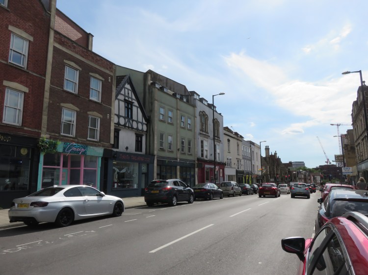
Victoria Street is the main road through Redcliffe. Victoria Street was superimposed over Redcliffe’s Mediaeval street pattern in the 19th Century to provide a link between the city centre and Temple Meads Station. A small group of timber-framed and Georgian buildings on the old alignment of Temple Street have managed to survive both the Blitz and post-war redevelopment, while a fine group of Victorian buildings survives on the east side of the street on the approach to Bath Street. When you get to the end of Bristol Bridge, Victoria Street frames a fine view of St. Nicholas’ Church.
There are a number of historic pubs in this part of Redcliffe, some of them hidden.On Victoria Street you will find the King’s Head and the Shakespeare. On Temple Street, the Cornubia lies tucked away on a forgotten street line, while the Seven Stars is hidden behind St. Thomas’ Church on Thomas Lane.
Continue up Victoria Street towards Bristol Bridge, then take a right into Bath Street.
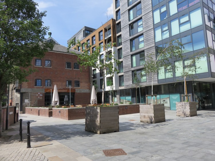
Bath Street is a short street containing a row of attractive Georgian houses, leading into the modern development known as Finzel’s Reach, built on the site of a former brewery.
There are a number of places to eat and drink in Finzel’s Reach, most prominently the Bocabar at the end of Bath Street. There is also sometimes a street food market.
The heart of Finzel’s Reach is the paved area at the junction of Bath Street, Old Temple Street (10), East Tucker Street, Grimes’ Lane and Hawkins’ Lane, the latter of which also provides access to Castle Park via the new Castle Bridge (see Walk Two ‘The City Docks’).
Continue straight on along East Tucker Street, following the street around a corner until you emerge on Counterslip.
As you emerge on Counterslip, note the former tramway generating station on the left, a fine Victorian building.
Turn left and cross the Floating Harbour via St. Philip’s Bridge, arriving on Passage Street.
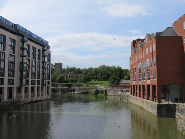
Passage Street is home to a pleasant row of two-storey shops, beyond which you enter an area with very few older buildings remaining.
Continuing straight on into Narrow Plain you will find St. Philip and St. Jacob, also known as Pip’n’Jay church, which is one of the few historic buildings surviving in this area, and whose leafy grounds provide a welcome contrast to the concrete and glass surroundings. In the middle distance you can see another row of historic buildings, but the busy Temple Way Underpass blocks the way.
Turn into Church Lane, the footpath that runs between Pip’n’Jay Church and Temple Way (11). Descend the ramp to enter a pedestrian subway that will take you to the far side of Temple Way. If you don’t like the look of the subway, alternative surface-level crossings are available at the nearby Old Market Roundabout.
Emerging from the subway, turn right to reach Broad Plain (12).
Broad Plain retains a collection of attractive historic buildings positioned incongruously on the edge of Temple Way. Looking back the way you came, you can see how Broad Plain and Narrow Plain were once part of a single street.
At the wide end of triangular Broad Plain is the Gardiner Haskins home centre, which occupies an old factory building.
Take Straight Street, which runs just to the right of the Gardiner Haskins building.
Pedestrianised Straight Street offers a closer look at the historic buildings that comprise Gardiner Haskins.
Turn right onto New Thomas Street past Gardiner Haskins car park (13), following it round into Russ Street.
As you approach the corner leading into Russ Street you can see the brick pinnacles of an old Victorian soapworks a little ahead and to the right. This local landmark was, until recently, also occupied by Gardiner Haskins, but is now set to be redeveloped.
At the end of Russ Street, turn left onto New Kingsley Road and then immediately right into a paved lane running between Hannah More School and the modern flats of Kingsley House (14). You will emerge amidst new build flats at the end of Sweetman Place.

Sweetman Place is part of a development of modern flats known as ‘The Zone’, which has been built on the edge of an older residential community known as The Dings. The streets are laid out to shared space principles and are landscaped with planting and public art.
Go straight on into Barleyfields. At the end of the street, turn left into Chimney Steps.
Chimney Steps lies at the heart of the new residential development. There are actually no steps to be found in this new street, whose name alludes to the industrial heritage of the area. The street lies on an incomplete cycle route that connects Bristol Temple Meads station with the Bristol and Bath Railway Path at Lawrence Hill. The Dings cycle path, ahead of you, is part of this link.
Turn left onto Barton Road.
Barton Road is the threshold between The Zone and the older housing of the Dings. The sculpture at the end of the cycle path references this identity.
Barton Road is home to an historic pub, the Barley Mow. Opposite the Barley Mow is a real oddity: a Jewish burial ground, complete with Hebrew writing on the headstones.

The Barley Mow is a pleasant local watering-hole that also does food.
After the Jewish burial ground, you will pass the pleasant playground and field at the rear of Hannah More primary school. The school is lucky to have such a large green space this close to the city centre.
Just after the school fields, turn left onto a short cycle path and then right into Louisa Street (16).
Originally home to terraced houses, Louisa Street has little left of its historic character apart from its cobbles.
At the end of the street, turn left onto Midland Road.
There’s not a lot to see on Midland Road, the main road through the St. Philip’s area. The road takes its name from the Midland Railway, which used to have a terminus here (the dismantled line now forms part of the Bristol to Bath Railway Path). These days it is an area in transition, with a mix of poor quality industrial buildings, more sensitively designed new-build homes and cleared sites awaiting redevelopment.
Turn right at the top of the hill, after the last of the industrial buildings, onto Waterloo Road.
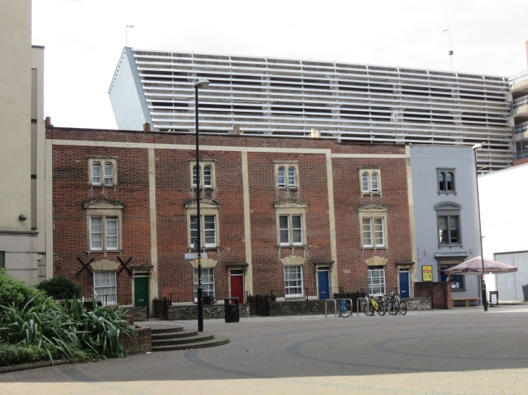
Waterloo Road has been subject to intensive residential development in recent years, making the most of its view-commanding position overlooking St. Philip’s Marsh and the steep terraces of Totterdown in the distance. If you can see over the stone wall that bounds one side, you will get a good view of the colourful terraced houses of Totterdown and the green-topped tower of Holy Nativity church on Wells Road (see Walk Eight ‘Bedminster, Totterdown and Arno’s Vale’).
Turn left onto Waterloo Street to reach West Street.
West Street is part of the main A420 running through the Old Market area. Economically, Old Market is a shadow of its former self. It was once a busy thoroughfare leading directly into the city’s main shopping district, but these days it is cut off from the rest of the city centre by the Temple Way Underpass and Castle Park. However, the area still contains a number of fine historic buildings, and in recent years has developed a new role as Bristol’s ‘gay village’. Looking to the right, you may catch a glimpse of the Trinity Centre, occupying a former church with ornate corner towers.
Turn left and follow West Street towards the city centre, continuing straight on into Old Market Street.
When you reach the crossroads at the top of Midland Road, don’t miss the Palace Hotel, a fine-looking inn that was built to coincide with the construction of the Midland Railway. The Palace dominates the right hand corner as it is distinctly taller than its neighbours. On the left you will find Barstaple House (17), a fine Victorian almshouse in a quadrangle layout with Gothic trappings. Albion Place, a more modest almshouse, can be found opposite, a short way on from the junction.
After the almshouses, turn left into cobbled Jacob Street.
Essentially a back lane but one that contains a few interesting historic industrial buildings, Jacob Street has experienced major regeneration in recent years, with new offices and flats occupying converted buildings on both sides. It seems likely that the remaining, more modern, industrial buildings will follow suit.
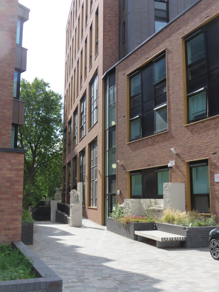
Originally, Jacob Street continued all the way to Tower Hill close to Castle Park, but it is now interrupted by Temple Way. The Print Hall, a new development of student housing, has reinstated a missing section of Jacob Street in the form of a footpath, beside which bits of old stone and brickwork have been retained as an interesting feature.
Just before descending through the new development, bear right into David Street (18).
Pedestrianised David Street is another old street that has been spruced up considerably by the Print Hall development. On the right you will find the Shepherds’ Hall, a fine old building that is still derelict and in need of a new use.
Follow David Street until you emerge back on Old Market Street. Turn right and then cross over at the traffic lights.
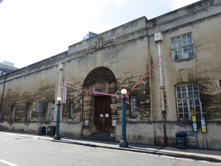
Old Market Street contains several more fine historic buildings, including the Central Hall with its green copper dome and the elaborate Drill Hall with central archway opposite, as well as the Stag and Hounds, an historic pub with a bay projecting over the pavement.
Roughly opposite the traffic lights there is a gated walkway, Cabot Mews, that runs under No.32 Old Market Street. The gates are kept closed, but they are not usually locked during the day and permissive public access is provided. Take this walkway now (19).
In the unlikely event that the gates are locked, continue along Old Market Street and go round the block via Lawford Street, passing St Jude’s Church, to rejoin the main route at Redcross Street (20).
Cabot Mews is a great example of how to carry out infill development in an historic environment like Old Market. The historic development of Old Market was built on long, narrow parcels of land called ‘burgage plots’. Cabot Mews makes a virtue out of this unusual layout, with a secluded terrace of modern houses and flats following the pleasantly landscaped walkway.

You will emerge on Redcross Street opposite St. Matthias’ Park (20). Redcross Street, like Jacob Street, originally led right into the city centre until the construction of the Old Market Roundabout and the Temple Way Underpass: in Mediaeval times, Redcross Street and its long-lost neighbour, Ellbroad Street, served as an alternative route into town when the main road was blocked on market days. There are a couple of fine Georgian buildings in the street, one bookended incongruously by post-war extensions in red concrete.
Cross the street and make your way through St. Matthias’ Park.
St. Matthias’ Park is a leafy if slightly gloomy space that is tucked away to the rear of some council flats that look like they took a wrong turn on the way to London.
Cross the road at the far end of the park, which is also called St. Matthias’ Park and is lined by an avenue of handsome London Plane trees. Bear left to reach Champion Square.
Champion Square is located to the rear of the Future Inns hotel on Bond Street South. To the rear of the hotel you will find a Georgian terrace located incongruously in otherwise modern surroundings (21). For years the terrace sat alone in an area of waste ground, but now it has more fitting surroundings.
The Phoenix, at the end of the terrace on the corner of Tucker Street, is a suitably secluded spot for a pint.
Optionally, take a detour along the length of River Street to the right. When you’re done, return to Champion Square (21).
On River Street you will find new housing, which cleverly conceals the Cabot Circus multi-storey car park. You are in fact standing on top of the culverted River Frome, which disappears underground just to the east of here to begin its long sentence of concealment beneath Bristol City Centre, eventually emerging in the Floating Harbour at St. Augustine’s Reach. Cross Wade Street if you like to see the river as it disappears underground (for a detailed exploration of the beautiful Frome Valley upstream of here, see Walk Twenty ‘Stapleton and the Frome Valley’).
From outside the Georgian houses on Champion Square, take the walkway that runs underneath the Future Inns hotel.
The tunnel under hotel brings you out on the dual carriageway Bond Street South opposite the back of the Cabot Circus development. That’s right – it’s finally time to visit the shops!
Cross the main road and enter Cabot Circus via Milk Street (22).
The name Milk Street is a throwback to an historic street that was wiped out by the widening of the Inner Circuit Road after the Second World War. The short street will bring you out in the heart of the £500m Cabot Circus development, on the middle level. You will notice an immediate change in atmosphere after the quietness of the St. Matthias’ Park area. Quite apart from the crowds touring the shops, this space, like much of the new development, is partially covered by a glass roof.
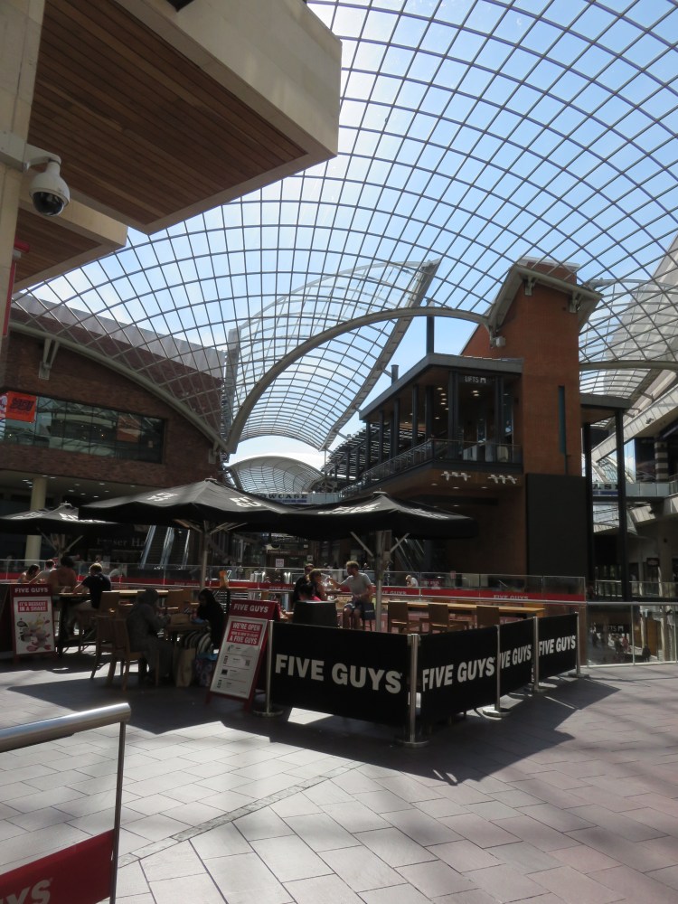
Cabot Circus offers a wide range of dining choices across its three floors, from cafés to restaurants, particularly on the top floor.
Make your way round to George White Street, on the far side of the central space, staying on the middle level.
From the centre of Cabot Circus, George White Street descends gently past further shops until you emerge from beneath the glass roof onto Penn Street. Ahead of you is Broadmead, the city’s older shopping precinct, built in the 1950s but recently subject to some refurbishment.
Continue straight on into Broadmead.
Broadmead leads towards a crossroads known as the Podium, at the heart of the shopping centre.
Turn left just before you get to the Podium, into Quaker Lane (23).
Quaker Lane leads into a new public square known as Quakers Friars. Historic buildings in the middle of the square are all that remain of a series of ecclesiastical buildings that have occupied this site over the centuries, including a Dominican Friary and a Quakers’ meeting house, giving the area its quirky name. Quakers Friars, which was relegated to a serve as a car park and service yard after the war, is now one of the most vibrant spaces in the city centre following the completion of the Cabot Circus development.
Quakers Friars is also home to further dining options, most of which can offer a decent meal.
Exit Quakers Friars to the right via Philadelphia Street.
Philadelphia Street leads you out onto Merchant Street, just outside another attractive almshouse (24). Behind the former almshouse is the glass elevation of The Galleries shopping centre, built in the 1980s.

The food court in the Galleries is the best spot in the Broadmead area for fast food options.
Turn right along Merchant Street to reach The Podium.
The Podium, at the heart of the Broadmead shopping centre, was built as a roundabout when the Broadmead shopping centre was originally constructed in the 1950s. This junction is now fully pedestrianised.
Turn left into Broadmead.
In the western arm of Broadmead itself, the 1950s architecture is broken up by a few historic survivors, including the former Greyhound Hotel on the south side (now an entrance to the Galleries), John Wesley’s New Room on the north side (the first ever Methodist chapel, with its quiet and inviting courtyard garden) and, last but not least, an old shopping arcade, located just next to John Wesley’s New Room.

At the far end of Broadmead, Union Street is home to the 1930s Odeon Cinema.
Continue straight on into the final stretch of Broadmead, which quickly becomes Nelson Street.
Nelson Street is home to the old Bridewell Police Station, an unusual fortress-like design from the 1920s that is now used by an arts collective. Aside from this, Nelson Street is largely a concrete jungle.
At the junction of All Saints Street, take the left fork onto a sloping footpath named St. John’s Steep (25).
St. John’s Steep climbs next to the former labour exchange, built to a 1930s design in dark red brick (now a bar and bowling alley). St. John’s Steep will take you out onto John Street, a little-known and atmospheric backwater in the Old City.
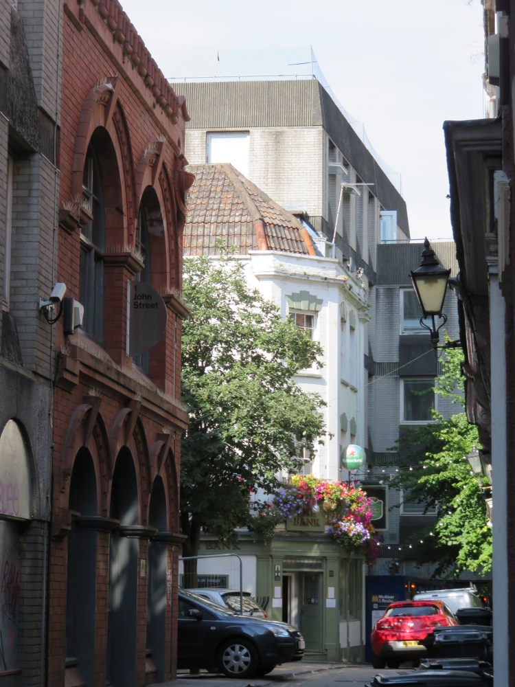
The Bank Tavern in John Street is a welcoming and quiet spot for a drink.
At the end of the street, turn right into Broad Street.
Broad Street is home to St. John’s Gate, which is the last surviving part of the old city wall and also incorporates and the church of St. John on the Wall (see Walk One ‘Introduction to Bristol’).
Pass through St. John’s Gate and turn left into Quay Street (26).
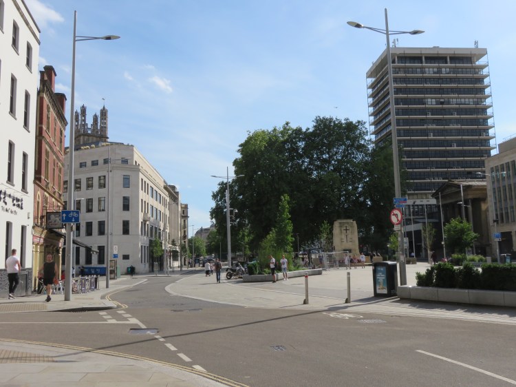
Quay Street will lead you to the newly refurbished area of the Centre Promenade around the Cenotaph, Bristol’s main war memorial. Long dominated by swirling lanes of traffic, the Cenotaph now has a much greener and more dignified setting.
Make your way back down the Centre Promenade to complete Walk Three.
Coming Up
In Walk Four ‘The Northern Edge’ we’ll be returning briefly to Broadmead and climbing a few steep hills as we explore the hidden by-ways, Georgian squares and historic gardens of the northern edge of the city centre, not to mention taking in a few panoramic views.
