Last updated: March 2021
Walk Map | Download walk as PDF
The North Somerset harbour village of Pill has long since receded from its historic importance as a ferry crossing point and sheltered harbour near the mouth of the River Avon. However, it remains a characterful place with several historic features that is worth at least one quick visit.
Pill is attached to the neighbouring communities of Ham Green and Easton-in-Gordano. At present, this route just comprises a short stroll around Ham Green and Pill that can be done in about an hour. I may revisit the area for longer walking options at a later date.
Useful Information
Terrain: Undulating, including a couple of steep climbs.
Ground: A mix of paved and unpaved areas, with the potential for softer and slippery conditions after wet weather.
Key Attractions: Ham Green, Watch House Hill, Pill Harbour.
Refreshments: There are a couple of pubs along the way.
Starting point: Macrae Road, Ham Green
Getting there: At present there is no railway station in Pill, although there are proposals to reinstate one. The main road through Ham Green and Pill is served by buses running from Bristol to Portishead. Free on-street car parking is usually available on Macrae Road itself.
Approx. Time: 1 hour
Approx. Distance: 2.2 miles
The Route
Our route starts on Macrae Road at the junction with The Green.
Make your way along Macrae Road so that you keep the modern houses to your right and you have a green space on the left.
The green space is part of the open area that gives Ham Green its name. Surrounded by modern housing, it has a pleasant ‘village green’ feel. An avenue of tall trees runs along the far side.
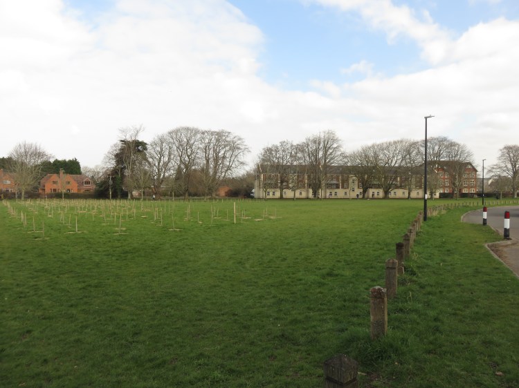
At the next corner of the green you will reach a junction of several routes (1).
Further walking available
Ham Green is also a good springboard for a pleasant there-and-back-again walk along the River Avon. It can be combined with this circuit or explored separately.
Simply turn right along Hart Close and then immediately left along Chapel Pill Lane. This quiet country road will lead you down to the pleasant environs of Ham Green Lake. Shortly after that you can join a cycle path that leads to a lovely route alongside the River Avon heading towards Leigh Woods – known as the Ashton to Pill Path.
To follow the main route, turn left from the first junction (1) and follow the cycle path across the green so that you walk along the avenue of trees.
At the end of the path you will emerge back on the road called The Green.
Turn right towards the red brick houses and then immediately left, still on the road. Bear right straight away onto the next section of cycle path, which is signed for Watch House Hill (2).
At this point, if you look over to the right, you will see Pill Community Orchard in the middle distance, where a variety of fruit trees have been planted. Explore it If you like, and then return to the cycle path (2).
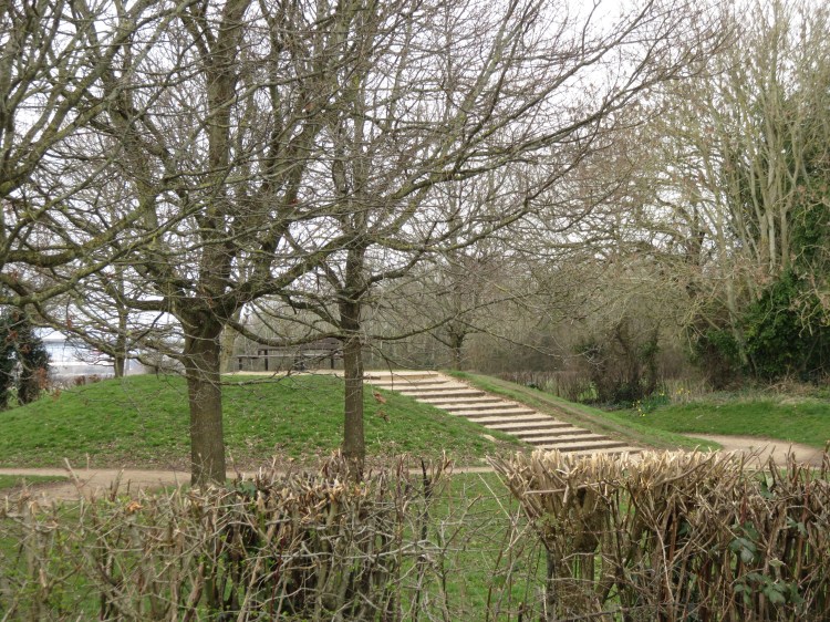
Follow the cycle path, making your way around a circular mound and through a hedge line (3). Continue straight on.
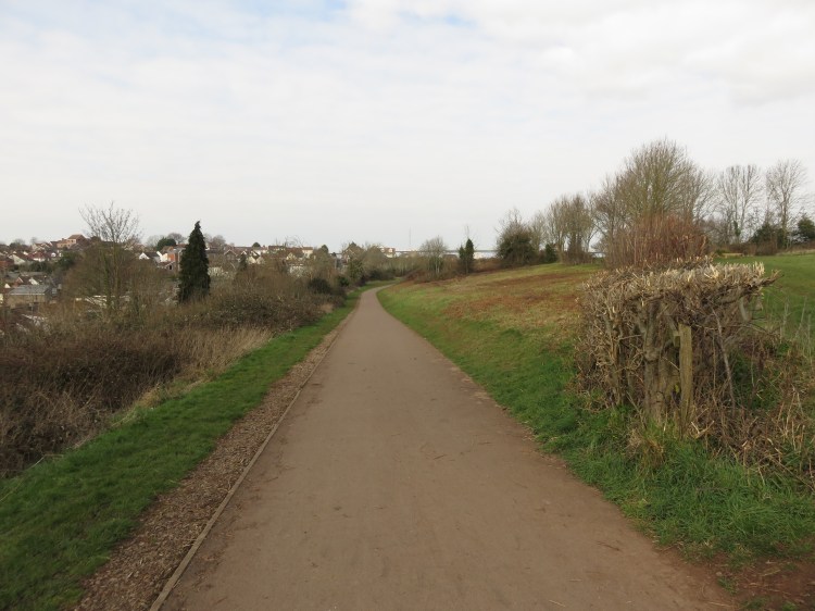
The next section of the cycle path skirts Watch House Hill (you also have the option of walking across the grass on the other side of the basketball courts if you prefer). Watch House Hill is a major public park that connects Ham Green and Pill. It includes sports pitches, woodlands and areas of natural grassland. Thanks to its elevated position it provides good views over the centre of Pill village and the mouth of the River Avon.
Make your way gradually down the cycle path until it sweeps into a steep left bend as it descends the hill (4). Turn off onto a rough footpath across the remaining area of grassland.
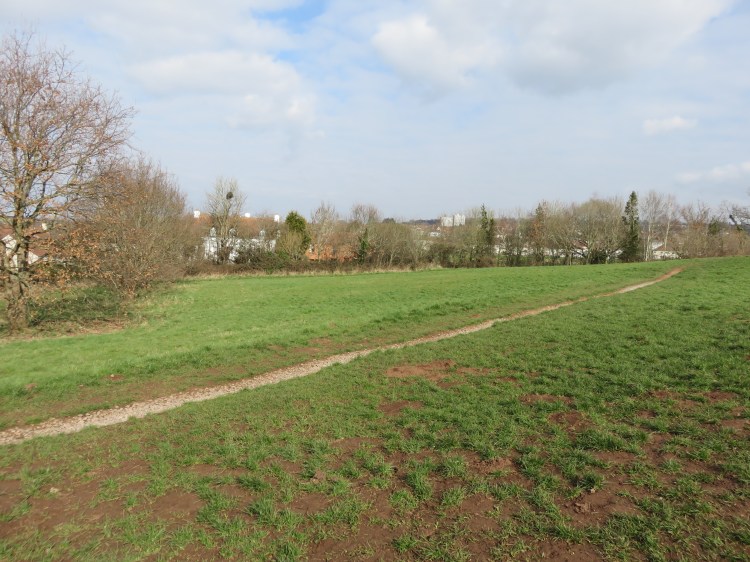
The rough path will take you to a viewpoint overlooking the River Avon next to one of its distinctive old white river lamps.
Descend through the tree belt to the fence to take in the view, then follow the path round to the left so that you emerge back in the bottom corner of the grassland (5). The ground may be soft at this point.

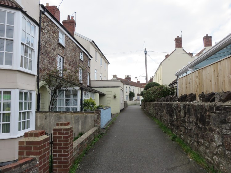
At the bottom of the corner of the grassland you will find a gate leading onto a narrow lane lined with old cottages.

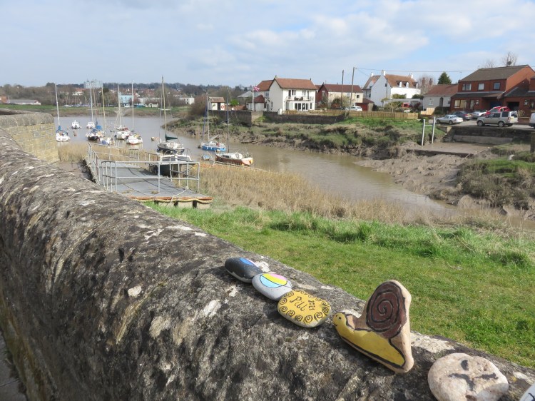
Make your way down the lane until it opens out onto Watch House Road next to Pill Harbour (6). Turn left.
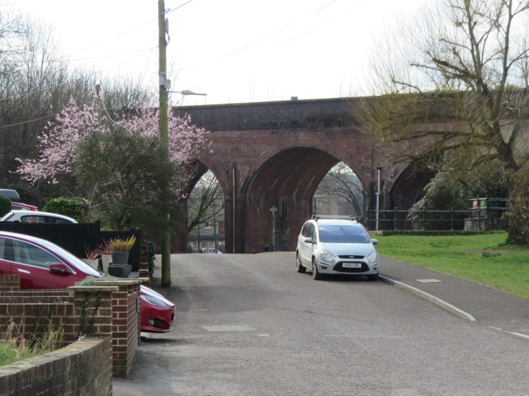
Pill Harbour is a sleepy place these days, clogged with river mud and only used by small craft. Watch House Road follows the east side of the harbour. As you walk along it, you will see how the harbour and, indeed, the centre of the village, is dominated by the hefty brick viaduct of the Portishead Railway Line.
Follow Watch House Road until you reach a grassy area at the head of the harbour (7). Cross the grass and climb up onto the harbour wall at Underbanks. Turn right.
The quaintly named Underbanks follows the west side of the harbour. It offers a good view across the River Avon to the Lamplighters pub at Shirehampton (see Walk Thirty-Two ‘Shirehampton and Kings Weston House’).
Underbanks will lead you to Pump Square (8), which is a small village green outside a landmark pub, the Duke of Cornwall.
The Duke of Cornwall is one of two watering holes on this route.

Follow the path around the water’s edge of Pump Square and climb onto the flood wall at Marine Parade.
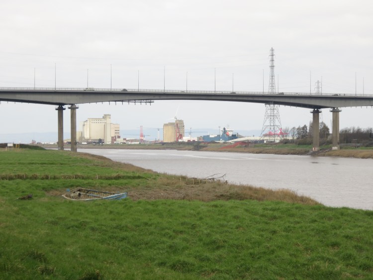
Marine Parade slightly misses its potential seaside feel with a succession of concrete bungalows. However, it provides excellent views of the mouth of the River Avon and the dramatic concrete span of the M5 Avonmouth Bridge.
At the far end of the concrete wall (9), climb a short flight of steep steps to continue along the flood defence, which is now a grassy embankment.
The view of Avonmouth will continue to unfurl as you make your way along the embankment. After a while the embankment will lead you naturally round to the left so that you approach Avon Road.
At the crossroads with Avon Road (10), go straight on and climb a short, steep hill to reach Severn Road.
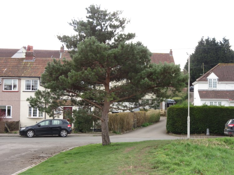
Severn Road is a quiet backwater next to the railway line. The hedgerow next to the tracks provides the concrete block houses with a leafy outlook and some of the residents have made a real effort with their gardens.
At a kink in the road (11), continue straight on into Monmouth Road.
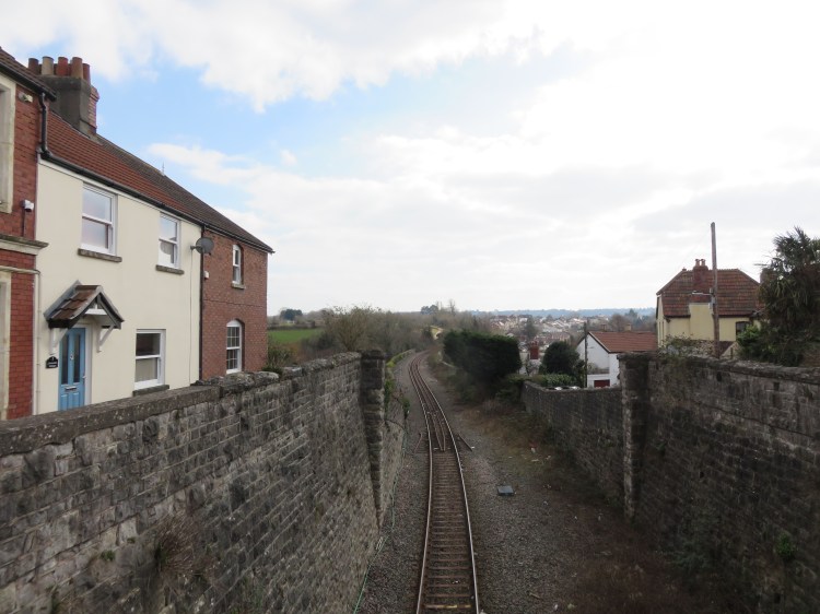
Monmouth Road is home to larger detached and semi-detached houses. It appears to be one of the more prestigious addresses in Pill, and many still have colourful front gardens. The street once overlooked Pill station, which was accessed from the bridge at the far end.
At the end of the road you will reach a railway bridge connecting Back Lane and Station Road next to a food store. Continue straight on briefly along Chapel Row, passing the food store, and turn right onto a parallel bridge at the top of Myrtle Hill (12).
After crossing the bridge you will arrive on Upper Myrtle Hill, a particularly picturesque little street containing old houses.
At the end of Upper Myrtle Hill (13), turn left into Church Walk.
Descending Church Walk you will cross Heywood Terrace, a pleasant little street with gabled Victorian houses.
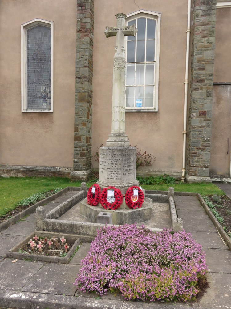
Continue straight on into the churchyard of Christ Church (14).
Christ Church is a modern-looking church occupying a quiet spot above the centre of the village.
Make your way down the main path through the churchyard so you emerge on Church Place.
Church Place continues the historic enclave feel.
Go straight on down Church Place and turn right into New Road.
New Road descends into the centre of the village, which has suffered from unsympathetic redevelopment over the years. You will find yourself at the back of a row of single-storey shops (15).
Turn right along Pill Street until you are standing on Heywood Road (16) opposite a pub called the King’s Head.
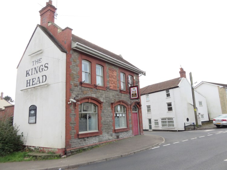
The King’s Head is a Victorian pub at the junction of several roads.
The King’s Head is the second of the two pubs available on this route.
Take the side turning immediately to the right of the pub, Water Lane.
Passing a few older buildings, Water Lane opens out into a modern cul-de-sac called Bow Cottages. There are two footpaths in the left-hand corner of the cul-de-sac.
Take the footpath signed Brinsmead Crescent, which climbs gently uphill. The path splits in two to either side of a brick wall. Take the right hand path to emerge on Wilmott’s Way (17).
Wilmott’s Way is classic post-war suburbia.
Follow Wilmott’s Way, then at the end of the road turn left into Westward Drive.
Westward Drive descends past grassy verges to join the main road next to Pill’s small fire station. As you descend the hill, you can see Watch House Hill rising behind the cottages on the main road.
Turn right onto the main road, here called Ham Green.
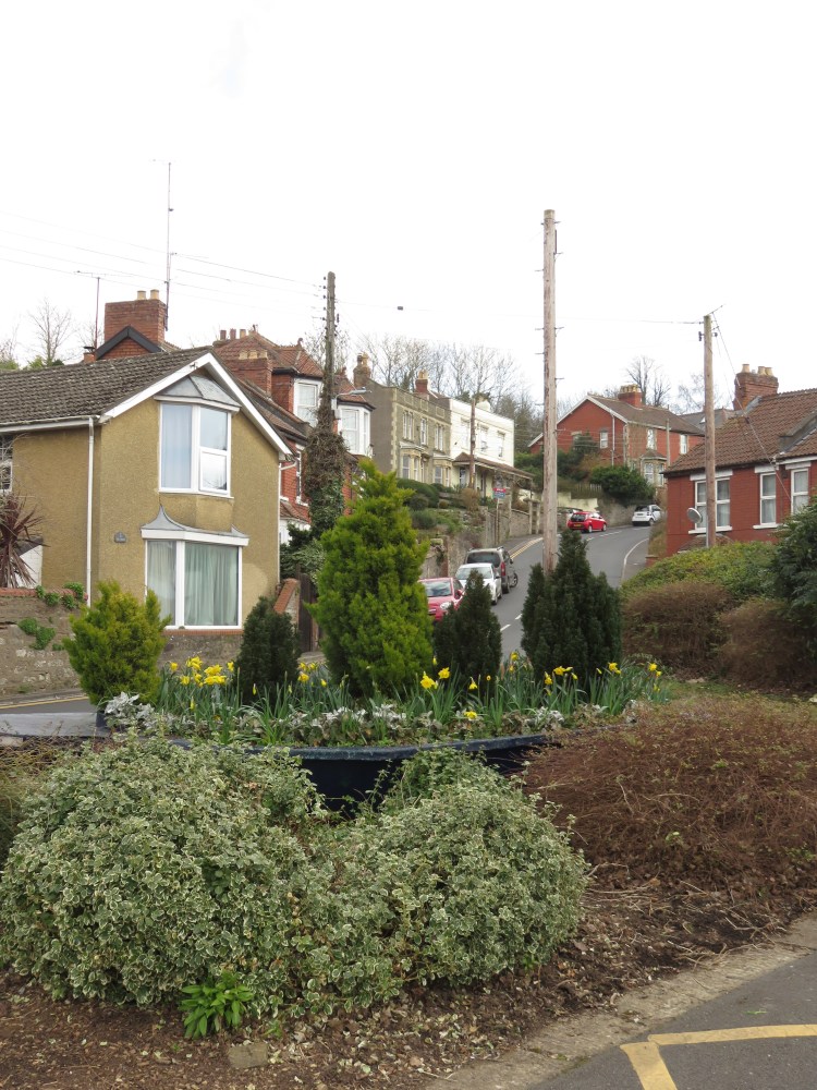
Ham Green (the road) climbs steeply between a variety of interesting older properties, some of which enjoy a raised position with terraced front gardens.
As you approach the crest of the hill, turn left onto a track/footpath between Nos.37 and 39 Ham Green (18).
The footpath soon brings you back to The Green, near to where you started, at the top of Watch House Hill.
Follow the road until you reach the first of the red brick houses, then turn right along The Green (19) to return to Macrae Road and complete Walk Thirty-Three.
Coming Up
In Walk Thirty-Four ‘Hallen and Avonmouth North’ we will stray away from our usual territory in search of wildlife and historic interest by following the old country lanes through an industrial area on the edge of Avonmouth.
