Last updated: June 2021
Walk Map | Download walk as PDF
Inner east Bristol is a sprawling area of residential communities with rather blurred edges, gradually decreasing in density as you move away from the city centre. It’s a difficult area to pin down from a character point of view. However, the contains several lovely green spaces, some of the best of which have already featured in Walk Eleven ‘Easton and Eastville’ and Walk Nineteen ‘Crew’s Hole, Conham and St. George’.
This route turns its attention to the area around Whitehall and the edge of Speedwell. The last of Bristol’s major Victorian parks to feature in this collection, St. George’s Park, makes its debut, along with several other less well-known green spaces, including the parks and allotments that follow the Coombe Brook between Eastville and Speedwell.
Useful Information
Terrain: Gently undulating, including some steps.
Ground: Paved and unpaved, and some sections may be soft underfoot in winter or after wet weather. There is no fully accessible route available.
Key Attractions: Church Road shops, St. George’s Park, Greenbank Cemetery, Coombe Brook valley, Ridgeway Playing Fields, Coombe Brook Nature Reserve, Plummer’s Hill open space.
Refreshments: Various options at Church Road. There are two local pubs along the route.
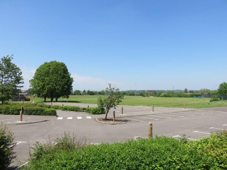
Starting point: St. George’s Park main gates, Church Road / Chalks Road.
Getting there: Church Road is served by regular bus services towards Kingswood and Hanham. There are free car parks at Chalks Road (next to the park) and Derby Street. Free on-street parking is available in the surrounding streets, but they are narrow.
Approx. Time: 3 hours
Approx. Distance: 5.3 miles
The Route
Our route starts at the grand main entrance to St. George’s Park on Church Road, the main high street for Redfield and St. George. On one of the gateposts, you will find a plaque dedicated to local boy Bob Hope.
Church Road offers a a variety of shops, cafés, pubs and takeaways.
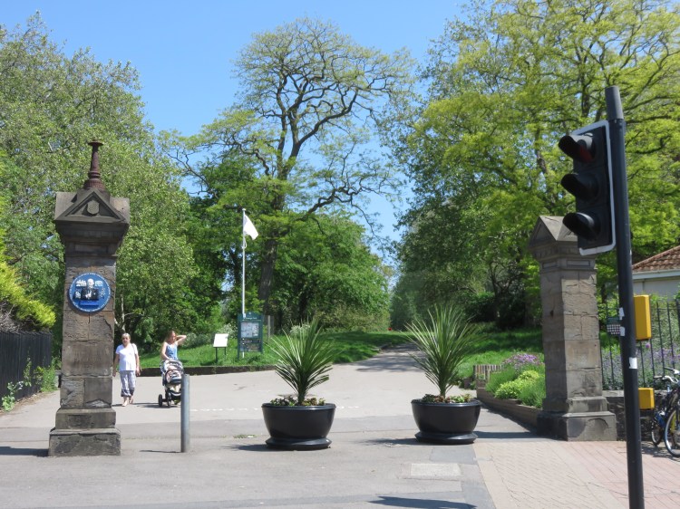
Enter the park and take the upper path.
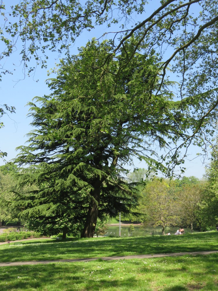
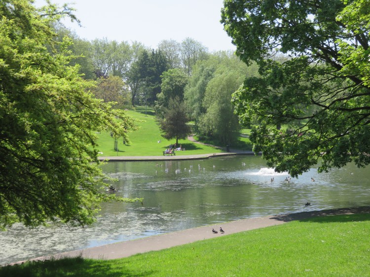
St. George’s Park is one of Bristol’s major Victorian suburban parks. The upper path will take you along a fine avenue of London plane trees, offering views down over the rest of the park towards the lake.
Take the first left at the ornate lamp post (1) and descend towards the lake.
The park was created in the valley of the largely extinct Wainbrook, whose original course runs under the houses to the north of Church Road / Lawrence Hill. Located at the bottom of the valley, the lake makes reference to this historic waterway.
Make your way round the left-hand end of the lake and climb up to the top corner of the park (2).
At the top corner of the park, turn left along the perimeter path, parallel to Park Crescent.
Park Crescent is a street of ordinary Victorian terraced houses that are given a boost by their lovely parkside location.
When the path connects with the road, join the road, walk on a little further and turn right into Stretford Road (3).
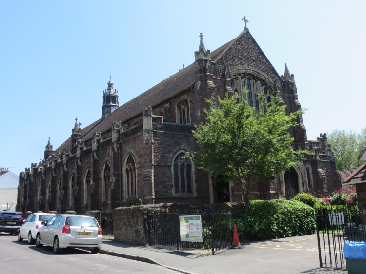
You will approach the slightly forbidding-looking church of St. Ambrose & St. Leonard.
Turn left past the church into Stretford Road and follow the road round the corner to come out on Whitehall Road opposite a playing field (4).
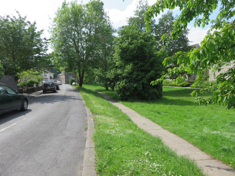
Whitehall Playing Fields, also known as the Packers Field, occupy a large open area between Whitehall and Greenbank. Although public access is limited, they help to define the surrounding area and offer decent long-distance views.
Cross Whitehall Road and take the footpath behind the Kings Head pub to reach Johnson’s Lane.
The Kings Head is the first of two local pubs on this route.
Johnson’s Lane is a quiet street bordering the playing field. It is home to a school that occupies tastefully renovated buildings at the edge of the field.
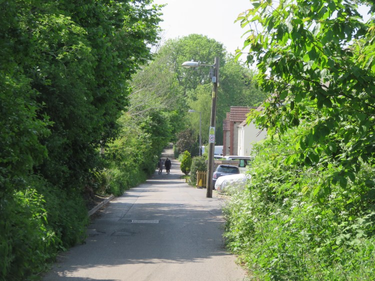
At the end of the road, turn right onto Johnson’s Road and then descend a ramp to reach the Bristol & Bath Railway Path (5).
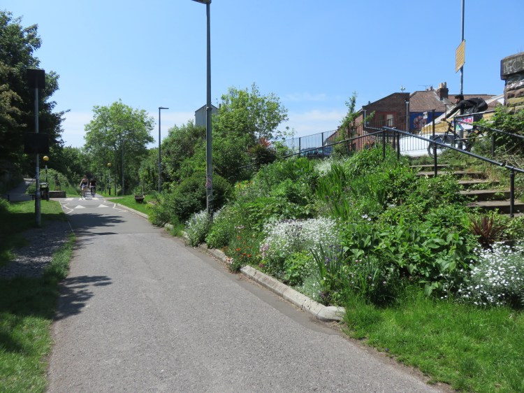
The Bristol & Bath Railway Path is an extremely popular inter-city cycle route. It also serves as a linear park of sorts that cuts through the dense inner-city area of Easton.
Turn right along the railway path.
You will pass the Former Elizabeth Shaw chocolate factory, which is currently being redeveloped for new homes. On the other side of the path, you will have a view over the pleasant Packers Allotments.
Once you are passing the back of a terrace of modern houses, take the first exit on the left (6) to reach Greenbank Road. Turn left towards the cemetery gates.
This part of Greenbank Road is usually very quiet, as it is closed to traffic at the bottom of the hill. You will pass another terrace of modern houses called Green Oak Crescent.
When you reach the main cemetery gates (7), step inside.
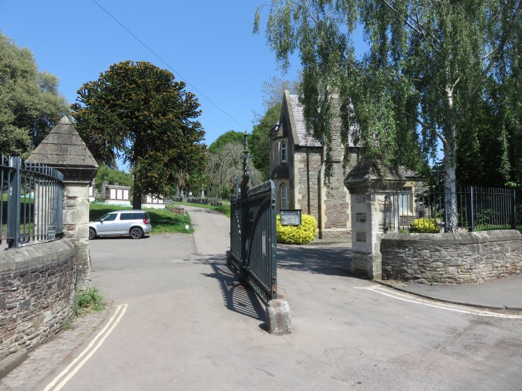
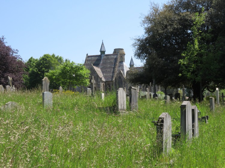
Greenbank Cemetery is one of Bristol’s largest civic cemeteries and is a valuable, peaceful green space for this part of Eastville and Greenbank. The cemetery is generally kept in decent order, although the chapel buildings in the centre are currently cordoned off and need restoration.
Take a walk around the cemetery. I recommend starting with the path that runs to the left of the treeline and taking a clockwise loop around the centre of the cemetery, ending up on an avenue of birch trees (8). Leave the cemetery via the eastern driveway leading out onto Rose Green Road (9).
Alternative route
The secondary gates to Greenbank Cemetery are not always open. If you find that the eastern gate is shut, return to the main gate (7). Turn left and go back along Greenbank Road, skirting the cemetery, then turn left again onto Rose Green Road to pick up the main route again at the east gate (9).
Make your way down Rose Green Road.
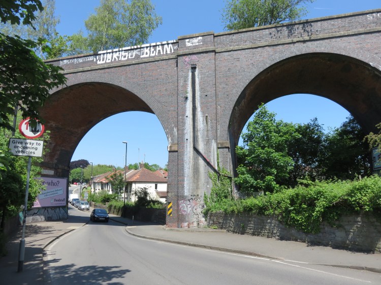
You will pass under the Royate Hill Viaduct, an imposing former railway bridge that is now part of a wildlife corridor and nature reserve (see Walk Eleven ‘Easton and Eastville’). Just before you go under the viaduct, you can catch your first glimpse of the Coombe Brook, running through an overgrown channel on the left.
Immediately after passing under the Royate Hill Viaduct, turn right onto an unsigned track below the houses (10).
The track will take you into the Coombe Brook valley. To begin with, the track is bordered on both sides by the verdant Royate Hill Allotments.

After a while, you will pass two flights of steps. The Coombe Brook can be glimpsed at the foot of the steps on the right just before a row of houses crowds in from that side of the track.
Continue past the backs of the houses.
After a while, the track becomes grassy and then turns into a woodland footpath. You will reach a footbridge on the right (11).
Alternative route
The next section of the main route involves steep steps and uneven ground. If you prefer, skip it by crossing the footbridge and rejoining the main walk at Dubber’s Lane (12).
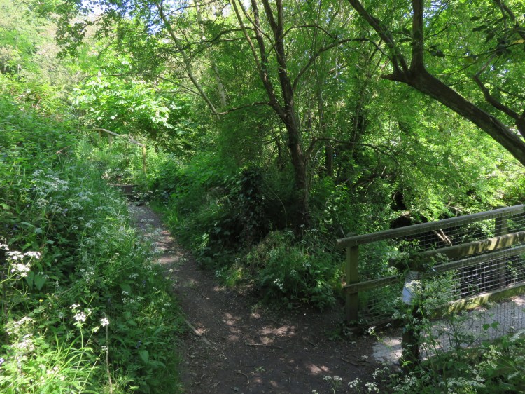
To continue along the main route, go straight on past the footbridge and climb the steps.
The steps climb steeply up to the corner of Ridgeway Road, leaving the stream temporarily behind you and offering a different perspective on the valley.
At the corner of Ridgeway Road, immediately turn right down another path, Greens Hill (12).
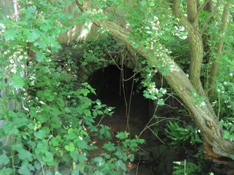
Greens Hill is an old path that, at the time of writing, has been eroded by surface water and is in a poor state of repair, so watch your footing. It will take you back down to the Coombe Brook, where it emerges from a culvert under Ridgeway Playing Fields.
Coming out on Dubbers Lane, bear right until you reach a footpath on the left between Nos.26 and 28, where the alternative route rejoins from the right (13). Climb the footpath between the houses to reach Clay Bottom.
At Clay Bottom, rejoin the Bristol and Bath Railway Path and turn left. After a few metres, bear right onto another cycle path and then climb a short flight of steps to reach Ridgeway Playing Fields (14).
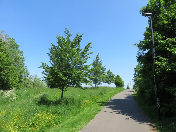
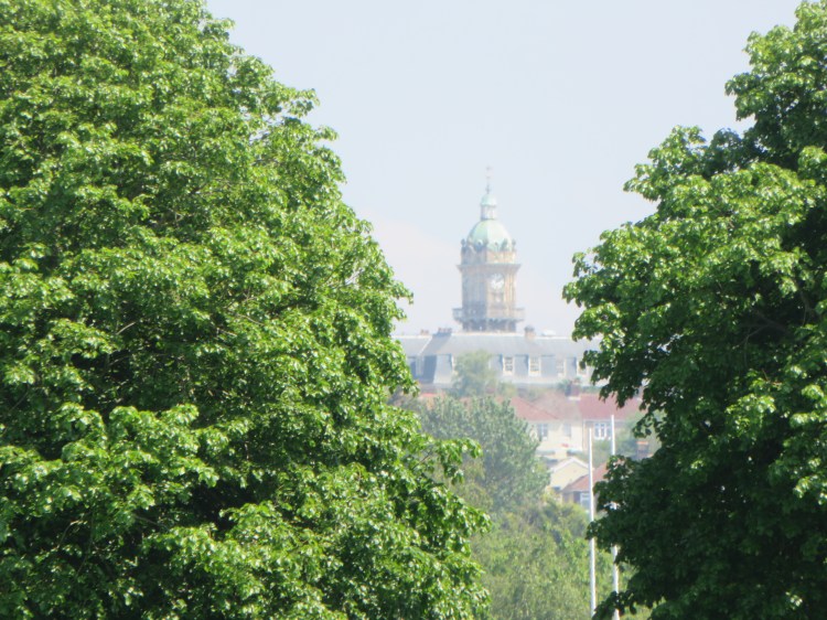
Ridgeway Playing Fields is a spacious green area that separates residential Fishponds from the industrial area at Clay Hill. The playing fields are criss-crossed by cycle paths linking the adjoining communities. The dome of Cossham Hospital, at one of the highest points in east Bristol, can be seen in the distance.
Follow the main cycle path for the length of the playing fields, avoiding the exits to the right. Eventually you will get to a fork in the path just before an area of woodland. Take the left fork and, leaving the paved path, enter the woodland via the little gate ahead of you, next to a litter bin (15).

You have entered the Coombe Brook Nature Reserve, a quiet area of woodland that follows part of the Coombe Brook Valley.
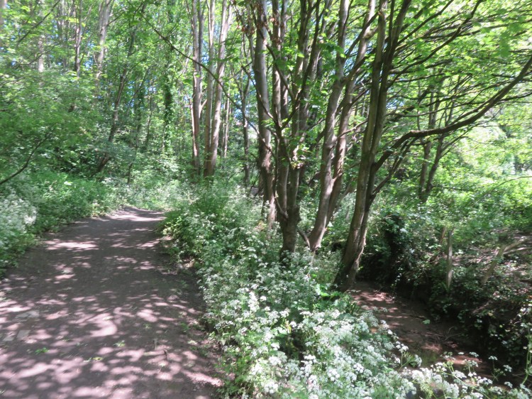
Follow the main path as it sweeps down into the valley, then cross a little wooden bridge so that you walk through the valley with the stream to your left.
After a while you will reach a point where steps climb out of the valley to both sides (16).
Alternative route
The next section of the path along the valley is treacherous and muddy and there is an obstruction. To avoid this section, climb the steps on the right, crossing the end of Holly Close, to rejoin the main route on the footpath at the back of Holly Close (18).
To continue following the main route, go straight on along the narrowing path.
After a while, the path is obstructed by an open drainage culvert. You will have to either scramble round the edge of the culvert or cross through the middle of the culvert. Once you have crossed the culvert, the path will lead you out onto Whitefield Road (17).
Turn right along Whitefield Road.
Walking along the otherwise unremarkable Whitefield Road, you will pass the understated Argyle Morley United Reformed Church in red brick.
Turn right into Holly Close and immediately bear left onto a footpath to the rear of the houses. After a while, the alternative route rejoins from the right (18).
Shortly before the footpath joins Deans Drive it becomes cobbled, with an unusual European pattern of stone setts.

At the end of the footpath, turn right onto Deans Drive and then immediately bear left onto Holly Lodge Road (19).
A quasi-rural oddity on the edge of Speedwell, Holly Lodge Road is lined by a mix of different houses and hedgerows. Off left, it abuts the Whitefield Road Allotments.
You will pass an entrance to Ridgeway Playing Fields on the right, just before an isolated terrace of Victorian houses.
Opposite the entrance to the playing fields, turn left into Whitewood Road, which is actually a footpath (20).
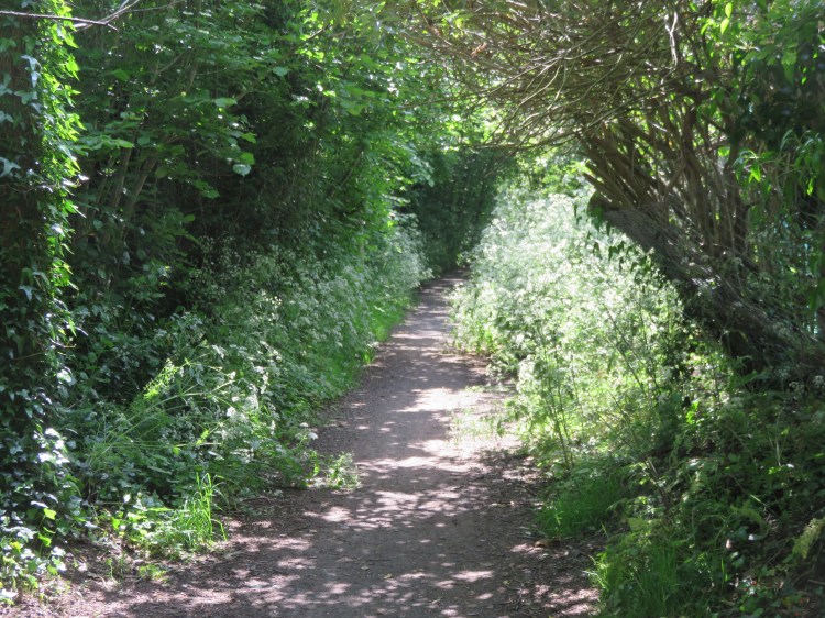
Whitewood Road is an unsurfaced footpath / track that provides a pleasant green link through the industrial estate at Clay Hill. Watch your step, as there is a slight problem with dog fouling.
Coming out at the junction of Fernhurst Road and Deep Pit Road, go straight across into the one short section of Whitewood Road that is actually a road. Turn right into Brook Road (21).
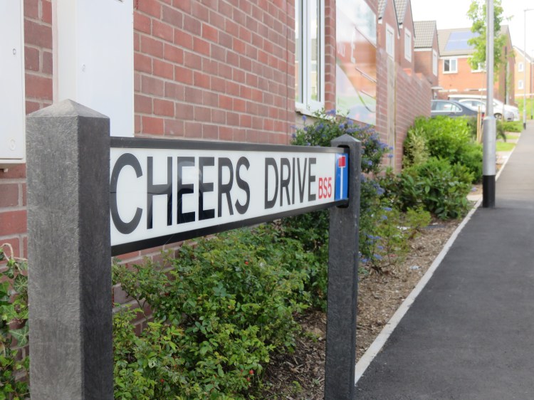
Brook Road is an area that has been extensively redeveloped in recent years, and you will pass several modern homes. The name of the most recent new street to be completed pays homage to the local Bristolian dialect with the traditional goodbye to a bus driver, Cheers Drive.
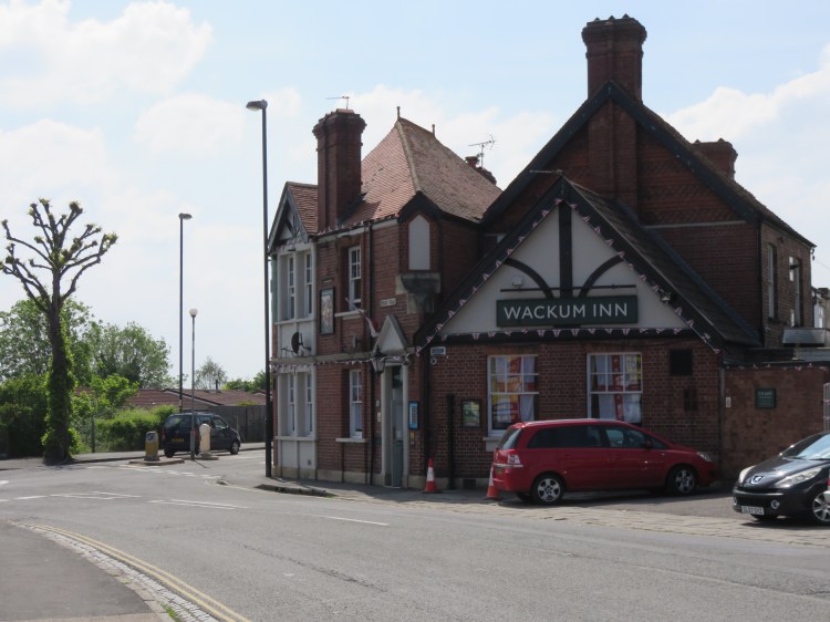
You will approach the junction of Speedwell Road and Whitehall Road next to the curiously named Wackum Inn.
The Wackum Inn is the final local watering hole on this route.
Turn right onto a footpath just before the Wackum Inn and then turn left into Brickworks Close (22).
Brickworks Close is a very pleasant modern residential square with a communal garden in the middle.
Exit the square at the left-hand corner and then turn left onto a footpath to return to Whitehall Road. Go straight on into Sycamore Close (23).
Sycamore Close is a part of a complex of prefab homes. There were once several sites like this around Bristol, particularly in this area. Many have since been redeveloped, but this site lingers on. Some of the prefabs are well-kept and have colourful gardens. The close is also home to a surviving Georgian building.
Take the footpath on the right at the end of Sycamore Close. You will be led down to Whitehall Avenue. Turn left and then double back through the prefabs, crossing Alder Drive, to reach Plummer’s Hill (24).
Cross Plummer’s Hill and go through the gate between Nos. 132 and 138 to reach Plummer’s Hill open space.
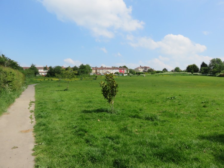
Plummer’s Hill open space is an informal park laid out over an undeveloped hillside, surrounded by houses. It offers few facilities apart from a couple of benches, but the views are pleasant enough.
Climb the hill via the diagonal path and then bear right onto a side path just below the top of the hill. Coming out on Crown Hill, go straight across onto another footpath.
You will descend past the Plummer’s Hill Allotments to reach Hudd’s Vale Road (25).
Turn right onto Hudd’s Vale Road. Go straight on across Plummer’s Hill into another section of Hudd’s Vale Road.
The final, dead-end section of Hudd’s Vale Road passes a pleasant green area on the approach to some old industrial buildings.
At the end of the road, turn left onto a lane past some garages (26). Climb up to Park Avenue, turn right, and then left into Clouds Hill Avenue.
Clouds Hill Avenue is a typical St. George terraced street, with the distinction that it is a fairly steep climb.

Just before you come out on the main road, turn right into Park View Terrace (27).
Park View Terrace is one last odd little backwater on this circuit. It will lead you directly back to St. George’s Park at the top of the avenue of London plane trees.

Simply return along the avenue of London plane trees to reach the main gates at Church Road and complete Walk Thirty-Seven.
