Last updated: August 2022
Walk Map | Download walk as PDF
This walk appears in the collection with thanks to Maggie Thomas, who suggested it.
The area around Hanham Abbots and Longwell Green alternates between the suburban and the rural. This longish walk, suggested by a reader, follows green corridors through the suburban sections to join up a variety of interesting and historic spaces.
Starting with a visit to Hanham Hall Park, the walk explores the modern eco village development surrounding historic Hanham Hall itself. It then follows the Ring Road Cycle Path to reach Cock Road Ridge Open Space on the edge of Kingswood. A suburban section brings in Barrs Court Park and moat. A trip across a small area of open countryside leads eventually to a pleasant stroll along the River Avon at Hanham Lock, although this section can be omitted to shorten the walk a little.
Useful Information
Terrain: Undulating.
Ground: Paved and unpaved sections with some steps. Areas may be muddy in winter or after wet weather. Unfortunately there is no accessible alternative route available.
Key Attractions: Hanham Hall Park, Hanham Hall, Cock Road Ridge Open Space, Barrs Court Park and moat, Hanham Court, Hanham Lock, River Avon.
Refreshments: The walk passes close to the Aspects Leisure Park, where there are various chain restaurants available. In the latter stages, the walk passes two very popular pubs as it passes Hanham Lock.
Starting point: Abbots Road, Hanham, at Castle Farm Road / Crossleaze Road junction.
Getting there: Buses to Cadbury Heath and Keynsham pass fairly nearby via Memorial Road and Whittucks Road. On-street parking available on Abbots Road to the north of the starting point.
| Approx. Time | Approx. Distance | |
| Long route | 3 hours 30 mins | 6.7 miles |
| Short route | 3 hours | 5 miles |
The Route
Our walk starts on Abbots Road on the edge of the urban area of Hanham.
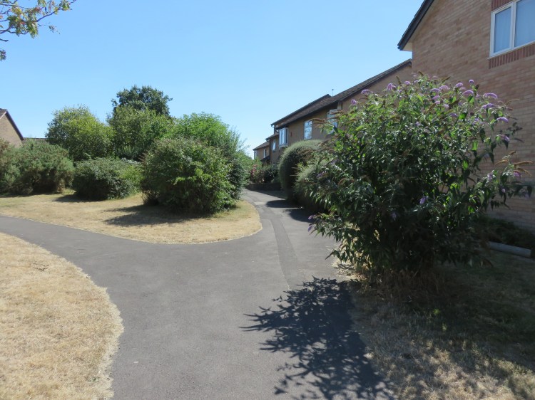
Begin by following Crossleaze Road until it ends at a wooden gate. Step through into Hanham Hall Park.
Hanham Hall Park is a pleasant open space with areas of trees and scrub and a children’s playground.
After a few metres you will reach a path junction with a litter bin (1). Bear left along the main footpath.
The main path will lead you through the middle of the park.
At the end of the footpath, turn right onto Gover Road.
Gover Road skirts a development of unremarkable modern houses. The street has pleasant countryside views. Keep an eye out to the left, where an avenue of birch trees (2) frames a view of Hanham Hall that has been safeguarded by the development.
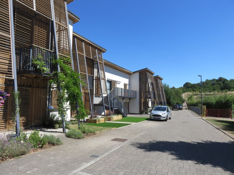
After a long left hand bend, Gover Road enters a development of ultra-modern homes and becomes Roman Way (3).
The Roman Way or Hanham Hall development is notable for its very high standards of sustainable building design. It is also architecturally interesting and pleasantly landscaped.
Turn left into Malpass Drive and follow the winding street until it emerges by Hanham Hall itself (4).
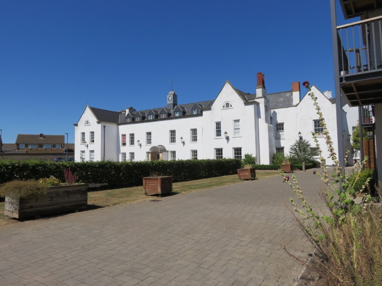
The lone historic building on the site, Hanham Hall is a pleasant surprise at the heart of all the modernity.
Turn right past the corner of Hanham Hall and then right again onto a footpath parallel to the northern arm of Roman Way (5). Continue straight on, crossing Kynaston View.
The footpath runs alongside a pleasant swale that is part of the development’s sustainable drainage system. It also passes a children’s play area and an interesting row of greenhouses.
When the path comes back out on the southern section of Roman Way, turn left briefly and then right to exit the development via turning signed as Roman Way 57-69 Odds, leading to a cycle path (6).
Follow the cycle path up the hill until you emerge on the Ring Road Cycle Path adjacent to the A4174 Avon Ring Road (7). Turn left.
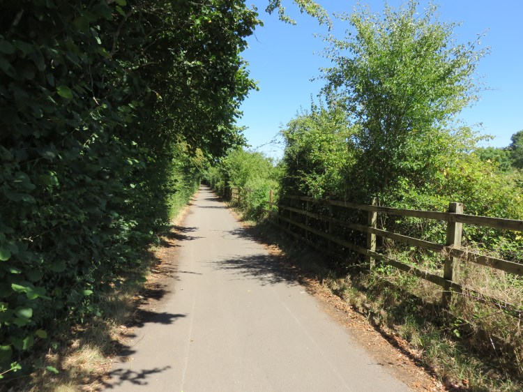
The Ring Road Cycle Path is a useful local route that shadows the Avon Ring Road throughout the east Bristol fringe. Some sections are easier to follow than others; this particular section is a pleasant green corridor along a good, straight rural path.
Follow the path north, crossing the A431 at the traffic lights on Stonehill.
North of Stonehill the path runs along the backs of the houses but still retains a green feel.
After a while you will see a footbridge up ahead. Bear left (8) to avoid the footbridge; then, at the next path junction, take the gentle left – not the hard left – to reach the foot of Kingsfield Lane (9).
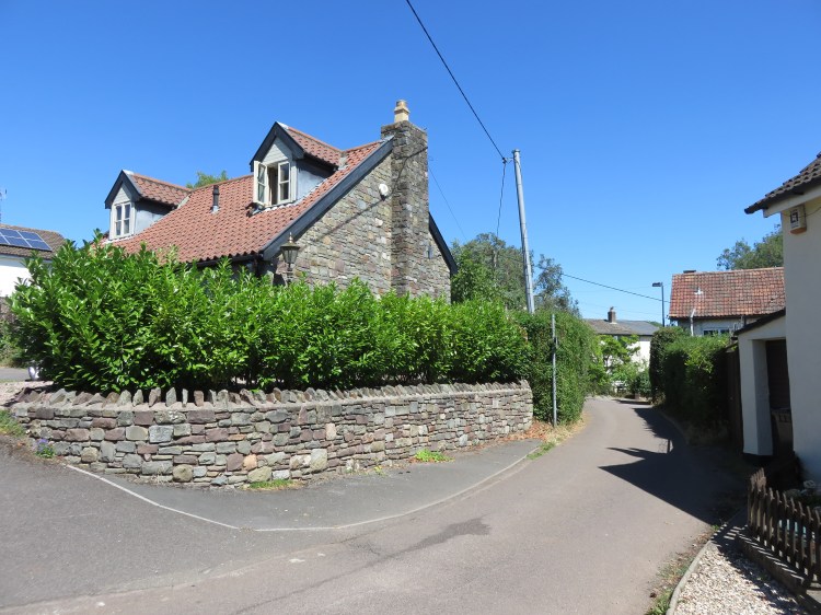
Kingsfield Lane is an old country lane with a few older houses on it. Prior to the construction of the Avon Ring Road and the Gallagher Retail Park it originally connected through to the A431 at Longwell Green; now it’s a quiet backwater.
Follow winding Kingsfield Lane. After a long right-hand bend, turn right onto a track leading onto a cycle path (10). The cycle path connects Kingsfield Lane to the Aspects Leisure Park.
The Aspects Leisure Park is home to a number of chain restaurants typical of an out-of-town development of that kind.
Just before the cycle path turns right into the leisure park, take the higher, unsurfaced route on the left to enter an open space to the rear of Tyler Close (11).

The open space is a pleasant semi-wild patch on the edge of the residential area.
Climb up through the open space to emerge on Hollyguest Road.
Hollyguest Road is mainly suburban, but this section has a more village feel.
Turn right along Hollyguest Road and then, at the bend, turn immediately right again down a track past allotments (12).
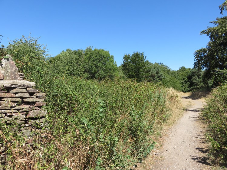
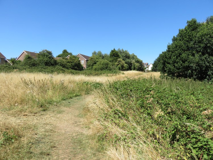
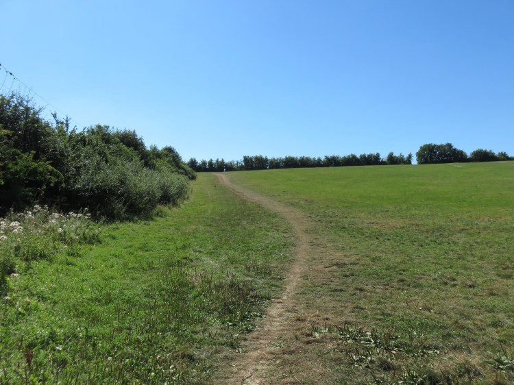
The track will lead you to Cock Road Ridge Open Space. A large marginal area on the slopes leading up towards Kingswood, there’s a pleasant air of wildness about the place, albeit the noise of the ring road is never far away.
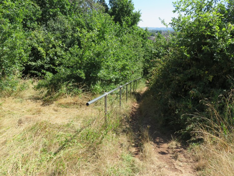
Entering the open space, take the slightly upper path then descend gradually towards the ring road. After passing a large grassy slope on the left, bear left and climb the steps up through the wood (13).
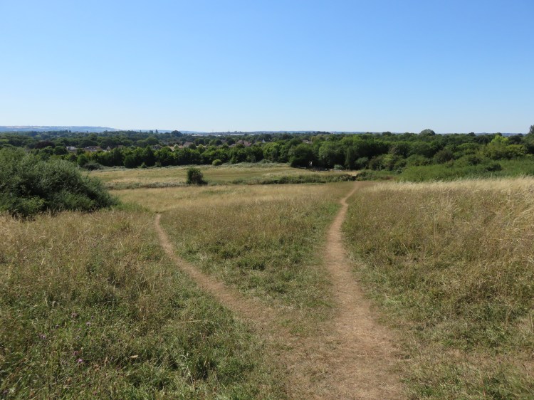
Explore the upper section of the open space at your leisure. There is a pleasant meadow area and an interpretation board with information about the wildlife and history of the site.
When you’re done, you will need to locate the steep footpath that leads down to a footbridge over the Avon Ring Road (14). It lies below a line of recently planted trees and is marked by a distinctive metal handrail.

Descend the path to the footbridge.
The footbridge will lead you to a long flight of steps that will return you to the Ring Road Cycle Path at a path junction just east of Tintern Close (15).
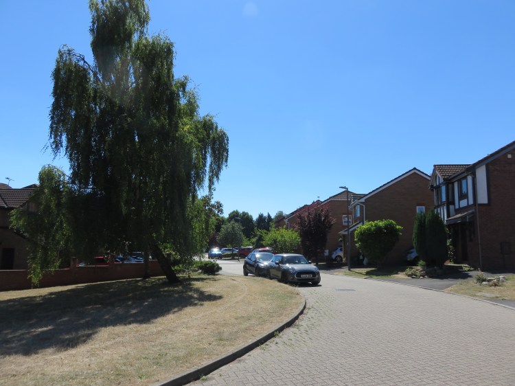
You are now among the late 20th Century housing of Barr’s Court. Typical of the period, the area is laid out as an endless sprawl of landscaped cul-de-sacs connected by little footpaths. From this point onwards, the route can be confusing to follow, so tread carefully.
Take the following steps:
- Turn right at the path junction, coming out on Tintern Close.
- At the end of Tintern Close, turn right briefly onto Fountains Drive.
- Pick up the cycle path again just after the junction of Downside Close on the left.

- Cross Lacock Drive and continue straight on along the cycle path.
- When the main cycle path turns right up the hill, go straight on instead, emerging on Stoneleigh Drive.
- Bear right so that you curve around the top section of Stoneleigh Drive.
- Reaching a junction, turn left onto the lower section of Stoneleigh Drive.
The lower section of Stoneleigh Drive descends past an open space. The distinctive ring of trees at the top of Kelston Round Hill can be seen in the distance.
Reaching the main road, Craven Way, turn right briefly, crossing the road, then turn left into Stephens Drive. Follow the road until you reach the stone-walled entrance to Barr’s Court Park (17).
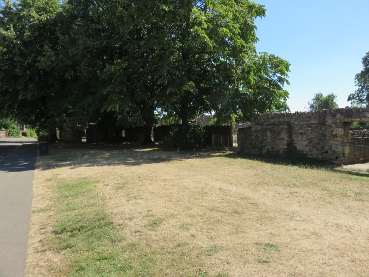
Today’s stone walls and the Indian restaurant next door are the only standing remains of the country house that once stood here. Today, Barr’s Court Park is a public open space with a good children’s playground that is unique for the continued existence of its historic moat.
Enter the park. Take an anticlockwise walk around the space for glimpses of the moat, exiting via the gate on the left-hand-side of the space (18).
You will emerge on a footpath to the rear of the Indian restaurant. Once again, the route from this point onwards can be confusing to follow.
Take the following steps:
- Keeping the moat to your right, bear right briefly and then take the second left, a narrow footpath to the rear of the houses on Allington Drive and Stourton Drive.
- Continue straight on through a small green area, eventually emerging on Woodward Drive.
- Cross Woodward Drive and take the footpath opposite, which curves round to the right to join Frampton Court (19).
- Keeping to the left hand side of Frampton Court, go straight on onto another footpath and continue straight on, passing the ends of various cul-de-sacs. Keep to the right at the larger green area south of Stibbs Court (20).
- Emerging on Moor Croft Drive, turn left and then immediately right into Steel Court.
- Go straight on into a footpath and then turn left under the trees onto another footpath (21).
- Turn right onto a final footpath to emerge on Shellard Road close to the junction with Watson’s Road (22).
We have finally finished with the confusing suburban section. The next stage of the walk will take us out into open countryside for a while on the way down towards the River Avon.
Turn right onto Shellard Road and then bear right again onto Watson’s Road.
You will reach the A431 Bath Road in the heart of Longwell Green. Unfortunately, there is no pedestrian crossing on this section, but the road is usually not terribly busy.
Longwell Green is equipped with The Crown, a Harvester restaurant. There are also two local supermarkets just down the road.
Carefully cross the A431 and take Bagworth Drive opposite. At the end of the road, continue straight on along a narrow public footpath, reaching a path junction on the edge of the countryside (23).
The map shows a path continuing straight on in this location but, at the time of writing, it was not visible.
Take the following steps:
- Turn right briefly to enter a field, then climb the hill, keeping the field boundary to your left.
- At the top of the hill, go through a gap in the hedge to enter the second field.
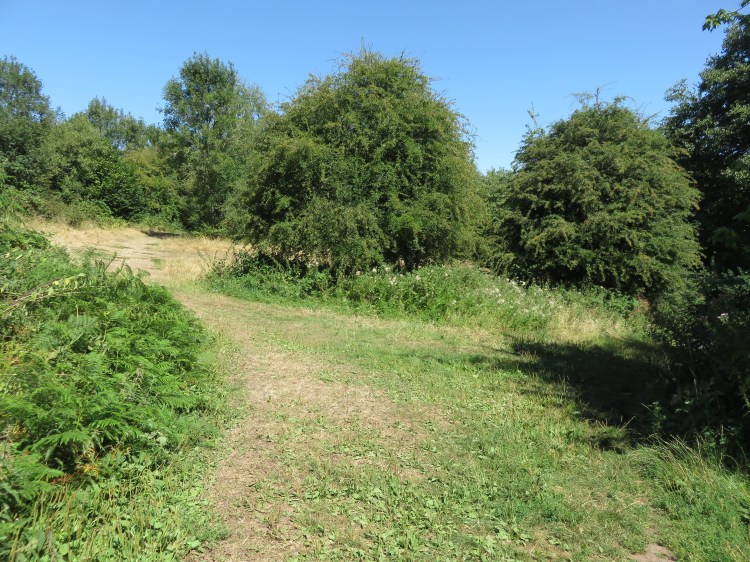
- Cross the field to a gate roughly opposite (24). You will emerge in a third field which slopes down away from you. Walking this time with the field boundary to your right, walk along the top of the field, eventually following the path up into a copse at the right-hand corner (25).

- As you emerge from the copse, bear left onto a lower path. You will reach a fork where the field falls away downhill and you can see a footbridge over the Avon Ring Road in the distance (26).
Here, you have a choice. You can either follow a shorter route back to the starting point, or you can continue along the main route.
Shorter route
To follow the shorter route, take the right fork and make your way to the footbridge, crossing a stile. Go straight on across the Ring Road Cycle Path and follow another footpath to return to Crossleaze Road. Turn left to complete the walk.
To continue following the main route, take the left fork. Crossing a stile, you will reach a footpath between two broken-down farm buildings (27).
Turn left between the two buildings, crossing another stile. Continue straight on, following the path down through three more fields to emerge on Abbots Road. Turn left and immediately bear right onto Ferry Road (28).
Ferry Road leads down to the River Avon at Hanham Lock, an area also known as Hanham Mills.
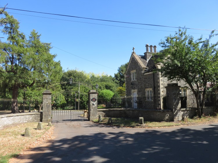
At the top of Ferry Road, the pleasant triangle of grass lined with lime trees is part of the approach to the nearby Hanham Court. At certain, limited times of year, the gardens at Hanham Court are open to visitors.
On the first corner in Ferry Road you will find Hanham Lodge, an attractive country property.
Ferry Road is narrow and fairly busy at certain times of day due to the popular pubs at the bottom of the hill. Beyond Hanham Lodge, you may wish to take the rough footpath that runs parallel to the top section of the road.
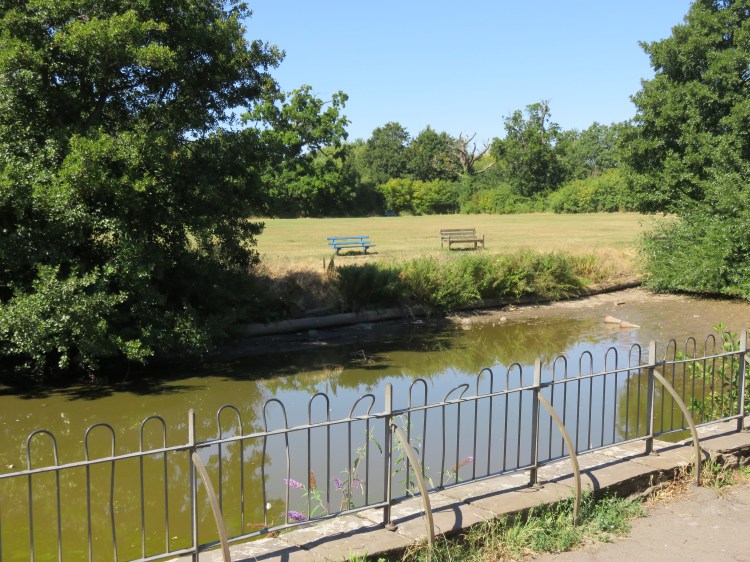
Follow Ferry Road to the bottom of the hill, reaching the river (29).
You have finally reached Hanham Lock, where there is also an attractive weir and a cluster of pretty historic buildings.
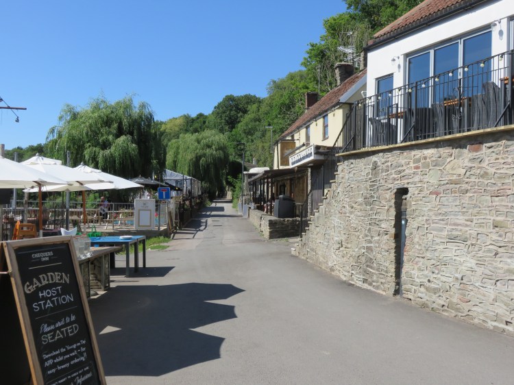
The Chequers Inn and Old Lock and Weir Inn are both very popular destinations for food and drink. Both have pleasant beer gardens next to the river.
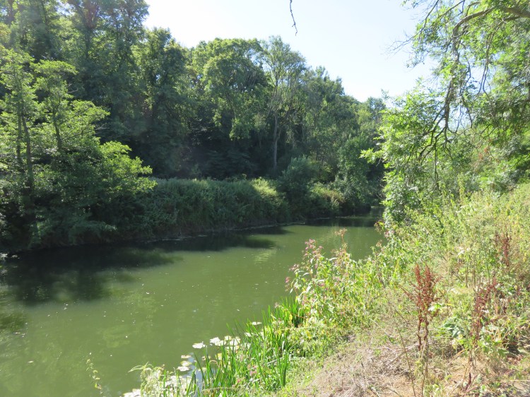
Follow the road past the pubs and the historic houses. At the end of the road, continue along the towpath (30).
Passing underneath the Avon Ring Road, the towpath will offer you a very pleasant stroll alongside a quiet section of the River Avon.
Continue along the towpath until you reach Riverside Cottages.
Riverside Cottages is a pleasant enclave that feels a world away from the bustle of the city. It can only be accessed via a rough track leading down the valley side from Hanham.
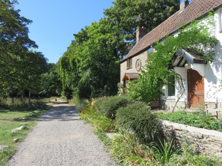
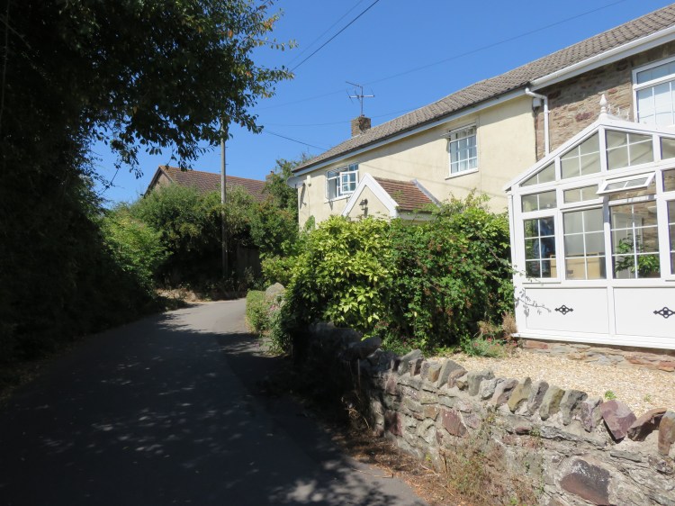
Turn right up the track just after the last cottage, which is signed as a public footpath to Castle Farm Road (31).
The track climbs gradually, winding through the woodlands of the Avon Valley. Eventually, it joins Castle Farm Road next to a small car park.
Bear right along Castle Farm Road and follow it to return to Abbots Road and complete the walk.
