Last updated: August 2024
Walk Map | Download walk as PDF
Walk Thirty-Four ventures into an industrial area of Avonmouth. This may seem like an unusual choice, but there is a lot of interest to be found here.
The area of Avonmouth west of Hallen village used to be farmland. It is an artificially drained landscape criss-crossed by a network of drainage ditches known as rhines. Because of the development constraints presented by the drainage rhines, two of the area’s old country lanes have survived, threading their way between the solar farms and warehouses of Avonmouth.
These lanes are valuable corridors for wildlife. It’s common to see birds such as ducks, herons and little egrets in the area, as well as a wealth of smaller bird life making use of the scrub and hedgerows.
Explore a unique and alien landscape with this circuit. In the process, you will cross the M49 Motorway no less than four times.
Update, January 2026: I have been advised that footpath access has been closed and compromised on the stretch between Moorhouse Lane and Lawrence Weston Road, possibly due to development works. As such, this walk may not currently be passable. Thank you to the two readers, James and Tracy, who have contacted me with this information. I would welcome any further updates from readers as time goes on.
Useful Information
Terrain: Largely flat, with occasional raised road bridges and one stile.
Ground: Paved and unpaved. Some areas are likely to be muddy during the winter or after wet weather. Unfortunately there is no accessible alternative route available.
Key Attractions: Avonmouth old lanes and rhines.
Refreshments: Pub in Hallen village at the start and finish of the route.
Starting point: Moorhouse Lane, Hallen
Getting there: The route is most easily reached by car. There is usually space to park at the Hallen end of Moorhouse Lane.
Approx. Time: 2 hours
Approx. Distance: 3.9 miles
The Route
Our circuit starts in Hallen, a sleepy village just over the boundary in South Gloucestershire. A small cluster of houses and buildings centres around the crossroads of Moorhouse Lane, Berwick Lane and Severn Road.
The King William IV pub in Hallen is the only refreshment stop on this route.
Begin by walking out of the village along Moorhouse Lane.
Moorhouse Lane is the first of our old country lanes that criss-cross the northern part of Avonmouth. To begin with it, is an ordinary village street. However, later stretches are closed to traffic and become a pedestrian / cycle route only.
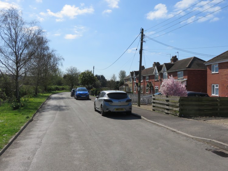
The first stretch is home to a pleasant row of red brick terraced houses (1), after which you will pass the historic buildings of Wellinghouse Farm opposite a quiet estate of park homes, after which the first drainage rhines emerge on both sides of the lane. Behind you to the left, the M5 Motorway heads uphill towards Almondsbury.

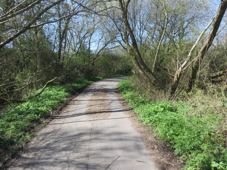
Continue past a playing field. At a junction after the playing field (2), go straight on into the closed section of Moorhouse Lane.
The closed section of the lane winds through a pleasant copse of native trees. Due to the road closure, nature has started to take over, and the lane gradually narrows down.
As you emerge from the copse, the lane widens out again as you cross the M49 Motorway for the first time. Native scrub lines the approach ramp to a very wide bridge that looks like it was built to handle industrial or farm traffic (3).
The bridge will give you views over the Avonmouth area with its numerous wind turbines. The Henbury Loop railway line passes to the left.
After you cross the Motorway, you will drop down to pass under the railway line at an old stone bridge (4).
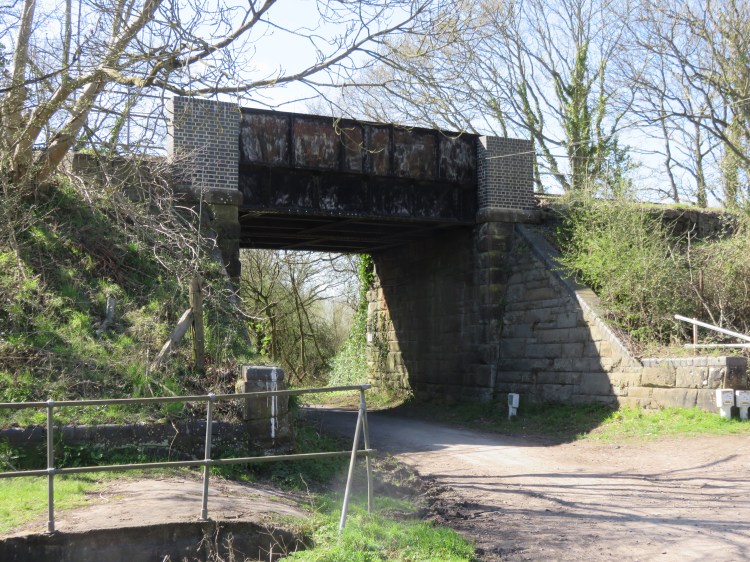
Proceed under the railway line. After the next right-hand bend, when the warehouses of Avonmouth start to come into view in the distance, take the small wooden footbridge that carries a footpath across the rhine on the left (5).
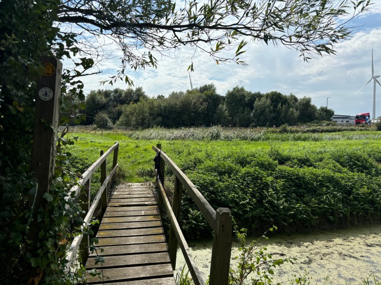
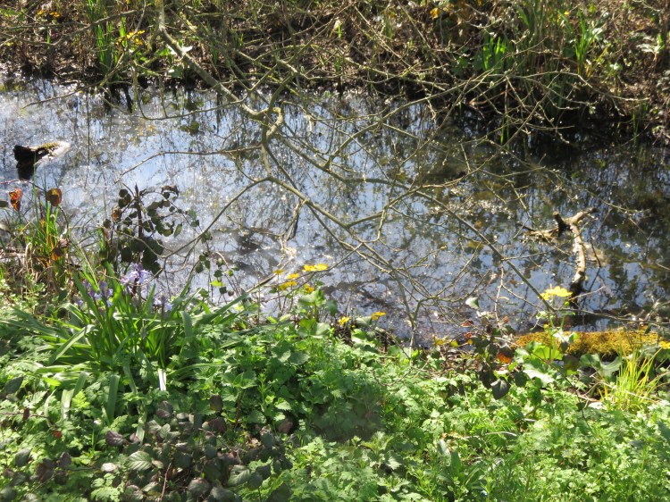
You will reach a pleasant grassy area containing a retention pond.
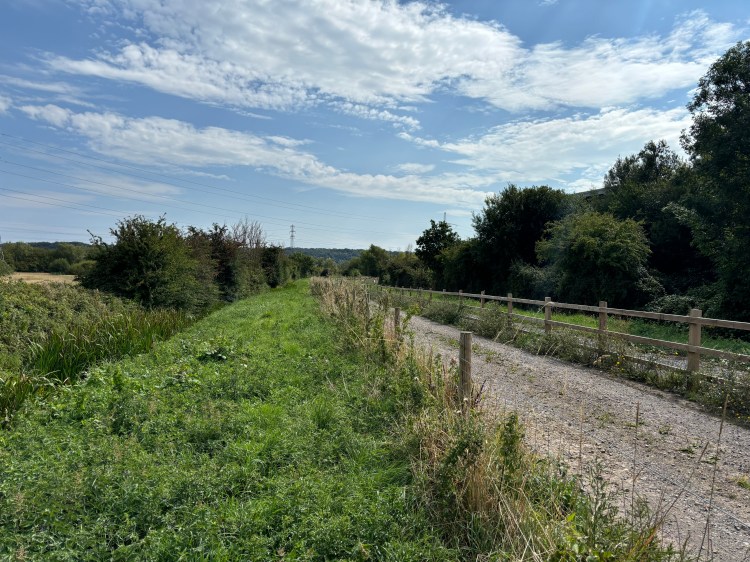
Bear left until you reach a pair of pedestrian gates. Go straight on along the metalled track beyond the first gate, following a grassy bank between two rhines.
The track will take you back towards the Motorway until it turns right across one of the rhines (6).
Follow the track across the rhine, then immediately bear left onto a gravel track that is blocked by a concrete barrier (7).
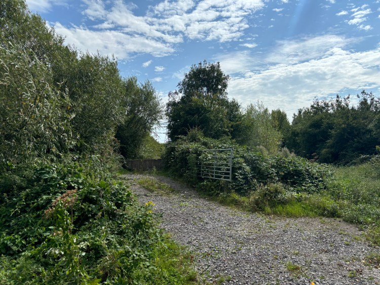
The gravel track climbs gradually, passing a massive Amazon distribution centre, to bring you to a most unusual feature of this walk: a bridge to nowhere.
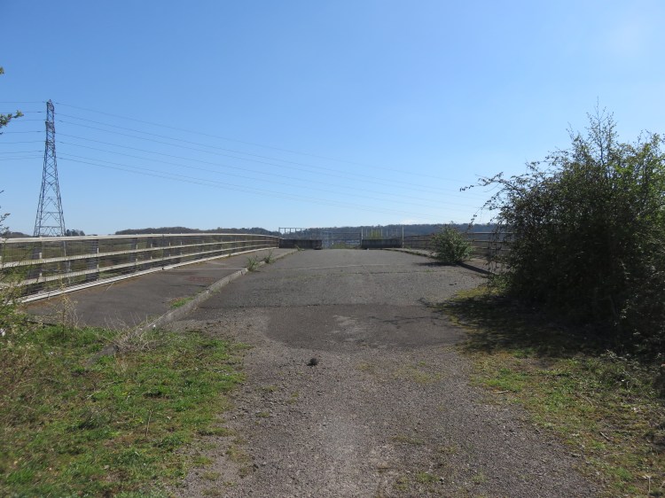
The bridge spans the M49 Motorway. Built to a similar standard as the Moorhouse Lane road bridge, it seems to have been built to safeguard access to the adjoining open land for future development. However, it has been entirely ignored by the modern warehousing development on the Avonmouth side, and now leads to nowhere at either end.
Cross the bridge to nowhere and descend the gravel track on the other side until you emerge at the end of a long field next to a solar farm (8).
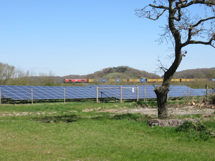
From the end of the long field you have a view northeast back towards Hallen next to the M5. The Henbury Loop railway line crosses the view. The line is closed to passenger trains, but is occasionally used for freight.
Turn right and walk along the edge of the long field. Watch out for boggy patches in the winter or after wet weather.
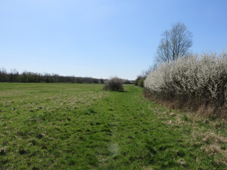
At the far end of the field, locate a stile behind a section of concrete pipe. Cross the stile and the footbridge beyond then turn right into Lawrence Weston Road (9).
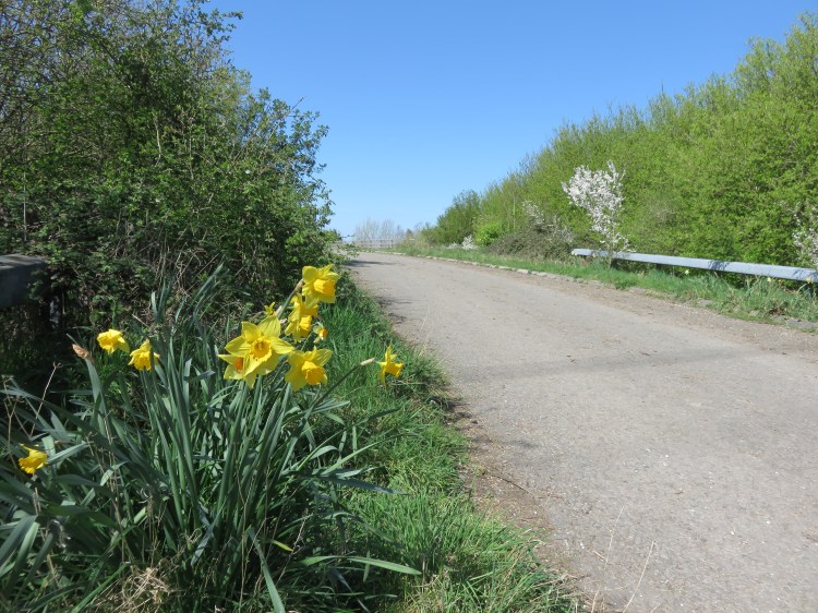
Lawrence Weston Road, linking Lawrence Weston with Avonmouth, is the second of our old country lanes through the industrial area (for a visit to very different section of Lawrence Weston Road, see Walk Thirty-Six ‘Lawrence Weston’). Like Moorhouse Lane, it is bounded by rhines on both sides and closed to cars. Recently upgraded to a superior cycle path with lighting, the lane has lost some of the ‘lost in time’ character it had when this walk was first published in 2021, but if you ignore the modern street furniture you can still get a feel for how it might have looked in its older, rural days.
Following Lawrence Weston Road you will quickly cross the M49 Motorway again, this time via an underpass.
You will emerge next to an open area that is often used for off-road biking (9). Unfortunately the area also attracts fly-tipping and the occasional burnt-out car. However, the grottiest section is short-lived.
Continue along Lawrence Weston Road.

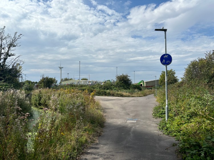
The wind turbines on the Wessex Water estate loom over the road here. It’s quite common to see grey herons fishing in the rhines along this stretch, which suggests that the water is quite healthy, despite the high level of littering. If you should be lucky enough to put up a heron, enjoy its prehistoric look as it takes to the skies.
There are a couple of features of interest to note here. At the first bend, behind some very overgrown metal gates, you can glimpse the remains of Katherine Farm (10), comprising an old farmhouse and a stone barn. The site is now part of the Wessex Water estate. A short while after the second bend, you will have an unusual pedestrian view of the Avonmouth Household Waste Recycling Centre (11).
On a bend shortly after you pass the recycling centre, turn right onto a wooden footbridge that carries a public footpath over the rhine to an open area beyond (12).

The open grassy area contains another retention pond.
Follow the path along the right-hand side of the open area. After a kink to the right, the path will bring you out on Poplar Way East.
Poplar Way East is a service road within Cabot Park, a modern industrial estate dominated by large warehouses.
Cross Poplar Way East. Turn left briefly until you have crossed another rhine and then turn right next to a sign that reads ‘Public footpath to Moorhouse Lane’ (13).
The footpath runs through a pleasant grassy strip next to an industrial compound. As you go, an avenue of trees will appear on the right. The rural scene is reminiscent of the lines of poplar trees that you can find in Normandy. The trees are also laden with mistletoe.

At the end of the footpath, cross two concrete bridges and turn right onto a dirt and gravel track (14).
This track is an extension of Moorhouse Lane, which we were on earlier. You will find yourself walking down the middle of the avenue of trees. Historic mapping suggests that the land may once have belonged to nearby Moorend Farm or Packgate Farm; both farms are long gone now, commemorated only by the names of the roads within the Cabot Park estate.

Make your way down through the avenue of trees. Eventually the track turns into a tarmac cycle path as you cross Packgate Road (15). Go straight on to return to the main section of Moorhouse Lane.
You will quickly return to the point on Moorhouse Lane where you turned off earlier (5).

From here, simply retrace your steps along Moorhouse Lane, crossing the M49 Motorway for a fourth and final time, to return to Hallen (1) and complete Walk Thirty-Four.
Coming Up
In Walk Thirty-Five ‘Hambrook and Winterbourne Down’ we will explore a lovely section of the Frome Valley just to the north of Bristol, and get a taste for some of the adjoining villages and footpaths.
