Last updated: April 2021
Walk Map | Download walk as PDF
The River Frome threads its way into Bristol through several villages of traditional stone cottages.
Walk Twenty ‘Stapleton and the Frome Valley’ explored the relatively well-known stretch of the Frome close to Bristol. Walk Thirty-Five goes a bit further out to discover a particularly quiet and idyllic section of the valley at the hamlet of Moorend, also visiting the historic villages of Hambrook and Winterbourne Down in the process.
The main part of the route is an on-road route that is fully accessible if you include one detour. By contrast, the last part of the route follows footpaths and is not accessible, but that part can easily be skipped.
This is not a particularly long circuit, but it is not one to be rushed.
Useful Information
Terrain: Undulating, including a couple of fairly significant climbs.
Ground: Paved for the most part, with an unpaved and potentially muddy section at the end that can be skipped.
Key Attractions: Whiteshill Common, Frome Valley, Bradley Brook Valley.
Refreshments: Two pubs within easy reach of the route.
Starting point: Whiteshill Common, Hambrook
Getting there: Whiteshill Common is served by bus services running from Bristol to Yate via Hambrook and Winterbourne. Free car parking is available at the edge of the common itself.
Approx. Time: 2 hours
Approx. Distance: 3.1 miles
The Route
Our route starts at Whiteshill Common in the Hambrook area.
The White Horse pub, a short walk away at the corner of Whiteshill and Bristol Road, is one of two refreshment stops available on this circuit – it can also be reached easily from a later point in the route.

A pleasant green space that also serves as a cricket ground, the common is surrounded by a number of historic buildings including a war memorial and Whiteshill Evangelical Church. Over the far side of the common there is a view to an attractive tree-crowned hill above The Old Vicarage, an historic property on Mill Road on the edge of Winterbourne Down.

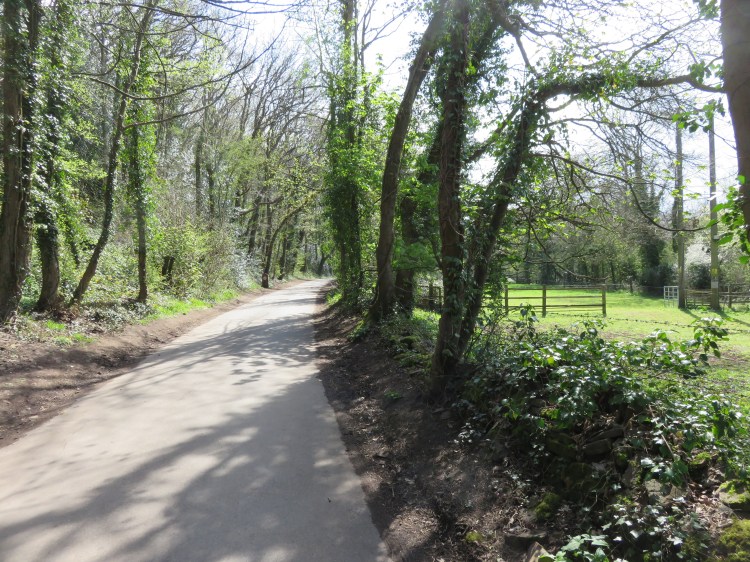
Make your way along the start of Worrells Lane, a quiet road on the south side of the common. Turn right into Moorend Road at the corner of the green (1).
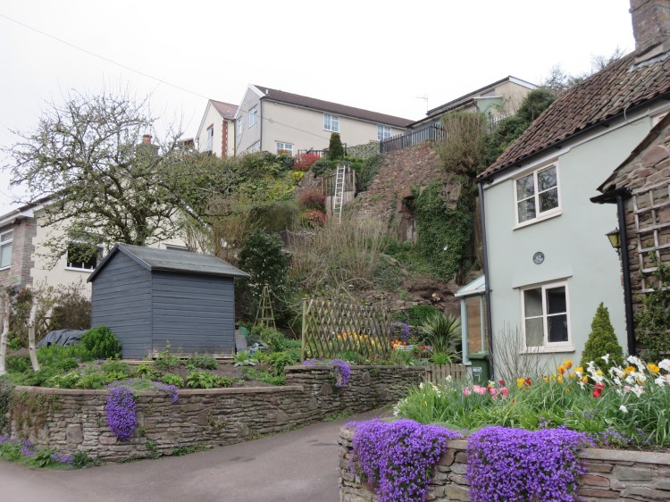
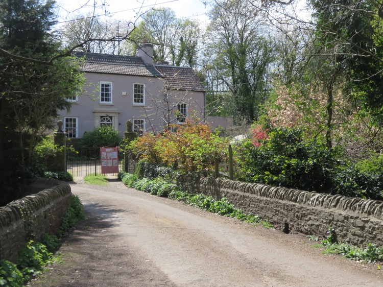
Moorend Road has the feel of a quiet country lane. It descends into the Frome Valley next to an attractive stone wall, arriving on a little stone bridge over the River Frome in the hamlet of Moorend (2). Pretty, well-kept gardens sit below the road on either side.

Continue across the bridge, following the curve of the river round to the left past the first junction.
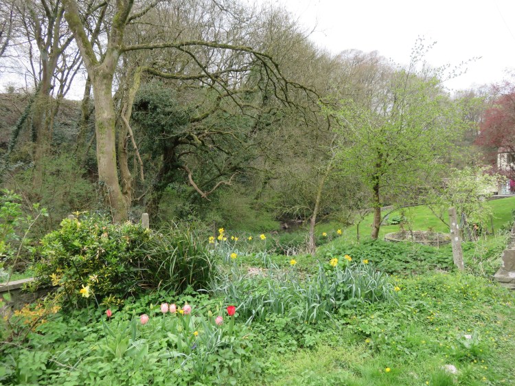
After passing a small cluster of historic buildings, the road follows a fairly placid section of the river for a little while, through woodland with green pastureland to either side.
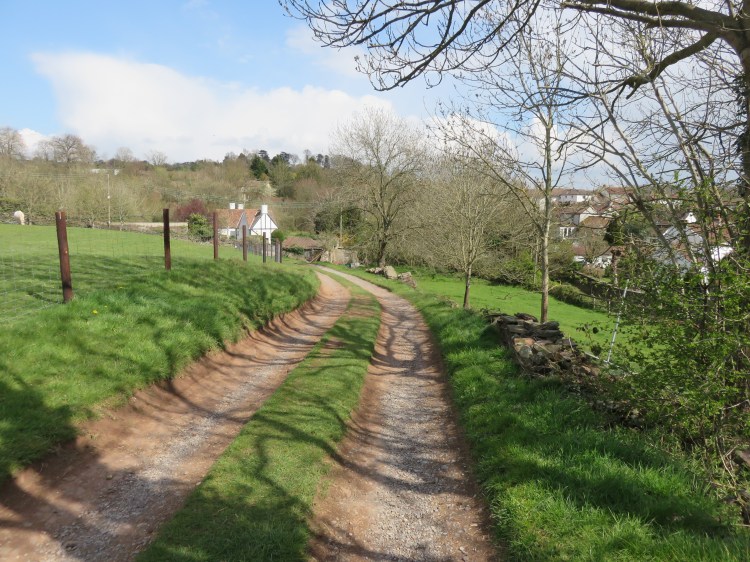
At the next junction, leave the river, going straight on into Bury Hill (3).
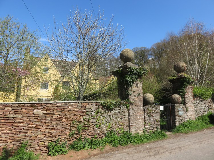
To start with, Bury Hill climbs up past several historic properties, most substantial of which is Moorend Farm with its imposing gate posts.
At the next crossroads (4), go straight on to continue climbing past a belt of trees.
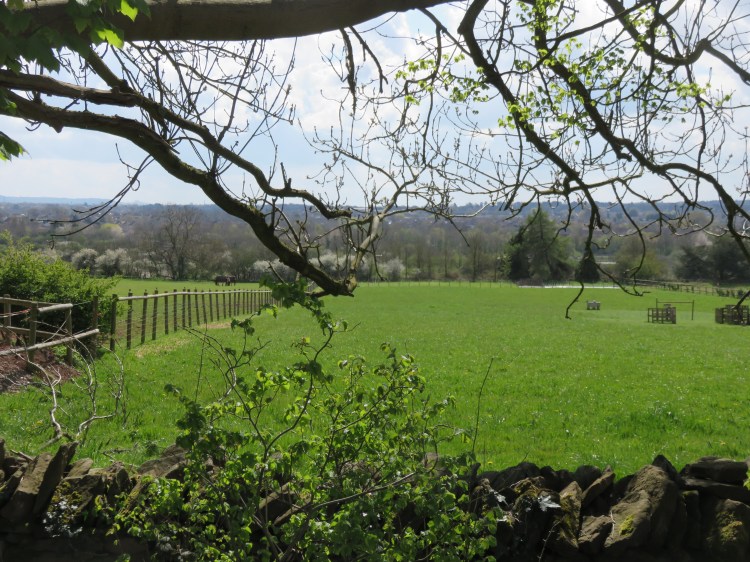
As you begin to crest the hill, you will have decent views towards Bristol across the fields to the right. The M4 Motorway crosses the view, but is largely hidden from sight.
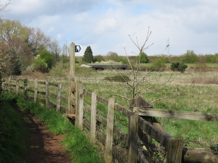
You will reach a right-hand bend with a footpath gate on the left (5).
Alternative route
The main route is an accessible route that stays on the road but, optionally, turn off at the gate (5) and follow a straight section of unsurfaced footpath for a better view of the distant houses of Winterbourne Down. Rejoin Bury Hill at the far end of the path (6).
The main route continues along Bury Hill. After a short while you will reach a row of pleasant cottages at a left-hand bend. This is followed by a right-hand bend, where the alternative route rejoins via a footpath gate on the left (6).
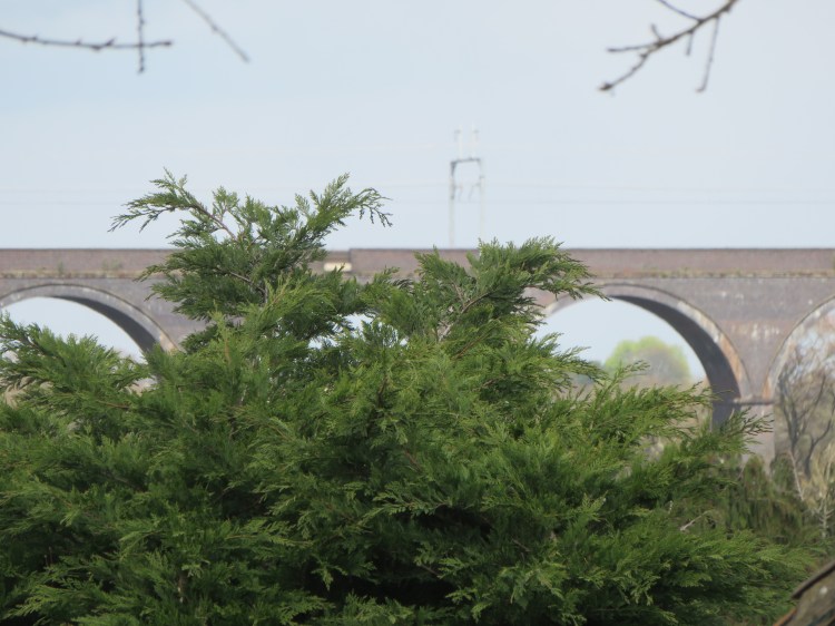
From this point, Bury Hill descends fairly steeply towards the Frome Valley. As you descend, look out on the left for glimpses of the distant Winterbourne viaduct that carries the main railway line over the Frome Valley a little further upstream.
Bear left at the next junction and descend the final, meandering section of Bury Hill.
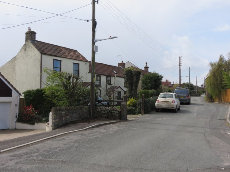
At the foot of the hill you will cross the pleasant little Folly Brook to emerge on the fairly busy Down Road.
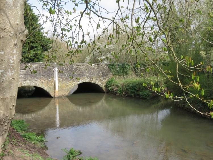
Cross Down Road and turn left to cross the River Frome via the footway marked on one side of an old stone bridge (7).
You are now entering the village of Winterbourne Down.
Immediately after the bridge, turn left onto The Dingle.
The Dingle is a pleasant riverside street whose vertically stacked houses are very reminiscent of the nicest parts of Frenchay Village (see Walk Twenty ‘Stapleton and the Frome Valley’).
Make your way along The Dingle, climbing gently.
The River Frome can be glimpsed over gardens to the left.
The hill gets steeper next to a gravel driveway where signs mark the Frome Valley Walkway leading off to the left (8).
Alternative route
The main route remains on the road for accessibility’s sake and to see some more of the historic lanes of Winterbourne Down. However, if you would prefer to hug the river, bear left at the driveway (8) and follow the Frome Valley Walkway, an unsurfaced path, crossing the river as you go. Rejoin the main route at the next road (12).
To follow the main route, continue up The Dingle.
At the top of the hill, The Dingle merges with Stone Lane. The housing becomes a bit more ordinary for a while until you merge with Church Road (9), when older cottages start to reappear on the left. These properties benefit from a position at the top of the Frome Valley, and must have a pleasant view from their rear windows.
The Cross Hands pub can be found on the parallel road to the right.
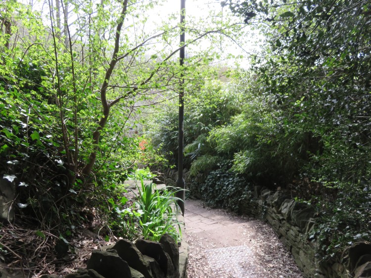
Follow Church Road until it begins to descend again, then turn left onto Mill Steps, a footpath next to a stone house at No.10 Church Road (10).
Accessible route
To avoid the steps, continue down Church Road and then turn left onto Mill Road, rejoining the main route at the bottom of Mill Steps (11).
Mill Steps is a charming footpath that descends past a few cottages and their quiet gardens. It comes out at the junction of Mill Road, Worrells Lane and Frome Bank Gardens, where the accessible route rejoins the main route (11).
Bear left so that you cross a bridge over the River Frome, reaching an apparently unnamed road where the alternative route along the Frome Valley Walkway rejoins from the left (12).
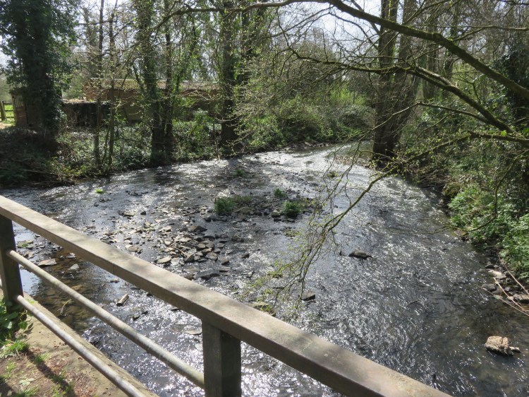
This particularly wide and shallow part of the Frome clatters down over the rocky riverbed.
Follow the unnamed road.
The road runs along the bottom of a pleasant wooded slope, heading back in the direction of Moorend. To the right, a secluded paddock where horses are kept separates you from the river.
At the next fork (13), bear right to continue following the river.
You will now find yourself back on the peaceful section of the river that you saw at the beginning of this walk.
At the junction with Bury Hill (3), bear right and retrace your steps from earlier until you return to the stone bridge with the pretty gardens to either side (2).
Accessible route
The rest of the main road leaves the good roads and paths behind and ventures onto unsurfaced footpaths, also including five stiles in various states of repair. To skip this section, simply go straight on up Moorend Road to return to Whiteshill Common (1) and finish the walk early.
To follow the main route, cross the stone bridge (2) and immediately turn left along the Frome Valley Walkway.
The footpath runs at an elevated position above the Frome surrounded by pleasant vegetation. Please note that this section may be muddy after wet weather.
After a while, the footpath turns into a track that descends to a little road next to another stone bridge (14). This bridge crosses the Bradley Brook, a tributary of the River Frome that we will now be following for a while.
Cross the bridge.
You will approach Rock House, a large Georgian property. You may notice that it backs directly onto the M4 Motorway, which runs along a high embankment here.
Walk past the main entrance to Rock House’s driveway and then take the first pedestrian gate on the right onto a public footpath (15).
The footpath runs directly in front of Rock House, crossing its driveway, and then takes you – via another pedestrian gate – into a pleasant meadow next to the brook.
Follow the trodden path across the meadow and climb the stile to reach Bristol Road (16) next to the Motorway viaduct. Cross Bristol Road and climb a second stile which is roughly opposite to reach another footpath.
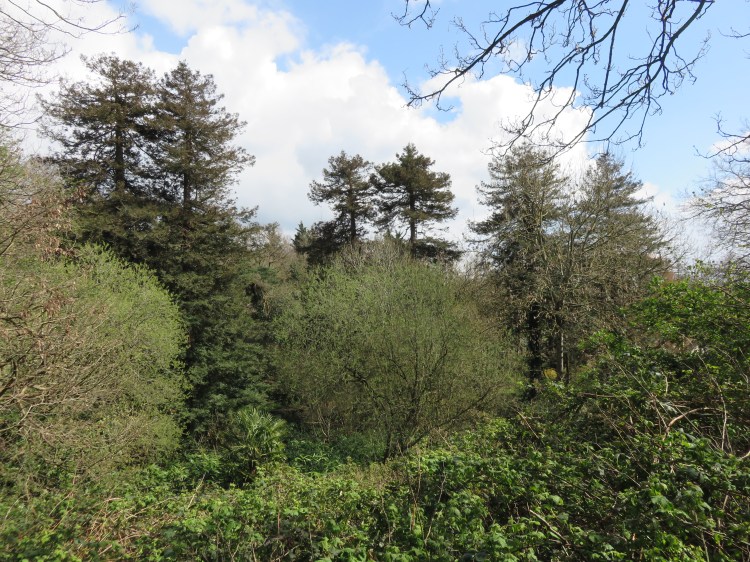
The footpath climbs up along the top of the Bradley Brook valley. The landscape here has a feeling of intention and age, with several significant specimen trees visible in the distance.
Soon bounded by an old stone wall, the footpath gradually converges on the M4 Motorway, which remains largely hidden from a view in a cutting, although you will certainly hear it.

After a while you will find yourself looking directly down onto the roundabout at the junction of the M4 and M32 Motorways.
Climb the stile next to the Motorway junction and take a footpath across a field (17).
The footpath makes its way through a pleasant area of pasture, crossing two further stiles until it comes out on a track leading to Brook Farm (18). The Bradley Brook is visible again on the right, running through a channel below the houses around Whiteshill Common.
Make your way down the farm track towards the houses.
At the end of the track, turn right onto Quarry Barton to reach another stone bridge (19).
This is the last of the stone bridges on our route, providing a final crossing of the Bradley Brook before we return to the main road. The traditional cottages here have a quiet, village feel.

Climb the hill and, at the end of the road, turn right onto the main road. Simply follow the road to return to Whiteshill Common and complete Walk Thirty-Five.
Coming Up
In Walk Thirty-Six ‘Lawrence Weston’ we will return to Bristol’s outer suburbs to look for natural and historic interest among one of the city’s larger council estates, taking in nature reserves, parkland and even a Roman villa.
