Last updated: May 2020
Walk Map | Download walk as PDF
Walks Eight ‘Bedminster, Totterdown and Windmill Hill’ and Nine ‘Knowle, Windmill Hill and the Northern Slopes’ have already provided a solid introduction to this part of south Bristol, but there is still more to discover in the area.
Walk Ten explores the pleasant residential streets of Upper Knowle before leading you, via quiet alleyways, to the wild spaces of Callington Road Local Nature Reserve. From there, you will trace a course through the residential quiet of Kensington Park before visiting Arno’s Court Park and returning briefly to Arno’s Vale Cemetery as seen in Walk Eight.
Please note that the cemetery gates are locked overnight. Opening times vary by season.
Useful Information
Terrain: Undulating, with fairly flat sections and one major climb. Includes steps (can be avoided by taking detours).
Ground: Paved and unpaved. Ground may be soft underfoot at the back entrance to Arno’s Vale Cemetery during the winter or after wet weather (can be avoided by taking detour).
Key Attractions: Perrett Park, Callington Road Local Nature Reserve, Arno’s Court Park, Arno’s Vale Cemetery.
Refreshments: There is a range of pubs and eateries available around the start and end of the walk at Wells Road. There is a major supermarket at Callington Road and a café at Arno’s Vale Cemetery.
Starting point: Bushy Park, Totterdown
Getting there: 30 minutes’ walk from Centre Promenade and 15 minutes’ walk from Temple Meads Station. Widely accessible by bus including routes running to Stockwood and Hengrove via Wells Road. On-street parking available in surrounding area.
Approx. Time: 2 hours
Approx. Distance: 3.7 miles
The Route
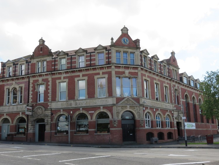
Our route starts at the nominal centre of Totterdown: Bushy Park, the small open space at the junction of Wells Road and St. John’s Lane. The once thriving centre of Totterdown was badly fragmented by demolitions for an abortive road scheme in the 1970s, but the various distinct parts of modern Totterdown converge here. The Banco Lounge, occupying a former Lloyds Bank building, is the area’s principal historic landmark.
If you would like to fuel up before you start, the Banco Lounge is part of a local bar / restaurant chain that has now gone nationwide. They serve a range of food throughout the day, often with an American inspiration.
Begin by walking along Bushy Park, to the side of the Banco Lounge. Take the first left into Winton Street.
Winton Street passes the rear of a former cinema. It’s not much to look at now, but a mural of people queuing for the ‘flea pit’ is a nod to its history.
At the end of the road, turn right onto Knowle Road.
Knowle Road, as the name suggests, marks the boundary on this side of Wells Road between Totterdown and Knowle. Whereas Totterdown is dominated by small Victorian terraced houses, Knowle is a leafier area of larger Edwardian terraces and between-the-wars semi-detached houses. The houses in this particular street have a more upscale feel, albeit with quite a lot of modern infill and unsympathetic alterations.
Knowle Road ends in a cul-de-sac. Turn left onto Bayham Road.
On Bayham Road you will begin to climb up past Perrett Park Allotments (1). There may be no finer view from an allotment in Bristol. The panorama stretches from the distant ridge line of Dundry on the left, over east Bedminster and Victoria Park in the foreground, to Ashton Court and Clifton Suspension Bridge on the far right.
As you continue up Bayham Road, you will pass Perrett Park itself, whose steep and panoramic slopes make it a popular sledging spot in winter.

At the crossroads just beyond Perrett Park, turn left into Crowndale Road.
Crowndale Road is a particularly leafy example of Knowle street, flanked by lime and London plane trees.
Returning to Wells Road, turn left briefly to cross over at the traffic lights next to Totterdown Baptist Church (2), then double back and begin to climb the hill.
This stretch of Wells Road provides a number opportunities for refreshment, including food stores, the popular Acapella café and the George pub at the top of the hill. Restaurant meals tend to be served in the evenings rather than during the day.
Wells Road is very busy and has a rather narrow pavement, but it has just about enough trees to stay pleasant. After cresting the hill next to the George pub and crossing Somerset Road you will soon reach the junction with Beaconsfield Road, which is marked by three particularly lovely pine trees.
Turn left onto Beaconsfield Road.

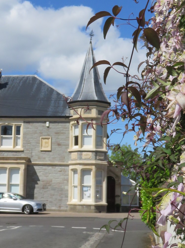
Once on Beaconsfield Road you have entered the area known locally as ‘Upper Knowle’. Most of the houses in the area are substantial Edwardian terraces, but this street is home to some particularly graceful properties, including a house with a distinctive turret that looking like something out of a J.K. Rowling novel (3).
Apart from the unusual name, Maxse Road is a more ordinary Upper Knowle street of terraced villas. As you reach the far end of the street, a converted former school draws the eye with its decorative stonework and arched windows.
At the end of Maxse Road, turn left into Greenmore Road and immediately right into Glena Avenue.
Glena Avenue distinguishes itself with an avenue of attractive lime trees, which continues around the corner onto Priory Road. Watch out for fairy doors on the trees.
At the end of Glena Avenue, turn right onto Priory Road until you reach a complicated junction with a main road.

The winding, five-way crossroads (4) of Priory Road, Talbot Road and St. Martin’s Road can cause much confusion with the way its streets are named. It can also be a dangerous place to cross the road due to its blind corners, so choose your spot carefully.
Cross Priory Road / Talbot Road (main road section), turn right along Priory Road (main road section) and then immediately left into St. Martin’s Road.
St. Martin’s Road has a slightly more prestigious feel than its neighbours, with some detached and semi-detached houses in the mix, one pair of which sports twin three-storey turrets. Along the way, you will pass the back of St. Martin’s Church.
At a sharp corner just after the church (5), where St. Martin’s Road doubles back towards the main Wells Road, turn left instead onto St. Martin’s Gardens.
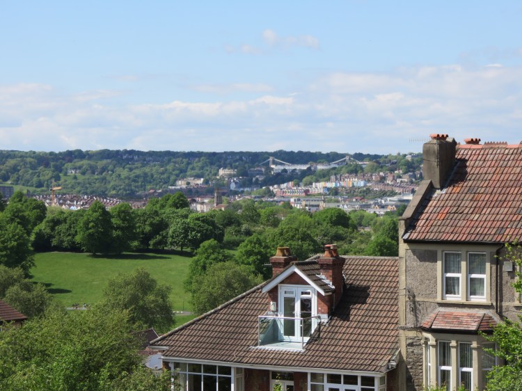
A short cul-de-sac, St. Martin’s Gardens ends with a panoramic view out over Brislington, with the tree-capped Kelston Round Hill in the distance. Next to the viewpoint, you will find a narrow footpath heading on down the hill.
Alternative route
The next stretch of the main route involves descending two flights of steep steps on the way down into Callington Road Local Nature Reserve. The steps can be avoided by taking a fairly significant detour along main roads.
Return to St. Martin’s Road (5) and bear left to rejoin Wells Road. Turn left and walk down the hill, crossing Imperial Walk, eventually arriving at a major junction with traffic lights.
Turn left onto Wootton Park, where you can at least put some distance between yourselves and the busy traffic. After the last of the houses, where Wootton Park becomes Callington Road, continue along the cycle path next to the road.
Look out for a gate on the left and enter Callington Road Local Nature Reserve via the meadow. Follow the footpath round past the pond to rejoin the main route at a crossing of paths marked by a carved wooden statue of an owl (6).
If following the main route, continue down the narrow footpath from the end of St. Martin’s Gardens. Beware steep steps, particularly at the bottom.
Emerging on Imperial Walk, cross over and descend another flight of steps to enter Callington Road Local Nature Reserve.

Your visit to Callington Road Local Nature Reserve begins with a gentle descent down a sun-dappled, tree-lined path overgrown with cow parsley and other woodland plants. Before long you will reach a crossing of paths, watched over by a carved wooden statue of an owl, where another path comes in through a meadow on the right (6).
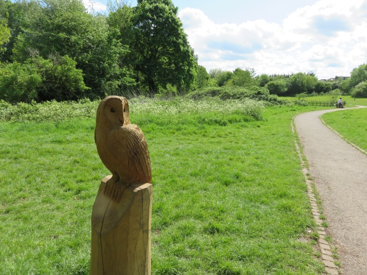
Turn left through a gate to find yourself on a second path running through hawthorn scrub. Follow the path in either direction – it’s a loop – to see the more peaceful, wilder area of the nature reserve. Look out for meadow flowers, insects and birds. There is more to explore in this area if you are willing to venture off the path for a while. When you are done, return via the same path to the owl statue (6).
Turn left back onto the main path, descending towards Callington Road. Emerging from the nature reserve, turn left onto the cycle path next to the road.
Busy Callington Road is the main orbital route in these parts, at least until south Bristol gets a proper ring road. There’s no need to linger here, so press on along the cycle path, walking alongside the boundary fence for Callington Road Hospital. Before long the path will lead you away from the main road, diverting towards a major supermarket.
Avoid going through any underpasses and continue straight on, emerging alongside the supermarket car park. Cross the access road to Callington Road Hospital (7) and continue straight on along the cycle path.
The cycle path, which is part of the Whitchurch Way route out from Bristol City Centre, now runs between the Talbot Road Allotments (left) and a scrapyard (right). The scrapyard is all that remains of Brislington Station. Long-delayed transport plans may yet see the track bed converted into an orbital transport link that will relieve pressure on the busy A4 bath road.
As you turn the corner at the far end of the allotments, a view back up to Upper Knowle will open out in front of you, drawing your eye up the backs of the houses on steep Talbot Road to the distinctive red brick water tower at the top of the hill.
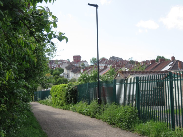
Follow the cycle path round to the right, passing between the houses to emerge on Talbot Road. Cross Talbot Road and go straight on into Hampstead Road.
This neighbourhood is known locally as Kensington Park. Hampstead Road is a road of two parts. The first section is a fairly busy rat-run, whose main distinctive feature is its attractive and unusual street trees. However, as you cross Kensington Park Road, passing a corner shop (8), it becomes a much quieter affair.
The lower section of Hampstead Road is a long but gentle descent between well-kept terraced villas. Many of the houses have their own individual names inscribed above the front door. At the mid-way point you will pass the workmanlike St. Christopher’s Church, faced in red brick. The distant trees mark the edge of Arno’s Court Park.
At the end of the road, turn right onto Kings Road. After a short distance, turn left through a gap in the wall to enter Arno’s Court Park.
Arno’s Court Park is the main recreational resource for the communities of Kensington Park and Arno’s Vale. Its children’s playground and BMX pump track are always popular, as is its south-facing, grassy slope with pleasant views over Brislington.

If following the main route, strike out across the grass, climbing to the highest point of the hill. There you will find, after a couple of steps, a hidden gate providing access to the upper area of Arno’s Vale Cemetery (10). However, be warned that this access can get very slippery and muddy during the winter or after periods of wet weather. Two alternative routes are available.
Alternative route 1
The steps and potentially muddy climb can be avoided if you are prepared to spend some time walking along the main road.
From the Kings Road gate to Arno’s Court Park (9), follow the cycle path round to the right of the children’s playground. Sticking to the edge of the park, you will soon emerge on the main A4 Bath Road close to the Arno’s Manor Hotel (said to be one of Bristol’s most haunted buildings).
Turn left and follow Bath Road past the hotel and the television studios that follow it. Soon you will pass the main gates to Holy Souls Catholic Cemetery. Go past these gates to reach the main front entrance to Arno’s Vale Cemetery, with its two distinctive lodges.
Entering the cemetery, bear right and keep right to take the paved drive leading up the hill. Continue up the drive, enjoying the peace and quiet and views across the cemetery, until you can exit via the upper gates to rejoin the main route at Cemetery Road (11).
Alternative route 2
At time of writing, Arno’s Vale Cemetery is closed to general visitors due to the COVID-19 outbreak. A second alternative route is required if you are completing this walk at a time when the cemetery is closed for this or any other reason.
From the Kings Road gate to Arno’s Court Park (9), begin by striking out across the grass to the left of the children’s playground, but only as far as the main paved path running diagonally across the park.
Bear left along this path to reach the woodland at the southwest corner of the park. From this point, follow the main paved path steeply upwards through the woods, avoiding the left turn that leads out onto Queensdown Gardens.
At the top of the hill, just before coming out onto Withleigh Road, turn right onto another path so that you emerge at the end of Somerset Road.
Follow Somerset Road, with its terraced houses, all the way back to Wells Road, emerging by the George pub. Turn right down the main road and then right again into Clyde Road, entering Totterdown. Follow Clyde Road as it turns the corner into Clyde Terrace then, at the end of the road, turn right into Cemetery Road to rejoin the main route just outside the upper cemetery gates (11).
If following the main route, enter the cemetery via the gate at the top of Arno’s Court Park (10).
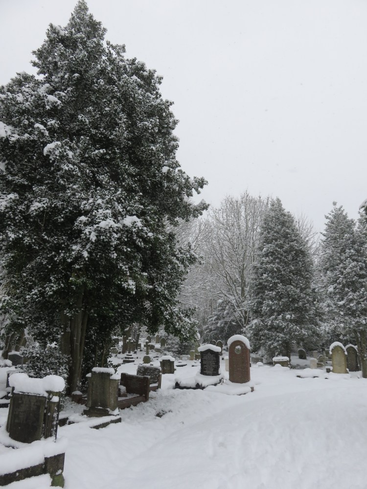
You will enter the top section of Arno’s Vale Cemetery via an unmade path leading up the hill. This peaceful area of the cemetery is a long way from the noise of Bath Road. As you continue up the hill, you will pass an area of woodlands off to the left which are now used for natural burials.
We will be sticking to the top section of the cemetery today, but for a fuller exploration try Walk Eight ‘Bedminster, Totterdown and Arno’s Vale’.
Continue up the path until you emerge at the end of the main driveway, next to the war memorial.
The top section of the cemetery is one of its sunniest areas, and is home to lots of lovely meadow flowers in the summer.
Continue straight on along the main driveway. Follow it round to the right to reach the upper cemetery gates. Step out onto Cemetery Road (11). Alternative routes 1 and 2 rejoin the main route here.
The nonconformist chapel, in the lower part of the cemetery, is home to the Atrium Café, which may be a good opportunity to pause for a drink and a cake if you don’t mind the detour.
You have now returned to Totterdown. The area around the upper cemetery gates is home to some of the area’s most peaceful and well-kept streets. Locals know this area as ‘Upper Totterdown’.
Turn right into Hawthorne Street.
Hawthorne Street is a well-mannered street of colourful terraced houses that is typical of this area of Totterdown.
Take the next left, Fordell Place. At the end of the road, turn left into Arno’s Street. Follow the road past the back of Hillcrest Primary School, turning the corner into School Road. After crossing the top of Park Street, turn right through the gates into School Road Park (12).
The north-facing School Road Park may not look like much, but it is extremely popular with the local school children. To the far left, you can see the green copper tower of Holy Nativity Church on Wells Road. Off to the right, as you pass the children’s playground, you can glimpse views of industrial St. Philip’s Marsh in the distance. Closer at hand, you will also have a good view of Vale Street (said to be the steepest street in England), whose houses really do appear to ‘totter down’ the hill.

Continue past the playground and leave the park via the steps down to Goolden Street. Go straight on and across the crossroads to reach Stanley Hill.
Alternative route
Walkers wishing to avoid the steps can bypass this section. Instead of going down the steps, leave the park via the side gate onto School Road and follow the road round to emerge on Wells Road next to Holy Nativity Church. Head down the hill, rejoining the main route at the top of Firfield Street (13).
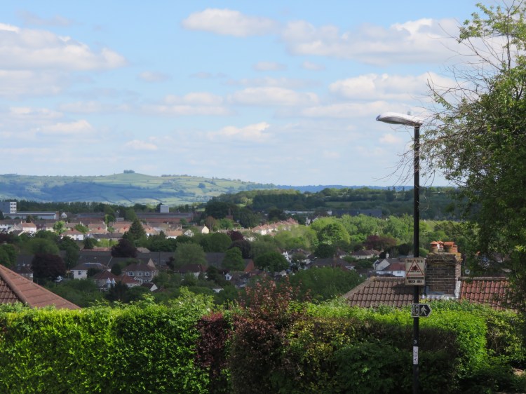
Stanley Hill is an attractive Totterdown street featuring gabled houses. The street offers a dynamic view out over Temple Meads Station and the City Centre beyond, with the terraces of Kingsdown visible in the far distance (see Walk Four ‘The Northern Edge’).
Descend Stanley Hill. After passing the first row of houses, turn left onto Firfield Street and climb back up the hill. As you approach the main Wells Road, cut across the pocket park on the right (13).
The open space at the top of Firfield Street is another legacy of the Totterdown clearances for the abortive road scheme. These days it is a pleasant green lung with long views out towards the Avon Valley at Crew’s Hole (see Walk Nineteen ‘Crew’s Hole, Conham and St. George’).
Rejoining Wells Road, continue down the hill until you reach the traffic lights outside the Banco Lounge to complete Walk Ten.

Coming Up
In Walk Eleven ‘Easton and Eastville’ we will turn our attention to Easton, an inner-city area located to the east of Bristol City Centre, and sample its multicultural shopping streets. We will also visit the tranquillity of Greenbank Cemetery and Eastville Park, before returning to Easton via part of the Bristol and Bath Railway Path.
