Last updated: July 2020
Walk Map | Inset Map of Blackboy Hill area | Download walk as PDF
We complete our exploration of the Inner Suburbs with a walk that contrasts the imposing spaces of Clifton College and Clifton Cathedral with some of the most hidden and eccentric corners of residential Clifton and Redland in the area around Blackboy Hill. I then provide an introduction to the Downs, a major area of common land in north Bristol with panoramic views of the Avon Gorge. At the end of the route, there’s an optional extension down into the Gorge itself.
Useful Information
Terrain: Largely flat but with two major climbs. Includes very steep steps (can be avoided by taking detours). Optional route extension involves further steep hills.
Ground: Paved and unpaved. Some areas may be soft or uneven underfoot on the Downs and on the optional route extension into the Avon Gorge.
Key Attractions: Bristol Zoo Gardens, Clifton Cathedral, Blackboy Hill shops, Durdham and Clifton Downs, Avon Gorge.
Refreshments: Food and drink available from pubs/cafés at Alma Vale Road and Blackboy Hill.
Starting point: Bristol Zoo Gardens.
Getting there: Twenty minutes’ walk uphill from Clifton Down Station, with trains at least hourly from Temple Meads Station and suburban stations on the Severn Beach Line. Forty minutes’ walk uphill from Centre Promenade. Twenty Minutes’ walk from Clifton Down Station. Accessible by bus route 8 running from Temple Meads Station and the Centre Promenade. On-street car parking available in the surrounding area, notably at Clifton Down (southwest of starting point, pay and display) and Ladies’ Mile (free).
Approx. Time: 2 hours 45 mins
Approx. Distance: 4.9 miles
The Route
Our route begins at the attractive gatehouse of Bristol Zoo Gardens on Clifton Down. The zoo is, of course, very much worth a visit if you have the time to do so.
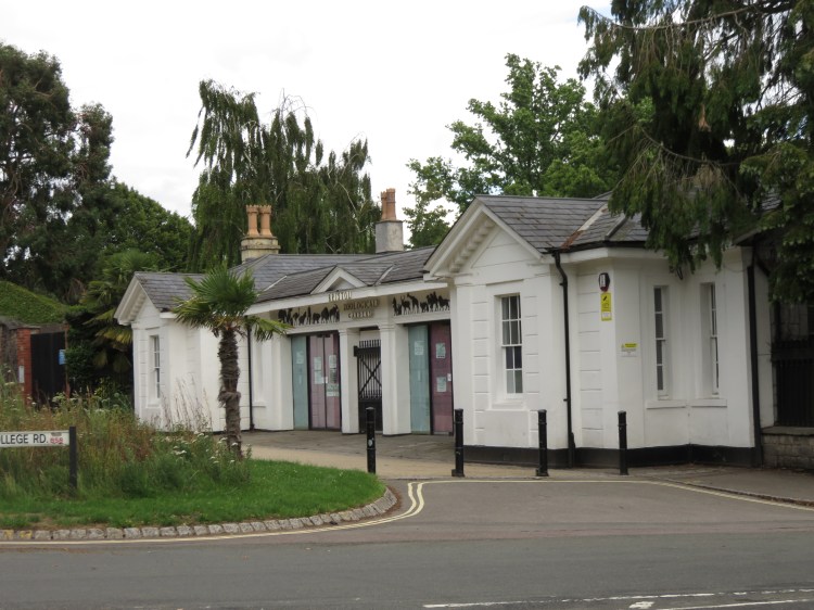
Begin by following College Road, which runs to the side of the zoo gatehouse.
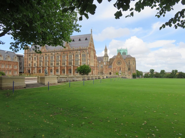
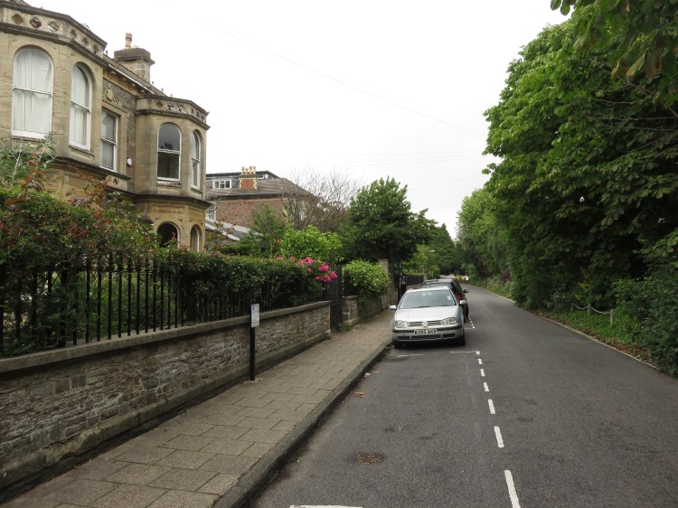
College Road is unremarkable at first as you pass the zoo. However, when you reach the junction with Guthrie Road (1), the grand institutional buildings of Clifton College make their first appearance on the left.
The best view of the college is over its playing fields, which lie just a little bit further along College Road. For a school to have this much space on such prime Clifton real estate is quite remarkable.
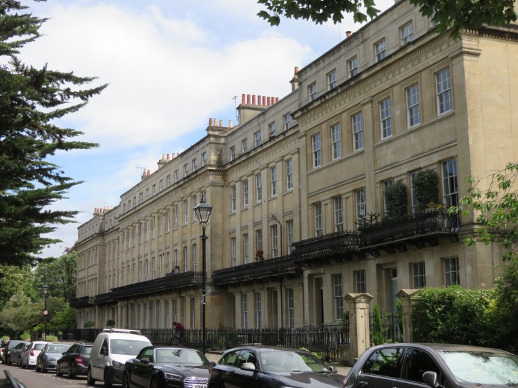
Continue following College Road until you have passed the school site. Take the second left, Worcester Terrace (just after Worcester Road).
Worcester Terrace is a particularly handsome, symmetrical Georgian terrace with a raised pavement. However its communal gardens, on the far side of the street, are rather hidden from view.
At the end of the street, turn left onto Clifton Park past the rear entrance to Clifton Cathedral (2).
Clifton Cathedral is the city’s Catholic cathedral. It is a striking, if rather severe, design in textured concrete. Its three slender towers are probably the best feature of the exterior and are visible from a number of vantage points in Bristol. The light and airy interior is well worth a visit if the Cathedral is open (access via the front entrance on Pembroke Road).
Turn right onto Worcester Road to emerge on the main road, Pembroke Road. Cross the road and go straight on into Buckingham Vale.
An L-shaped street behind Pembroke Road, Buckingham Vale is home to a number of very grand houses. One bears a dedication plaque to Dorothy Brown, a tireless campaigner for Bristol’s built heritage during a period when a lot of it was in danger of being swept away.
At the end of Buckingham Vale, turn left along Alma Road to return to Pembroke Road (3). Turn right.
You will soon approach All Saints’ Church. One of many churches to be destroyed during the Bristol Blitz, All Saints’ was rebuilt to another striking modern design, making it a good partner for Clifton Cathedral.
Just before the church, turn right into Alma Vale Road.
Alma Vale Road is one of those tucked-away little shopping streets in the middle of an historic residential area. Much of its retail function has been lost over the years, but it is still home to a number of businesses.
Alma Vale Road provides a couple of food and drink options, notably the welcoming Alma Tavern.
Towards the far end of the main shopping parade, turn left into Thorndale (4).
Thorndale is a short and narrow street of tall terraced houses that leads to a back lane, Thorndale Mews. The mews is home to a number of quirky little houses.
Go straight on onto a footpath. Emerging onto All Saints Road, turn left.
All Saints Road is a comfortable but unremarkable road of Victorian villas typical of this area. As you approach Pembroke Road once again, you may catch a further glimpse of Clifton College over the private access opposite.
Returning to Pembroke Road (5), turn right.
Pembroke Road is the main road through this area. It has a wide variety of houses, from the highly imposing to the more human-scaled. If you look back down behind you, you will have a view back towards the three slender towers of Clifton Cathedral.

It takes a while to walk up Pembroke Road, but the large trees and occasional ornate Victorian lamp post add a bit of interest.
Just before Pembroke Road ends at the Downs, next to a post box (6), turn right into Downfield Road.
We are about to enter a very different part of Clifton. We will leave the grandeur of the Pembroke Road area behind and will enter a much quieter and more understated neighbourhood.
Downfield Road is a quiet side road. To the left, you will find substantial detached and semi-detached Victorian homes. To the right, you will find a planted bank and a long stone wall that feels like it belongs to a railway cutting – but is, in fact, just the rear boundary of properties on nearby Apsley Road.
Continue around the corner at the far end of the road.
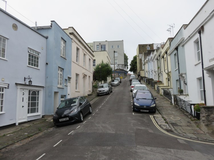
This Victorian backwater has little in common with the grand Georgian ‘village’ that we visited in Walk Five ‘Introduction to Clifton’. Instead, the area feels more like parts of Redland, with substantial but not vast houses faced in the classic Bristol pennant sandstone.
Turn right when you get to a T-junction.
You will find that you are still on Downfield Road. Downfield Road has a charming randomness about it, wiggling about all over the place before it eventually ends.
Indeed, before long you will round another sharp corner to the right and will find that Downfield Road ends in a small cul-de-sac lined by terraced houses. Thankfully, however, the developers had the foresight to include a footpath to link through to the next street.
Take this narrow footway (7) to emerge on Wellington Park.
A grander street, Wellington Park has larger, rendered properties, sometimes with front gables and elaborate bay windows.
Turn left onto Wellington Park and follow it until you get to the next junction.
Here, you will find a quirky property with a rounded corner wall that looks a little like a wizard’s manse.

Turn left into Anglesea Place.
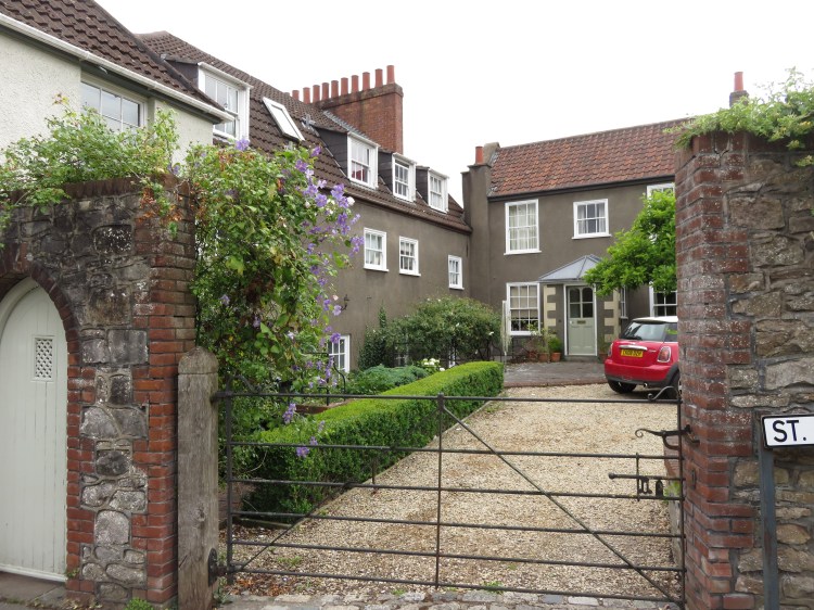
Anglesea Place boasts an elegant, three-storey Georgian-style terrace. At the top of the road, note how the remains of an older have been incorporated into the modern complex of St. John’s Primary School.
You are now entering one of the oldest parts of Clifton, which developed as a maze of village streets centred on nearby Blackboy Hill. The landscape is partly defined by the remains of former quarries. It has a quiet and almost rural character, in stark contrast to the rest of genteel Clifton.
You will emerge on Worrall Road opposite a row of pleasant cottages that appear older than most of the surrounding buildings.
Cross Worrall Road and take the turning for Sutherland Place, which roughly opposite to the left.
Sutherland Place is a very steep terraced street that heads up towards the Downs. Although short, its gradient recalls the terraces of Totterdown (see Walk Eight ‘Bedminster, Totterdown and Arno’s Vale’).
Turn right at the bottom of the hill onto a side road, Quarry Steps (8).
One of three quiet, mews-like streets tucked away below the imposing terrace of Upper Belgrave Road, Quarry Steps terminates, as the name suggests, at a flight of very steep steps. Make your way up the steps, but take your time. This may possibly be the steepest and most uneven public flight of steps in Bristol.

Quarry Steps will bring you out on the curiously named High Street. With no major businesses to speak of, this quiet street would appear to have been named for its elevated position more than anything else. However, this whole area of Clifton, which has a singular character, does have a genuine ‘village’ feel reflected in the scale of its buildings and the names of its streets.
Accessible route
As an alternative to climbing steep Quarry Steps, turn left onto Quarry Road and then right onto pleasant Richmond Dale to reach High Street by a much easier route. Turn right to reach the Easter Garden (9).
Turn left onto High Street to reach the Easter Garden (9)
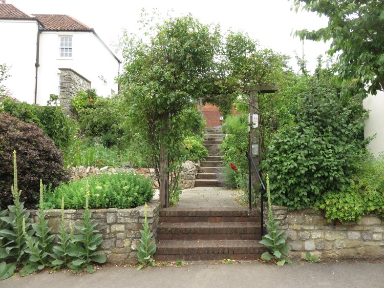
The Easter Garden is a very pretty terraced space, maintained by the local community, which is filled with flowers and contains a staircase leading up to Wesley Place.
Climb the steps to reach Wesley Place. Turn right to reach the junction with York Street (10).
Accessible route
To avoid the steps in the Easter Garden, go down High Street instead to reach Highland Square, a curious tarmacced area dominated by the Coach & Horses pub. Note the eclectic, untidy mix of buildings that surround the square. Go left and left again to climb Wesley Place, rejoining the main route at the junction with York Street (10).
Turn along York Street.
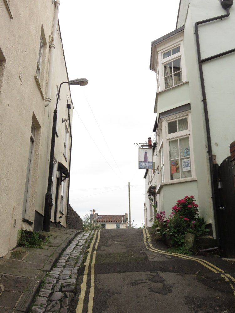
Tiny and eccentric York Street contains only a couple of houses and a pub as it climbs over a steep little hump on the way down to Blackboy Hill. The house on the left has a double storey bay window that projects into the street in a manner that recalls the seaside towns of Devon or Cornwall.
The Port of Call in York Street is a tucked-away pub with a cute garden terrace.
You will emerge on Blackboy Hill, a busy shopping street that takes traffic from the City Centre up to the Downs. Blackboy Hill is how the street is known locally, but the official address of the shops and other buildings is Whiteladies Road.
This used to be the centre of the village, but a number of buildings, including the Blackboy Tavern that gave the street its name, were demolished long ago to widen the road.
Cross Blackboy Hill at the traffic lights and turn left. Just after the petrol station, turn right up a short flight of steps (11).
Accessible route
You can avoid the steps by skipping the next little section. Turn right down Blackboy Hill instead, rejoining the main route at the junction with Grove Road (12).
We are now going to leave Clifton and enter Redland. Redland makes its own contribution to the quirky ‘village’ feel of the Blackboy Hill area.
You will find yourself on a neglected footpath called St. Vincent’s Hill, which is surely one of the oddest corners of Redland. You will pass the backs of various buildings, some residential, some institutional, as St. Vincent’s Hill becomes a more defined track. Eventually you will pass the entrance to a very pretty residential courtyard as you reach the junction with Grove Road.
Turn right onto Grove Road, passing the access to another, disconnected, section of St. Vincent’s Hill. Returning to Blackboy Hill (12), turn left down the hill.

This section of Blackboy Hill has a pleasant architectural unity. Ahead you can see the delicately detailed twin towers of the former St. John’s Church in Apsley Road.
Optionally, you may wish to put your head around the corner of the first left, Woodbury Lane, which is another odd little mews containing a mix of old, new and converted buildings. Return to Blackboy Hill afterwards and continue down the hill.
Blackboy Hill is your main remaining chance to get refreshments on this walk, containing a number of pubs, restaurants and food shops.
At a crossroads next to a supermarket, turn left onto Lower Redland Road.
Lower Redland Road extends Blackboy Hill’s shopping offer for a little while. Redland also still has its fair share of interesting backwaters to offer.
Just after passing the first row of shops, turn left into Redland Terrace (13) to visit the first of these.
To the left on Redland Terrace you will see a residential terrace that, while fine, must have virtually no rear gardens.
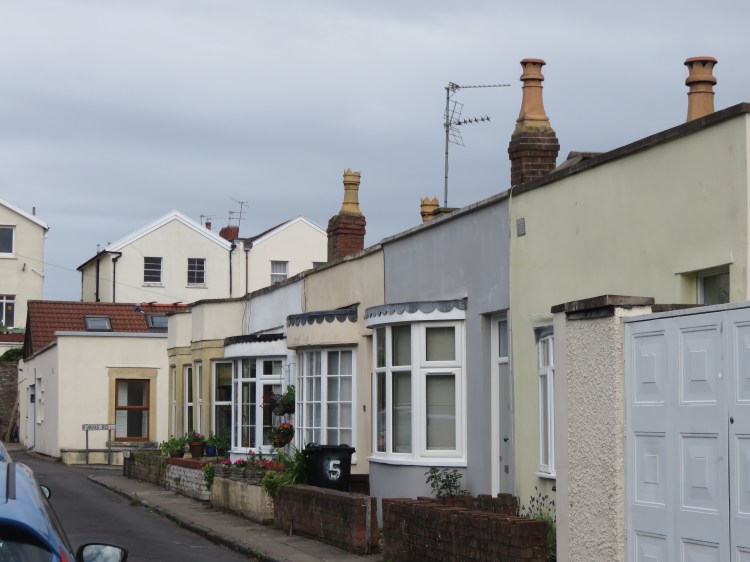
At the top, you will be led around to the right into the quietest of quiet backwaters. On the right is Fitzroy Terrace, a terrace of tiny, single-storey Victorian homes unique to this location in Bristol. Opposite, South Terrace nestles at the back of long front gardens, two storeys this time but still low-slung.
Turn right into Evans Road and you will be led past more of the strange little single-storey Victorian homes until you emerge back onto Lower Redland Road. Turn left and shortly left again to enter West Shrubbery (14).
Pleasant three-storey Victorian houses line West Shrubbery on both sides, with a sensitive modern development visible at the top. At the top, Shrubbery Cottages is another very quiet little street containing, once again, characterful properties particular to this location. At the far end, heading to the right past a tall pine tree, East Shrubbery is another welcoming street which will return you once again to Lower Redland Road.
Turn left and follow Lower Redland Road once more. Take the next left into Elm Lane.
Elm Lane is part of an old route that leads up towards the Downs. At the bottom of Elm Lane you will find a right turning leading into an alleyway (15).
Take this alleyway, which soon narrows down into a footpath.
You will reach the turning head of Hazel Grove, with its small collection of assorted bungalows.
Continue straight across to enter another footpath.
This footpath has sometimes been called ‘the Snicket’. Follow the pleasant route as it climbs between creosote-scented fences until you emerge on the main road, Redland Road.
We will need to follow the main road briefly. Turn left and follow the road. Cross over the bottom of busy Redland Hill when you get to the roundabout to continue up the next stretch of Redland Road.
After passing the turning for Coldharbour Road on the right, you will lose most of the traffic and the hill levels off.
After crossing the end of Iddesleigh Road, look to the right to see the imposing gateposts of Cambridge Park, complete with statues of lions, making it one of the most extravagantly announced residential streets in Bristol.

Opposite the gateposts, turn left into Westmoreland Road (16).
This short street will lead you through to Durdham Park, where you will find large blocks of modern flats in spacious grounds bordered by mature trees. They contrast in fairly striking fashion with the traditional Victorian houses on the far side of the street. The modern buildings have been built to this height to capitalise on their views of the Downs, which are now very close by.
Turn right and follow Durdham Park until you reach a junction. Bear left.
This short cul-de-sac spur of Durdham Park will lead you past Carfax Court, a sheltered housing scheme with an interesting quasi-traditional design and inviting courtyards. A few moments later and you will emerge at last on the edge of the Downs, next to a set of traffic lights on busy Westbury Road.
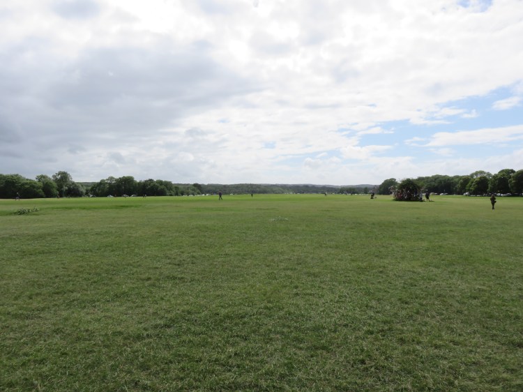
Make your way across the road and onto the grassy expanse.
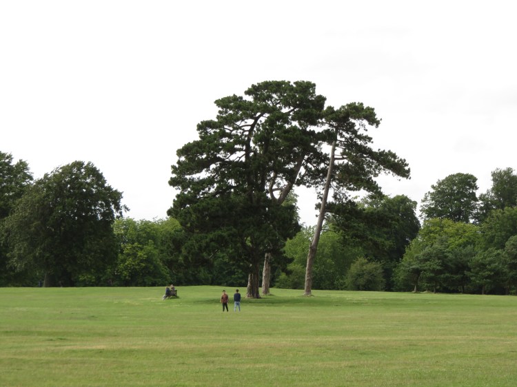
The Downs are actually two conjoined spaces, Durdham Down and Clifton Down. Durdham Down is the flatter and more open of the two, and has been providing a recreational amenity for the people of Clifton, Redland, Westbury Park, Stoke Bishop, Sneyd Park and beyond for over a Century.
To the right, note the Seven Sisters, a circle of handsome pine trees. Over the years, several of the trees have been lost to storms and other damage, and they now number only three. A new circle of pine trees has been planted a short distance beyond.
Set a course that will take you to the right of the prominent water tower, which can be seen to the left.
The Downs are a popular destination in north Bristol for general relaxation, dog walking, jogging and kite flying. The Downs also play host to a local football tournament, the Downs League.
After passing the water tower you will reach another main road, Stoke Road.
On Stoke Road, Café Retreat occupies a decorative little building that was once a public toilet.
Cross Stoke Road when it’s safe to do so, keeping to the right of the side turning on the far side, Ladies’ Mile (17).
Having crossed Stoke Road, set a course roughly diagonally across the open space so that you converge gradually on the large houses lining the edge of the Downs to the right.
As you cross this stretch of the Downs, you are offered unbroken views across to Leigh Woods on the far side of the Avon Gorge, giving an overriding impression of grass and trees and a big sky.
After a while, the buildings to the right will come to an end.
Continue straight on so that you approach the far end of the Downs, where a road and railings denote the edge of the Avon Gorge.
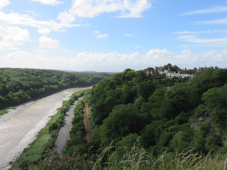
On crossing the perimeter road and reaching the railings, you will find yourself at a popular viewpoint known as the Seawalls (18) (Walk Twenty-Four ‘Stoke Bishop and Sneyd Park’ approaches this area from another angle). The viewpoint offers great views down over the Avon Gorge, notably of Avonmouth docks to the right – keep an eye out for distant wind turbines – and of the busy Portway snaking its way along the bottom of the Gorge. To the left you can see the Clifton Suspension Bridge in the middle distance. You may also want to consider stopping here for an ice cream from the ever-present ice cream van. Should you require them, there are also public toilets just to the right.
When you’re done enjoying the view, take to the winding perimeter road (known as Circular Road) back in the direction of Clifton (i.e. to the right if you’re looking back towards the water tower).
You will pass between the open area of the Downs on the left and a wooded area to the right. At about two thirds of the way to the next bend, look for an opening in the trees on the right, marked by a litter bin (19).
Accessible route
Unfortunately the final section of the walk along the top of the Avon Gorge – and the optional route extension – are not fully accessible and include narrow and uneven sections.
If you wish to avoid all this, the main alternative route is to stay on Circular Road all the way to its junction with Ladies’ Mile. Enjoy the views of the Downs as you go and pause to check out the view of the Gorge from the peregrine lookout (22).
At the junction with Ladies’ Mile, turn right and descend Fountain Hill to rejoin the main route close to the end (24).
To continue following the main route, take this opening and pass through a gate to reach a small clearing.
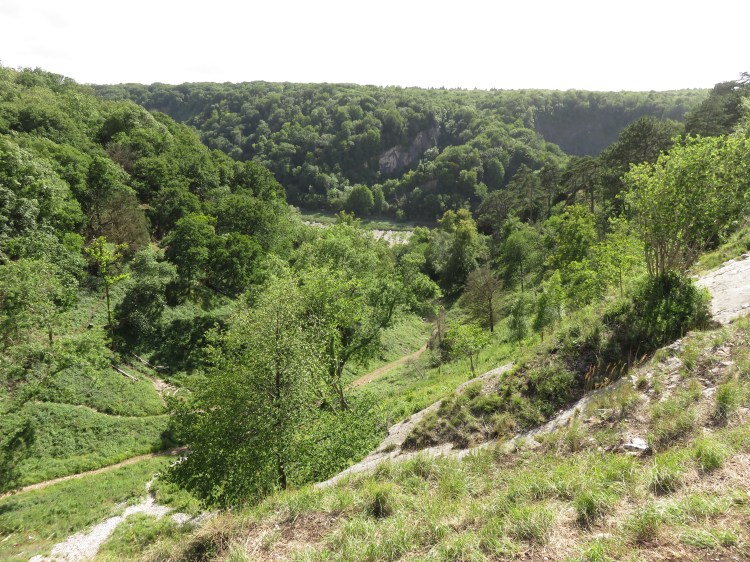
The clearing provides an impressive view down over Walcombe Slade, also known as The Gulley, a steep valley that leads down the side of the Gorge to the River Avon at the bottom. In recent years, a herd of goats has been grazing the Gulley as part of a programme of landscape restoration. Keep an eye out for the white figures of the goats. If you look carefully down the valley you may also see a round stone tower: this is a ventilation chimney for the Clifton Down Tunnel, which takes the Severn Beach railway line under the Downs until it emerges in the Gorge. The tower has a larger, better known brother at the Clifton side of the Downs close to the top of Pembroke Road.
Follow the fence that borders the Gulley, passing gates, until you reach a gate where a flight of steps leads down into the Gulley (20).
Portway route extension
This alternative route will allow you to get up close and personal with the Avon Gorge itself. However, be warned that the route can be treacherous underfoot and I would not recommend attempting it in wet conditions or without good shoes. You will also have to cross the fast and busy A4 Portway twice without any proper pedestrian crossings or traffic islands, so you may want to avoid attempting this route at busy times.
From the gate at the top of the steps (20), make your way down the steps into the Gulley. The route down to the bottom of the Gorge is fairly obvious. Look out for the goats and the stone ventilation tower.
You will emerge on a grassy area adjacent to the Portway at the bottom of the Gorge. Cross over very carefully to reach the broad footway on the far side, which runs adjacent to the River Avon.
From here, the dramatic scale of the Gorge can be truly appreciated. The Clifton Suspension Bridge is visible to the left; make your way in that direction. On the far side of the river, note the Ashton to Pill Path, which is well-used by cyclists.
After a while, you will pass another grassy area on the left. You may also see entrances to an old railway tunnel. This is part of the old Port and Pier Railway, which used to run from near the lower station of the Clifton Rocks Railway (see Walk Six ‘The Clifton Hillside’) out to Avonmouth Docks, but became redundant and was subsequently removed to make way for the roads that we have today. You may also see the remains of an old drinking fountain on the cliff side of the road; this is an old outlet for the St Vincent’s Spring, a later rival to Bristol’s main hot spring that gave Hotwells its name. Lining the river, note the old metal river lights that used to aid navigation in central Bristol’s days as a commercial port.
You will need eagle eyes to find the last stretch of this route. Shortly after you pass a small fenced compound to the left, you will pass a small exposed section of cliff. Next to this is the entrance to a public footpath, denoted by a small iron bollard with a crossbar (if you reach the traffic lights at the junction of Bridge Valley Road, then you have gone past it). Once again, cross the Portway very carefully to reach this footpath.
The footpath, which is known as the New Zig-Zag (you may remember climbing the original Zig-Zag in Walk Six), will take you steeply up the side of the Avon Gorge and through a pleasant wooded area until you emerge at the top of Bridge Valley Road to rejoin the main route at the bottom of Fountain Hill (24).
To stick to the main route, turn left away from the Gulley to emerge back out on Circular Road (21). Turn right.
Continue following Circular Road for some time until it converges once again with the cliff edge at a small grassy area with benches (22). This is apparently the best place from which to spot the Gorge’s elusive population of peregrine falcons.
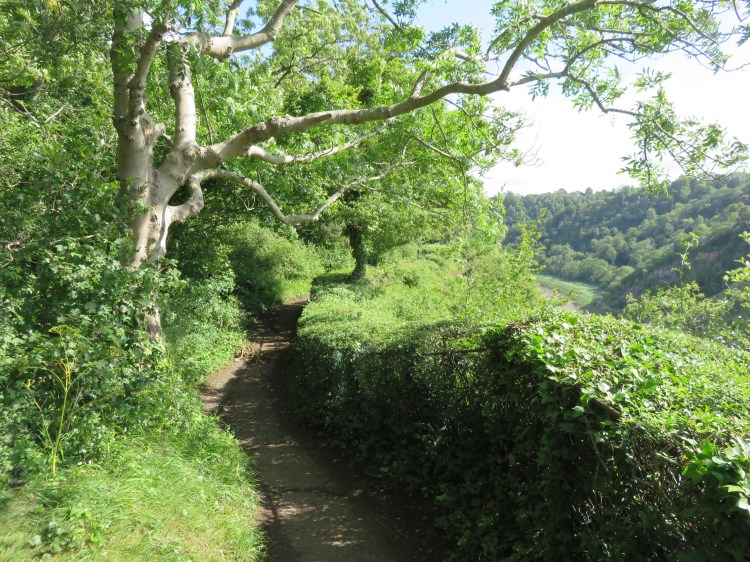
Look for a small footpath following the clifftop railings to the left. Take this path now.
The path is largely tarmacced, but beware of a few tricky rocky stretches. It’s worth the trouble, however, as you will be treated to more great views of the Gorge, including views down to the Clifton Suspension Bridge and the bonded warehouses in the Cumberland Basin.
After a while, the path leads you away from the cliff and splits in two as it leads you through a short stretch of pleasant woodland. It doesn’t matter which path you take, as they join up shortly anyway. However, when you get to a second fork, take the left hand path to stick to the high road (23).
The path will bring you out at the bottom of Fountain Hill, close to its junction with Clifton Down (24). The accessible route and the Portway route extension rejoin the main route here.
Make your way down to the junction and cross Bridge Valley Road via the traffic island and then turn left, crossing Clifton Down itself in the process.
Note the grand properties of Clifton Down, as seen in Walk Five ‘Introduction to Clifton’.
Follow the main road for a short distance until you have crossed College Road to return to entrance to Bristol Zoo Gardens and complete Walk Sixteen.
Coming Up
Next we will begin venturing further out into more outlying parts of Bristol to find further interesting walking routes. Each of the ‘outlying walks’ in this collection focuses on one or more places of particular interest, whether that be a natural valley or waterway, a landscaped park or an old village centre subsumed by Bristol’s suburban sprawl. Walk Seventeen ‘The Malago, Crox Bottom and Nover’s Hill’ will begin this process with an exploration of some of south Bristol’s hidden waterways.
