Last updated: December 2020
Walk Map | Download walk as PDF
Having been introduced to the fashionable heart of Clifton Village in Walk Five ‘Introduction to Clifton’, now seems like a good time to investigate the lesser-known part of Clifton: the many streets and lanes that criss-cross the steep Clifton hillside, extending down into Hotwells and the Avon Gorge.
For its pure scenic quality and for the preponderance of quiet little nooks and crannies that the Clifton hillside has to offer, this walk is probably my personal favourite in the first part of this collection. Be warned, however, that this walk involves a lot of steep hills and steps.
Useful Information
Terrain: Steeply hilly; includes steep steps. Unfortunately there is no accessible alternative route available.
Ground: Paved.
Key Attractions: Floating Harbour, Watershed, Bristol Aquarium, We The Curious science centre, Harbour Inlet, Clifton hillside routes, The Polygon, Windsor Terrace, Avon Gorge, Clifton Suspension Bridge, Clifton Village shops, Brandon Hill, College Green, Bristol Cathedral.
Refreshments: Pubs are available at various points en route. There are dining options at the start of the walk around the Floating Harbour area and also in the Clifton Village area.
Starting point: The Centre Promenade
Getting there: Widely accessibly on foot or by bus. 20 minutes’ walk from Temple Meads Station. Multi-storey car parks at Berkeley Place, Trenchard Street, Harbourside, Prince Street, Queen Charlotte Street, Nelson Street and Rupert Street.
Approx. Time: 2 hours 15 minutes
Approx. Distance: 4.2 miles
The Route
As is customary for the first part of this collection, our walk starts and finishes at the Centre Promenade. For more information about this important space see Walk One ‘Introduction to Bristol’. This time, however, we’ll begin by passing through the Harbourside area, so as to avoid having to negotiate Park Street again.

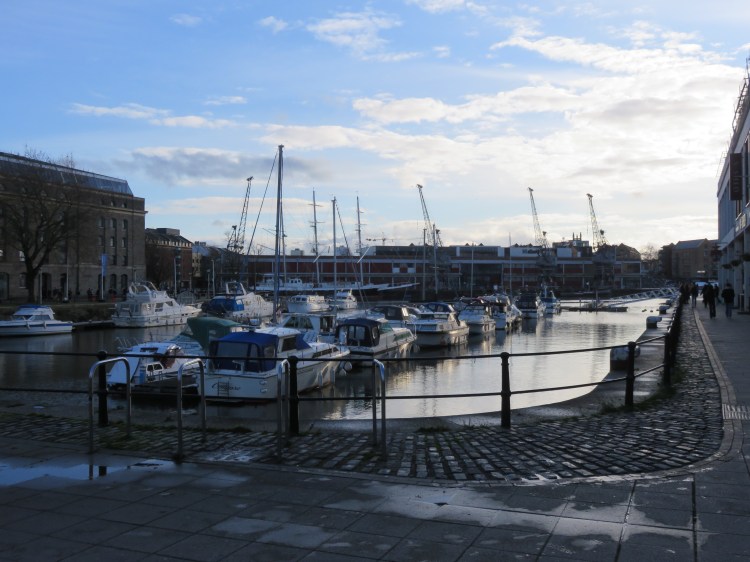
Start by taking Bordeaux Quay, to the right hand side of the Floating Harbour.
Bordeaux Quay, home to the Watershed Media Centre, will be familiar from Walk One ‘Introduction to Bristol’ and Walk Two ‘The City Docks’, as will the distinctive horned structure of Pero’s Bridge.
The Watershed café bar is a pleasant and informal place to stop for a drink or a bite to eat with good views of the harbour.
Turn right at Pero’s Bridge (1) to enter Anchor Square.
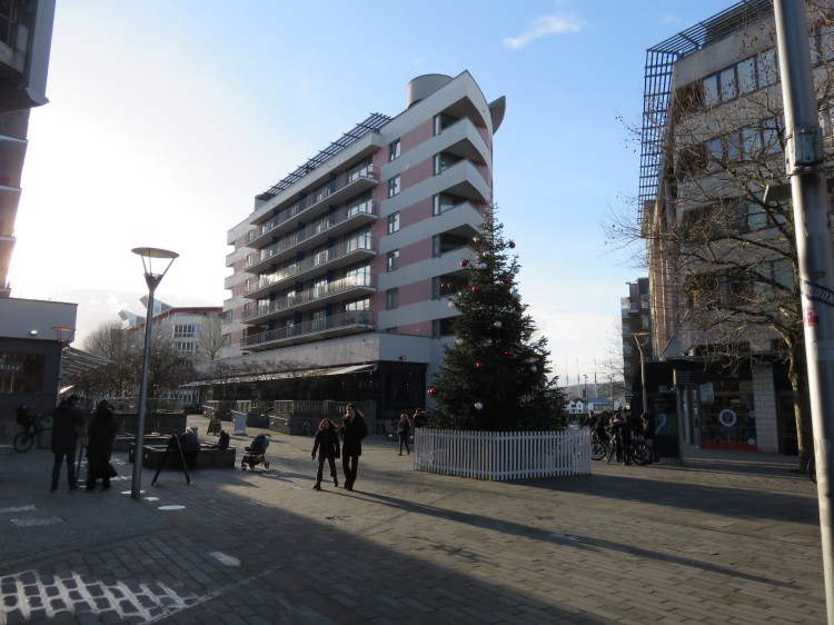
Anchor Square is the heart of Bristol’s modern Harbourside development. This first phase was built for the Millennium and occupies a mixture of new and converted buildings. The We the Curious science centre with its mirror-clad planetarium is a great attraction for the young ones. The engaging Bristol Aquarium occupies another side of the square.
Keep to the left as you pass through Anchor Square so that you enter Millennium Square (2).

The large paved space of Millennium Square – which can seem slightly desolate when not in use for the many events that take place here during the year – is actually the roof of an underground car park. Focal points of interest, however, include an unusual stainless steel water feature that children like to splash around in during the summer months and the mirror-clad planetarium attached to We The Curious. There are also several statues of historical Bristol figures, including Cary Grant, and one or two other curious elements of public art. See if you can find a dog swimming in the puddle.
Cross Millennium Square, passing close to the planetarium and making for a pedestrian walkway between modern buildings on the far side (3). Take this walkway.
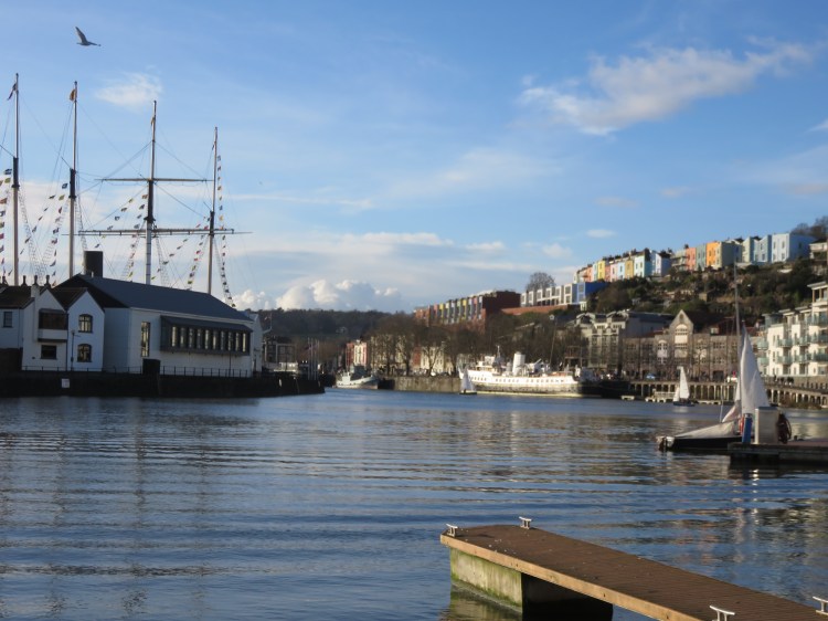
This is the Millennium Promenade, which is home to a number of businesses and frames a view of the funnel and masts of the s.s. Great Britain in the distance.
There are a number of places to eat in this area. Businesses come and go, but Pizza Express has been a relative constant.
En route you will cross Cathedral Walk, a broad avenue lined with modern flats that frames a view of Bristol Cathedral.
Continue straight on, crossing Canon’s Way, and follow the Millennium Promenade as it widens out and descends to a new inlet on the Floating Harbour.
The recently constructed Harbour Inlet, which combines the restored stone East Purifier House with a variety of interesting modern buildings, has become a very popular spot. A sun-trap that can also be reached by quayside walkway, the inlet is home to houseboats and surrounded by bars. A popular cross-harbour ferry takes passengers to and from the s.s. Great Britain on the far side of the water.
The Harbour Inlet offers a number of dining and drinking options.
The harbour inlet offers you expansive views of Floating Harbour and s.s. Great Britain, and also provides your first glimpse of the Clifton hillside.
Turn right and follow the walkway or pontoons around the harbour inlet. Climb the steps on the far side of the inlet to reach the higher level quayside walkway at Porto Quay.
The viewing platform at the top of the steps on Porto Quay offers good views up and down the docks.
Turn right into Gasworks Lane (4), leaving the Floating Harbour.
Gasworks Lane is an atmospheric cobbled lane bounded by high stone boundary walls that date back to the days of the Canon’s Marsh gasworks. The lane used to be called Gasferry Road, and took its name from the Gasworks Ferry, which used to provide a link across the Floating Harbour here. The cross-harbour ferry serves a similar purpose to this day.
At the end of the lane, turn left to follow the main road, Anchor Road, until you reach the traffic lights at the Jacob’s Wells Roundabout. Make your way around the roundabout in an anticlockwise direction, crossing St. George’s Road and Jacob’s Wells Road.
The Bag o’ Nails, on the roundabout, is a pub where you can stop for a drink in the company of free-range cats.
We are now ready to begin the ascent into Clifton via the first of our many historic footpaths. This first by-way is well hidden: from the northwest side of Jacob’s Wells Roundabout, look for a tunnel leading under the central part of St. Peter’s House, a large block of council flats.
Step through this tunnel (5).
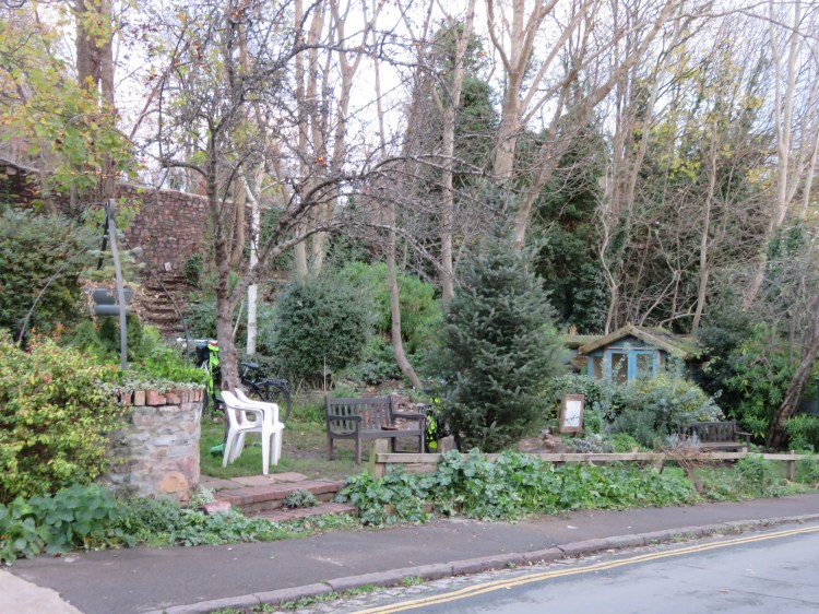
Stepping through the tunnel is like entering another world, as you find yourself at the bottom of the atmospheric White Hart Steps, named after a pub that used to stand on the main road at the bottom of the lane.
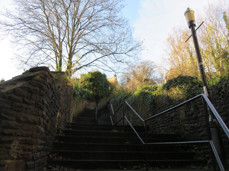
White Hart Steps winds its way between isolated houses and charming secluded gardens as it climbs steeply up the hillside. The council flats, although far from beautiful, provide an effective screen from the hustle and bustle of the Jacob’s Wells Roundabout and, for the first time, you are more likely to hear birdsong than traffic.
The path splits at the top of the steps; make sure that you branch left.
You will pass below the end of Bellevue Crescent along the eccentrically named World’s End Lane, a quiet footpath bounded once again by high stone walls. A couple of tucked-away houses break the boundaries of the leafy lane.
You will emerge in the Southernhay (6), an oddly-shaped open area beyond World’s End Lane where several little roads meet. This quiet, ad-hoc residential layout welcomes you to Clifton Wood, a part of the Clifton hillside characterised by streets of modest terraced houses following the contours of the escarpment. Lacking the pretentions and sky-high prices of Clifton Village, Clifton Wood is a salubrious and welcoming area that is popular with professionals and young families.
Bear right up the ramp leading to Clifton Wood Road.
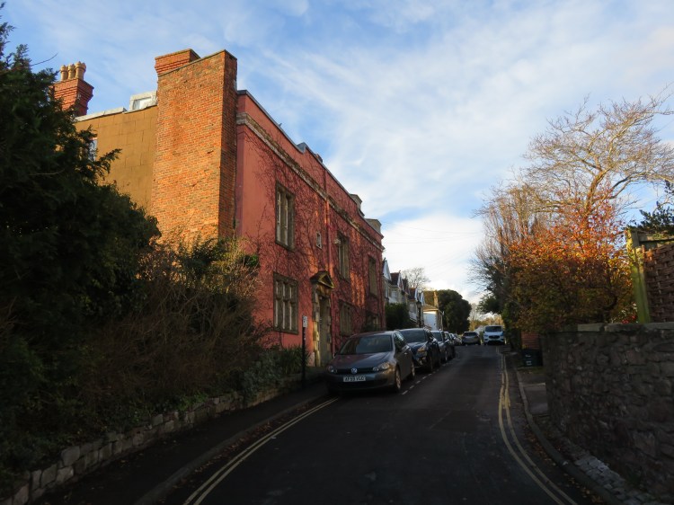
Clifton Wood Road has a decidedly mixed character. Look out for a pair of inviting, creeper-covered houses on the left just after you climb the ramp; pause for good views of Cabot Tower as you pass the turning for Glentworth Road; and, just before the road comes out on Constitution Hill, don’t miss the terrace of quirky houses to the right, which includes one incredibly narrow, unique little property. Opposite, high stone walls enclose the grounds of Goldney House, a landscaped garden complete with a tower and a fascinating manmade grotto that, unfortunately, is only open to the public a few times a year.
At the end of the road, turn left up Constitution Hill.
A short climb up Constitution Hill will bring you to Lower Clifton Hill outside the entrance to Goldney House.
Turn left and follow Lower Clifton Hill towards Clifton Village. Cross the top of Goldney Avenue to reach a green area (7).
The Goldney Avenue junction and the open area beyond offer great views out to Ashton Court and Dundry.
You will soon approach the shopping area at Regent Street. We’re not due to reach Clifton Village for a while yet, however.
Just before the shops, turn left down Hensmans Hill.
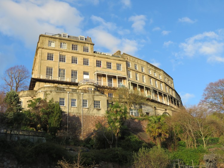
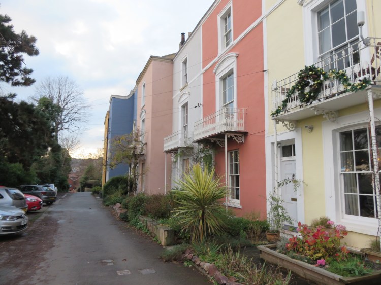
Hensman’s Hill, a side turning just below the shops, provides a short but steep descent to Cornwallis Crescent. Definitely the lesser of Clifton’s grand Georgian crescents but fine in its own way, Cornwallis Crescent plays a somewhat subservient role to the more famous Royal York Crescent on the Clifton skyline. Closer to home, Cornwallis House dominates the crescent from above.

Our next historic hillside by-way, which will take us back down towards Hotwells, is located just a few metres away.
Turn right onto Cornwallis Crescent and then cross the road. Take the narrow footpath next to the first lamppost on the left (8).
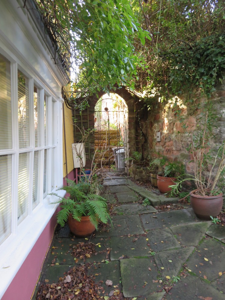
This is Polygon Lane, a leafy and intimate footpath that is a personal favourite of mine. Don’t miss the intriguing old metal gates at the top of the lane on the left, which look like they haven’t been opened in years.

After a short and winding descent into Hotwells you will see the Polygon itself, an attractive Georgian crescent nestling in a tucked-away location at the foot of the hill, at the heart of a maze of quiet lanes and cul-de-sacs. There are no cars in sight, as the terrace fronts straight onto a quiet garden that provides an oasis of calm just a stone’s throw from busy Hotwell Road. The high retaining walls and trees of the hillside above add to the secluded feel.

After a brief pause to soak up the peaceful atmosphere, continue straight on down Polygon Lane (not to be confused with Polygon Lane South, which turns off to the left) to reach Hopechapel Hill (9).
Hopechapel Hill takes its name from the church on the left, currently called the Hope Community Church. The confident and harmonious Georgian architecture of Albermarle Row in red brick and limestone ashlar dominates from across the street.
Turn right and make your way up Hopechapel Hill.
As you climb Hopechapel Hill, note the curious triangular layout of Hope Square to the right (10), which now includes a mixture of historic and modern buildings after wartime bomb damage and a long period of post-war dereliction and neglect.
You will reach Granby Hill (11), another distinctively steep street, which carries a surprising amount of traffic for its narrow size. At this point we will be taking a brief detour.
Turn right up Granby Hill and then left up Victoria Terrace.
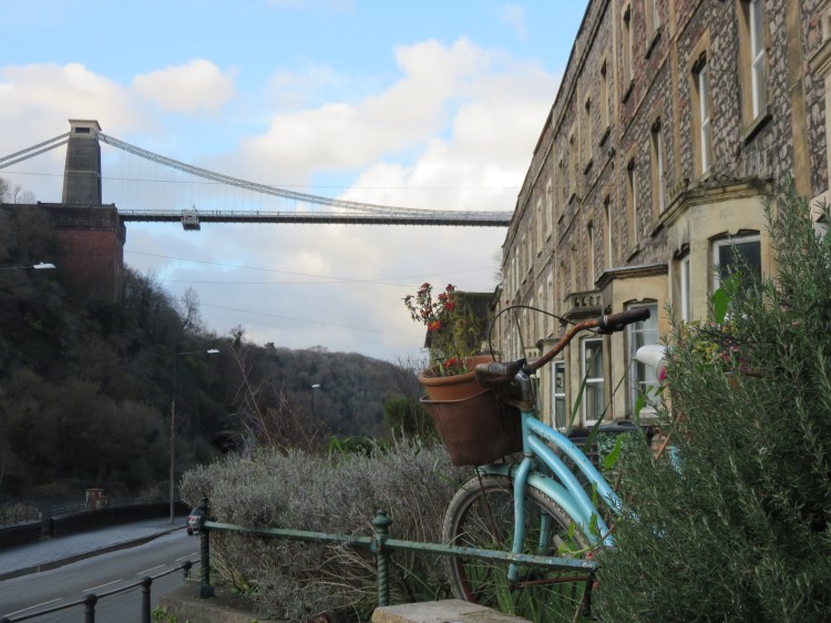
At the top of Victoria Terrace you will reach Windsor Terrace, a proud but somewhat windswept and faded-looking terrace occupying a view-commanding position overlooking the Cumberland Basin. If you venture to the far end of the terrace and look down over the barrier on the left, you will see that the whole terrace has been built on top of a manmade promontory, held up by a massive stone retaining wall.
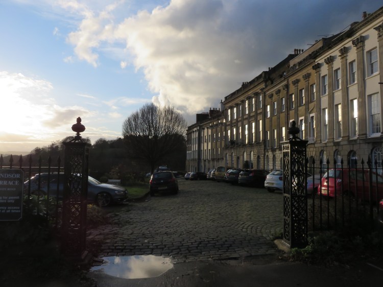
Clinging to the cliff above Windsor Terrace, meanwhile, is fine, tight crescent form of The Paragon.
When you’re done, retrace your steps to Granby Hill (11). Turn right and then immediately right again into Hinton Lane.
Hinton Lane is a narrow pedestrian lane that runs to the rear of the Georgian houses on Freeland Place, off left. When you reach the bottom, look above you for another view of Windsor Terrace’s retaining wall, which looks even more impressive from below.

Hinton Lane brings you out on the raised pavement of Hotwell Road, at the bottom of the Avon Gorge.
Turn right along the raised pavement (12).
The raised walkway fronts rows of Georgian and Victorian houses which look out over the river while the Clifton Suspension Bridge looms impressively overhead. (For more perspectives on the Avon Gorge see Walk Five ‘Introduction to Clifton’, Walk Sixteen ‘Northern Clifton and the Downs’, Walk Twenty-Four ‘Stoke Bishop and Sneyd Park’ and Walk Twenty-Five ‘Ashton Court, Leigh Woods and the Avon Gorge’).
The once fine but now rather weathered-looking houses along this stretch of Hotwell Road date back to Bristol’s brief period as a fashionable spa town. For many years, the water from Bristol’s natural hot spring was pumped to a spa complex located a little further along Hotwell Road. After the spa’s popularity waned, the spa complex was demolished, along with Hotwell Point (the promontory of land upon which the spa had once stood), in order to ease navigation of the winding River Avon for ships visiting the Floating Harbour. As you descend the steps at the end of the raised walkway you will pass a tiny crescent of houses named The Colonnade (13), which is all that remains of the original spa complex.
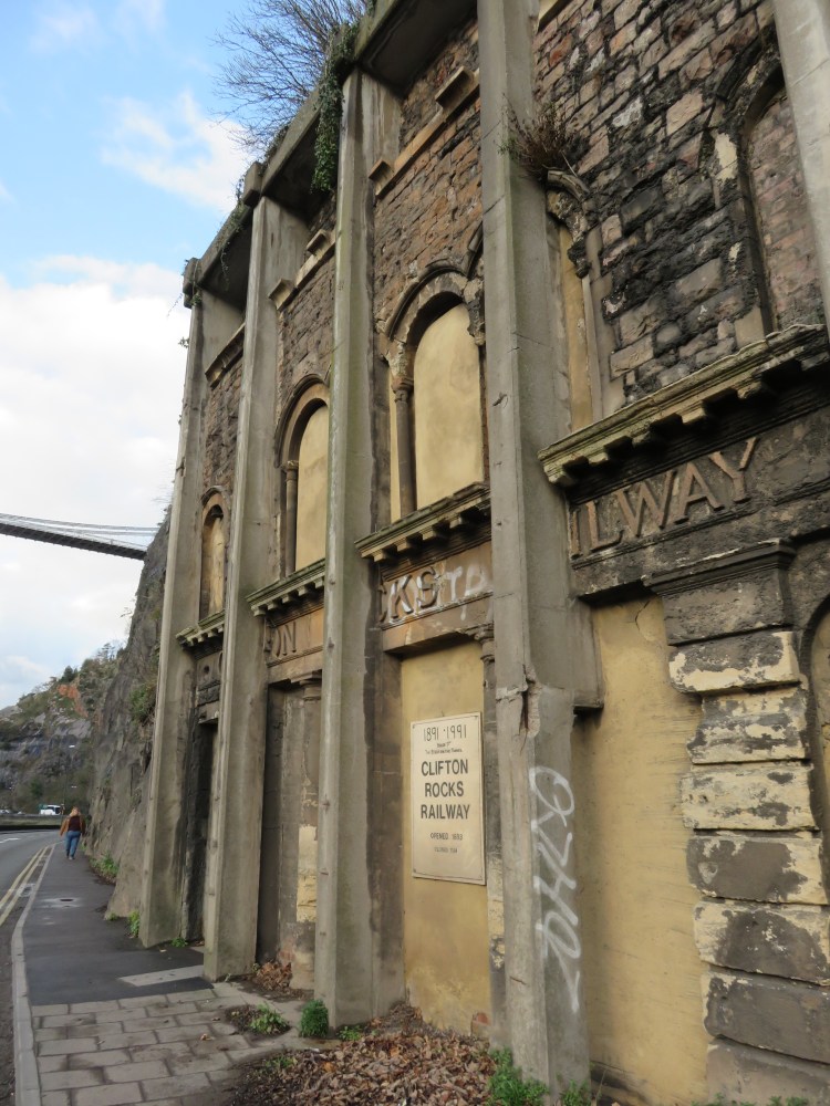
Shortly after the Colonnade you will pass a stone façade set into the rockface, propped up with concrete buttresses: this is the original entrance to the bottom station of the Clifton Rocks Railway, an underground funicular railway leading up to Clifton (see Walk Five ‘Introduction to Clifton’). There is also a wide stone archway, which at one time contained a pump that provided water from the hot spring after the demolition of the spa.
Shortly after the Clifton Rocks Railway, the pavement ends at a flight of steep steps. The aptly-named Zig-Zag winds its way up the cliff via a series of hairpin bends; set in the shadow of the Clifton Suspension Bridge, the Zig-Zag is a very scenic route, but it’s also very steep – so don’t be ashamed of stopping for a rest at one of the occasional benches on the way!

You will emerge on Sion Hill close to the top station of the Clifton Rocks Railway and the Avon Gorge Hotel. It’s time to head back towards the city centre now, but there are a couple of historic by-ways to discover yet.
The Avon Gorge Hotel has a terrace with great views and isn’t a bad spot to pause for a drink if you’re getting thirsty.
Make your way down Sion Hill and take the second left, Princess Victoria Street (14).
Comparatively demure in scale next to its grand surroundings, Princess Victoria Street is home to a mixture of shops, artisan houses and workshops. Princess Victoria Street will bring you to vibrant Clifton Village, after which you will emerge on the main road, Clifton Down Road.

If you’re hungry or thirsty, then in Clifton Village you’re spoiled for choice. I couldn’t possibly list all of the options, but pubs, cafés and restaurants can be found throughout the area, particularly on Boyce’s Avenue, Regent Street, Princess Victoria Street, The Mall, Waterloo Street and Portland Street.
Turn right onto Clifton Down Road (15), which shortly becomes Regent Street.
You will descend through the shops before briefly retracing your steps past the top of Hensman’s Hill and through the green area beyond (7) until you return to the top of Goldney Avenue.
Turn right onto Goldney Avenue.
On the left hand side of the street, just to the right of the entrance to Goldney Hall (a University hall of residence), you will see a narrow little footpath running down the hill.
Take this footpath now (16).
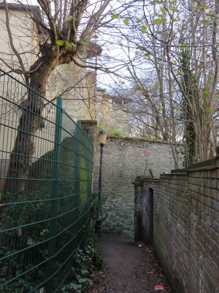
This is Goldney Lane, a narrow and shadowy route that leads down the hillside towards Hotwells. Further down the hill you pass high stone walls, as you once again find yourself bordering the enclosed gardens of Goldney House. At length, Goldney Lane emerges back in the residential surroundings of Clifton Wood at the top of Ambra Vale (17).
Turn left along Ambra Vale East.
There’s another brief climb ahead. Ambra Vale East crests the brow of the hill between a pair of unassuming residential terraces that are typical of Clifton Wood. At the junction with Argyle Place, don’t miss the cute little Cliftonwood Community Garden on the left.
Beyond, Argyle Place is home to a small playground that offers a glimpse of the Floating Harbour. After a few moments you will reach a crossroads junction with Church Lane.
The Lion on Church Lane is a popular local pub that also offers food.
Turn right down Church Lane.
At the bottom of Church Lane (18), you will be treated to further views out over the Floating Harbour towards Baltic Wharf.

You will find yourself at the top of Church Path Steps, the last of our old pedestrian by-ways, which will take you back down to Hotwell Road. Church Path Steps offers great views of the Floating Harbour and Underfall Yard (see Walk Two ‘The City Docks’), as well as longer distance views to the countryside outside Bristol at Ashton Court and Dundry.
Diversion route
Unfortunately, at time of writing, Church Path Steps is subject to a long-term closure following a landslip.
Until the path is repaired, it will be necessary to take a diversion. Turn right into Cliftonwood Terrace, a private road at the bottom of Church Lane. The terrace is home to an attractive mix of historic and modern houses.
Continue straight on into Rosemont Terrace, where the original houses were demolished years ago, and then straight on again into Crosby Row, which has been redeveloped in a fairly pedestrian way by a housing association.
Reaching Ambra Vale once again, turn left and descend to the main road, Hotwell Road. Turn left along Hotwell Road, passing a petrol station, to rejoin the main route at a pedestrian crossing at the bottom of Church Path Steps (19).
Reaching the bottom of Church Path Steps (19), cross Hotwell Road at the traffic lights. Turn left and proceed to the quayside walkway alongside the Floating Harbour.
This part of the City Docks is called the Mardyke.
The Grain Barge, moored at the Mardyke, is a good spot to pause for a drink. On the otherside of the road you will find a pub also called the Mardyke.

Follow the Mardyke towards the city centre. When Hotwell Road splits away from the Floating Harbour (20), follow the road, returning to the Jacob’s Wells Roundabout.
There is one further detour to be had here, involving a small extra climb.
Reaching the roundabout, make your way around it in a clockwise direction, crossing Hotwell Road and the bottom of Jacob’s Wells Road. A short distance up Jacob’s Wells Road, take the steep little staircase on the right (21).
You will come out on a quiet footpath which is actually part of the nature area at Brandon Hill (see Walk Five ‘Introduction to Clifton’). The steep hill to the left leads up to the main grassy part of the hill, but we are going to stick to the lower edge.
Turn right along the footpath.
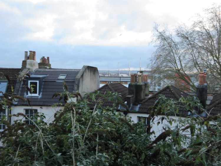
The footpath runs to the rear of Jacob’s Wells Roundabout at roof level, allowing you to see the masts of the s.s. Great Britain peeping up above the chimney pots.
The path will lead you to a cobbled street called Queen’s Parade, passing one of Bristol’s smallest primary schools in the process. At length the more open, grassy area of Brandon Hill will come into view.
When you reach the houses, turn right into York Place (22).
Steep little York Place will lead you down to St. George’s Road, opposite the City of Bristol College.
Turn left into St. George’s Road.
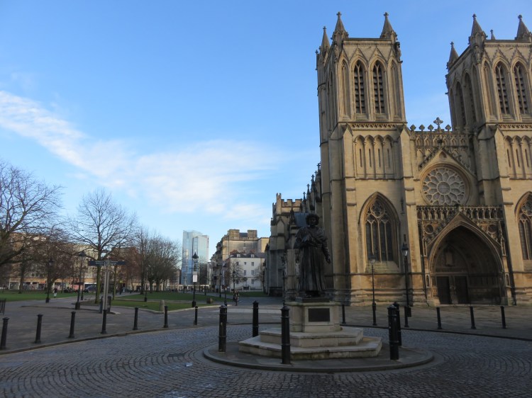
From St. George’s Road, continuing straight on into Deanery Road will take you past the Central Library to emerge on College Green close to Bristol Cathedral. From there, it’s a simple matter of descending the main road past the Marriott Royal Hotel to return to the Centre Promenade and complete Walk Six.
Coming Up
The next part of this collection will introduce you to Bristol’s inner suburbs. These historic areas vary in character from the modest inner-city terraces of St. Paul’s, Easton and Bedminster, through the more middle-class areas of Bishopston, Redland and Cotham and the affluent residential areas bordering the Downs. Walk Seven ‘The New Cut and Southville’ will give you a detailed look at Bristol’s biggest manmade waterway before returning through one of the city’s most popular inner-city neighbourhoods.
