Last updated: June 2020
Walk Map | Download walk as PDF
The steep north side of the Avon Valley around Crew’s Hole and Conham is riddled with fascinating, little-known lanes and by-ways, and is also home to the Trooper’s Hill nature reserve. The suburban expansion of St. George has encroached on many of these ancient lanes, but parts of the hillside retain a distinctly rural feel in the middle of Bristol. This walk seeks to get the best out of the various quirky by-ways on offer. In doing so, the route goes steeply up and downhill, much like Walk Six ‘The Clifton Hillside’, but also offers scenic views and a pleasant walk along the bottom of the valley itself. You will also discover the Stradbrook, a little-known waterway that flows down to the River Avon through the charming Conham Vale.
There are two pleasant shorter circuits that you can complete if you don’t feel like doing the whole thing:
- Short Route 1 focuses on the Crew’s Hole section of the Avon Valley and the unique wildlife habitat of Trooper’s Hill.
- Short Route 2 focuses on Conham River Park and the delights of Conham Vale; it also covers a small amount of additional territory not featured on the main walk.
Useful Information
Terrain: Steeply hilly; includes steep steps. Unfortunately there is no accessible alternative route available.
Ground: Paved and unpaved. Some areas may be soft underfoot (can be avoided by taking detours).
Key Attractions: Avon View Cemetery, Avon Valley, Conham River Park, Conham Ferry, Conham Vale, Magpie Bottom nature reserve, Trooper’s Hill nature reserve.
Refreshments: Limited provision apart from in the nearby centres of Redfield (Church Road) and Hanham. There is a popular tea garden at Conham Ferry. Conham River Park is well suited to a picnic.
Starting point: Avon View Cemetery, Beaufort Road (Long Route and Short Route 1); Jeffries Hill Bottom (Short Route 2).
Getting there: Accessible by bus, including routes towards Hanham and Longwell Green running via Church Road and Bryants Hill. On-street car parking available on Beaufort Road and (for Short Route 2) on Jeffries Hill Bottom.
| Approx. time | Approx. distance | |
| Long route | 3 hours | 4.6 miles |
| Short route 1 | 1 hour | 1.9 miles |
| Short route 2 | 1 hour | 1.8 miles |
The Route
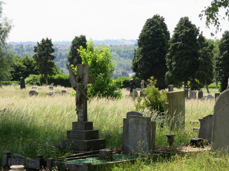
The Long Route and Short Route 1 begin on Beaufort Road outside the peaceful Avon View Cemetery, a very large burial ground on a plateau overlooking the Avon Valley. You may want to step in through the gates and take a wander round before continuing.
For Short Route 2, start instead at Jeffries Hill Bottom (9).
The centre of Redfield at Church Road, a few blocks away, offers a few food and drink options and is your best bet if you want to fuel up before embarking on this walk.
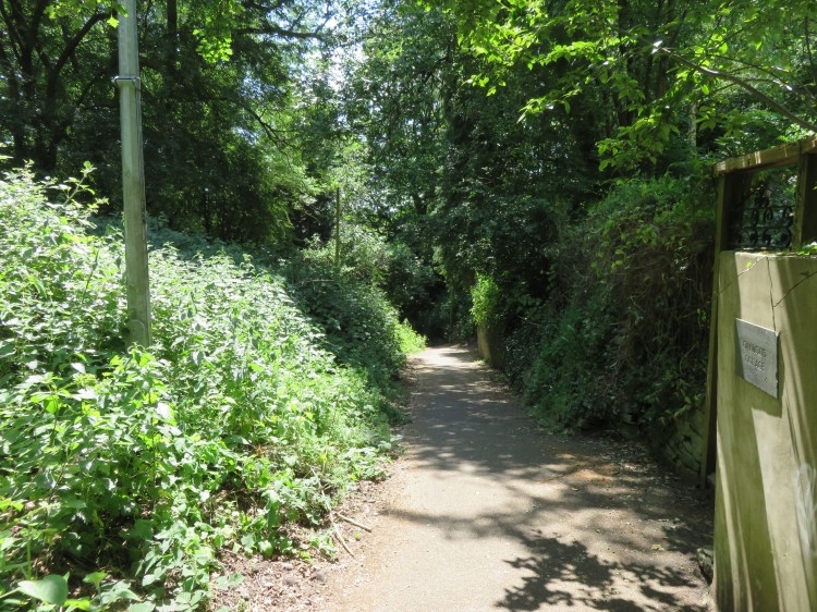
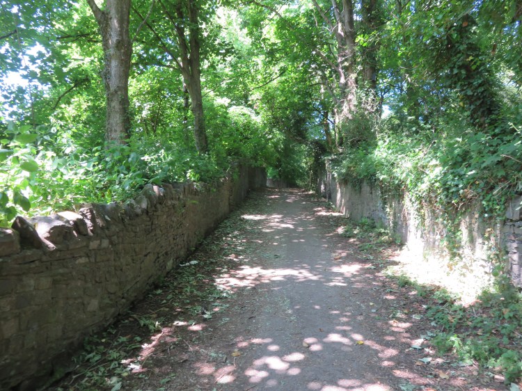
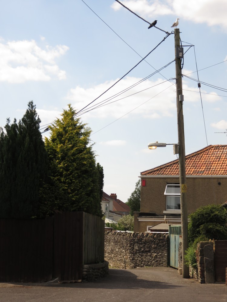
Head east along Beaufort Road (keeping the cemetery to your right). Immediately after the cemetery you will come upon turning for a residential mews, Beaufort Heights, immediately beyond which a paved driveway forks off to the right (1). Look for a narrow footpath leading off to the right between these two turnings.
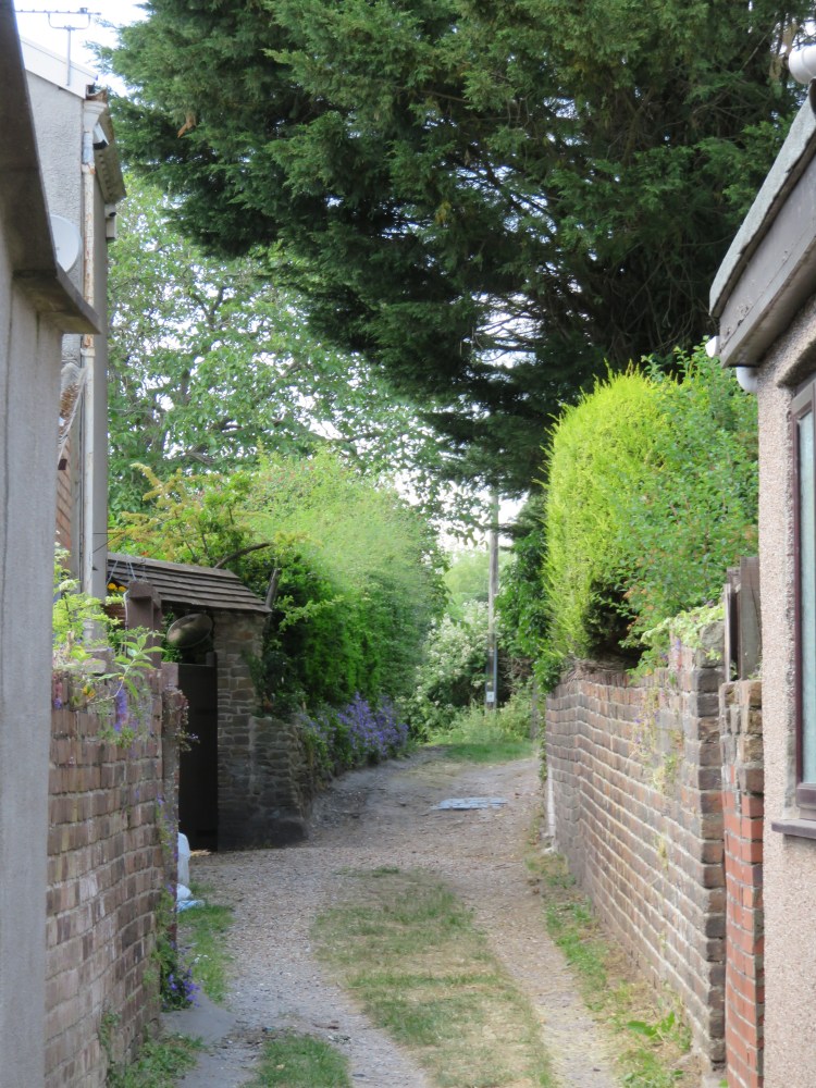
This is Strawberry Lane, the first of our tucked-away little by-ways leading down the side of the Avon Valley.
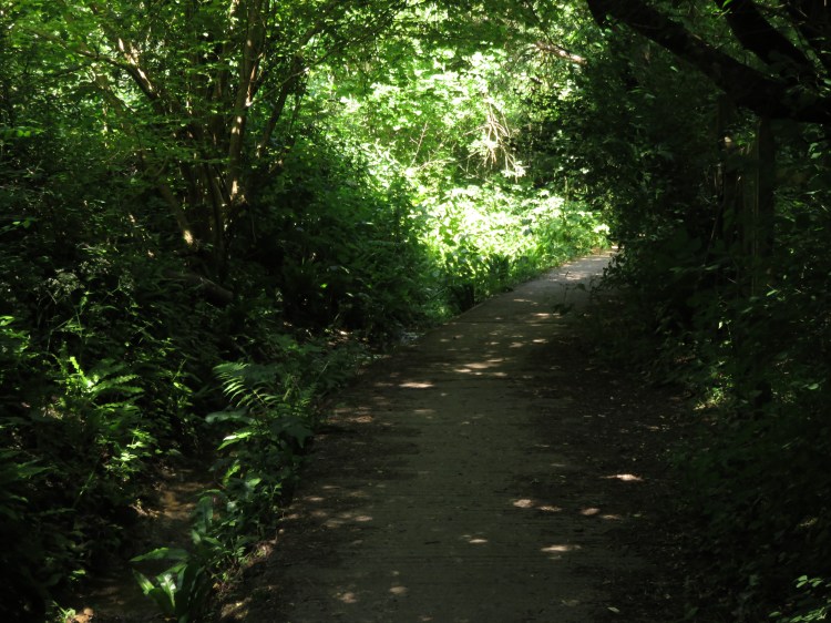
After a few moments, the footpath joins with another path coming down from the left and the lane broadens out into a wide paved footpath descending through woodland. For a moment, it feels like you have left the city behind you.
I have looked out for wild strawberries on this lane, but all I have ever seen is the yellow-flowered or ‘mock’ strawberry, whose fruit are technically edible but do nothing for the taste buds.
On reaching the bottom of the valley you will come out on Crew’s Hole Road amidst small industrial buildings.
Turn left and then look for a narrow footway almost immediately to the right (2).
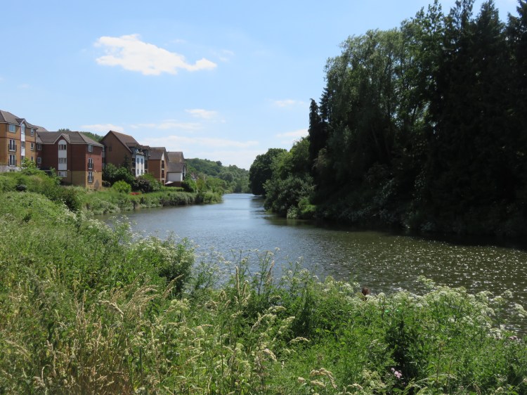
You will emerge on the towpath alongside the River Avon. Watch out for bicycles.
Turn left and follow the path upriver.
You will find yourself walking along the riverside opposite the part of St. Anne’s that we visited in Walk Eighteen ‘Brislington and St. Anne’s’. Thanks to the extensive wooded area on the northern slope of the valley and the trees planted opposite, this part of the valley (known as Crew’s Hole) has a pleasant semi-rural feel.
Over the last few years the main land use in Crew’s Hole has been shifting gradually from industry to housing as old buildings are converted or redeveloped. As such, the industrial sheds soon give way to residential houses and flats which shield you from the noise of traffic on Crew’s Hole Road. If you’re doing the walk at a quiet time, this is a great spot to listen out for birdsong. Look out for ducks and anglers along this stretch of the river. A glance over your shoulder will give you a good view of the hillside behind you, complete with isolated cottages.
As you walk past the modern houses and flats of Quayside Lane, you will pass a footpath on the left signed for Trooper’s Hill (3). We will visit Trooper’s Hill later. For now, continue along the river path.
Some distance later, the towpath merges with the road again as Crew’s Hole Road becomes Conham Road (4).
Short Route 1
If you are following Short Route 1, turn around and head back down the river path until you return to the footpath signed for Trooper’s Hill (3), which is accessible by ramp or stairs on the right.
Take the footpath to reach Quayside Lane. Go straight on to return to Crew’s Hole Road.
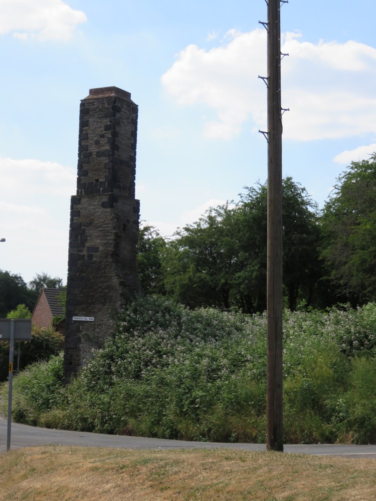
Turn right briefly onto Crew’s Hole Road and then left into Trooper’s Hill Road. Rejoin the long route at the entrance to Trooper’s Hill nature reserve on the left, next to a ruin with a square chimney (17).
To continue following the long route, go straight on into Conham Road.
There is no longer any development on the hillside to the left. Instead, you will have a high stone wall backed by woodland on the landward side of the road, and pleasant river views on the other.
Continue following the road until you see a footpath branching off to the right (5). Take this footpath to enter Conham River Park.

Conham River Park occupies a low-lying area of land that juts out into the course of the River Avon as it meanders through the valley. At the beginning of Conham River Park there is a picnic area with useful public toilets.
As you make your way around the towpath, development on both sides of the falls away, barring a few isolated buildings on the far bank (which include the pavilion and stores of the Bristol Ariel Rowing Club). This is one of the most beautiful and rural-feeling parts of this walk.
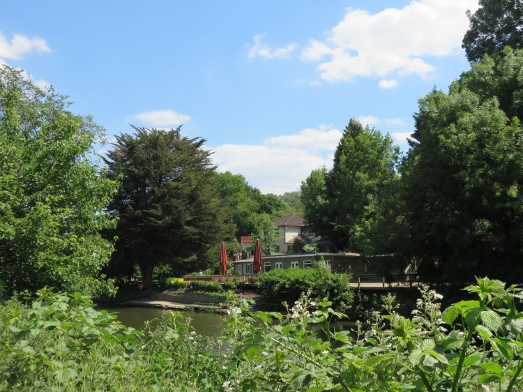
Shortly after passing a stone railway viaduct on the far bank, you will reach Conham Ferry, where a tiny ferry boat runs passengers across the river during the summer months to reach the tea room on the far side. The spot that the ferry runs from is marked by a fragment of stone wall, steps leading down to the water and a broad track leading up into the woods on the left (6).
Beese’s riverside bar and tea garden, on the far side of the river at Conham Ferry, has long been a popular spot for a drink or a snack.
It’s worth pausing for a while to take in this quaint scene – maybe even cross the river for a tea if you fancy it. We will be leaving the river next, and starting to make our way back up the side of the valley.
When you’re ready to move on, take the broad track that leads away from the river next to the ferry.
This pathway, lined with stone walls, is an extension to Conham Road that is closed to traffic. On the way up the gentle climb, look out for the ‘bat cave’ on the right – a vaulted stone structure that makes an ideal roost for the nocturnal mammals. Other gaps in the walls lead onto secluded woodland glades.
The track takes you back to the main road at the bottom of Conham Hill. Climb over the stile at the end of the track to access the road. Go straight on, very briefly, then turn right into Lower Conham Vale (7).
Short Route 2
Short Route 2 joins the Long Route at this point.
The much quieter Lower Conham Vale is a no through road for traffic, and is home to a row of attractive stone cottages.

Follow the charming valley route as it continues beyond the houses.
You will soon join up with the Stradbrook, a stream which cascades down alongside the footpath in little steps. The road becomes gradually narrower as you pass a few isolated houses, some of which are derelict, until it is little more than a track. This is border country, with Bristol on the left bank of the stream and South Gloucestershire on the other, and the area has that muddled feel, as if nobody really knows who should be maintaining it.
Don’t get sidetracked by the steps that branch off to the right, up towards Conham Hill (8). Continue along the lower route.
The route soon becomes a narrow footpath enfolded by ferns and overhanging trees. After passing a large and intriguing ‘secret’ garden, the footpath emerges back out onto a quiet paved road.
Turn right and climb Upper Conham Vale.
Upper Conham Vale, a quiet little backwater containing houses and smaller cottages, begins to climb more steeply as it approaches a crossroads. To avoid an unnecessary extra climb, look for a small flight of steps leading down to the right after the last of the cottages.
Go down the small flight of steps to reach the next street, Jeffries Hill Bottom (9), at the bottom of Lovell’s Hill, a footpath leading back up to the main road.
Short Route 2
Short Route 2 starts and finishes at this point.
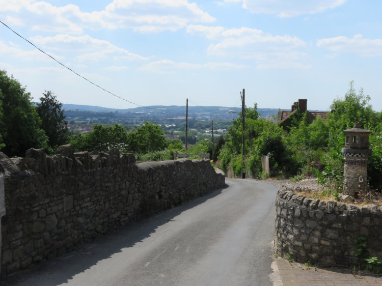
If you are starting Short Route 2, begin by climbing Lovell’s Hill from the end of Jeffries Hill Bottom. The narrow footpath climbs up to join the main road at the top of Conham Hill.
Turn right onto Conham Hill and make your way back down the hill. Be careful after you pass the last of the houses as there is no pavement for a while.
As you head round a sweeping right hand bend, look out for the start of a stone wall on the left. Just before the stone wall is a footpath signed for ‘Avon Valley Woodlands’ that goes steeply down to the side of the valley.
Take this path, which is known as the ‘100 Steps’. Keep going down until you reach the tow path at the bottom of the Avon Valley.
Turn right and follow the tow path, which offers views of the Eastwood Farm nature reserve on the far side of the water.
You will soon reach Conham Ferry (6), albeit from the opposite direction as the Long Route.
Continue along the tow path around the lovely Conham River Park, still going against the Long Route, until you see a path turning inland through a picnic area. Take this turning and exit Conham River Park through the car park, passing the toilets.
Arriving on Conham Road, cross the road and go roughly straight on to join the Long Route at Lower Conham Vale (7).
To follow the long route, continue straight on along Jeffries Hill Bottom.
The culverted Stradbrook can still be heard flowing under manhole covers. Although occupied by suburban housing at first, Jeffries Hill Bottom takes on a more rural feel after the turning for Gillingham Hill (10) (you will need to take a slight right turn to continue effectively straight on) thanks to its green surroundings and old cottages.
When you get to the next crossroads, where Jeffries Hill Bottom meets Polly Barnes Hill, turn left.
A brief climb will take you up to another crossroads with John Wesley Road and Dundridge Lane (11), at which point you have a choice.
Alternative route
The next section of the main route runs through Magpie Bottom nature reserve. The paths through Magpie Bottom are not as well made as the rest of this walk, and may be muddy at certain times of year.
If you are concerned about this, or wish to foreshorten the walk for any other reason, go straight on along John Wesley Road amongst ordinary suburban houses.
Follow John Wesley Road until you emerge on the main road, Bryant’s Hill, next to the Trooper’s pub. Continue along the main road, passing the Wesley Memorial Methodist Church, rejoining the main route at the traffic light junction with Kingsway and Rossiter’s Lane (15).
The Trooper’s on Bryant’s Hill is the only pub that is directly on this circuit.
To keep following the long route, turn right into Dundridge Lane.
Next we will follow a further stretch of the Stradbrook into the Magpie Bottom nature reserve, a leafy glade that separates St. George and Kingswood.
Follow Dundridge Lane until it ends at a car park just of Bryant’s Hill. Locate the footpath through to the main road, climbing a few steps, and then cross over.
Bryant’s Hill is part of the main A431 road from St. George to Bath via Hanham, Willsbridge, Bitton and Kelston.
Hanham village, a short distance to the right along the main road, is the only other place along this route with places to eat or drink. I can offer no specific recommendations.
Go through the gates opposite and follow the gravel path round to the left.
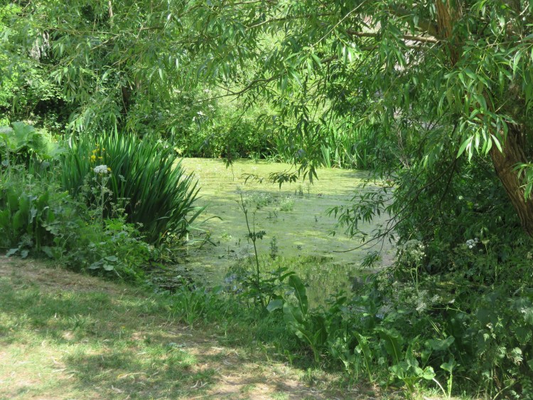
You will arrive in Magpie Bottom nature reserve at a peaceful grassy area. The Stradbrook re-emerges on the right, pleasantly enclosed with trees, and flows through a wildlife pond.
Keep following the main path. When the main path turns to cross the stream (12), take the small footpath to the left so you stay on the same side of the water.
Next you will pass through a woodland area, passing two white-painted footbridges.

Stay on the left hand side of the stream. Keep going straight on, following the waterway, until you emerge at a T-junction of sorts next to a third white-painted structure crossing the stream (13). Take the left, signed to the ‘Magpie Bottom nature reserve orchard’.
You are now on Magpie Bottom Lane, a quiet track that winds its way up the side of the valley between tumbledown stone walls and ruined buildings, giving the place an atmospheric air of abandonment.
Continue climbing, sticking to the main path, until you emerge on a paved stretch of road with a few bungalows. Follow this lane to emerge on Furber Road, in suburban St. George.
Turn left onto Furber Road and take the second right into St. Anne’s Road.
Furber Road and St. Anne’s Road are typical St. George streets containing a variety of stone-fronted houses, some with bay windows and some with more rustic flat fronts.
About half way down St. Anne’s Road, at the crest of the hill, turn right through a gap between Nos. 25 and 23 into Peartree Lane (14).
Peartree Lane is a small alleyway that leads to a couple of tucked-away houses. It has a secluded and intriguingly scruffy feel. In due course this will lead you back onto Bryant’s Hill opposite the junction for Kingscote Park.
Turn right onto Bryant’s Hill.
On Bryant’s Hill you will find the Wesley Memorial Methodist Church, which provides something of a local landmark.
Continue up Bryant’s Hill until you reach a traffic light junction with the broad Kingsway heading off to the right, and turn left into Rossiter’s Lane. Be careful, as there is no proper pedestrian crossing on this side of the junction (15).
An ordinary suburban street containing a mixture of modern and older houses, Rossiter’s Lane brings you out at a junction of several quiet roads, where you can glimpse great views out over the city centre and south Bristol.
Optionally, take a brief wander down White’s Hill to the left.
A tucked-away cul-de-sac, White’s Hill contains a couple of significant period properties and, for some reason, gives its name to the surrounding neighbourhood, suggesting a more important role as a through route prior to the suburban development of the rest of this area.
Return to the junction and turn right into Nicholas Lane.
Nicholas Lane will take you past a patch of allotments, affording you more good views, and back to the main road, now called Nag’s Head Hill, next to the parish church of St. Aidan with St. George.
From here, turn left into Firtree Lane.
Firtree Lane is an interesting street containing an eclectic mix of modern and older properties. As you descend the hill, it becomes gradually narrower, and as well as more long-distance views you may also catch glimpses of Trooper’s Hill to the right, with its distinctive crooked chimney. The Trooper’s Hill nature reserve is our next destination, but first we have to head back down to the bottom of the valley.
After descending gradually for a while, the road peters out and turns into a flight of steps.
Make your way down these quirky steps now so that you emerge on Niblett’s Hill (16).
Niblett’s Hill is another suburban-looking street whose evokes an older, more rural origin.
Turn immediately right onto another flight of steps, Parfitt’s Hill, which will eventually bring you out at the bottom of the valley, close to the junction of Crew’s Hole Road and Trooper’s Hill Road.
The smattering of old cottages surrounding these narrow lanes and footways harks back to Trooper’s Hill’s days as a mining area.
Cross the bottom of Trooper’s Hill Road and locate the footpath opposite.
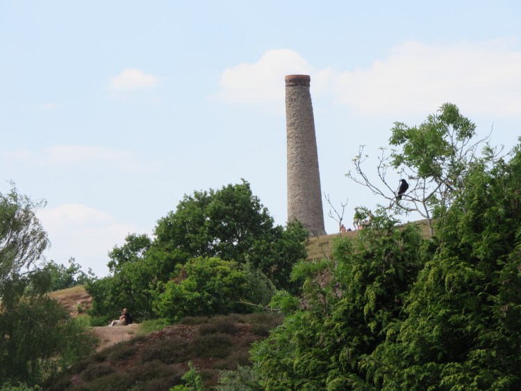
This is the entrance to Trooper’s Hill nature reserve. The footpath sets a course back up the hill behind an intriguing ruined building with a square chimney (17).
Short Route 1
Short Route 1 rejoins the Long Route at this point.
Climb the steep steps up onto Trooper’s Hill nature reserve.
This exposed hillside of Trooper’s Hill offers fantastic views southwest to Ashton Court, Totterdown and Dundry. The combination of heather and broom that dominates the plant life is unique in the area. At the top of the hill, the distinctive crooked stone chimney provides a prominent landmark in the area. Take your time over what is our last major climb for this walk, as it’s very steep.
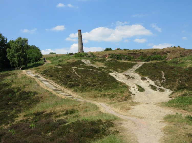
Stick to the main path, climbing the steps to the left of the main open area. Take a detour to look inside the chimney if you wish. Exit the nature reserve via the gate to the left of the chimney, at the top of the hill (18).
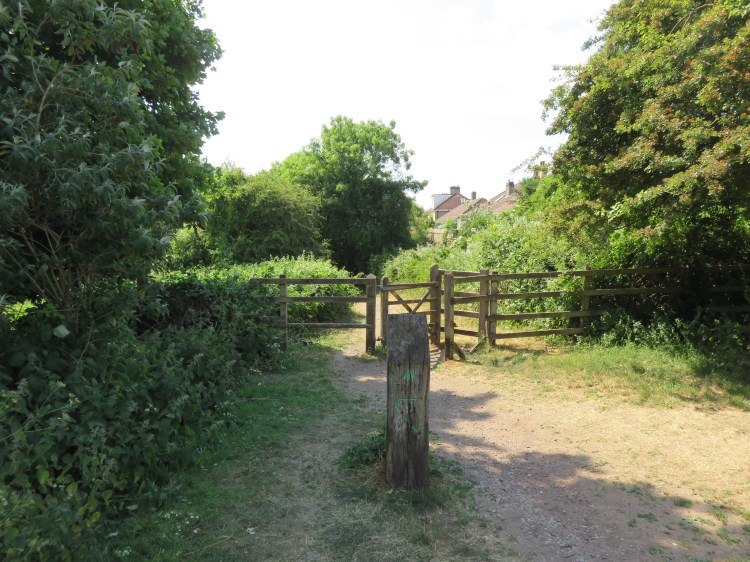
You will arrive in Trooper’s Hill Field, a small recreation ground off Malvern Road.
Look for a pedestrian gate to the left of the houses on Malvern Road (19). This will take you onto an earthen path that runs along the top of the wooded hillside.
Alternative route
You can, again, avoid the softer ground by taking a detour. Exit Trooper’s Hill Field via the gate onto Malvern Road. Follow Malvern Road until you can turn left onto a lane signed ‘To Lamb Hill’. Rejoin the main route at the top of Lamb Hill itself (20).
The quiet path will bring you out onto a narrow paved path that climbs the hillside. This is Lamb Hill, a quiet pedestrian route much like Strawberry Lane.
Optionally, take a brief wander down the hill to the left.
The detour will take you to a small hillside dwelling that nestles in the hillside opposite a secluded paddock. It’s a little like going back in time.
Having done that, climb back up the hill.
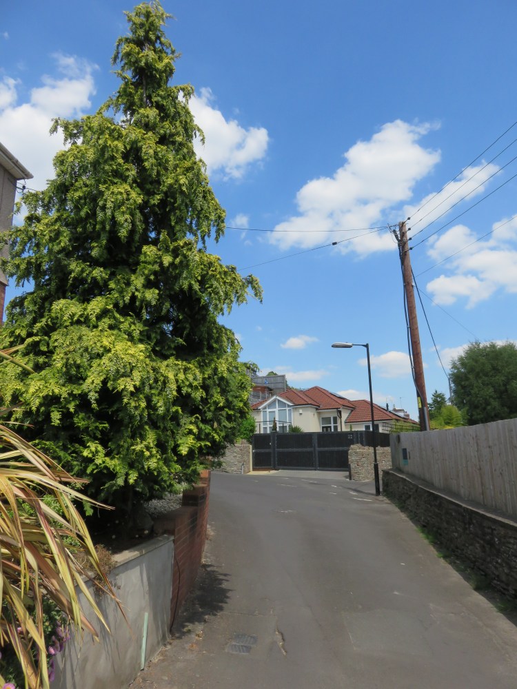
The path brings you out at the end of a small tarmacced driveway (20).
Go straight across and onto another stretch of footpath, going down a few steps. Take the left fork.
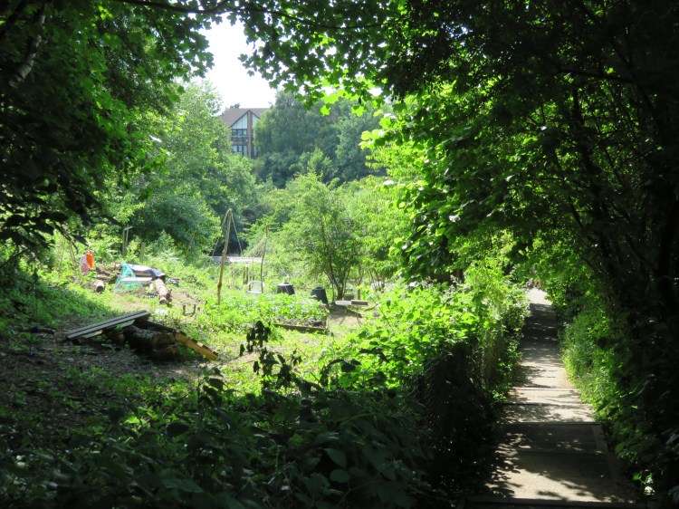
There’s one last treat in store. You will find yourself passing next to a secluded spot called Strawberry Lane Community Garden. It’s a final quiet and peaceful spot at the end of a walk that has been full of quiet green spaces.
Continue straight on, ignoring side turnings, and you will eventually emerge on Beaufort Road at the top of Strawberry Lane (1). Follow Beaufort Road to the left to return to Avon View Cemetery and complete Walk Nineteen.
Coming Up
In Walk Twenty ‘Stapleton and the Frome Valley’ we will turn our attention to another major river valley, this time the beautiful Frome Valley, which lies to the north of the city. We will walk from Stapleton Village to Frenchay Village and back via the Oldbury Court Estate and a few interesting hillside lanes.
