Last updated: May 2020
Walk Map | Download walk as PDF
Walk Nine is really all about the best-kept secret of south Bristol, the Northern Slopes. They contain some lovely natural spaces that are relatively little-known, maybe because of their poor visibility and because they border Knowle West, a part of south Bristol that many Bristolians would have no reason to go to. The Northern Slopes can suffer from antisocial behaviour, but the spaces are beautiful in the spring and offer some of the best views in the area.
As well as the Northern Slopes, this walk makes a return visit to Victoria Park (featured in Walk Eight ‘Bedminster, Totterdown and Arno’s Vale’) and follows part of the Malago Greenway, overlapping with part of Walk Seventeen ‘The Malago, Crox Bottom and Nover’s Hill’.
Useful Information
Terrain: Steeply hilly; includes steep steps. Unfortunately there is no accessible alternative route available.
Ground: Paved and unpaved. Ground may be soft underfoot at wet times of year on parts of The Bommie.
Key Attractions: Broadwalk Shopping Centre, Redcatch Park, Perrett Park, Victoria Park, River Malago, The Northern Slopes (The Novers), The Northern Slopes (Glyn Vale / Kenmare), The Northern Slopes (The Bommie).
Refreshments: Takeaway food and shops selling soft drinks and snacks are available around the area of Broadwalk Shopping Centre. Refreshment kiosk in Victoria Park.
Starting point: Wells Road/Broad Walk, Knowle
Getting there: Accessible by bus including routes running to Stockwood via Wells Road. Broadwalk Shopping Centre has a multi-storey car park. On-street parking also available in surrounding area.
Approx. Time: 2 hours 15 minutes
Approx. Distance: 4.5 miles
The Route
Our route starts in the centre of Knowle, at the junction of Wells Road and Broad Walk, outside the Broadwalk Shopping Centre. The shopping centre has struggled a little since losing its supermarket several years ago, but it is still home to a library and a variety of shops. Ambitious redevelopment plans may see the site transformed into something more modern.
There are not many opportunities to obtain refreshments on this walk. The takeaways and shops selling drinks and snacks in and around Broadwalk Shopping Centre may be your best bet.
Begin by walking along Broad Walk, passing a row of shops on your right. After passing several houses and crossing the exit from the Broadwalk Shopping Centre Car Park (1), turn right onto a footpath and go through the gates to enter Redcatch Park next to the basketball courts.
Redcatch Park is the main local park for this part of Knowle. It is not quite as beautiful as some of the other open spaces on this walk, but its shrub and flower borders are pleasant, it has climbable trees and its wide grassy spaces are popular with local children. The multistorey car park of Broadwalk Shopping Centre glares out over one side of the park, but may soon be replaced with something more engaging.
After passing the basketball courts, bear left onto the path that cuts diagonally across the middle of the park, keeping the shrub border to your left. Leave the park via the gates at the far end of the path, emerging on Redcatch Road (2).
Redcatch Road is the main local road in this area. It marks the edge of a pleasant neighbourhood of Edwardian and between-the-wars terraces and semi-detached houses.
Cross Redcatch Road. Turn left along Redcatch Road then, at the double junction with Bayham Road and Woodbridge Road on the right, take the left hand option (Bayham Road).
Bayham Road continues the pleasant suburban feel. As you walk along it, the properties get a little older. At the crest of the hill, a reasonably impressive view opens out of Bristol City Centre, with the buildings of the University of Bristol prominent on the horizon.
Descend the steeply sloping section of Bayham Road, reaching a crossroads at the corner of Perrett Park. Enter Perrett Park via the corner gate and follow the path along the top edge of the park to the left.

As seen in Walk Eight ‘Bedminster, Totterdown and Arno’s Vale’, the steeply sloping Perrett Park offers excellent views of south Bristol. From this angle, the two tower blocks on Windmill Hill dominate the middle distance. Beyond, the green escarpment of Leigh Woods and Ashton Court Estate defines the edge of the city (see Walk Twenty-Five ‘Ashton Court, Leigh Woods and the Avon Gorge’).
Follow the path along the top edge of Perrett Park until you see a second path sloping down to the right next to tall trees (3). Take this path and then descend the steep slope of the park via the zig-zag route below.
The numerous and varied willow trees along the zig-zag path were planted by local schoolchildren.
At the bottom of the zig-zag path, bear left past the children’s playground, leaving Perrett Park via a gate onto a lane behind the next row of houses. Go straight to emerge on Ravenhill Road. Turn right and make your way down the hill.
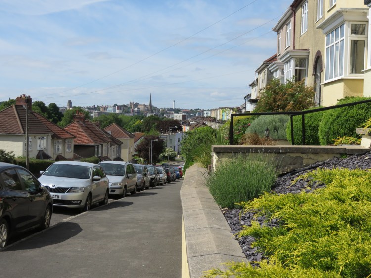
The undulating Ravenhill Road is typical of this area, known as Lower Knowle. Between-the-wars semi-detached houses are the theme. The houses on the right are elevated above road level, making the most of their hillside position. As you crest the hill once again, you will have another view of Bristol City Centre in the distance.
At the bottom of Ravenhill Road, turn left at the roundabout onto St. John’s Lane.
St. John’s Lane is an important local route from Bedminster to Totterdown, also linking Lower Knowle and Windmill Hill. However, it’s not that exciting to walk along, so we won’t linger.
Cross St. John’s Lane at the pedestrian crossing and then turn right into Marmaduke Street (4).
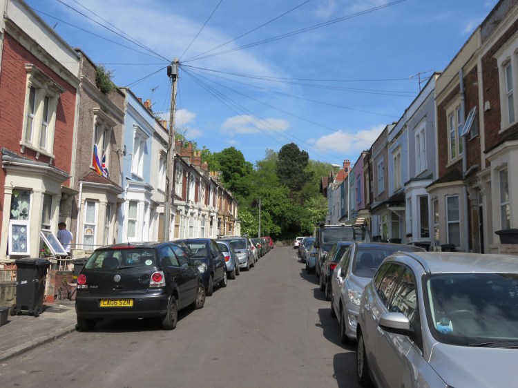
You are now in the neighbourhood known as Victoria Park. Marmaduke Street is typical of the lower part of the area, narrow with colourful houses rising straight from the back edge of the pavement on both sides.
Walk to the end of Marmaduke Street, cross Hill Avenue and go through the gates to enter Victoria Park itself.
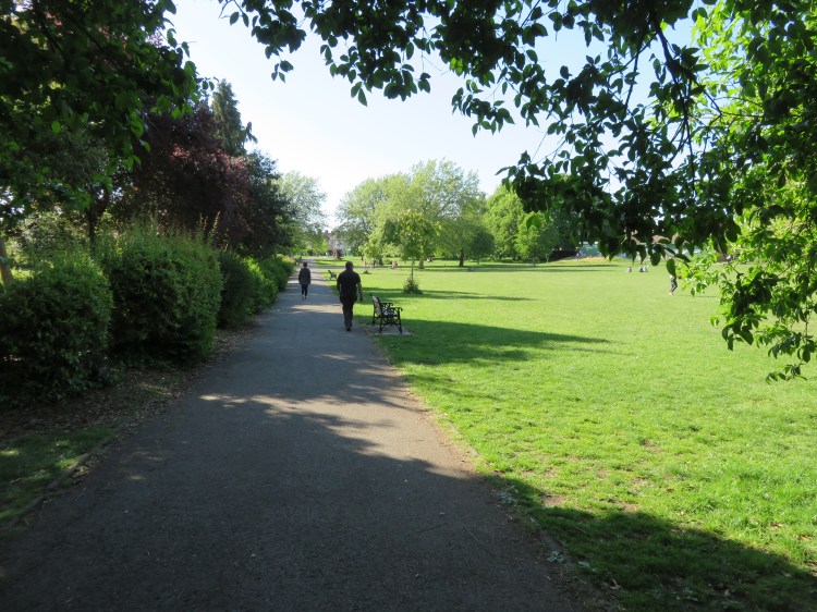
Victoria Park is one of Bristol’s largest city parks, which straddles the hilltop between Bedminster, Windmill Hill and Totterdown. The park was created by the Wills Tobacco company, which then dominated employment in the Bedminster area, in a philanthropic gesture. Today, the well-used park offers three children’s playgrounds, a basketball court, football pitches, a wheels park, a water maze and many opportunities for walking, running and fitness training.
Go straight ahead to begin climbing the hill, walking at first through an avenue of young chestnut trees. Crossing two paths, continue up the hill along a second avenue of mature lime trees (5).

The path that runs up through the centre of the park offers good views in either direction. Off to the right you can see the colourful houses of Totterdown. Off to the left you will have a view back up to Knowle, with Redcatch Road climbing the hill in the distance.
Continue straight on so that you crest the hill with the tennis courts on your left. Looking to the left after the tennis courts you will see a three-way fork. Take the middle fork to reach the Victoria Park rose garden (6).
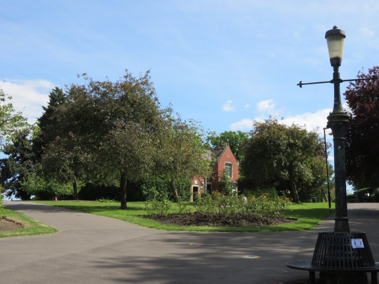
An ornate lamp standard sits at the centre of the rose garden, but could use some refurbishment. Off to the left, at the top of the hill, you can see the park lodge, which also provides some rather basic toilets.
Stuffed, based in a kiosk at the rear of the park lodge at the top of Victoria Park, is a good place to grab a coffee or a snack.
Go straight across the rose garden so that you begin to descend along the edge of the park.
The church of St. Michael and All Angels can be seen on higher ground to the left. There are also some fine pine trees here.
At the bottom of the path, leave Victoria Park via the gate onto Fraser Street.
You are now in the Windmill Hill area. Fraser Street is a typical Windmill Hill street with dignified Victorian terraced houses, some of which could do with some tender loving care.
Descend Fraser Street, reaching a crossroads with Windmill Hill at the entrance to Bedminster Station (7).
Don’t miss the mural in the Bedminster Station forecourt.
Cross Windmill Hill to Cotswold Road North. Immediately turn right onto the cycle path that runs next to the railway embankment, descending past an open green area.
You are now on the Malago Greenway, following the hidden River Malago. Bedminster’s main river is now a shadow of its former self. Once a driver of industry in the area and, occasionally, a cause of major flooding, the Malago has now been reduced to a partially buried trickle. These days, the bulk of the storm water flowing down from Dundry hill is diverted to the River Avon New Cut via a culvert at Manor Woods Valley in Bishopsworth (see Walk Seventeen ‘The Malago, Crox Bottom and Nover’s Hill’).
Follow the cycle path to the bottom of the hill, where the River Malago emerges from a tunnel under the railway line. Crossing a footbridge, continue along the path with the river on your left.
This part of the river flows through a wooded gulley shrouded by sycamore trees. The red-brick backs of the houses on Cotswold Road and their secluded gardens can be glimpsed through the trees to your left. On the right are the red-brick sheds of the Malago Vale Trading Estate.
Follow the greenway until it emerges back on St. John’s Lane. Bear left towards the pedestrian crossing. Note the steep leafy quiet of St. John’s Burial Ground off to the left (8). Cross St. John’s Lane to reach Francis Road.
Now closed to traffic, Francis Road makes the third side of a triangle with the main roads St. John’s Lane and Bedminster Road. The River Malago can still be glimpsed through the tree line on the left, running through a hidden glade.
Reaching Bedminster Road, cross at the pedestrian crossing and then go straight on onto a footpath parallel to the Malago Greenway, which is off to the left.
The path here has a more open feel. The Malago runs through marginal wildflowers to the left, while the new homes of Malago Drive make a tidy boundary to the right.
Cross the footbridge to rejoin the Malago Greenway. Continue straight on through Marksbury Road Open Space.
Marksbury Road Open Space is one of a string of open areas that follow the Malago through this part of Bedminster. Its recreational facilities are popular with local families and teens.
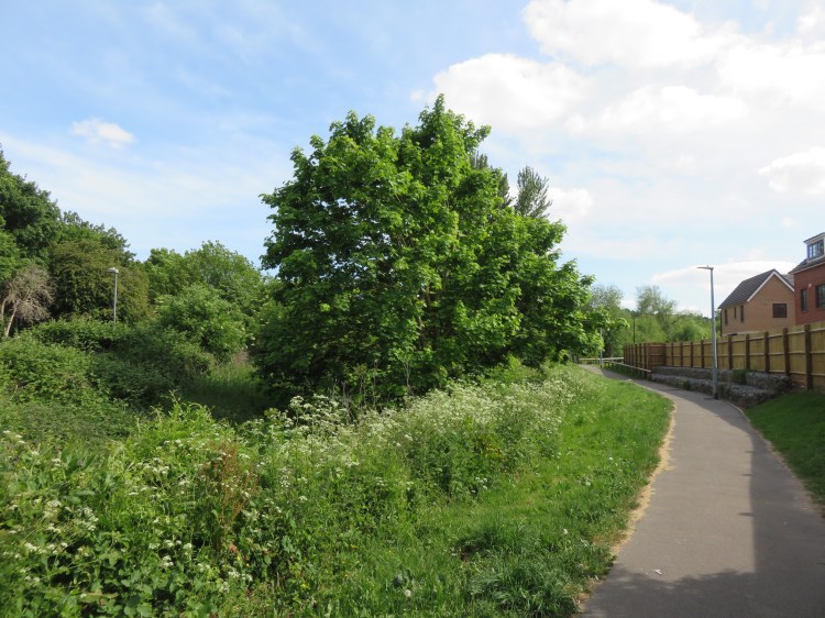
Following the greenway, leave the open space via the gates onto Marksbury Road. Turn right and follow Marksbury Road until you reach a small stone bridge over the river (9). The Malago Greenway continues to the left just before the bridge span. Take this left turn.
The next section of the Malago Greenway takes on a wilder and more airy feel. Beyond the houses on the far left of the space you will see a green hillside. This is your first close view of the Northern Slopes.

A notable feature of this area is the Berry Maze (10). Designed by a local schoolboy and created and maintained by a group of volunteers, an attempt is being made to create a maze of edible fruit bushes. It’s testament to the community spirit in an area that is short of other facilities.
Leave the green space via the gates onto Parson Street. Head left to the junction of Parson Street, Lynton Road and Nover’s Hill. Take the footpath that climbs up from the far side of the junction towards steep steps visible in the distance.
You are now on Nover’s Steps, which lead up into the first section of the Northern Slopes, which is known locally as The Novers. This first section is characterised by young woodland and bramble scrub. Look out for birds, butterflies and other insects.

Nover’s Steps may seem endless, but it is worth the climb for the views you can obtain as you look behind you. As you approach the top of the steps you will have a clear vista over the rooftops of Bedminster to the Avon Gorge, the Clifton terraces and the Clifton Suspension Bridge.
You will soon reach the rear gates to Knowle West Health Park (11). Before going through the gates, take a detour.
Turn left along the narrow earthen path just outside the gates. You will soon emerge in an open space.
This open space is the true hidden gem of the Novers. While climbing the steps you wouldn’t know it is there at all, but discovering it rewards you with one of the very best views in south Bristol. From a wide grassy sward at the top of the hill, a panorama opens out over everything from Ashton Court to the Avon Gorge, to Clifton and Bristol City Centre and even the distant escarpments of Kingsdown, Montpelier and Purdown. The yellow Dower House at Stoke Park, next to the M32, can be glimpsed to the far right (see Walk Twenty-One ‘Stoke Park and Purdown’).

At time of writing, there is no clear route onward along the Novers from this point, although planned redevelopment at Kingswear Road may change that. Instead, when you’ve finished admiring the view, return along the earthen path and turn left, stepping through the gates into Knowle West Health Park (11).
Knowle West Health Park is an important local facility for the deprived Filwood Park estate, providing medical facilities and space for outside recreation in its grassy grounds.
Turn left to follow the path around the perimeter of the health park, passing through a gate to the rear of the medical centre. Continue around the perimeter from there, passing a mounded area popular with local children. Leave the health park via the gate in the northern corner (12).
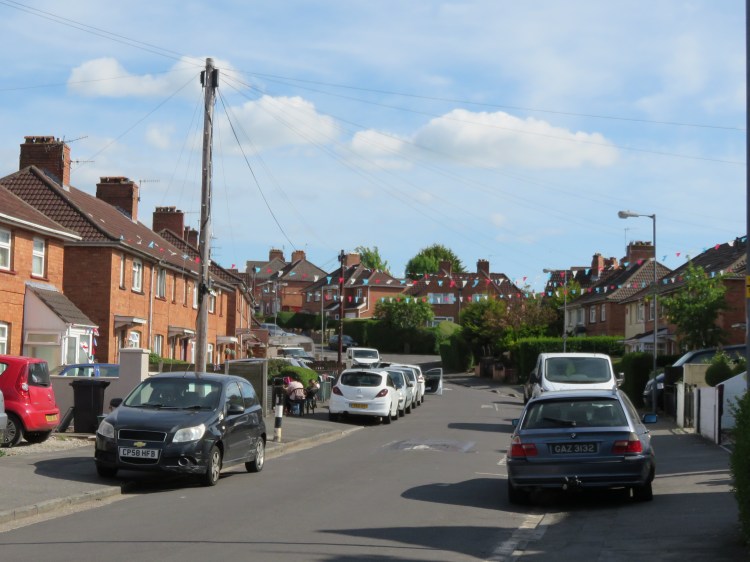
You will emerge amid red-brick council houses in Kildare Road, on the fringes of Filwood Park – part of the collection of housing estates known locally as Knowle West. Deprived the area may be, but Kildare Road still managed to muster some bunting for the centenary of VE Day.
Crossing Kildare Road, go straight on into Clonmel Road. You will reach a crossroads at the top of Glyn Vale. Go straight on into Cavan Walk. At the far end of the cul-de-sac, take the footpath in the right corner to enter the next section of the Northern Slopes.
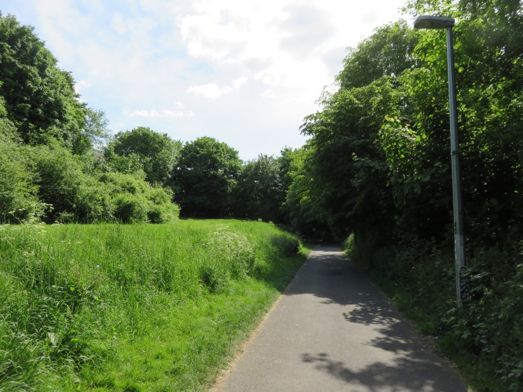
This next section of the Northern Slopes is known as Glyn Vale / Kenmare. Much like the Novers, a lot of the area is comprised of untamed scrubland. It is also largest of the Slopes’ three accessible sections. This area is the least supervised and probably has the greatest incidence of antisocial behaviour; watch out for the dirt bikers and amateur arsonists who sometimes come here. However, the area is also an attractive wild space in the heart of south Bristol.
You will enter Glyn Vale / Kenmare at a crossing of paths (13). Take the hard left so that you begin to head downhill.

You will begin your descent through Glyn Vale / Kenmare with an attractive glimpsed view of Windmill Hill; the towers of Clifton Cathedral are visible in the distance. Enjoy the wildlife as you descend; at the bottom of the hill, you will join up with the Filwood Quietway cycle route, coming down from Knowle West via a steeper route (14).
Leave Glyn Vale / Kenmare via the gates onto Wedmore Vale. Cross Wedmore Vale, heading downhill, then turn immediately right into Wingfield Road.
On Wingfield Road you are temporarily back in Lower Knowle, with its familiar mix of between-the-wars semi-detached houses, now with added bungalows.
On the right, look out for a narrow footpath between Nos. 73 and 71 Wingfield Road. Take this right turn to reach our final section of the Northern Slopes.
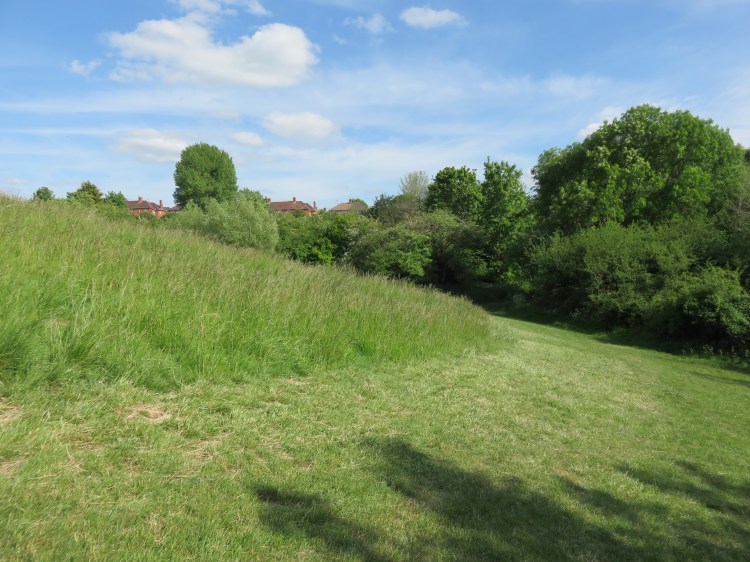
This final section of the Northern Slopes, known locally as The Bommie, may not look like much at first, but is my personal favourite section.
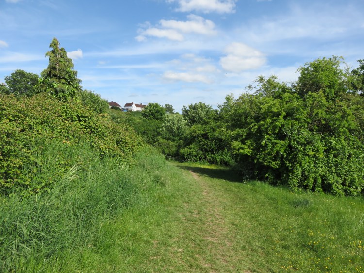
Climb the footpath until you reach a grassy clearing on the right (15). Strike out across the grass, following a roughly trodden footpath through the grass itself.
The steeply sloping Bommie is home to grassy meadows, scrub and a stream. This combination ensures that it is popular with wildlife. It’s also a really peaceful spot, rarely busy, and in the spring it is truly alive with the sound of birdsong.
Follow the grassy path through the lower clearings of the Bommie. Shortly you will dip down into a small wooded gulley. The ground may be soft here.
You will emerge from the gulley at the foot of a steep grassy hill (16).
The grassy hill is one of the Bommie’s most pleasant areas. Explore it if you like; there is a great view out towards Long Ashton out at the top, and a row of fruit trees has been planted along the far side.
Otherwise, continue walking along the foot of the grassy hill, keeping the trees to your right. At the bottom corner of the field, take the rough path through the trees. Cross the stream (17). Watch out for soft ground here.
Climb straight up the steep grassy slope. You can leave the Bommie via a gate leading onto a small square just off Daventry Road (18).
The small grassy square off Daventry Road is home to St. Barnabas’ Church, an unusual design in red brick with an exposed bell tower.
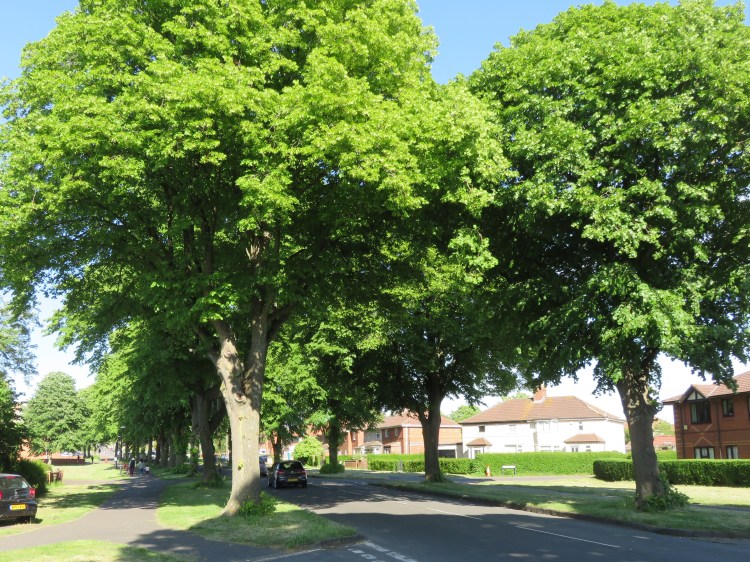
Turn left along Daventry Road and make your way up past red brick houses until you reach a tree-lined rectangular roundabout at the start of Broad Walk (19).
Broad Walk is the main road serving the Knowle Park estate. Knowle Park is the leafier part of Knowle West, and Broad Walk is no exception, being lined with lovely lime trees.
From now on it’s simply a case of walking back along Broad Walk, passing Bristol Nazarene Church and crossing the exit from Broadwalk Shopping Centre car park (1) to return to where you started and complete Walk Nine.
Coming Up
In Walk Ten ‘Upper Knowle and Kensington Park’ we will return initially to Totterdown before exploring the lived-in residential streets of Upper Knowle. This will lead us eventually to wildness of Callington Road Nature Reserve and a return trip via Kensington Park and Arno’s Vale.
