Last updated: May 2020
Walk Map | Download walk as PDF
This one is a residential street walk, really, but one in which I try to bring out the most interesting features.
The areas we are exploring continue to become more affluent as we head to the suburbs lying just to the north of the city centre. This time we will be exploring Redland and Cotham, both leafy Victorian suburbs home to a settled middle-class population but also large numbers of student houses and rented flats, resulting in a mixed feel. Redland and Cotham merit a visit due to the attractive mix of generously-proportioned Victorian houses and tree-lined streets that make up the area, plus the presence of a few more interesting historic green spaces.
Useful Information
Terrain: Hilly.
Ground: Paved.
Key Attractions: Cotham Gardens, Kingsdown terraces, Chandos Road restaurants, Redland Green.
Refreshments: There are a number of pubs and opportunities to buy food in the Kingsdown area. Chandos Road is home to a number of independent eateries. Further pubs can be found in the higher parts of Redland later in the walk.
Starting point: Redland Station
Getting there: Trains at least hourly from Temple Meads Station and suburban stations on the Severn Beach Line. Thirty minutes’ walk from the Centre Promenade and forty minutes’ walk from Temple Meads Station. Accessible by bus routes running via Gloucester Road and also route No.9 running to Redland Station. On-street car parking available in surrounding streets, subject to residents’ parking restrictions on weekdays.
Approx. Time: 2 hours
Approx. Distance: 3.5 miles
The Route
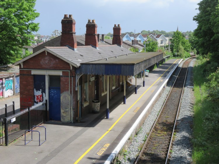
Our walk starts at Redland Station, a quaint little suburban station that still retains one of its Victorian station buildings (there would previously have been more buildings, notably when the station had two platforms rather than the present one). The remains of the second platform are still visible on the far side of the track.
Exit the station onto South Road and climb towards the top of the hill. Just before you hit the crossroads, turn left onto a footpath, so that you reach an old iron footbridge (1).
This footpath has the rather lovely name of Lovers’ Walk, and is one of Bristol’s most stolen street name signs. The footbridge will allow you a better view of the station and the railway lines.
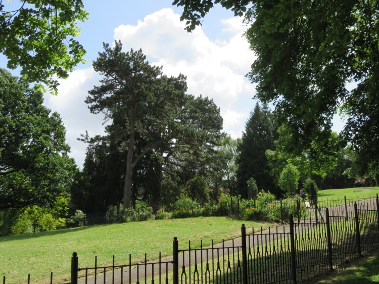
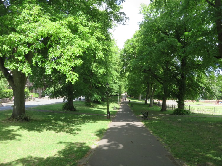
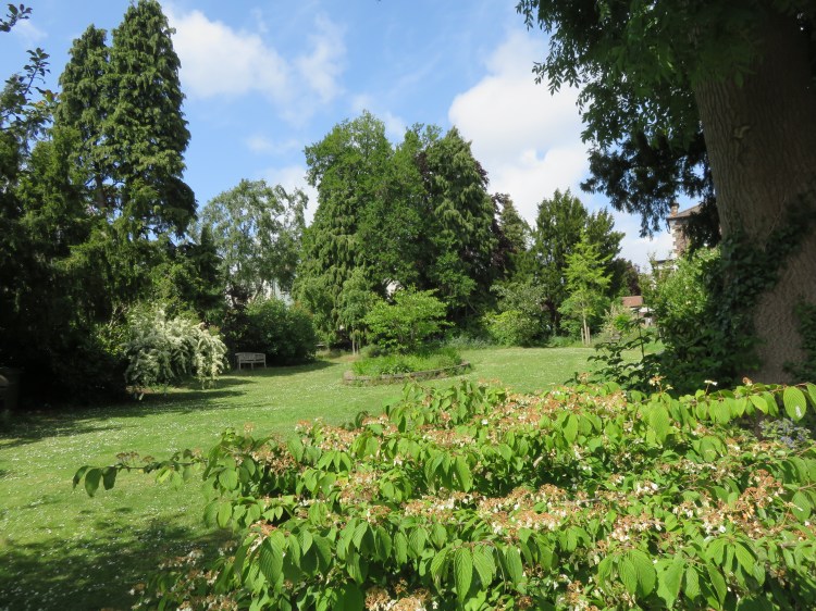
After crossing the bridge, you will reach Cotham Gardens, a good-sized park with a popular and well-equipped play area for younger children. Lovers’ Walk continues along the edge of this area as a beautiful avenue of mature lime trees, climbing alongside Redland Grove to the right.
Climb to the top of the hill, where Lover’s Walk converges on Redland Grove (2).
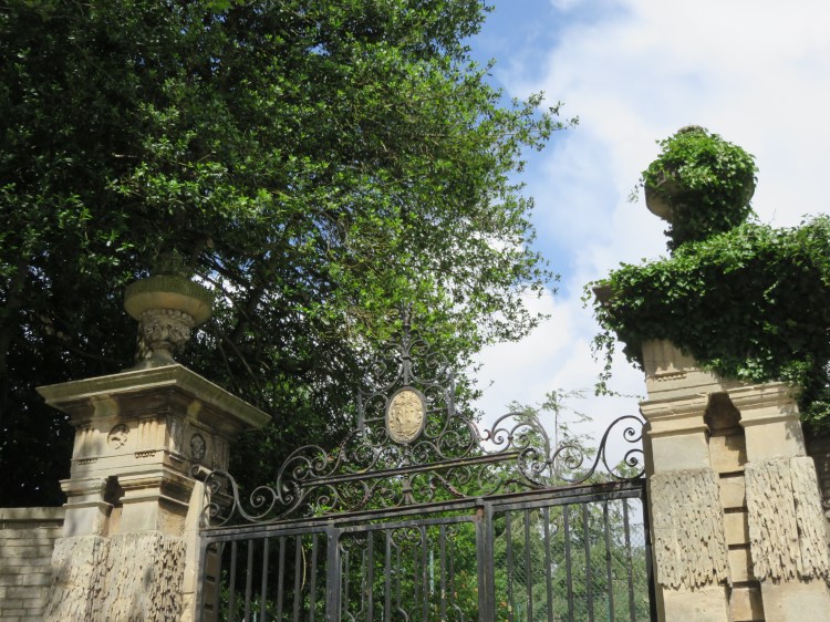
Take a moment to look back down Lovers’ Walk. At the right time of year, you will be able to see that the avenue of trees continues beyond Redland Station to end at the gates of Redland Court, which sits commandingly at the top of the hill beyond. This must have made a fine driveway when it was part of a rural estate.
Continue along the path so that you merge with the footway of Redland Grove.
To the right is Cotham Gardens Primary School, occupying a converted Victorian house.
Before exploring leafier Redland, we are going to explore the older, and appropriately more ‘urban’ area of Cotham. Most of Cotham is still Victorian in origin, but you will find that the grey and red sandstone that characterise the semi-detached villas of Redland gives way to a preponderance of Bath Stone or other limestone ashlar finishes in the design of the buildings, as per the fashion at the time.
Just after the zebra crossing, take the left fork onto Fremantle Road.
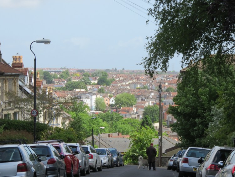
You will cross the top of Elmgrove Road, and will be treated to a view across to St Andrew’s and Bishopston, with the lights of the County Cricket Ground dominant in the skyline.
Shortly after crossing Elmgrove Road, turn left onto the parallel Southfield Road.
Southfield Road descends at first past a small development of post-war Council houses. As you start to go more steeply downhill, the houses tiptoe their way down the steep gradient until the road ends abruptly at an embankment, as if the original developers intended to extend it but never got around to it.
Just before you reach that dead-end, turn right and follow the steep side road down to Cotham Brow (3).
As you do so, you will pass one of the many small, mews-style infill houses that have sprung up in this area in recent years. Gibson Road, further down the hill, is the best example of this, but we’re not going to make it down there today unless you fancy a detour.
Cotham Brow is the main road in these parts. Go straight on into Sydenham Hill.
Sydenham Hill is a typical Cotham hillside street. On the lower side you will find extremely elegant Victorian semi-detached houses, while on the upper side you will find the garages at the back of the houses on the next street up the hill. It’s a very odd mix and gives the road a slightly scruffy quality, but it’s very distinctively Cotham.
At the far end of Sydenham Hill you will pop out on Nugent Hill next to another mews style house. While Sydenham Hill and its neighbours follow the contours of the hillside, Nugent Hill climbs steeply up the side of the hill to link them. This is a pattern of development that you may well recognise from previous walks in Kingsdown and Montpelier, neither of which are very far away from here. Looking down Nugent Hill, you can actually see the hillside development of Montpelier on the far side of the valley.
Continue across Nugent Hill into Springfield Road.
You are drawing closer to the city centre now and, Springfield Road being an older street than Sydenham Hill, some of the houses start to appear in small terraced groups.
Springfield Road terminates on Nine Tree Hill, another very steep street. Nine Tree Hill also marks the boundary between Cotham and Kingsdown, specifically the Dove Street area of Kingsdown’s lower slopes where the Georgian charm was swept away in favour of monolithic blocks of flats in post-war years (see Walk Four ‘The Northern Edge’). To the left, over the rooftops of Stokes Croft, St. Paul’s Church tower can be seen in the near distance.
If you want a drink, a short detour along Dove Street will take you to two characterful little pubs: the Hare on the Hill and the Hillgrove Porter Stores.
Climb the top section of Nine Tree Hill so that you emerge in Fremantle Square (4).
We are about to briefly retrace parts of Walk Four as we navigate the area where Cotham collides with Kingsdown.
Fremantle Square is a small sloping square with a raised central garden that bookends Somerset Street and Kingsdown Parade. The square is in the approximate location of the Prior’s Hill fort, an important part of Bristol’s civil war defences.
Turn left along the side of the square and continue briefly into picturesque Somerset Street. Take the first right, passing a curious red-brick corner property as you return to Fremantle Road. Continue straight on across Kingsdown Parade.
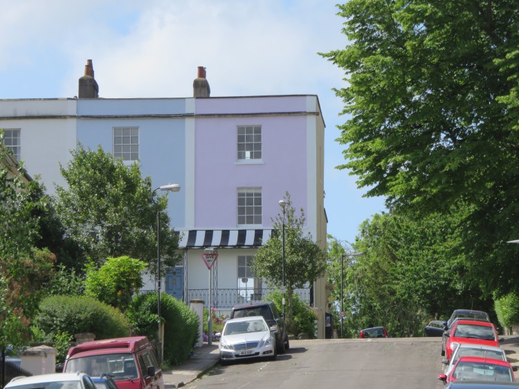
Fremantle Road continues past the Prior’s Hill council flats. Soon you will pass a view-commanding terrace with distinctive black and white wrought iron verandas.
Turn left at the top of Nugent Hill into Cotham Side.
As in Walk Four ‘The Northern Edge’, you will find yourself in the peaceful surroundings of St. Matthew’s Church. The church and its pretty garden are surrounded by quiet back streets and feel secluded despite being close to the main road.
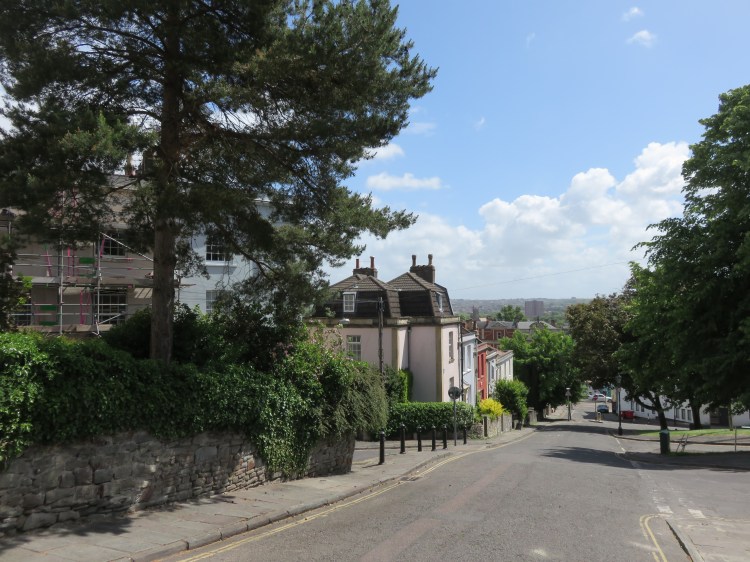
Follow Cotham Side around the first corner and continue straight on past the church so that you emerge once again on the main road, Cotham Road (you are now just at the top of Cotham Brow). Turn left and take a short walk along the main road.
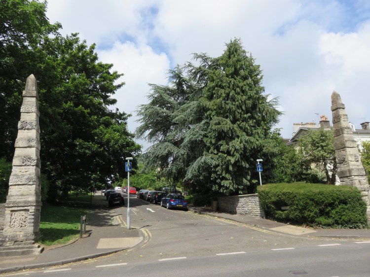
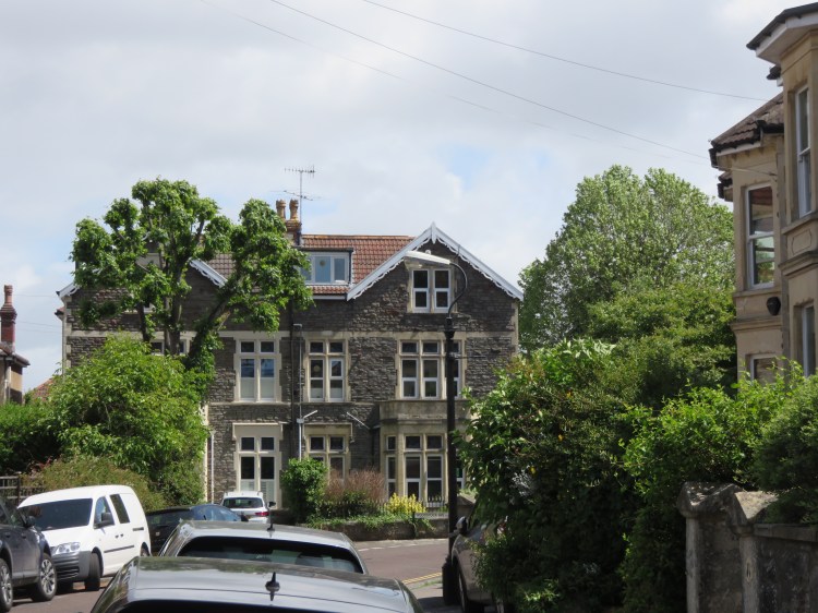
Note how the elegant houses on Cotham Road conceal themselves behind mature trees to escape the traffic. One rather Gothic property on the right looks like somewhere a wizard might live (5). Shortly you will come to a distinctive junction on the right that is lined by a pair of stone obelisks.
Take this side turning to enter Cotham Park.
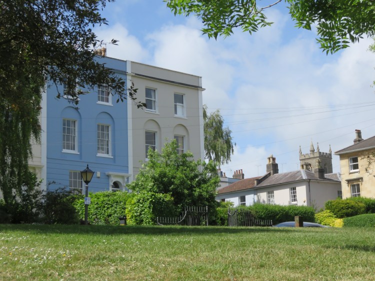
Tree-lined Cotham Park has the feel of a very grand street that has experienced mixed fortunes over the years. However, note how each pair of properties has a distinct design.
At the far end, Cotham Park curves sharply round to the right. Take the first left after this bend, so that you enter Trelawney Road.
The pleasant and quiet Trelawney Road occupies a hillside location. The properties on the right-hand side of the street benefit from great views out over Redland, which you may catch glimpses of between the houses. On the far side of the street, many of the houses are built in an elevated position so that they also benefit from the views.
After a short while, a panorama opens out over Redland on the right as you reach the junction with Cotham Vale (6).

Turn right here and descend the short, steep hill to reach the main part of Cotham Vale, which leads off to the left.
Cotham Vale is a pleasant street with a degree of formality in its architecture and planning that blends the Cotham and Redland styles.
You will emerge on Hampton Road, the main road through this area. Although a comparatively busy road, it’s not without its interest thanks to the widespread use of red sandstone in its three-storey houses.
Turn right into Hampton Road and then right again into Ravenswood Road.
You are now in Redland. Although typical of the area in many ways, the housing in Ravenswood Road does make use of some atypical materials. To the right, the first few houses are finished in a blue stone cut into unusually regular blocks in an area where random rubble is more common. Meanwhile, as you pass the first junction on the left, St. Ronan’s Avenue, you will see several houses finished in neatly cut ashlar with a general scarcity of windows. Ravenswood Road itself meanders around intriguing bends with lovely mature trees, but it would be too much of a detour for us to follow the whole street.
Continue along Ravenswood Road until it jinks round to the right and then turn left into Woodstock Avenue.
Pleasant Woodstock Avenue is lined with mature lime trees.
At the end of the road, turn left onto Waverley Road to head back towards Hampton Road.
Narrow Waverley Road can sometimes feel dominated by bins and parked cars, but a few of the houses are quite imposing.
At the end of the road, turn right once again onto Hampton Road.
You will soon find yourself crossing the Severn Beach railway line (7), after which you will pass a small chapel.
Turn right into Melville Road opposite the petrol station.
Melville Road will return you to quieter surroundings. It will lead you to Cowper Road, which ends abruptly at the railway line to the right.
Turn left along Cowper Road. Make your way past the unassuming terraced and semi-detached houses to reach Chandos Road.
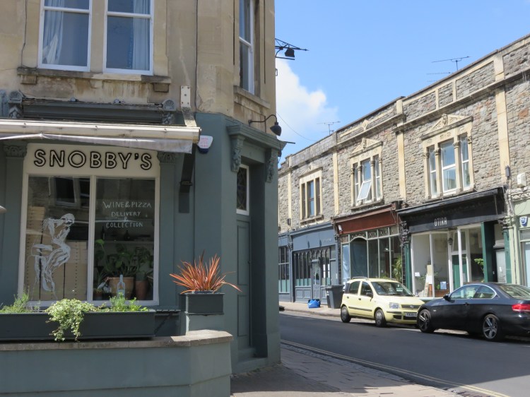
Something of a local centre, Chandos Road has experienced some decline as a shopping street but has risen again to become a successful destination for independent restaurants and bars.
Chandos Road, with its various restaurants and shops, is an obvious place to stop if you would like to include a meal on your walk. Check opening hours first.
Turn right along Chandos Road.
You soon will reach the street’s dominant feature, the former St. Saviour’s Church (8), now sensitively converted to flats. Two very fine copper beech trees cast a shadow on the street to the front of the church.
Turn right into Brighton Road opposite the church to head back towards the railway.
You will soon find yourself passing between two ashlar-fronted terraces, the right hand one of which is designed in a mock Georgian style.
At the end of the terraces you will turn a corner into Kensington Road. This characterful street runs directly alongside the railway for much of its length. On the left, several interesting side streets terminate, leaving Kensington Road with a mixture of end of terrace houses with mews-style outbuildings in between.
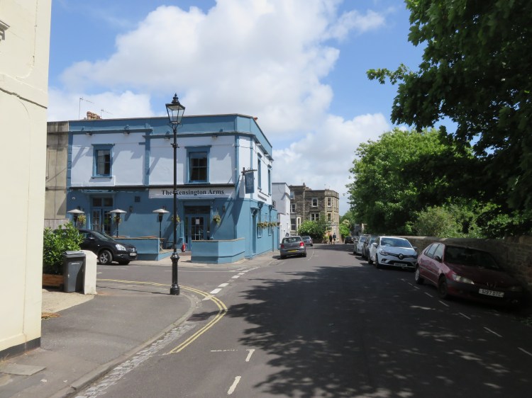
On the corner of Stanley Road you will pass the Kensington Arms, a local watering hole now converted to a gastro-pub.
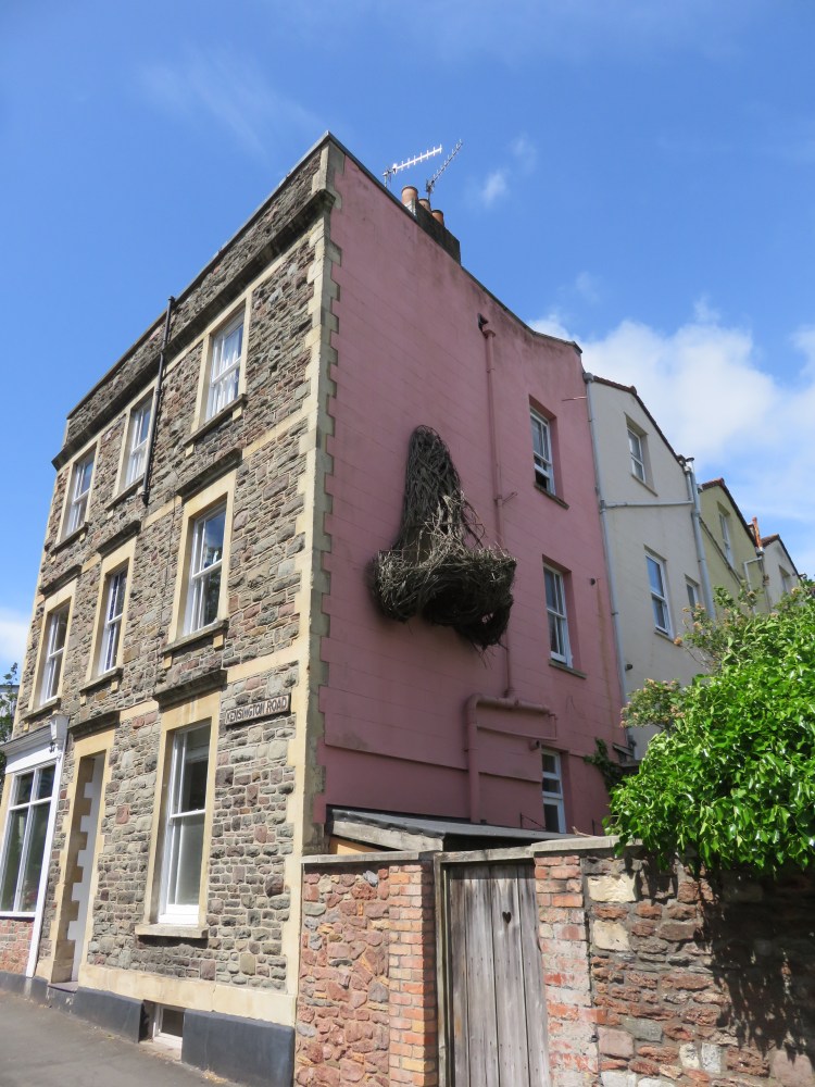
The true highlight occurs just after the junction of Roslyn Road. On the back of the end of terrace property to the left you will find the famous Kensington Road nose (9). Originally built out of papier maché, but since rebuilt in wickerwork after it started to deteriorate, the giant nose has been puzzling and delighting passers-by for many years now. At time of writing, it looks like the birds have been raiding it for twigs.
After leaving the nose behind you, turn left into Alexandra Park.
Alexandra Park is a pleasant street that wiggles its way back towards Chandos Road. On the way, you will pass an unusual flat-fronted terrace in soft-looking red sandstone that would be more at home in the east part of Clifton.
Returning to Chandos Road, turn left.
Make your way back through the substantial and diverse properties until you return to St. Saviour’s Church (8).
Take the small pedestrian gate at the far end of the church building to cut through a footpath to emerge on Woodfield Road.
Don’t miss the war memorial at the Chandos Road end of the footpath.
Turn left into Woodfield Road and then immediately right adjacent to another fine copper beech tree to enter Clyde Park.
A pleasant, very quiet backwater with substantial semi-detached houses, Clyde Park distinguishes itself from most other Redland streets by having a small, oval communal garden in the centre of the street (10).
At the far end of Clyde Park, turn right into broad Clyde Road.
The Clyde, a local pub, can be reached via a short detour along Clyde Road in the other direction.
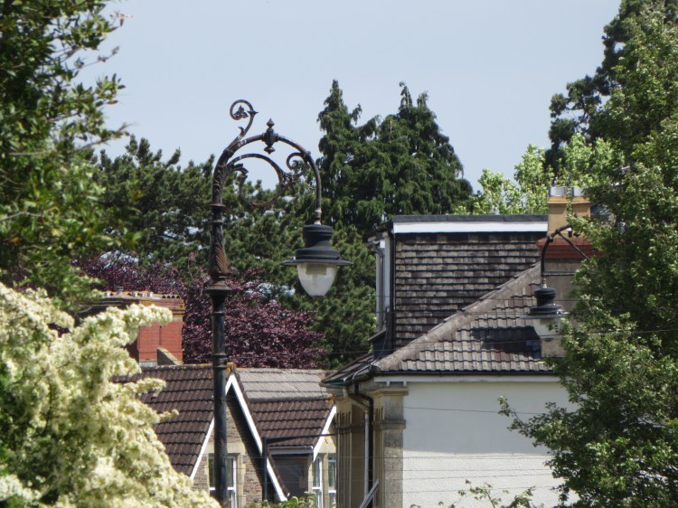
Clyde Road will take you past large villas and ornate street lights until you reach a group of attractive, smaller terraced houses to the left. These less ostentatious homes mark the entrance to Woolcot Street, a quaint terraced street which presumably owes its more working class character to a history as estate workers’ housing for Redland Court.
Turn left into Woolcot Street.
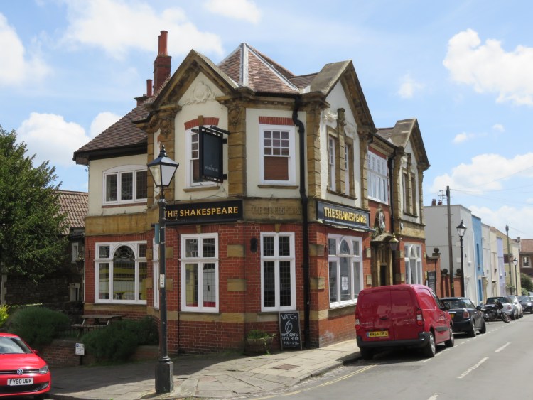
At the top of Woolcot Street you will reach The Shakespeare, another of Redland’s few public houses.
You will emerge on Lower Redland Road in the area that has sometimes been called ‘Redland Village’. There used to be shops here, but most have now been demolished or converted to other uses.
Turn left onto Lower Redland Road and then right into Luccombe Hill (11).
On Luccombe Hill you will pass some quaint houses that may once have been stables. After a kink and a short climb you will reach the main road, Redland Road, opposite a green area lined with trees.
Cross Redland Road when it’s safe to do so, turn left along the main road and then, at the double junction on the right, take the footpath alongside Redland Green Road, approaching the church.
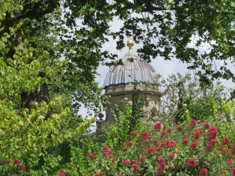
You are now on the edge of Redland Green, where a broad avenue of handsome, mature trees lines the approach to Redland Parish Church. Originally Redland Chapel, annexed to Redland Court, the distinctive domed building now serves the local congregation.
We will see more of Redland Green in Walk Fifteen ‘Bishopston and Westbury Park’. For now, take the footpath to the right of the church gates (12), cutting across to Woodstock Road. Turn left.
Woodstock Road is one of the most affluent-looking streets in Redland. As you make your way down through the mature trees, note the size and singular appearance of many of the houses that line the leafy street. Carrying very little through traffic, Woodstock Road is a very quiet and family-friendly corner of Redland.
After a series of bends, you will find yourself passing the back of Redland Court (13) (most recently used as a school, currently under conversion to flats). The landscaped grounds provide a pleasant enough setting as you descend the last stretch of Woodstock Road to join Clarendon Road.
Turn left and follow the rest of the hill down to emerge back on Redland Road opposite another tree-lined area.
Turn left past the grand gates to Redland Court and then cross Redland Road. Take the turning opposite, Grove Park.
You will find yourself once again on Lovers’ Walk (14), heading back towards Redland Station.
On reaching South Road, turn left to reach the station gates and complete Walk Fourteen.
Coming Up
In Walk Fifteen ‘Bishopston and Westbury Park’ we will venture out to slightly more suburban areas as we visit Bishopston and Westbury Park, touching on Horfield and Henleaze, before returning once more through the edge of Redland.
