Last updated: March 2022
Walk Map | Download walk as PDF
The far southeastern corner of Bristol is a mystery to most. The Bath and Wells roads don’t give the best account of the area, and the outer suburb of Stockwood is thoroughly isolated. But, for those in the know, the disparate residential communities in this area are linked by some very pleasant valleys and open spaces.
This walk introduces two main features: the Whitchurch Railway Path, a lovely green corridor that runs up the Brislington Brook valley between Hengrove and Stockwood; and the pleasant semi-wild environs of Stockwood Open Space.
Along the way, the walk takes the time for a short stroll around Whitchurch Village, which is just over the border in Bath & North East Somerset.
A certain amount of plodding along ordinary suburban streets is necessary to complete the circuit. We will get the main part of this out of the way at the very beginning of the walk.
Useful Information
Terrain: Largely flat or gently sloping.
Ground: Largely paved, with one unpaved section in Whitchurch that has slight potential to be muddy.
Key Attractions: Brislington Brook, Whitchurch Railway Path, Whitchurch Village, Stockwood Open Space
Refreshments: Pub / carvery in Whitchurch Village; food store in Stockwood local centre
Starting point: Hungerford Gardens, Brislington
Getting there: On-street parking available at Hungerford Gardens. Local buses call at Hungerford Road; change at Brislington or Knowle if travelling from Bristol City Centre.
Approx. Time: 2 hours 30 minutes
Approx. Distance: 5.4 miles
The Route
Our walk starts at Hungerford Gardens, an ordinary suburban crescent on the edge of Brislington. The street borders Hungerford Road Open Space, a children’s playground with a background view of Knowle Golf Club.
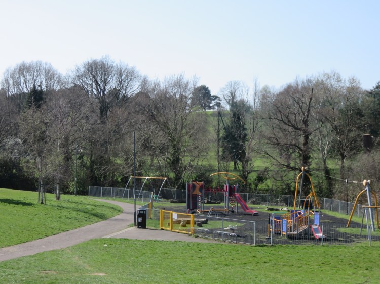
We will return through Hungerford Road Open Space later.
For now, follow Hungerford Gardens in a clockwise direction to reach Hungerford Road (1). Turn left.
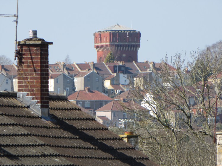
The walk down Hungerford Road is a necessary evil to reach the more scenic parts of our route. It isn’t terribly interesting, but it does offer a distant view of the water tower at Knowle, a distinctive local landmark.
At the end of the road, turn left onto West Town Lane. Make your way down to the bottom of the hill.
West Town Lane is a slightly more historic thoroughfare. There isn’t a huge amount of character, but you will pass a pleasant triangular green with a large tree and an old stone wall (2).
At the bottom of the hill, the road crosses the southern branch of Brislington Brook next to a pleasant woodland glade.

Turn left along Ellesmere Road. At the bend, take the footpath on the left after the first pair of houses (3).
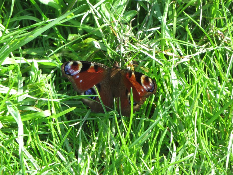
The streamside footpath meanders through semi-wild surroundings between Brislington Brook and a large area of football pitches. Keep an eye out for wildlife.
As you follow the path, views open up back towards Knowle.

At the end of the streamside path, turn right and cut through between the houses (4). Turn right at the triangular green then double back to the right so that you climb up to the main road on the edge of Durweston Walk (5).
Sturminster Road is the main road out to Stockwood from Bristol. It climbs a pleasant section of the Brislington Brook valley.
Turn right along Sturminster Road for a few metres and then cross over to reach Manston Close. Climb Manston Close to reach the Whitchurch Railway Path, on the right just after the bend (6).

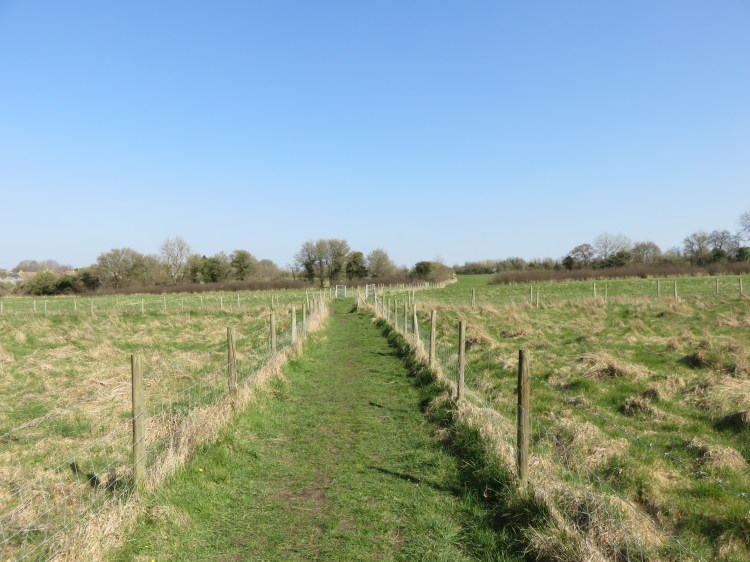
The Whitchurch Railway Path is one of the scenic highlights of this walk. Built on the remains of the Bristol and North Somerset Railway (whose iconic viaduct still dominates the nearby village of Pensford), the shared pedestrian / cycle path is much quieter than the popular Bristol & Bath Railway Path but is arguably much more attractive.
The path climbs the side of the Brislington Brook valley, climbing gently towards Whitchurch. At first, it offers pleasant views across to Knowle Golf Club. Then, after a kink (7), it crosses the Saltwell Valley, which separates Whitchurch Village from Bristol, offering interesting views in both directions.
Reaching a t-junction (8), follow the main path round to the left.
The path skirts Craydon Grove Open Space on the edge of Stockwood, a pleasant grassy area with picnic tables. We will be returning to Stockwood later.
Do not head in towards the houses. Follow the path around the open space, entering a more rural section.
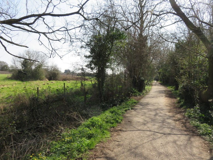
The final section of the path runs between woodland and fields and has a markedly different character.
Follow the path to the end, coming out on a main road, Staunton Lane (9). Turn right towards Whitchurch Village.
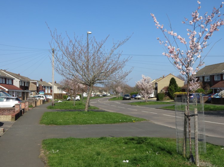
Staunton Lane leads you into Whitchurch Village, which is centred around the junction with the A37 Bristol Road.
The Maes Knoll Toby Carvery, in the centre of Whitchurch, is the only pub stop on this route.
Carefully cross Bristol Road when the traffic lights change and go straight on into Church Road (10).
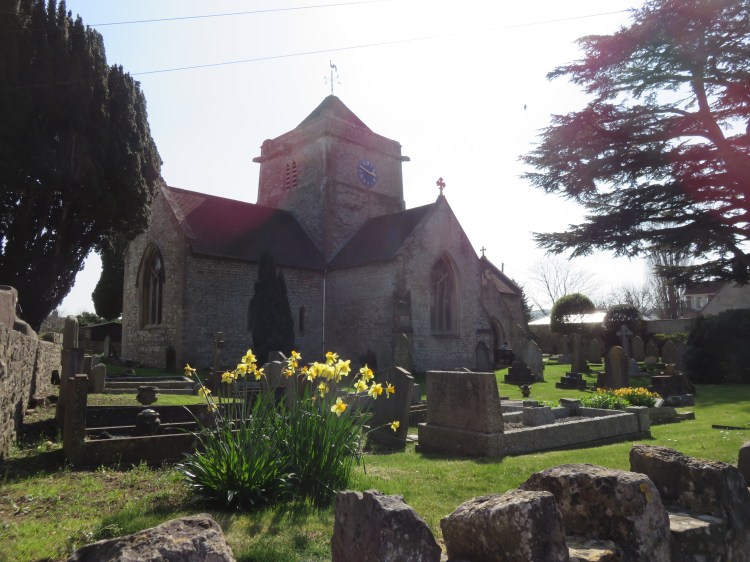
On Church Road you will find St. Nicholas’ Church, the main parish church for Whitchurch Village. It sits in a quiet spot away from the busy traffic on the A37.
The rest of Church Road has a quiet, semi-rural feel. You will cross Brislington Brook, here just a tiny trickle.
Follow the road to the top of an incline and turn right into Washing Pound Lane (11).
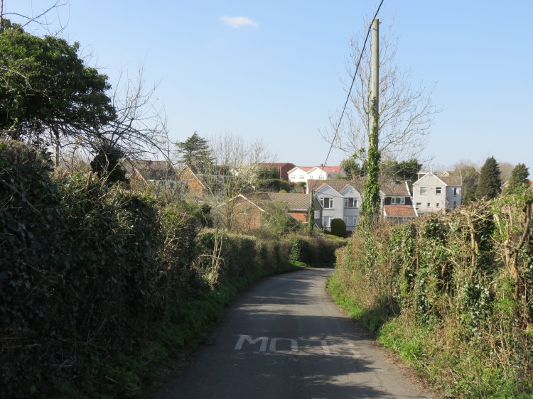
Washing Pound Lane descends past pleasant fields to the edge of Bristol.
Turn right into Maggs Lane. Be sure to take the footpath on the right that runs parallel to the lane (12).
Maggs Lane completes the loop back towards Bristol Road. On the way, you will cross another tiny section of Brislington Brook running through a small garden area.
Returning to Bristol Road, cross at the traffic lights on the left (13). Turn right towards the centre of the village and then left into The Witheys.
On Bristol Road you will pass Whitchurch United Reformed Church. The Witheys is a quiet residential close that ends at a footpath.
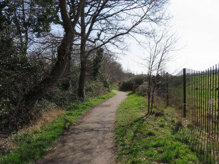
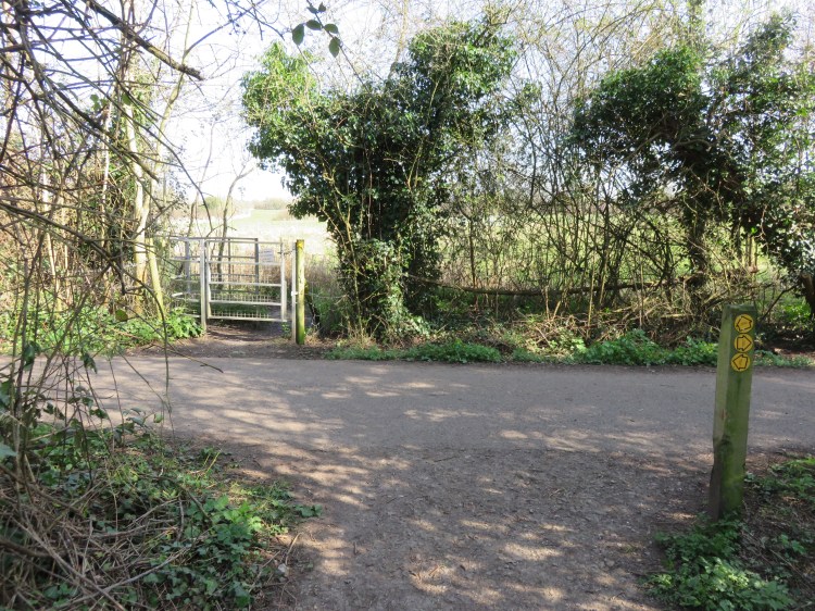
Take the footpath straight on from the end of The Witheys (14). Continue through woodland until you return to the railway path and then go straight on through a pedestrian gate (15).
Please note that this short section is unsurfaced and has the potential to be muddy.
You will find yourself on a clearly marked footpath that cuts across fields. Enjoy the last taste of the countryside as you approach Stockwood.
At the end of the field path, turn left onto Stockwood Lane (16). Follow the road round the bend and then turn left onto Stockwood Road.
Now, it’s necessary to plod through the middle of the Stockwood housing estate.
Stockwood Road is a pleasant enough road to walk down due to its large green verges and street trees. It also has a couple of points of interest, including the modernist Christ the Servant Church and Stockwood local centre, where you can pause for refreshments at the supermarket.
After you have passed the church, take the footpath along the left hand side of Stockwood Road for the most pleasant outlook (17).
Stockwood Road ends abruptly at the gates to Stockwood Open Space (18).
Go straight on, taking the main cycle path that leads into Stockwood Open Space.
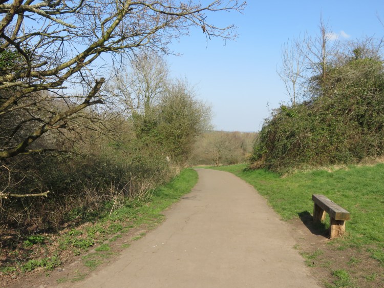
The cycle path traces a winding course through Stockwood Open Space, which is a pleasant mix of grassland and woodland with countryside views. There are even a couple of ponds lurking in amongst the trees.
Sticking to the main path, you will pass the back of Oasis Academy Brislington (19). Eventually, the cycle path will bring you back to Hungerford Road Open Space, completing the walk.
