Last updated: September 2023
Walk Map | Download walk as PDF
East Bristol can seem like a confusion of endlessly dividing roads, nowhere more so than in the area around Fishponds, Downend and Staple Hill, which can confuse even the most seasoned of Bristol drivers. However, there are also several pleasant green spaces in the area and a number of historic churches.
This walk begins by exploring some of the quieter, quirkier corners of Fishponds before dipping into one of the most scenic sections of the Frome Valley, aligning for a while with Walk Twenty ‘Stapleton and the Frome Valley’. Bouncing off Frenchay Village, the walk then threads its way through some little-known green spaces en route to the centre of Downend. From there, the walk strays up to Staple Hill to explore the pleasant and well-tended Page Park before returning to Fishponds via the Bristol and Bath Railway Path.
Useful Information
Terrain: Hilly.
Ground: Paved and unpaved. Some areas include steps and may be soft underfoot.
Key Attractions: Fishponds shops, Fishponds Park, UWE Glenside Campus, Snuff Mills, Oldbury Court Estate, Frenchay Bridge, Lincombe Barn Park, Britannia Wood, Downend shops, Page Park (including sensory garden and aviary), Bristol and Bath Railway Path, Staple Hill Tunnel.
Refreshments: Food and drink available at Fishponds and Downend, and a little way off the route at Frenchay and Staple Hill.
Starting point: Fishponds town centre, junction with Manor Road
Getting there: Accessible by bus routes to Staple Hill, Emersons Green or Downend. Car parking in the centre of Fishponds is time-limited, but fewer restrictions further out, such as in the Oldbury Court Road area.
Approx. Time: 3 hours 30 minutes
Approx. Distance: 7.3 miles
The Route
Our walk begins in the heart of Fishponds, in a section of Fishponds Road with a true high street feel. If you can ignore the constant growl of traffic, the town centre offers all the essentials for local people, particularly if you take into account the dubious contribution of the trio of supermarkets down the road. The architecture has an Edwardian feel.
In Fishponds you are spoiled for choice for food and drink, with a variety of pubs and cafés available.
Begin by crossing at the Manor Road traffic lights (1) and take the corner gate into Fishponds Park.
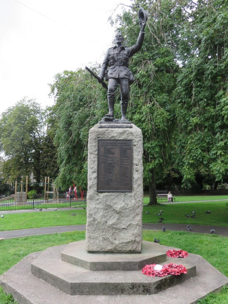
Fishponds Park seems like a tiny space for such a major centre, but of course the open expanses of Oldbury Court Estate are only a short distance away. It’s a cute space whose mature trees give it a sense of seclusion despite the traffic. There’s a playground and an interesting memorial to the First World War.
Continue across the park to the gates leading into St. Mary’s Churchyard.
On the right as you enter the churchyard, you will find an old stone property that was the birthplace of Hannah More, who campaigned alongside William Wilberforce for the abolition of the transatlantic slave trade (2).
The peaceful environs of St. Mary’s Church work alongside Fishponds Park to provide a place for quiet reflection in the heart of this busy suburb.

Continue through the churchyard, keeping the church to your right, exiting onto a footpath off Guinea Lane. Turn right to emerge on Manor Road (3), then turn left and follow the road for a while.
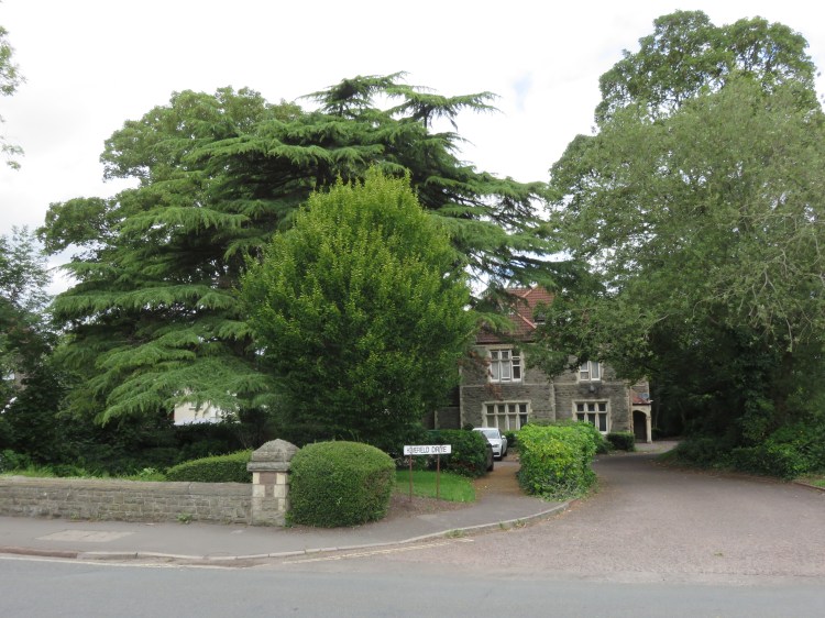
Manor Road is the local cut-through to Stapleton. It carries a pleasant but unremarkable mix of houses from a variety of different architectural periods and styles. At Homefield Drive there is a more imposing property surrounded by fine trees (4).
Turn left into Pound Lane.
Pound Lane is one of a number of old lanes in Fishponds that have been swallowed up by urbanisation. It has an eclectic feel, narrowing to an incredibly narrow kink about halfway along around a cluster of old stone cottages.
Emerging at the bottom of Channons Hill, cross the road, turn left for a few moments and then turn right onto a narrow footpath, signed to the Academy, just before the boundary fence of the retail park (5).
The narrow footpath is enclosed at first, but soon opens out onto the pleasant grounds of the Bristol Metropolitan Academy.
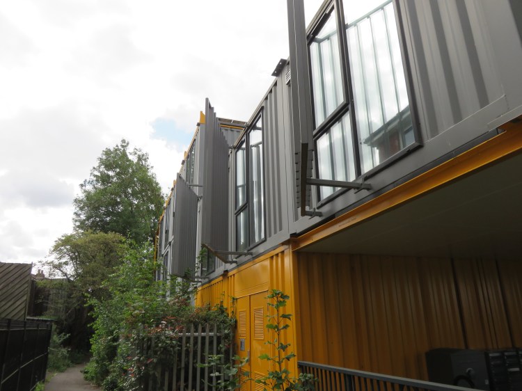
As the path crosses the end of the street Alexandra Park, it also passes the LaunchPad, an experimental development of homes based on cargo containers.
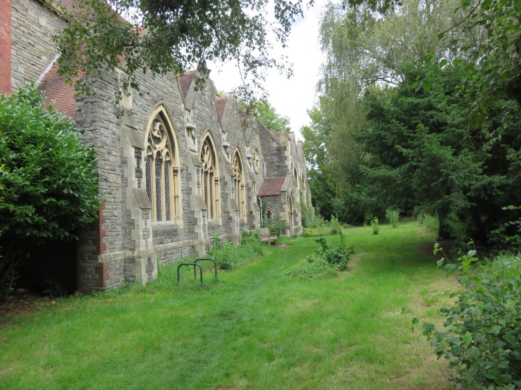
The footpath comes out next to our second historic church, All Saints. It seems a little sad and neglected compared to St. Mary’s.
At the end of the footpath go straight on into Grove Road then take the first right, also called Grove Road.
The lower section of Grove Road is a narrow lane that is an odd fusion of urban, rural and industrial. The road ends at a set of gates leading out into an open space (6).

Continue along the main path, keeping the fence to your right.
The open space has an oddly abandoned feel; the main path is an old roadway, complete with the remains of old lighting installations. It is, in fact, an old access to the long-vanished Snowdon Road Hospital. The avenue of trees at the far side of the space describes the perimeter of the former hospital site. As you follow the path, the telecommunications mast at Purdown comes into view (see Walk Twenty-One ‘Stoke Park and Purdown’), followed by the distant spire of Holy Trinity Church, Stapleton.
As the main path turns away from the fence, take the ramp on the right to access a field just off the bend in the main path (7).
The field at the back of the modern homes on Small Lane makes for a pleasant extension to the natural green space.
Follow the trodden path diagonally across the field, heading for a stand of tall trees, until you emerge at the junction of Small Lane and Blackberry Hill (8).
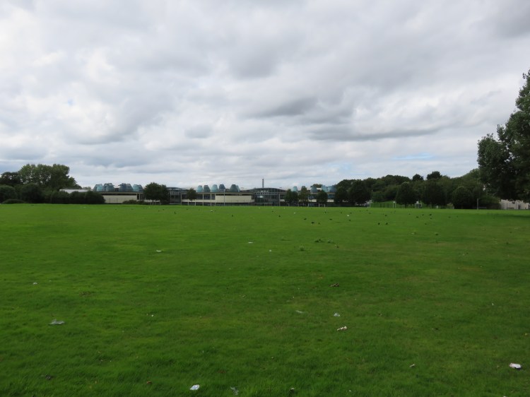
The next section of our walk takes us through the pleasant, mature parkland shared by Blackberry Hill Hospital and the University of the West of England’s Glenside Campus. Packed with fine specimen trees, it’s a hidden area that few Bristolians would ever have cause to visit.
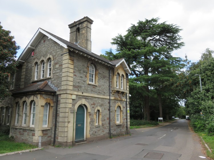
Cross the main road, Blackberry Hill, and enter the campus via the driveway next to the lodge. Go straight on along the driveway until you reach a roundabout (9).
Enjoy the trees, which are the dominant feature as you explore this section of the site.
At the roundabout, turn left onto the main central avenue.
The main buildings of the Glenside Campus are on your right, including the distinctive clock tower which is so visible from Purdown.

Reaching a mini roundabout (10), go straight on onto a cycle path to exit the site a little further down Blackberry Hill. Turn right and make your way down the hill.
At Blackberry Hill you will pass a cluster of historic cottages at the top of Wickham Hill, (complete with gas lamps), where we temporarily join Walk Twenty ‘Stapleton and the Frome Valley’.
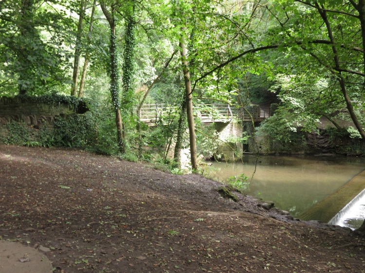
Continue down Blackberry Hill to the bottom of the valley, reaching the Frome Bridge (11).
Frome Bridge is an important crossing point on the modern road from Fishponds to Stapleton. Cross the bridge, noting the creeper-covered charm of Frome Place on the left.
Turn right into River View.
Quaint cottages line this small road, one of which used to serve as a chapel and still has decorative windows. Watch out for traffic, though, as this is also the main access to the Snuff Mills car park. Amenities in the car park include public toilets and a refreshment stand that sells snacks, ice cream, hot drinks and soft drinks.
Continue straight on to through the car park to reach Snuff Mills park and the riverside walkway.
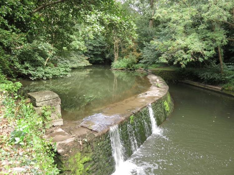
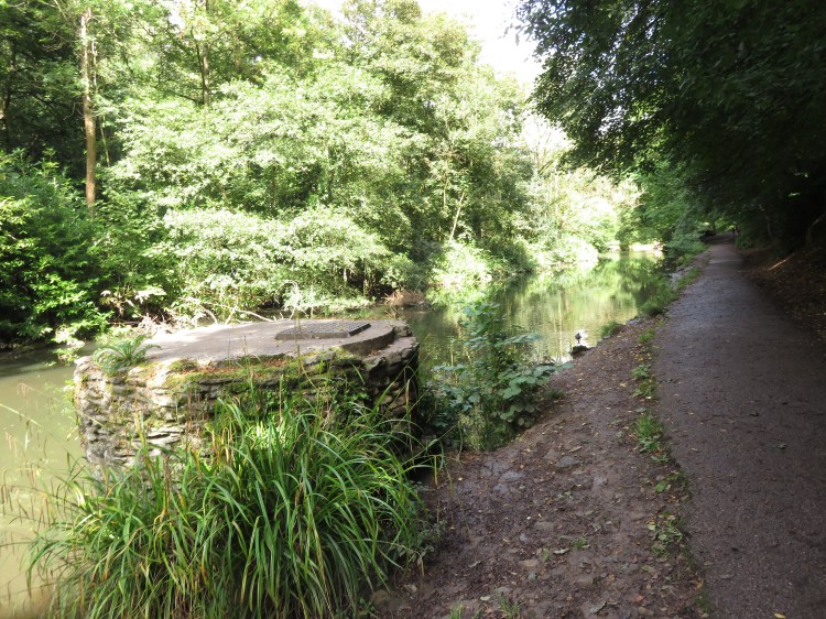
Snuff Mills is popular with young families and dog walkers, and is never short of visitors at the weekend. As you make your way along the path, look out for weirs and, of course, the former mill that gives the park its name.
The attractive, steep-sided Frome Valley is lined with rocky crags and trees. As you meander through the park with the river to your right, the valley opens out somewhat until you reach a pinch point leading to a footbridge.
Said to be a haunted spot, this is the Halfpenny Bridge (12). These days, it’s too busy to feel very spooky.
Cross the Halfpenny Bridge and turn left to continue following the river, which is now to your left.
You are now in Oldbury Court Estate, a large park which follows the east side of the valley.
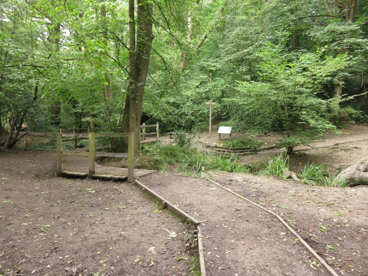
The popular riverside walkway continues as the river meanders through the bottom of the valley. Shortly after passing a weir, you will reach a major junction in the footpath where a smaller stream joins the Frome from the right (13).
Continue following the riverside walkway with the river to your left.
After a while, you will begin to see buildings descending the hillside on the far side of the river. The riverside walkway becomes a little more informal at this point and, as it climbs up past a particularly brisk stretch of the river, it can often get muddy underfoot.
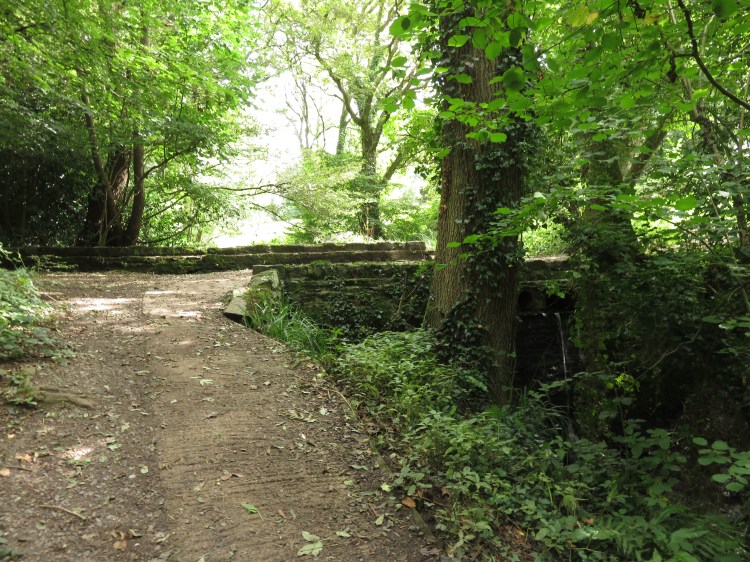
Continue following the path, looking out for slippery rocks and boggy patches. At length, a flight of steps will bring you out at the foot of Frenchay Road next to Frenchay Bridge.
Frenchay Bridge is an arched stone river crossing that is now closed to traffic. A plaque on the north side of the bridge reads “built by subscription 1788”. Keep an eye out for kingfishers and other wildlife. The picturesque Frenchay Village tumbles down to meet the river at this point; although not part of this circuit, it is well worth an explore (see Walk Twenty ‘Stapleton and the Frome Valley’).
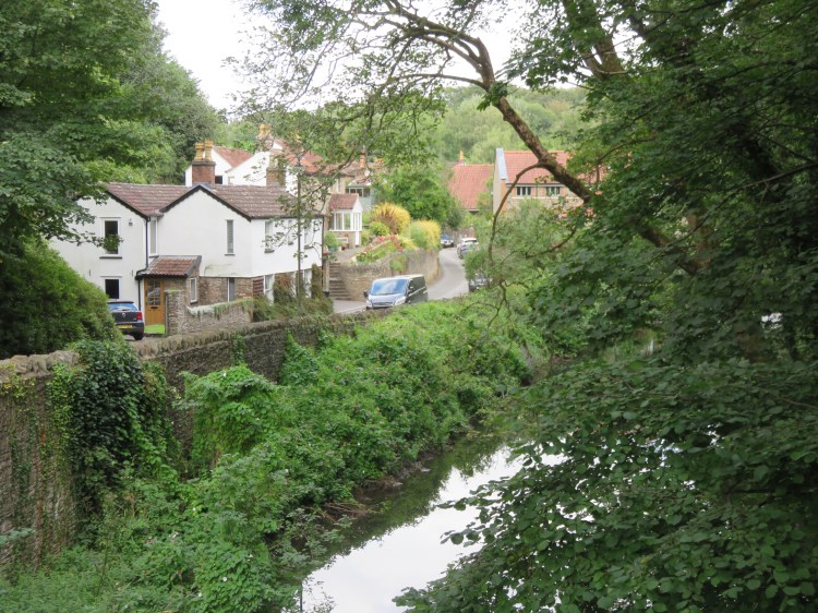
If you’re desperate for refreshment, you could leave the route for a while and climb up through Frenchay to visit the White Lion, which is an inviting for a drink or a hot meal.
To continue following the route, stay on the Fishponds side of the bridge and take the dirt path that leads on along the river (14), signed to Lincombe Barn (among other places).
The next section of the path has a couple of slightly treacherous spots, but most of it is well-maintained, with steps leading up and down through a grove of yew trees with more glimpsed views across to Frenchay.
Follow the path up and down through the woods until you reach a creek at the side of the main river, crossed by a boardwalk bridge, where the path splits two ways (15).
Optionally, you can continue along the river for a little while to enjoy the view, but this section of the river path is a dead end.
Otherwise, take the right hand path, which climbs up through the woods alongside the creek. Reaching a stone bridge (16), cross to the right hand side of the creek and continue uphill past a sloping meadow.
The sloping meadow, which marks the boundary between Bristol and South Gloucestershire, leads up to Lincombe Barn Park, a secluded and hidden green space with a decent children’s playground.

Immediately after the playground turn left, emerging onto Rockland Road (17). Turn right for a few moments to reach the main road, Overndale Road, and carefully cross over.
This stretch of Overndale Road is quite pleasant, lined with mature trees and with a row of houses set back and slightly down from the road against the backdrop of Britannia Wood.
Turn right along Overndale Road. After the last of the houses on the left, look for a footpath leading up into the woodland, signed for Britannia Wood (18).
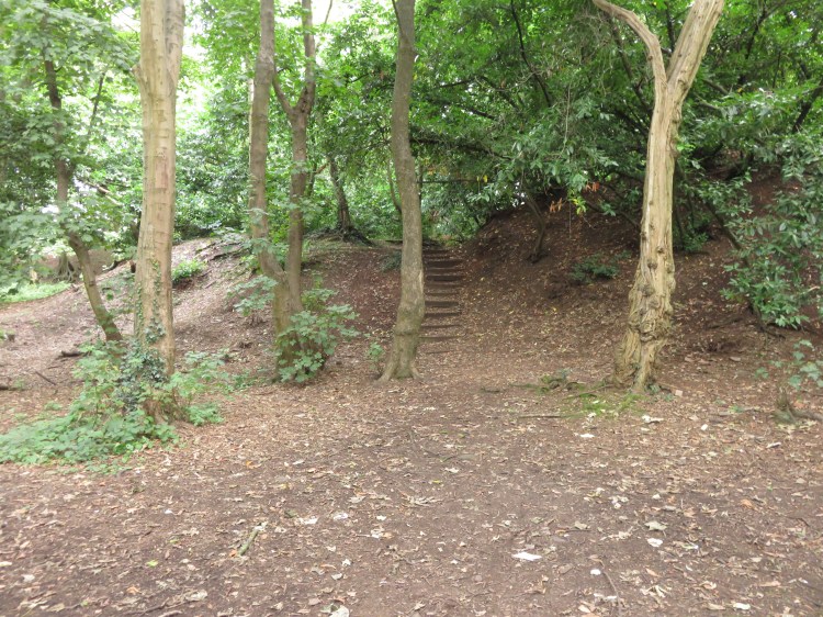
The path through Britannia Wood is rather informal in nature, but the first half of it is marked by steps. There’s nothing spectacular about the woodland, but it’s a pleasant green lung among the endless suburban streets of South Gloucestershire.
At the top of the last flight of steps turn right. Hugging the edge of the woodland, bear right again, keeping Downend Allotments to your left, to emerge on Croomes Hill (19).
Turn left on Croomes Hill to reach Downend Road at a crossroads. Cross Downend Road and then turn left along it for a short while before bearing right onto Christchurch Lane (20).
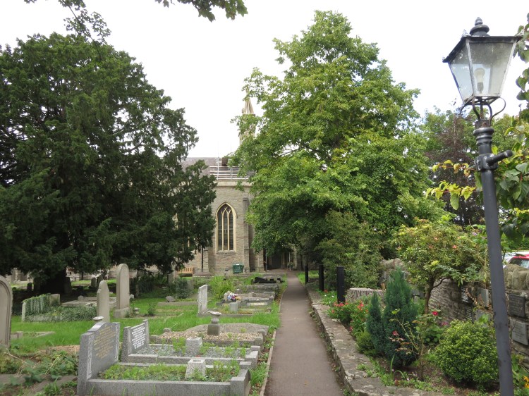
Christchurch Lane is a quiet terraced street leading to the back of Christ Church, the parish church for Downend.
Follow the lane as it turns into a footpath past the churchyard. At the church gates, enter the churchyard and double back towards Downend Road, following the main footpath. Turn right along Downend Road, passing the cricket club, and cross over at the next traffic lights to reach the village centre (21).
The centre of Downend has been thoroughly absorbed by suburban sprawl over the years, but it boasts a variety of shops, pubs and cafés and has a decent buzz to it despite the heavy traffic.
The shops, pubs and cafés in Downend are your main opportunity to obtain refreshments in this half of the walk.
Continue along Downend Road as it becomes Badminton Road and then cross back over at the next traffic lights to reach the corner of Westerleigh Road.
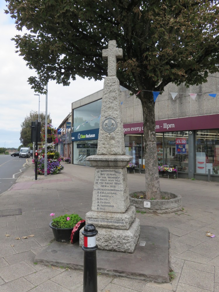
At the corner of Westerleigh Road you will find an unusual war memorial dedicated to the members of the 1st Downend Scouts who lost their lives in the First World War (22).
Turn left into Westerleigh Road then cross over and turn right into Buckingham Place.
You will emerge on Salisbury Road opposite The Foresters pub with its interesting mural.
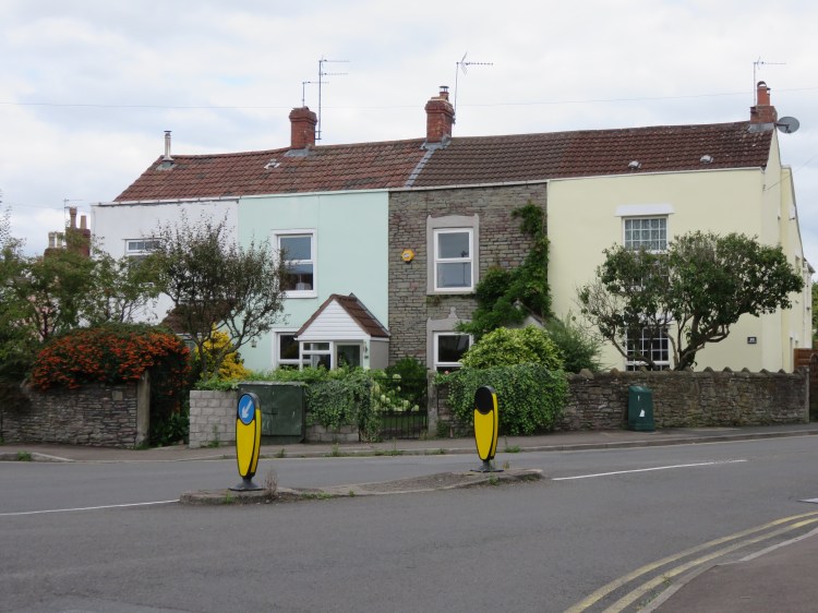
Turn left along Salisbury Road then right into Park Road next to a row of nice old cottages (23).
Climbing Park Road, an ordinary suburban street, the trees of Page Park eventually come into view.
Enter Page Park via the nearest corner gate, then turn left along an avenue of pine and lime trees. Turn right along the next path to reach the clock tower at the centre of the park (24).

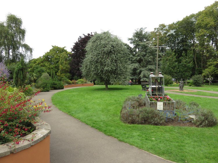
The main park for the Staple Hill area, Page Park may not be enormous, but it packs a punch. As well as its unusual clock tower centrepiece, the park has a bandstand, a café, multiple play and sports facilities, a sensory garden with interesting statues and sculptures and an aviary occupied by budgerigars and zebra sparrows.
To take in the park’s more unique features, turn right towards the café and then bear left to enter the sensory garden. Explore the sensory garden, making sure not to miss the aviary, then return to the central path through the park and turn right to exit the park via the main south gate onto Broad Street (25).
Leafy Broad Street descends from Staple Hill, the local high street. However, our return journey to Fishponds will follow a quieter route.
Turn left briefly along Broad Street and turn right into White Lodge Road to reach Signal Road overlooking a former railway cutting (26).
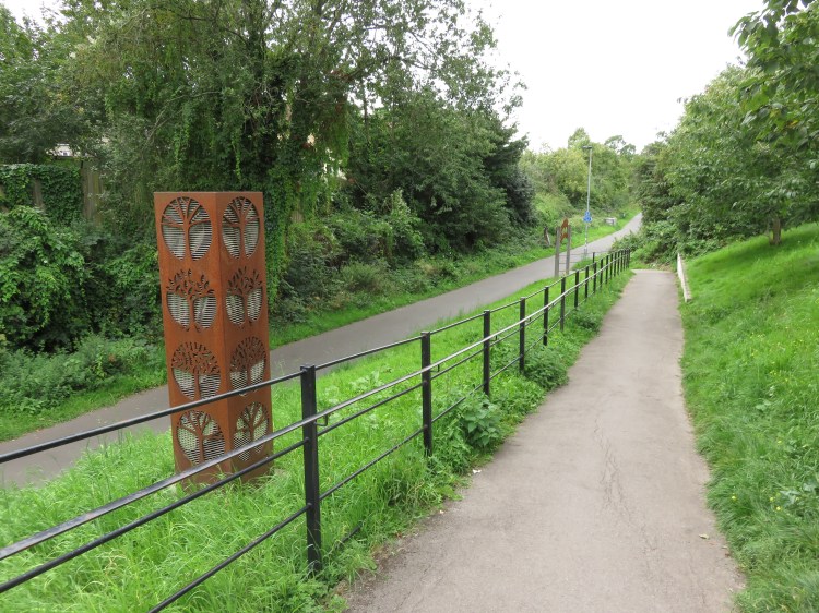
The railway cutting at Signal Road used to carry the Midland Railway out of Bristol. These days, of course, it is part of the popular Bristol & Bath Railway Path, which we will be following for much of our return journey.
Turn left along Signal Road and then take the gentle ramp down to the railway path. Go straight on, following the railway path in the direction of Fishponds.
After a short while you will have the unique experience of walking through the cool gloom of the Staple Hill Tunnel. You may wish to step off the paved path to avoid the passing cyclists.
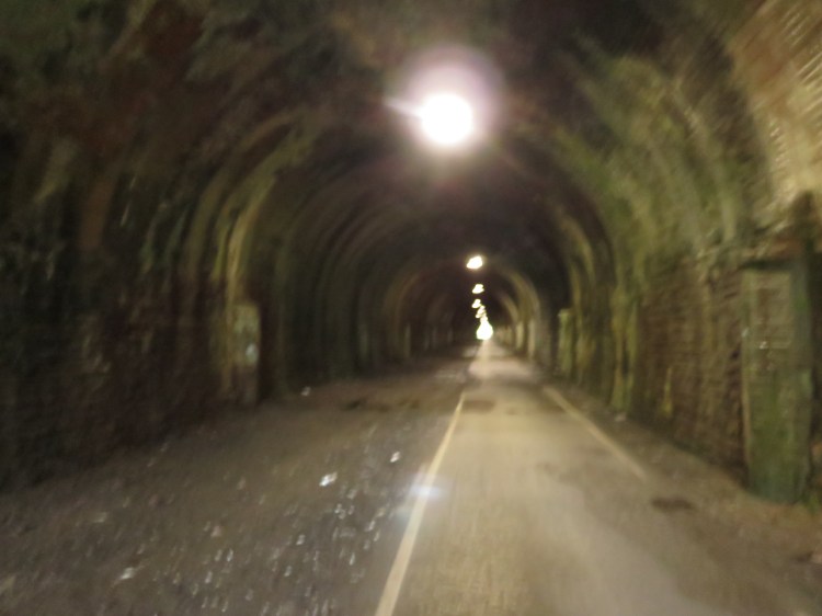
As you emerge from the tunnel (27) you will cross back into Bristol at the former Staple Hill Station, whose single platform still remains at the side of the path.
Continue along the path until you reach the distinctive ‘Fish on the Nose’ sculpture, marking your return to Fishponds in the general vicinity of the former Fishponds railway station.
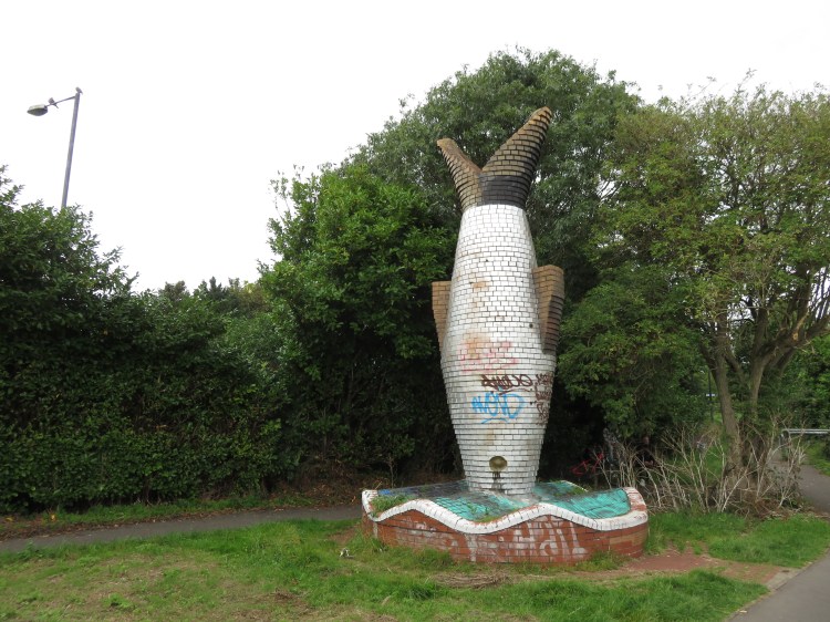
Unfortunately a target for graffiti, the distinctive Fish on the Nose provides a welcome landmark for cyclists who have just completed the protracted climb out to Fishponds from Bristol City Centre,
Double back past the sculpture to climb up to Filwood Road next to a roundabout (28). Go straight across the roundabout to reach New Station Road.
The last gasp of our walk follows the tree-lined New Station Road back to Fishponds town centre, passing a reasonably interesting mix of houses and old industrial buildings.
Reaching Fishponds Road, turn right through the high street to return to the starting point and complete the walk.
