Last updated: June 2020
Walk Map | Download walk as PDF
It’s finally time to head up into fashionable Clifton, a well-heeled area of Bristol that was, at one time, the refuge of wealthy merchants and upper-class families, determinedly separate from Bristol in its day but now fully integrated into the city.
Clifton is a large area, but the real heart of the neighbourhood is the group of fine Georgian streets close to the Clifton Suspension Bridge, known collectively as ‘Clifton Village’.
This walk will take you from the city centre up into Clifton Village. We will stop off on the way for a thorough exploration of Brandon Hill, a major park on the doorstep of Clifton, and then we will take a quirky back route to reach Clifton itself, after which we will focus on the major sights.
This walk is quite a long one. If you would prefer to tour the major sights without walking all the way up from Bristol City Centre, a shorter circuit is also available with a different starting point.
Useful Information
Terrain: Steeply hilly. Includes steep steps; an accessible alternative route is available.
Ground: Paved.
Key Attractions: Centre Promenade, Floating Harbour, College Green, Bristol Cathedral, Park Street shops, Georgian House museum, St. George’s concert hall, Brandon Hill, Cabot Tower, Victoria Square, Clifton Village shops, Christchurch Green, Canynge Square, Clifton Down, Clifton Observatory, Clifton Suspension Bridge, Avon Gorge, Royal York Crescent, St. Andrew’s Churchyard, Victoria Rooms, Royal West of England Academy, Clifton Triangle shops, City Museum and Art Gallery, University of Bristol.
Refreshments: Food and drink options are available principally in the Park Street, Clifton Triangle and Clifton Village areas, although there are pubs available at various other points en route.
Starting point: Centre Promenade (long route); Clifton Down (short route).
Getting there: For the long route, the Centre Promenade is widely accessibly on foot or by bus. 20 minutes’ walk from Temple Meads Station. Multi-storey car parks at Berkeley Place, Trenchard Street, Harbourside, Prince Street, Queen Charlotte Street, Nelson Street and Rupert Street.
For the short route, Clifton Down is served by the No.8 bus or there is pay and display car parking in the surrounding streets.
| Approx. Time | Approx. Distance | |
| Long route | 3 hours 30 mins | 5 miles |
| Short route | 1 hour 30 mins | 2.5 miles |
The Route
The long route begins, as usual, at the Centre Promenade. For the short route, join the route instead at Clifton Down (14).
The Centre Promenade overlooks the Floating Harbour. For more information about these important spaces see Walk One ‘Introduction to Bristol’ and Walk Two ‘The City Docks’.
Keeping the Floating Harbour to your left, leave the Centre Promenade via the main road climbing up to College Green (1).
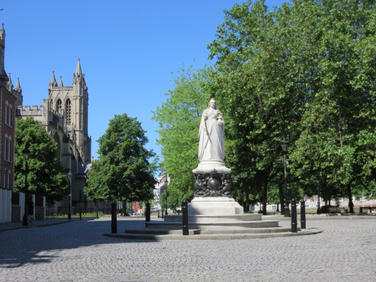
College Green is the civic heart of Bristol. As seen in Walk One ‘Introduction to Bristol’, it is home to City Hall and Bristol Cathedral. Don’t miss St. Mark’s Church, the Lord Mayor’s Chapel, nestled discretely on the right hand side of the main road. A statue of Queen Victoria stands at the apex of the green, facing down towards the Centre Promenade.
Follow the main road alongside College Green. At the traffic lights, you can take the footpath along the edge of the green to get away from the traffic. Continue straight on past City Hall into Park Street (2).
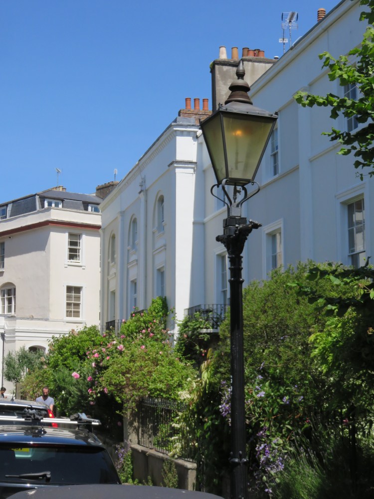
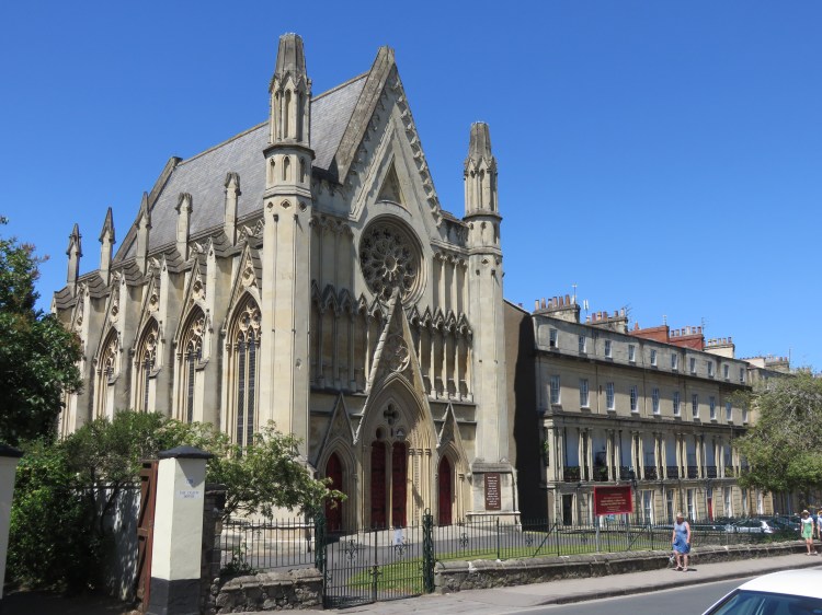
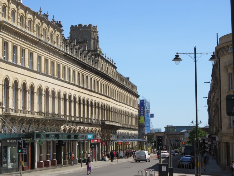
Park Street is a grand Georgian street that climbs the hill towards Clifton. The street began its life as affluent merchants’ housing, before gradually taking on a retail role during the mid to late 19th Century. In a rare example of sensitive post-war reconstruction, many of the buildings that you see in Park Street today are replicas, built after large parts of Park Street were destroyed during the Blitz. Today, Park Street is a fashionable alternative destination for shopping and bars, at the top of which is the imposing tower of the Wills Memorial Building (completed 1925 in the Gothic Revival style), which is home to the University of Bristol.
If you’re getting hungry, the Park Street area has plenty of food options.
About half way up the hill, turn left into Great George Street.
Great George Street is a fine street of Georgian and Victorian houses, lined with mature trees, which climbs gently towards Brandon Hill. On the left, shortly after Hill Street, you will find the Georgian House Museum – worth a visit to see how the Georgian properties lining this street might originally have looked inside – whilst, on the right, you will find the imposing St. George’s, a former church that is now a concert hall, which is said to boast some of the finest acoustics in the country.

Continue to the very end of Great George Street to emerge in Brandon Hill park.
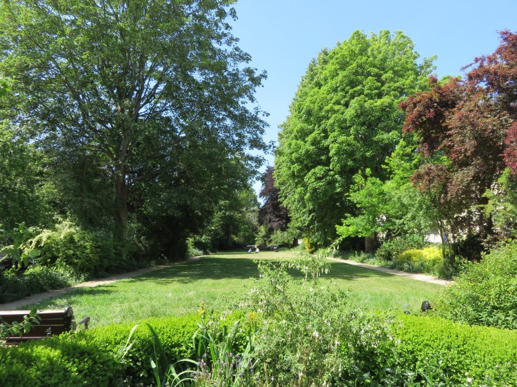
Brandon Hill is a major city centre park with a great deal to offer. As well as being one of the finest picnic spots in the city, the hill comes with children’s play facilities; wildlife aplenty; a magical shrub garden to explore, complete with meandering stairways and running water; and a major monument offering some of the finest views in the city. However, its steep terrain and secluded location mean that the park is often quite quiet despite its many attractions.
We will be exploring the park in as much detail as we can, given that this is only the first part of a much longer walk.
To start with, take the path that goes straight on from the end of Great George Street, climbing slightly.
Cabot Tower will become visible through the trees on the right. Built to commemorate the Italian explorer John Cabot, who sailed from Bristol to discover Newfoundland (you can see his statue and a replica of his ship, the Matthew, in Walk Two ‘The City Docks’), the monument stands proud at the top of the hill. These days, Cabot lends his name to many buildings and businesses in the city, including the Cabot Circus shopping centre (see Walk Three ‘The Eastern Arc’).

At a crossing of paths turn right, so that you pass the remains of an old drinking fountain on your left (3).
Follow this path more steeply up the hill until it merges with a much wider, shallower path coming in from the left, which is the main panoramic path in Brandon Hill. Turn hard left onto this shallower path and then immediately right, entering an avenue of tall trees just below the shrub garden (4).
Brandon Hill is famous for its very tame squirrels, which have been delighting visitors for many years. The animals are accustomed to being fed and will approach you quite boldly, hoping for nuts.
Follow the path through the avenue of trees until it merges with a path around the very edge of the park, then turn left, climbing steeply up towards the centre of the park. Turn left at the top of the hill (5) and approach Cabot Tower.

Accessible route
The next part of the main route involves several flights of steep steps. If you need to avoid the steps, follow this alternative route instead.
Instead of turning left towards Cabot Tower at (5), turn right and follow the winding path back down the hill. This will afford the best view of the stone bastions around the base of the tower. Returning to the avenue of trees, turn right and follow the path around the very edge of the park.
Keep left and descend to emerge on Brandon Hill Lane just above historic Berkeley Square. Bear right to enter the square. Turn left and follow the pavement around two sides of the square, eventually descending to emerge at the busy junction of Queens Road and Triangle South.
Cross to the centre of the Clifton Triangle and follow Queens Road past the shops. Cross the top of Triangle West and then turn left into Park Place just after the supermarket.
On Park Place, keep to the right of the triangular green and go straight on as the street becomes Bruton Place and, very shortly, Meridian Place.
Follow Meridian Place to rejoin the main route at the top of the steps up from Meridian Vale (9).
Cabot Tower stands atop a fortified area at the peak of Brandon Hill. The tower is usually open to visitors. If you don’t mind tackling 100+ narrow spiral stairs, the tower’s two viewing decks offer a 360 degree panorama over central Bristol. Plaques set into the balustrades at the top of the tower tell you how many miles it is to various world cities.
Otherwise, with the tower ahead of you, take the path that descends to the right of the tower next to the flood light.

You will find yourself on a long stone staircase, descending past an unkempt but rather lovely shrub border just below Cabot Tower, with south Bristol sprawling in the distance.
Carry on all the way down the staircase.
The staircase will return you to the main panoramic path below the shrub garden. On the way you will pass cascading water leading to a lovely ornamental pond.
Turn right along the main path and then left down a flight of concrete steps (6). Turn left at the bottom of the steps to return to the crossing of paths just below the old drinking fountain (3).
Turn right this time and go straight down the hill, descending a couple more steps to reach the main path with lamp posts that runs around the lower part of Brandon Hill. Turn right into a wooded area.
You will arrive in the nature area of Brandon Hill. First on the right is a wildlife pond (7), although this becomes pretty overgrown in the summer.
Follow the footpath until it terminates at a flight of stone steps leading down onto Jacob’s Wells Road.
Jacob’s Wells Road is a busy route carrying traffic from Hotwells up to the Clifton Triangle.
The Hope & Anchor on Jacob’s Wells Road is a nice little pub that also does good food.
We are about to climb up to Clifton via a quiet and quirky back route. If you enjoy this part of the walk, be sure to check out Walk Six ‘The Clifton Hillside’ for more paths of this ilk.
Turn right along Jacob’s Wells Road, cross to the other side and then, a short distance up the hill, bear left next to the new townhouses onto Gorse Lane (8).
Gorse Lane is a tiny, characterful little backwater that terminates at an intriguing-looking flight of steps.
The steps lead to Bellevue Terrace, a small row of houses that comes out on Lower Clifton Hill. Cast an eye to the right and you will see the castellated roof of Queen Elizabeth’s Hospital, a private school that occupies an imposing hillside position on the far side of Jacob’s Wells Road. In the foreground, you will see a set of almshouses with a distinctive timber balcony.
The Eldon House on Lower Clifton Hill is another local pub that also offers food.
Cross Lower Clifton Hill and take Meridian Vale, which the turning next to the high stone wall roughly opposite.
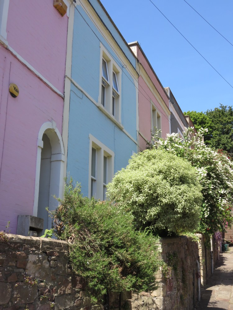
Nestled in the hillside below Dover Place, Meridian Vale is another quiet backwater. This one has a secluded, woodland feel due to the large number of trees growing in the steeply sloping gardens to the left. Like Gorse Lane, Meridian Vale ends at a flight of steep steps.

Climb the steep steps to emerge on Meridian Place (9). The accessible route rejoins the main route here.
You have arrived amidst Georgian terraces on the edge of Clifton proper. This street has many names: to the right it is known as Meridian Place, whereas to the left you will find Dover Place on one side of the street and Tottenham Place on the other. Each terrace has its own distinct design, but most notably Dover Place, with its peaked, Gothic windows.
Turn left onto Dover Place and follow the road on round.
As you round the corner at the far end of Dover Place and turn into York Place, you are treated to a fine panorama of south Bristol. The substantial building set down the hill just below youis the Manor Hall, currently part of the University of Bristol.
At the end of York Place you will emerge on Clifton Road next to two restaurants and a pub.
If you would like to pause for refreshments before exploring the main sights of Clifton, the small cluster at Clifton Road may be a good place to do it.
Turn right into Clifton Road.
You will soon find yourself passing Richmond Terrace, a raised residential terrace with a certain faded grandeur to it.
Clifton Road ends at the junction of Victoria Square and Queen’s Road (10), the main road back to the city centre, which we will be revisiting later in this walk. The short route joins the long route here.
Cross Queen’s Road and take the footpath that runs diagonally across the centre of Victoria Square.
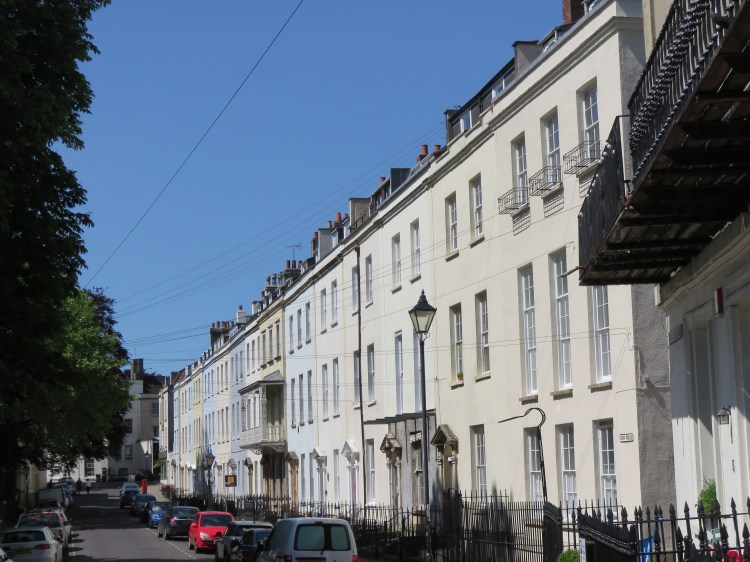
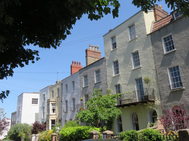
Victoria Square is an attractive space in the heart of Clifton. Graced on three of its four sides by fine Georgian terraces with a formal design, the fourth side is occupied by a main road. A very mature landscape, once inside the square you are enveloped by trees and it is quite difficult to see back out.
At the far corner of the square, go straight on through an archway onto Boyce’s Avenue (11).
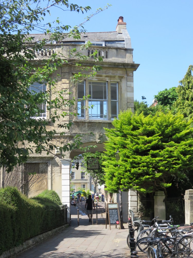
The pretty archway is your gateway to Clifton Village. This lively and buzzy area centres on Boyce’s Avenue, Princess Victoria Street and the Mall and features a wide range of interesting businesses.Restaurants, cafés, galleries and speciality shops predominate.
If you’re hungry or thirsty, then in Clifton Village you’re spoiled for choice. I couldn’t possibly list all of the options, but pubs, cafés and restaurants can be found throughout the area, particularly on Boyce’s Avenue, Regent Street, Princess Victoria Street, The Mall, Waterloo Street and Portland Street.
On the left as you enter Boyce’s Avenue you will find The Albion, an historic local watering hole. On the right you will find a real oddity, the Clifton Arcade: a small, tucked-away arcade containing shops of niche interest.
Turn left onto Clifton Down Road and then immediately right into Princess Victoria Street to enter the heart of Clifton Village.
As you walk along Princess Victoria Street, don’t miss the attractive Clifton Library to the left, and don’t forget to cast your eyes along Waterloo Street, an intriguing mews-like street to the right.

Take the second right off Princess Victoria Street, The Mall.
The Mall is an historic Georgian thoroughfare. Two distinctive lamp posts mark the entrances to West Mall and Caledonia Place, two grand terraces that form a striking enclosure to the long central garden.
Continue up the Mall until you reach a crossroads with Portland Street (12). Optionally, take a brief detour along the left hand arm of Portland Street to see an unusual historic feature.
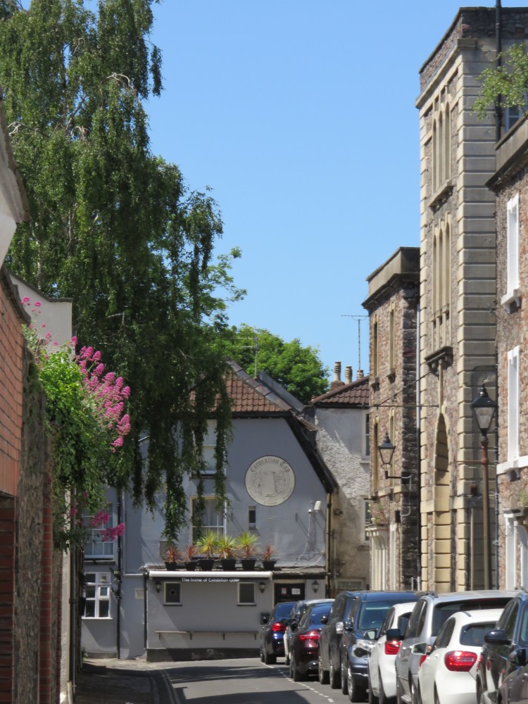
At the far end of Portland Street you can find a true hidden curiosity: leading off Portland Street are three very Dickensian-looking residential courtyards. Quite unique within Bristol, particularly in the middle of Clifton, this must be one of the least well-known corners of Clifton Village – except, perhaps, to patrons of the Coronation Tap, which has a back entrance at this end of the street.
The Coronation Tap is notorious for the strength of its Exhibition Cider.
Returning to the Mall (12), continue up the hill to emerge on Suspension Bridge Road at the edge of Christchurch Green.
Christchurch Green is a park on the northern edge of Clifton Village that is planted with attractive trees, framed by historic buildings and dominated by Christchurch itself in the far right corner.
Cross Suspension Bridge Road at the zebra crossing. Take the footpath, third from left, which crosses the green heading slightly to the right. Make your way across the green, crossing two roads, to reach Canynge Road.
Canynge Road leads gently downhill past a variety of interesting buildings.
Take the first right into Canynge Square (13).
Triangular Canynge Square is a fascinating, secluded residential enclave framed by handsome houses and lit intermittently by gas lamps. A peaceful garden occupies the centre of the square, while short footpaths leading off the square in two of its corners contain additional houses. Take a wander round the square to soak up the atmosphere, then return to Canynge Road (there are no other main routes into or out of the square, which adds to its quiet charm).
When you have returned to Canynge Road (13), turn right and continue down the street.
Further down Canynge Road, you will reach a wide crossroads with Percival Road.
Turn left onto Percival Road and left again onto Norland Road.
With its unusual bow-windowed houses, Norland Road is an unusual sight in Clifton.
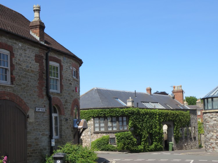
Emerging on Camp Road, follow it round to the right.
Camp Road is interesting because of the varied array of converted stables and coach houses (originally ancillary to the grand houses on the main road beyond but now converted to independent dwellings) that line the left hand side. There is little like it elsewhere in central Bristol.
Returning to Percival Road, cross it and continue straight on into Litfield Road.
Litfield Road continues the intriguing mews-like feel of the previous street, but in a more intimate way.
Litfield Road brings you back out onto Canynge Road. Turn left.
You will pass a set of playing fields belonging to Clifton College, opposite which you will also find the grand Mansion House – the official residence of the Lord Mayor of Bristol.
Continue straight on until you arrive at the busy junction at the top of Bridge Valley Road (14).
Short route
The short route starts and finishes at this point.
This is the tail end of Clifton Down, which forms the smallest and most self-contained part of a large open area known as the Downs. You can explore the more open areas of the Downs in Walk Sixteen ‘Northern Clifton and the Downs’ and Walk Twenty-Four ‘Stoke Bishop and Sneyd Park’.
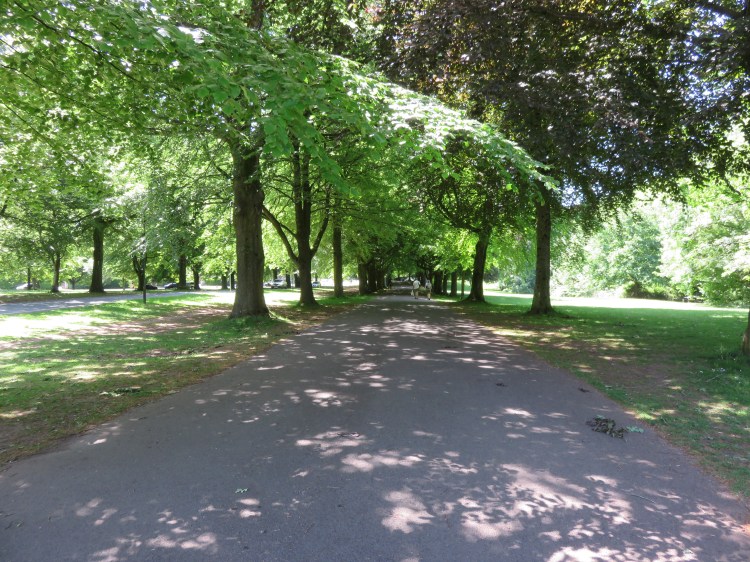
Cross the road to your left to join a broad tree-lined promenade heading back towards Clifton Village.
As you walk along The Promenade, lined with beautiful beech trees, note the large houses across the road to the left: these are the grand residences to which the stables and coach houses that you passed earlier will originally have belonged. One can imagine the wealthy merchants’ wives parading up and down the broad walkway in Regency times.
The broad pathway climbs gradually upwards as the road curves round to the left. As the hill becomes steeper just after the junction with Percival Road, take a right fork onto a narrower footpath that climbs towards a copse (15). The path winds around, taking you towards the cliff edge of the Avon Gorge, until you emerge on an open area known as Observatory Hill.
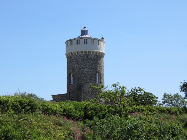
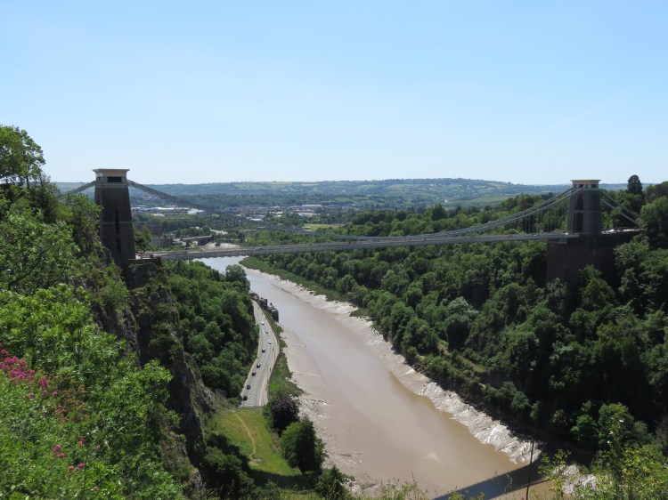
Observatory Hill is a view-commanding cliff-top location that offers fine views of Isambard Kingdom Brunel’s Clifton Suspension Bridge, with the bonded warehouses of the Cumberland Basin distant beyond (see Walk Two ‘The City Docks’). At the top of the hill is the Observatory itself, a stone tower where you can visit the Camera Obscura at the top or descend steep steps into the so-called ‘Giant’s Cave’ below. The observatory started out as a windmill, before being brought into its present use many years ago. On the far side of the Avon Gorge you can see Leigh Woods (see Walk Twenty-Five ‘Ashton Court, Leigh Woods and the Avon Gorge’).
As the footpath around the cliff edge begins to descend towards the Suspension Bridge, you will pass the top of a curiously even-looking rocky slope, which has been gradually polished over the centuries by the bottoms of all the local children who have used it as a slide.
Just after the ‘slide’, take the hard right right down another footpath, which leads down past the bottom of the same rock formation (16).
You will emerge on Suspension Bridge Road right next to the bridge itself. Optionally, you can walk across the bridge to the North Somerset side, to take in the views back towards Clifton.
Cross Suspension Bridge Road and take the footpath opposite, crossing back over Christchurch Green reach Sion Hill. Turn right down the hill.
Sion Hill is a street just below the Suspension Bridge, where an attractive curving terrace of Georgian houses with bow windows and balconies looks out upon the Bridge itself and the Avon Gorge below. There is an excellent photo opportunity to be had half way down the hill if you have a camera.
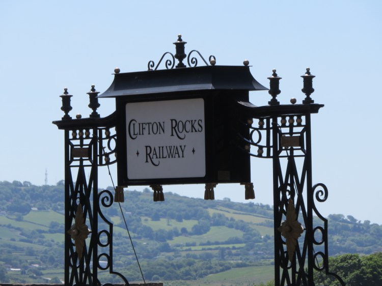
Further down Sion Hill you will pass the turning for Caledonia Place, which you passed the other end of earlier. Opposite, you will find the Avon Gorge Hotel, and also the top station of the Clifton Rocks Railway (17) – a now defunct funicular railway which, incredibly, provided train services between Clifton and Hotwells below via a tunnel running steeply downwards through the cliff. Volunteers have been working to restore the upper station, and if you look down into the pit you will see a mock-up of a carriage protruding from the bricked-up tunnel (which, during the Second World War, found alternative uses as an air raid shelter and an emergency broadcasting station for the BBC).
The Avon Gorge Hotel has a terrace with great views and isn’t a bad spot to pause for a drink if you’re getting thirsty.
Further down Sion Hill, at the junction with Princess Victoria Street, take the steps on the left to access the raised pavement of Wellington Terrace.
Accessible route
There are a number of steps to climb between here and Royal York Crescent.
If you wish to avoid the steps, take the lower pavement at Wellington Terrace and walk along at road level.Take the next left to walk along Royal York Crescent at road level, overlooking the communal garden.
Rejoin the main route at the far end of Royal York Crescent on Regent Street (18).
You will pass between Wellington Terrace on the left and Prince’s Buildings on the right. Prince’s Buildings, once a fine row of semi-detached Georgian villas overlooking the Avon Gorge, has been damaged by unsympathetic infill over the years. Wellington Terrace, meanwhile, contains a mixture of innocuous modern pastiche and period properties.
At the end of Wellington Terrace, before you get to the next junction, climb the flight of steep steps to the left to emerge on the raised pedestrian promenade of Royal York Crescent.
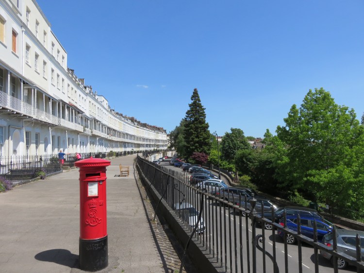
Royal York Crescent is one of Clifton’s finest set-pieces. The grand houses that front onto the raised promenade offer fine views over the Cumberland Basin to Ashton and Dundry beyond. You may, in fact, recognise this crescent as the one that dominated views of the Clifton hillside when you looked from Baltic Wharf, on the Floating Harbour, if you have completed Walk Two ‘The City Docks’.
Royal York Crescent brings you back the main road through Clifton Village, Regent Street.
Turn right into Regent Street (18).
As you walk down through the shops and restaurants, note the two rhythmic terraces that line the curving street – Georgian on one side, and Victorian on the other.
After you leave the shopping area, the road splits in two. Take the left fork, Clifton Hill.
Clifton Hill offers further good views over south Bristol. At the top of the hill, a set of fine iron gates provides access to a secluded area of open space.
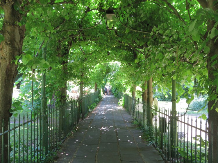
This is St. Andrew’s Churchyard, originally home to the parish church for this part of Clifton. St. Andrew’s Church was ruined during the Blitz, and the surviving tower demolished during the 1960s. The raised area of grass to the right is all that remains of the church itself. Beyond the church foundations, an atmospheric footpath, St. Andrew’s Walk (sometimes known as Birdcage Walk), runs between the graves, enclosed by carefully trained trees, which create a tunnel-like effect until you emerge once again on Queen’s Road at the junction of Clifton Road and Victoria Square (10).
Short route
If you are following the short route, turn left towards Victoria Square and follow the long route instructions from (10) above.
Turn right onto Queen’s Road to continue following the long route.
It’s time to head directly back to the city centre now. Queen’s Road, the main road from Clifton Village to the Triangle, is our route of choice – at least to begin with. Richmond Terrace looms above to the right at first, with small businesses occupying some of the many cellars fronting the lower pavement.
Richmond Terrace gives way shortly to the University of Bristol Students’ Union, a concrete monstrosity which looks rather out of place amidst the Bath stone of Clifton. Opposite, set back from the road, the residential terrace of Buckingham Place is more in keeping with the historic surroundings, as is the freestanding Buckingham Chapel.
When you get to a double mini roundabout (19), turn right onto Richmond Hill.
Richmond Hill will get you away from the busy traffic for a moment. You will emerge back on Queen’s Road just above the Clifton Triangle, as seen in Walk Four ‘The Northern Edge’. The grand Victoria Rooms lie to the left, with the Royal West of England Academy, an art gallery, on the opposite side of the Whiteladies Road junction.
Turn right into Queen’s Road, crossing to the far side at the traffic lights on the corner of the Clifton Triangle (20).
After passing the City Museum and Art Gallery and University of Bristol Wills Memorial Building, turn right down Park Street. Continue along Park Street and College Green to return to the Centre Promenade and complete Walk Five.
If you’d like to round the walk out with a meal, there are several drinking and dining options in the Clifton Triangle area.
Coming Up
In Walk Six ‘The Clifton Hillside’ we’ll be exploring a few of the intriguing nooks and crannies that can be found on the hillside between Clifton and Hotwells, which we have really only touched on in this introduction to Bristol’s most fashionable residential area.
