Last updated: May 2020
Walk Map | Download walk as PDF
Easton, an inner-city area lying a mile or so east of the city centre, has acquired a reputation over the years for being a dangerous part of town, but this is largely undeserved. Like any inner-city community, Easton has its fair share of problems, but it is also a strong, vibrant and multicultural community. Genuine efforts have been made in recent years to raise the profile and reputation of the area, and in Stapleton Road and St. Mark’s Road the tradition of local, independent shopping is very much alive.
This walk begins with an introduction to the tight Victorian terraced houses and colourful shopping streets that so characterise Easton, before branching out to visit some of the area’s major green spaces which border the neighbouring, more suburban neighbourhood of Eastville. After visiting Greenbank Cemetery and Eastville Park, the route ventures onto the area’s disused railway corridors, including part of the popular Bristol and Bath Railway Path.
Useful Information
Terrain: Largely flat, some medium climbs. Includes steep steps (which you can avoid by taking detours, but you will miss out on crossing the Royate Hill railway viaduct).
Ground: Paved and unpaved. Some areas may be soft underfoot on Royate Hill railway viaduct stretch.
Key Attractions: Stapleton Road shops, St. Mark’s Road shops, Greenbank Cemetery, Eastville Park, Royate Hill railway viaduct, Bristol and Bath Railway Path.
Refreshments: Food shops and takeaway food available principally on Stapleton Road and St. Mark’s Road. Eastville Park is a good spot for a picnic.
Starting point: Stapleton Road Station
Getting there: Trains run fairly regularly from Temple Meads Station and at least hourly from suburban stations on the Severn Beach Line. Buses run from the City Centre to Stapleton Road. On-street car parking available in St. Mark’s Road and surrounding streets (cars parked at owners’ risk).
Approx. Time: 2 hours 30 minutes
Approx. Distance: 5 miles
The Route
Our route begins on Platform 1 of Stapleton Road Station, the northbound / west platform. The platform is well-known locally for the mural on the boundary wall, which depicts Easton’s diverse community as well as key historical figures who have visited the area. The church visible to the south, beyond Platform 2, is the former St. Mark’s Church, which we will be passing again later.

Locate the exit onto Belmont Street, at the northern end of the platform (1). Leaving the platform, you will find a flight of steps descending to the north. Take these steps to emerge on Stapleton Road and turn left. If you need to avoid the steps, take a detour via Belmont Street itself to rejoin the main route at the start of the shops (2).
Stapleton Road is the main road through this part of Easton, so called because it leads out to Stapleton Village on the outskirts of Bristol (see Walk 20 ‘Stapleton and the Frome Valley’). As you climb out of the shadow of the railway viaduct, you will pass an eclectic mixture of buildings framing a tiny square of sorts behind which a footpath can be seen leading out to Fox Road. Further up the hill can be seen some reasonably graceful residential buildings on the right. Easton is traditionally a poor area, but Stapleton Road itself is home to some fairly substantial houses (many now converted to flats).
At the top of the hill you will enter one of Stapleton Road’s main shopping areas (2). Colourful shops, most of them independent, occupy the right hand side of the street, while a mixture of terraced and semi-detached houses occupy the left.
If you’re feeling adventurous, there are a number of places to eat and drink on Stapleton Road, although I can offer no specific recommendations. If you’re looking for a more familiar chain option, there is a Subway sandwich bar at the end of the street.
Although slightly scruffy, Stapleton Road certainly has a busy feel to it during shopping hours. After you pass the junction of St. Mark’s Road to the left, the buildings to the right become really quite handsome, culminating in the dignified colonnaded frontage of Kensington Baptist Chapel.
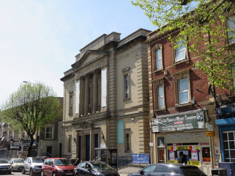
After passing the chapel, take the next left, Villiers Road.
After some initial scruffiness, Villiers Road turns a corner and becomes a respectable residential street, with its terraced houses sporting the bay windows and sandstone cladding more typical of the Victorian development in Bristol’s more affluent areas.
Just before you reach the far end of the street, turn left into Chaplin Road.
Continuing along Chaplin Road, you will see terraced street after terraced street leading off to either side. You are now in the heart of residential Easton. Originally streets like this stretched all the way from here over to Old Market close to the city centre, but post-war redevelopment and road building saw large areas of Easton demolished. Thankfully, areas like Chaplin Road have retained their character without suffering a lot of intervention. Only the neglect of properties by some landlords brings down the appearance of the area.
Chaplin Road is in fact a dead end. Take the final left, Lawrence Avenue, which climbs gradually uphill past more terraced houses, after which it emerges on St. Mark’s Road.
St. Mark’s Road is Easton’s second major shopping street, but this part of it is residential. Opposite, St. Mark’s Grove has been smartened up with heritage street lighting.
Turn right and make your way down St. Mark’s Road towards the railway viaduct (3).
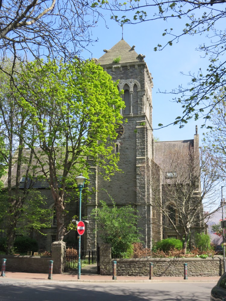
As you pass under the railway viaduct, the feel of the area changes completely as the houses give way to shops at the junction of St. Mark’s Road and High Street. You are now in Lower Easton, a greener and slightly wealthier part of Easton. This junction is dominated by St. Mark’s Church, no longer in use as a place of worship but retaining much of its character. You have returned to Stapleton Road Station, which is on the left (4).
Bear left into the next stretch of St. Mark’s Road.
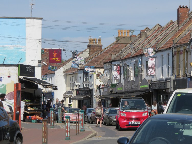
This is one of Easton’s most vibrant shopping areas, anchored by Bristol Sweet Mart, an inviting grocery store selling a variety of fruit, vegetables and ethnic foods. This part of St. Mark’s Road has benefited from investment in new shopfronts, signage and bollards and has a very lively feel to it.
St. Mark’s Road also offers a number of food and drink options, or there is the Black Swan nearby on Stapleton Road.
After a while you will leave the shops, and Lower Easton, behind you as you emerge back onto one of the most down-at-heel sections of Stapleton Road. The stifling presence of the raised M32 Motorway just beyond the buildings on the far side of the road has made it difficult for this area to attract investment. None the less, a number of key businesses survive here, including the listed Black Swan public house on the far side of the road.
Turn right along Stapleton Road and right again at the traffic lights (5) so that you enter Robertson Road.
The long, straight, terraced Robertson Road marks the boundary between Easton and Eastville, which has a more suburban character.
Make your way gradually up Robertson Road, which climbs up towards a kink at the top. Turn right at the kink onto Essery Road.
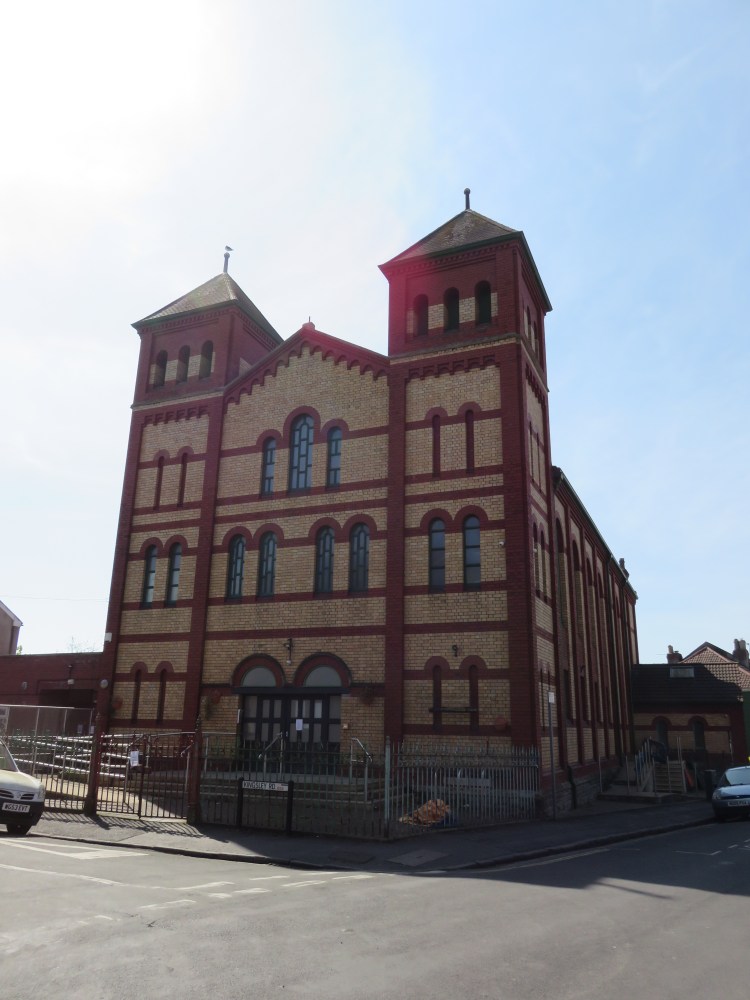
Upon turning into Essery Road you are entering a popular area of Easton known as Greenbank. After a short climb you will emerge on Greenbank Road next to the former Castle Green United Reform Church, now the Greenbank Masjid mosque, sometimes known as the ‘Lego church’ due to its unusual design.
Turn left onto Greenbank Road.
You will find yourself approaching an inviting green space. This is Greenbank Cemetery, a civic cemetery that rivals Arno’s Vale for size but has been better maintained (see Walk Eight ‘Bedminster, Totterdown and Arno’s Vale’). The main entrance is located in a dip just after the last of the houses on the right.
Turn left through the cemetery gates (6).
Alternative route
The exit gate at the far end of the cemetery is sometimes closed. If this happens on your walk, you will need to backtrack to this entrance (6). Go back the way you came along Greenbank Road then take the first right into Thurlow Road, a pleasant but very narrow little street that borders the cemetery. Go straight across the end of Robertson Road into Greenbank View and continue following the perimeter of the cemetery to rejoin the main route just before Gloucester Street (7).

Entering the cemetery, note the gatehouse on the right.
Make your way across the undulating parkland of the cemetery.
The chapel at the centre of the cemetery is sadly vacant and derelict, but the rest of the cemetery provides a well-tended oasis of calm in the middle of a densely developed area of east Bristol. When you’ve finished exploring, aim for the rear gate, which emerges onto Greenbank View in the northern corner of the cemetery (7).
From the rear gate of the cemetery, cross Greenbank View and turn left up Gloucester Street.
Gloucester Street is a very narrow terraced street that leads up through one of the older parts of Eastville. It runs the full gamut of typical terraced house designs of Victorian Bristol. At length you will emerge at the busy junction of Fishponds Road and Muller Road next to a pedestrian crossing. The large, tree-lined green expanse of Eastville Park is opposite.
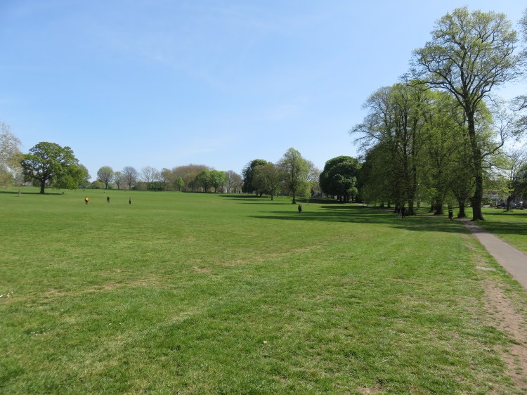
Cross Fishponds Road at the traffic lights and step through the gates of Eastville Park.
Eastville Park is a large Victorian park with a fairly informal layout. The M32 Motorway flyover, which dominates this part of Eastville on the old line of Stapleton Road, looms in the near distance, but the spacious park retains an open and pleasant feel.
Follow the tree-lined footpath down the hill to the left until it splits into two paths. Take the right fork, so that you sweep to the right of the Motorway flyover. At the far end, cut across to the next path and you will find yourself on the banks of the River Frome (8).
The River Frome enjoys its last few moments as an unsullied natural waterway here in Eastville before disappearing into a concrete trench as it heads into town. For a chance to get to know this part of the River Frome better, check out Walk Twenty ‘Stapleton and the Frome Valley’.
Turn right along the Frome Valley cycle path, which follows the river.
You will soon reach one of Eastville Park’s finest features: the secluded former boating lake, which is now popular with anglers. As you make your way around the lake, keep an eye out for ducks and other aquatic wildlife.
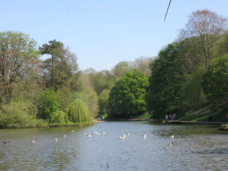
Follow the path around the left hand side of the lake, where a concrete platform is all that remains of the boathouse. Just after the far end of the lake, take a hard right so that you start to climb back towards Fishponds Road (9), then take the left fork to reach a flight of steps that climbs through a wooded area.
Alternative route
You can avoid the steps by taking a longer route via the right fork and then doubling back to (10).
You will emerge back in the main, more open part of the park.
When you reach the main part of the park, bear left (10) and follow the curving path around the edge of the park.
As you pass through the upper section of the park you will pass a disused outdoor pool, which is now an architectural curiosity. Soon you will converge once again on Fishponds Road close to its busy junction with Royate Hill (11).
The Queens Head on the corner of Royate Hill is another chance for a refreshment stop.
Leave the park by the gates next to the traffic lights. Cross Fishponds Road and Royate Hill, then make your way down the right hand side of Royate Hill.
The imposing Royate Hill Viaduct dominates the view, all that now remains of a branch line that once connected Fishponds and Ashley Down, crossing the Frome Valley at Eastville.
Take the first turning on the right, Edward Street.
Alternative route
The next part of this walk takes in the view from the top of the Royate Hill Viaduct, which is now part of a nature reserve. Unfortunately it is only accessible by steep steps.
If you need to avoid the steps, continue down Royate Hill instead of taking Edward Street. Pass under the viaduct and then climb the main road on the other side, Rose Green Road, bordering Greenbank Cemetery.
Towards the far end of the cemetery, take the first left to rejoin the main walk at Clay Bottom (14).
Edward Street will return you to Greenbank View at the back of the cemetery (7). Look for a footpath on the left just outside the cemetery railings, where decorative signs welcome you to Royate Hill Local Nature Reserve.
Climb the flight of steps here, which will take you up onto the old railway embankment (12).
After a moment you will find yourself crossing the Royate Hill Viaduct that you saw a few moments ago. The embankment and viaduct offer scenic views over Greenbank Cemetery as well as the valley to the left, which is known as Clay Bottom.
After crossing Royate Hill, the footpath is enveloped in trees.
Make your way along the path until a road is visible converging on the path to the right (13).
Here, a second flight of steps takes you down off the railway embankment and onto the grass verge of Crabtree Walk, an access road leading to Council flats.
Make your way down Crabtree Walk so that you emerge at the junction of Wainbrook Drive and Clay Bottom. Go straight across Clay Bottom (14) and through the parking area beyond, going through the gate on the far side.
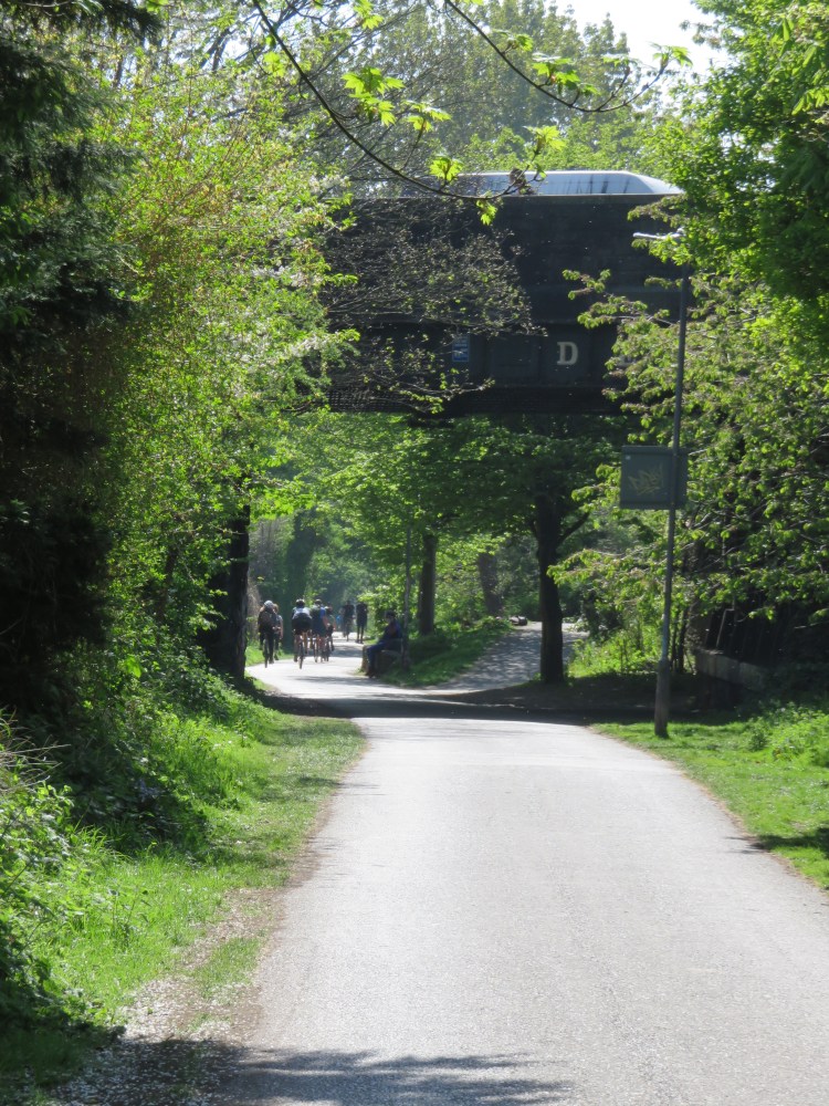
You will find yourself on the popular Bristol and Bath Railway Path, which, as well as providing a car-free route for pedestrians and cyclists, serves as a kind of linear park running all the way through northeast Bristol from the City Centre to the countryside beyond Kingswood. At one time, this was the Midland Railway, running originally from a terminus at St. Philip’s with an additional branch line to Bath Green Park Station.
Turn right along this leafy route, watching out for high-speed cyclists.
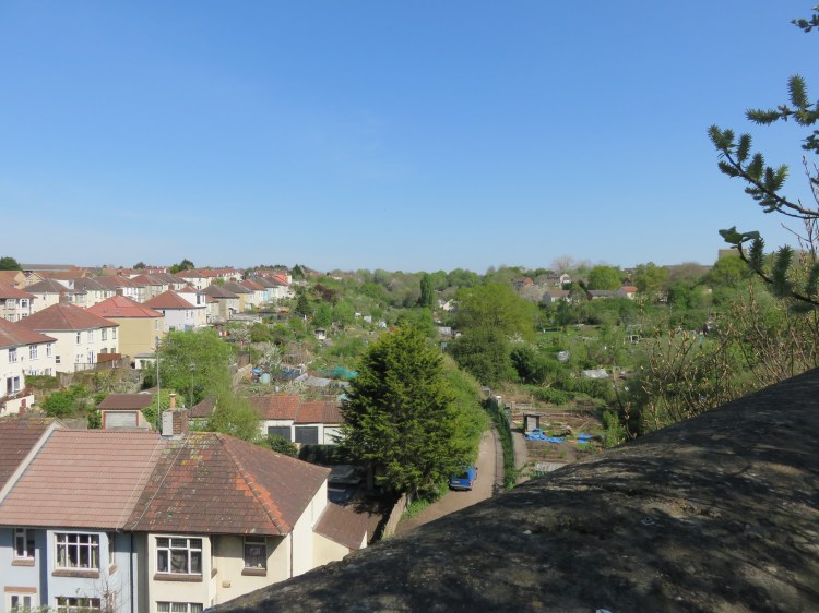
Making your way gently down the railway path, you will soon see Greenbank Cemetery off to the right, quickly followed by the site of the former Elizabeth Shaw chocolate factory (15), now being redeveloped for housing. To the left, as you pass the former factory, you will see allotments and tennis courts. After that, the railway path enters Easton, and your next landmark will be the Devon Road bridge, which spans the railway path here.
After passing under Devon Road you will pass the cul-de-sac ends of a series of residential streets on the right, where the presence of the railway effectively interrupted the development of the area, and now forms a natural boundary between Lower Easton and Whitehall.
When you reach the Owen Square Play Park, located in a dip to the right of the railway path (16), come off the railway path and cut through the play park so that you emerge at the bottom of Chelsea Road next to the Bristol Central Mosque. Turn right onto Chelsea Road. The pleasant and occasionally tree-lined Chelsea Road leads you gradually back towards the heart of Lower Easton. To the right you will pass a succession of terraced streets which climb the hill in the direction of Greenbank; there are no turnings opposite, however, because of the main Great Western Railway line, which runs to the rear of the houses on the left.
The Chelsea Inn on Chelsea Road is a final opportunity for a drink on this walk.
Chelsea Road splits two ways as the railway emerges from behind the houses as a viaduct beside the left fork (17).
Take the right fork, Roman Road.
You will pass between a small children’s play area and a compact but imposing former factory building. Shortly you will find yourself amidst shops once again as Roman Road emerges on High Street, with the familiar sight of St. Mark’s Church opposite.
Turn left onto High Street to return to St. Mark’s Road next to Easton Masjid Mosque. Climb the footpath here (4) and cross the footbridge to reach Stapleton Road Station and complete Walk Eleven.
Coming Up
In Walk Twelve ‘St. Paul’s and St. Werburgh’s’, we will be exploring the inner city areas to the north of the city centre. Beginning with a visit to multicultural St. Paul’s, we will then venture out to the calm of the Ashley Vale Allotments and St. Werburgh’s City Farm before plotting a course back through the bohemian neighbourhood of Montpelier and the artistic dilapidation of Stokes Croft en route back to the city centre.
