Last updated: July 2020
Walk Map | Download walk as PDF
At time of writing, Arno’s Vale Cemetery is running limited opening times for general visitors due to Covid-19. Access to the cemetery is essential for this walk, so please check before you travel.
Please also note that the cemetery gates are locked overnight. Opening times vary by season.
Our exploration of the areas immediately to the south of the city centre continues with this undulating walk. The route starts with a visit to Bedminster’s high street, before branching east to take in the terraces of Windmill Hill and leafy Victoria Park. From there, we head across the edge of Knowle to reach the atmospheric seclusion of Arno’s Vale cemetery, before returning to Bedminster via the hilltop streets of Totterdown.
It’s worth noting that there’s more to discover in Bedminster. For those wanting to get to Bedminster better, we’ll be returning to the area in Walk Seventeen ‘The Malago, Crox Bottom and Nover’s Hill’.
Useful Information
Terrain: Steeply hilly. Includes steep steps (can be avoided by taking detours).
Ground: Paved and unpaved. Some areas may be soft underfoot in Arno’s Vale Cemetery.
Key Attractions: Windmill Hill City Farm, East Street shops, Victoria Park, Perrett Park, Arno’s Vale Cemetery, Paintworks, Totterdown hillside routes, River Avon New Cut.
Refreshments: There are a range of pubs and eateries available at the start of the walk. Towards the end, Wells Road offers a further choice. There are also one or two other opportunities to refuel en route.
Starting point: Bedminster Bridge Roundabout
Getting there: 20 minutes’ walk from Centre Promenade and 15 minutes’ walk from Temple Meads Station or Bedminster Station. Widely accessible by bus routes to Hartcliffe, running to the bottom of Redcliff Hill from Broad Quay. Small car parks available at Bedminster Parade and Little Paradise, and on-street parking available at weekends in industrial estates behind York Road (cars parked at owners’ risk).
Approx. Time: 3 hours
Approx. Distance: 5.0 miles
The Route
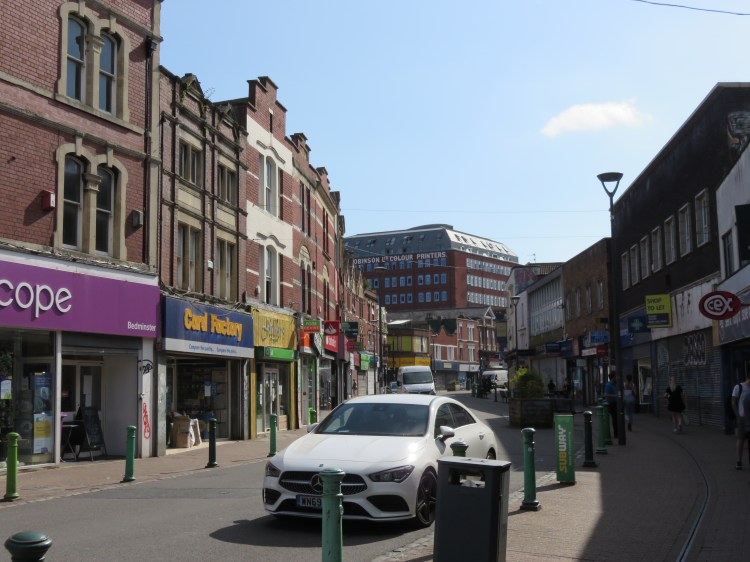
As with Walk Seven ‘The New Cut and Southville’, our route starts at the Bedminster Bridge Roundabout. This time, though, head straight down into Bedminster’s high street – which starts here as Bedminster Parade.
Unassuming Victorian shops frame this busy historic thoroughfare at first, but it’s not long before more imposing properties begin to take over. The first notable building we pass is the fortress-like former Bedminster Police Station, complete with tower, on the right hand side of the road.
Bedminster Parade has a number of drinking and dining options if you would like to start or end your walk with a meal or a coffee. For example, Grounded is a smart café that does food and excellent cakes. Ganesha is a perfectly acceptable local Indian whose speciality is its dosas. There is a McDonald’s at ASDA for the fast food lover.
Soon after the former police station note St. Peter’s Court, an attractive Victorian building on the corner of Regent Road, after which is the ASDA supermarket, constructed to a robust commercial design. Note also the ornate former Natwest Bank opposite.
Most imposing, however, are a pair of former tobacco factories located shortly beyond ASDA, where Bedminster Parade becomes East Street at the junction with Philip Street (1). These dramatic factory buildings act as a strong focal point for the area, and have been sensitively converted to other uses, with shops occupying a colonnaded walkway on the East Street frontage.
Windmill Hill City Farm
For an optional detour, turn left along Philip Street opposite ASDA. Windmill Hill City Farm is a short distance along on the right. Visitors can meet a range of farm animals surrounded by trees and allotments. The charity also provides a range of other services and is an important part of the local community.
Afterwards, return to East Street (1) to continue the main walk.
Beyond the converted tobacco factories, the busy traffic is taken away to the left onto Dalby Avenue.
Continue straight on into the next section of East Street, which is semi-pedestrianised.
Bedminster’s high street now takes on a small market town feel, with a mixture of low-rise buildings, both Victorian and post-war, and a blend of independent shops and national chain stores. The names of the side streets as you make your way along East Street hark back to Bedminster’s origins as a rural village: Mill Lane; Little Paradise; Church Lane.
If you’re thirsty, take your pick of the pubs that line Bedminster Parade and East Street. In any of them, you’re likely to find a pretty local crowd.
Stop at the junction with Warden Road and Church Lane (2).
Ahead is the looming red brick edifice of the Robinson building and the original centre of the village of Bedminster, where East Street, West Street (see Walk Seventeen ‘The Malago, Crox Bottom and Nover’s Hill’) and North Street (see Walk Seven ‘The New Cut and Southville’) loosely converge, but there is little evidence of that history remaining now. Turn instead into Church Lane and follow it until you reach an enclosed green area on the right (3).
This green area is the site of St. John’s Church, originally the principal parish church of Bedminster, now sadly lost. One memorial remains to signify the green area’s history as a churchyard.

Church Lane continues past the green area as a footpath. The footpath and the road beyond will lead you to Malago Road, a continuation of Dalby Avenue which diverts car traffic away from East Street, with the railway embankment ahead of you.
Turn left onto Malago Road.
Malago Road is named after the stream which runs nearby (see Walk Seventeen ‘The Malago, Crox Bottom and Nover’s Hill’).
Cross Malago Road at the traffic lights and take the cycle path beyond.
Providence Place was once a residential street, but is now just a footpath that crosses an area of green space (4). You will arrive at the end of Whitehouse Lane opposite the railway embankment.
Cross over and climb Windmill Hill.
Windmill Hill is a narrow street which passes beneath the railway. Note the entrance to Bedminster Station on the left.
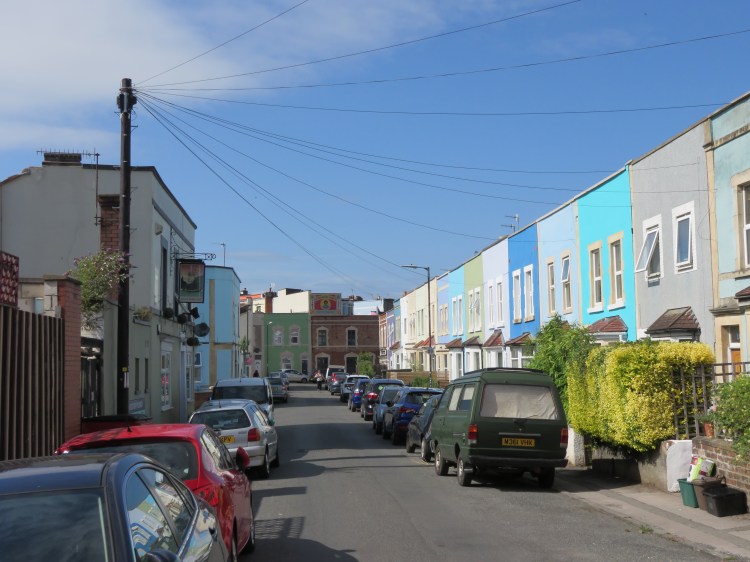
Windmill Hill is also the name of a distinct, fairly self-contained neighbourhood within the greater Bedminster area, which along with nearby Totterdown provides many a distinctive tableau of colourful terraces clinging to the hillside when viewed from a distance. Windmill Hill’s steep gradients and cramped streets also make it a challenge to navigate by car.
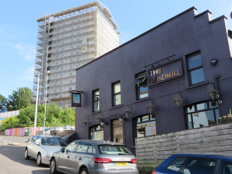
The Windmill has always been a popular spot for a pint, serving the mixed community of the up-and-coming Windmill Hill area (closed and awaiting new management at the time of writing).
Take the second left, Gwilliam Street.
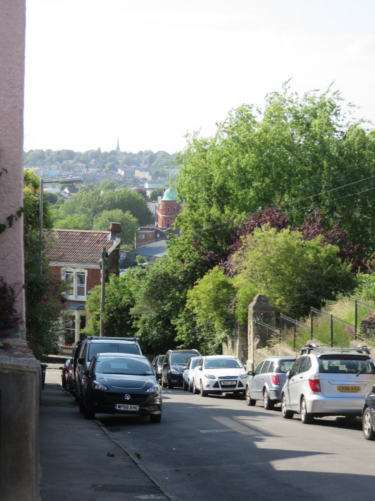
Gwilliam Street is a typical Windmill Hill terraced street that typifies the mixture of incomes and professions to be found in the area. At the top of Fraser Street, note the many-gabled structure of St. Michael and All Angels’ Church and the view out over Bedminster and Clifton beyond.
Turn right onto Fraser Street, left onto Vivian Street and then right into Orwell Street. At the top of short Orwell Street, turn left onto Somerset Terrace.
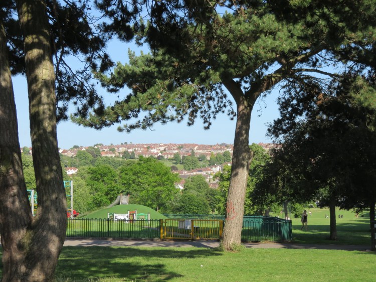
Somerset Terrace is a charming street running along the very top of the hill, which boasts a colourful terrace of flat-fronted houses on its south side. As you make your way down the cul-de-sac, you will find yourself approaching a set of park gates (5).
You will arrive in Victoria Park, one of Bristol’s largest city parks, which straddles the hilltop here. The park was created by the Wills Tobacco company, which then dominated employment in the Bedminster area, in a philanthropic gesture. Today, the well-used park offers three children’s playgrounds, a basketball court, football pitches, a wheels park, a water maze and many opportunities for walking, running and fitness training. To the left, glimpses of the distant city centre can be seen between the tall trees. There are some pretty basic toilets available in the two-storey park lodge just inside the gates.
Head to the right and follow the footpath that runs down the right hand edge of the park, adjacent to Nutgrove Avenue, through an avenue of lime trees.
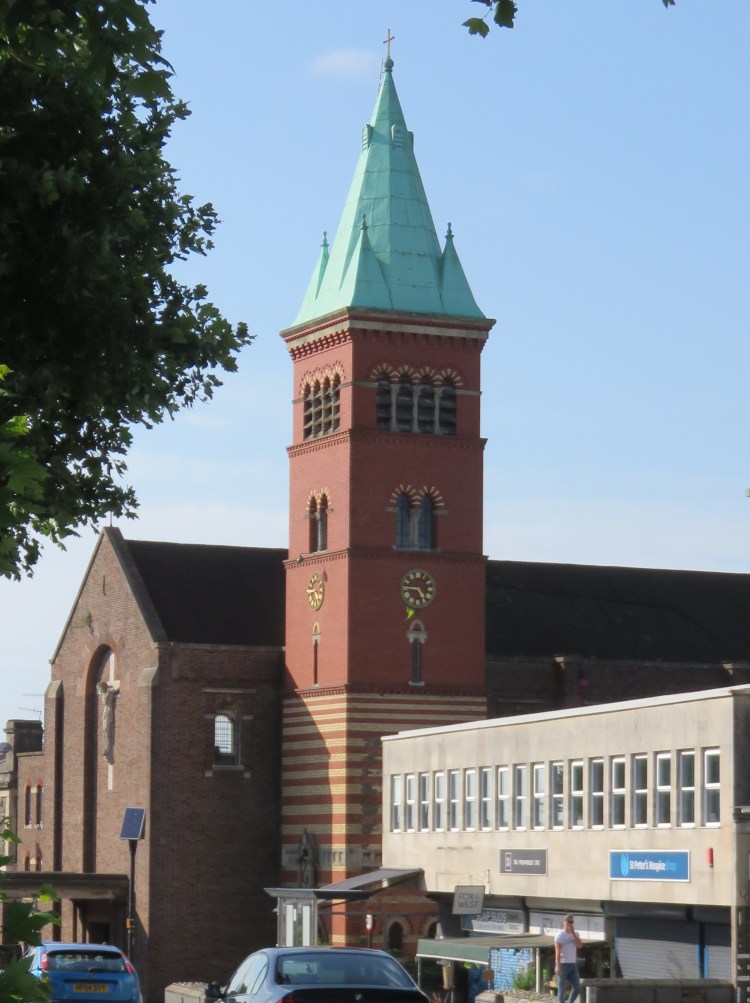
Note the views of Knowle and Totterdown ahead and to the left, particularly the red brick tower and distinctive green copper roof of Holy Nativity Church, which lies on Wells Road. Closer at hand nestled at the bottom of the Totterdown slopes, you may also glimpse the dome and minaret of Bristol Jamia Mosque on Green Street.
Stuffed, based in a kiosk at the rear of the park lodge at the top of Victoria Park, is a good place to grab a coffee or a snack.
At the bottom of the hill, exit the park and go straight on into Park Avenue.
Park Avenue will bring you out on the local main road, St. John’s Lane, at the junction of Redcatch Road, which climbs up into Knowle.
Turn left onto St. John’s Lane until you have passed the mini roundabout, then cross over and climb the next residential street, Sylvia Avenue.
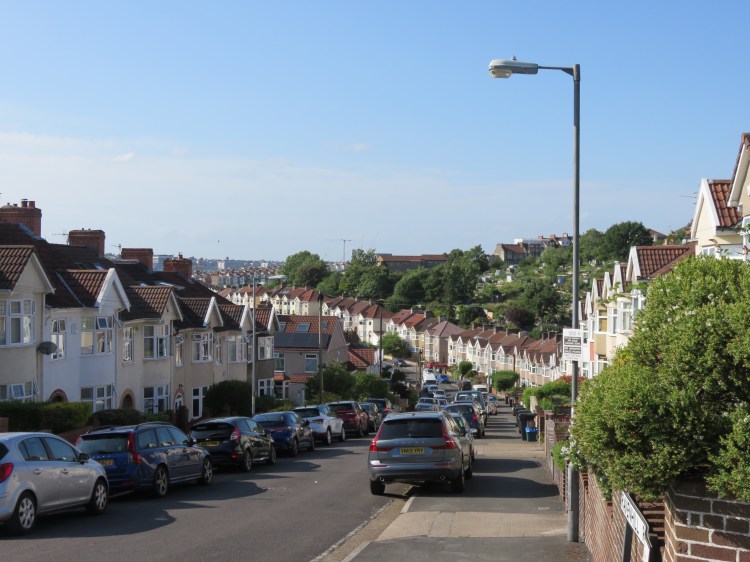
Sylvia Avenue climbs the hill from beside Victoria Park Baptist Church. You are now on the edge of Knowle, and the Victorian terraced housing of Victoria Park has given way to between-the-wars semi-detached properties. As Sylvia Avenue climbs the hill, some of the houses on the right are raised above street level, giving them the benefit of long distance views over central Bristol.
At the junction at the top of the hill (6), pause to look at the view.
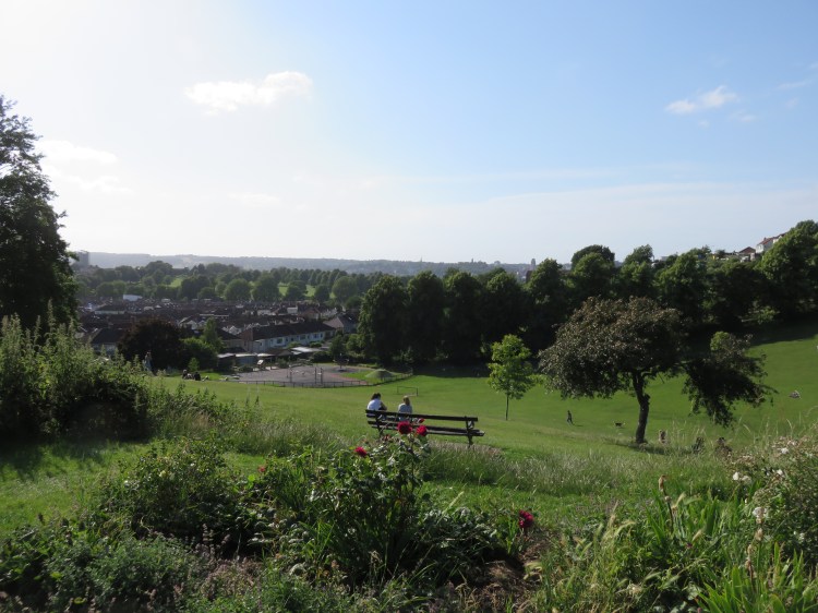
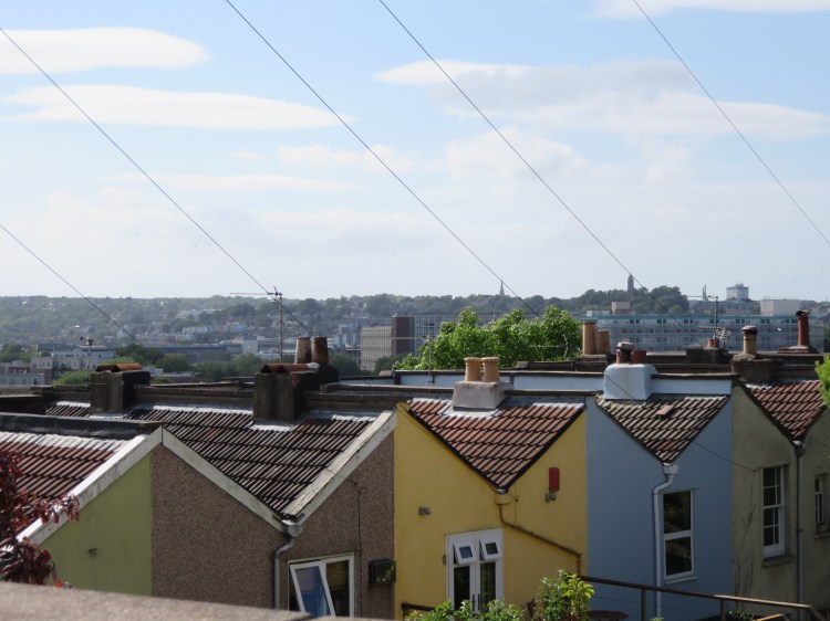
The view over Ravenhill Road is an interesting scene of rolling rooftops, the Perrett Park Allotments and the distant skyline of Bristol City Centre.
Continue straight across the junction into the next section of Sylvia Avenue.
We have now reverted to Edwardian terraced housing. These substantial, attractive properties occupy a view-commanding position facing Perrett Park and the allotments beyond.
Look out for a park gate on the left giving access to a footpath along the top of the park, parallel to Sylvia Avenue.
From within the park, the views across Bristol can be truly appreciated. Close at hand, you can look back over Windmill Hill and Victoria Park. In the distance you can see the North Somerset countryside and the skyline of Clifton and the Suspension Bridge.
Returning to the road at the corner of the park, cross Bayham Road into Crowndale Road.
Crowndale Road is one of a series of attractive, tree-lined streets that link Wells Road with Perrett Park. This one boasts substantial semi-detached properties which rival the wealthier parts of north Bristol. Shortly you will emerge on Wells Road itself close to the attractive Totterdown Baptist Church, a symmetrical design faced with stone.
Wells Road, the busy A37 bound for the Mendip hills, is partly residential and partly commercial. We will be returning to Wells Road later on.
This stretch of Wells Road provides a number opportunities for refreshment, including food stores and the popular Acapella café. Meals tend to be served in the evenings rather than during the day.
Cross over at the traffic lights, and then take Sydenham Road (just to the right of the lights).

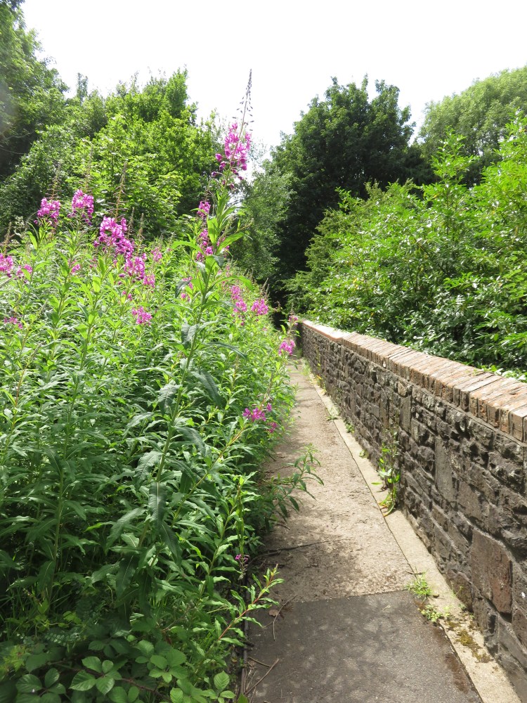
A pleasant residential street with gabled terraced houses in various pastel shades, Sydenham Road is typical of Totterdown. Less typical is the greenery visible at the far end of the street, which indicates that we are nearing Arno’s Vale Cemetery.
At the end of Sydenham Road, turn left onto Clyde Terrace and then right onto Cemetery Road to approach the upper cemetery gates (7).
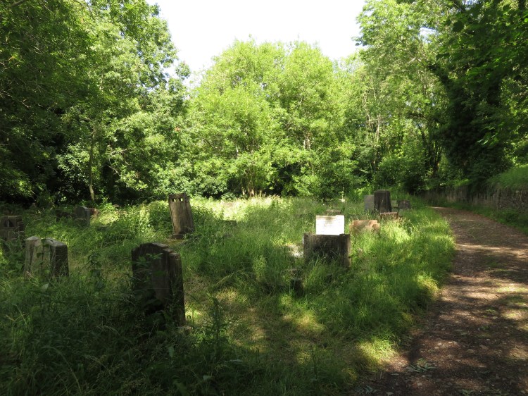
Arno’s Vale Cemetery has a chequered history. The massive estate, heavily used from the 19th Century to well into the 20th Century, was allowed to fall into decay following a long period of private ownership. The cemetery is now managed by a charitable trust and is subject to an ongoing programme of restoration. However, due to the spread of fast-growing tree species and creepers, the inner parts of the cemetery have developed a fascinating wilderness quality.
There are many routes you could take down through the cemetery, and feel free to take whichever route you fancy to get to the lower gates, but my suggested route would be as follows.
Begin with a walk around the upper part of the cemetery. Follow the main driveway round to the right from just inside the gates.
The upper part of the cemetery remains reasonably open, and is merely slightly run-down, boasting colourful displays of meadow flowers during the summer.
Follow the driveway until you reach a war memorial (8). Take the path on the left.
You will pass Sailors’ Corner, a series of well-kept naval gravestones in white marble, which resemble the wartime cemeteries of northern France.

When you reach a stone wall, head to the left and follow the straight path until it curves round to merge with another, parallel path below.
You will arrive behind the cemetery’s derelict upper lodge, which has definite haunted house potential.
Turn left past the upper lodge to return to the main driveway just inside the main gates (7). Turn right down the main driveway.
The main driveway is a pleasant route, but there is more interest to be found by turning off it again.
At the next junction, next to an open area signed as ‘Sunshine Corner’ (9), turn right onto a stony track next to a wall.
After a few moments you will pass the Underwood Centre, an educational facility used to engage with young people in the area.
Continue straight on past the Underwood Centre, still following the stony track.
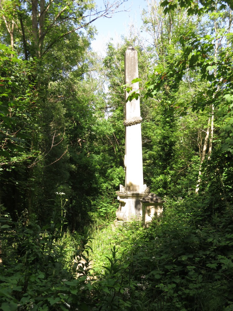
You are now entering the middle part of the cemetery. The middle part of the cemetery is the most overgrown and intriguing; notice how the area has become wooded with self-seeded trees, which have thrust their way out of the graves, cracking memorials and dislodging headstones. Obelisks are overgrown with creepers and threaten collapse. The area has a feeling of abandonment and seclusion despite the distant sound of traffic on Bath Road. There is also plenty of bird life in this part of the cemetery.

Look for a well-made path heading gently down the hill to the left past an unusually tall obelisk (10), which is the tallest monument in the cemetery.
Following this path, work your way down through the wilderness.
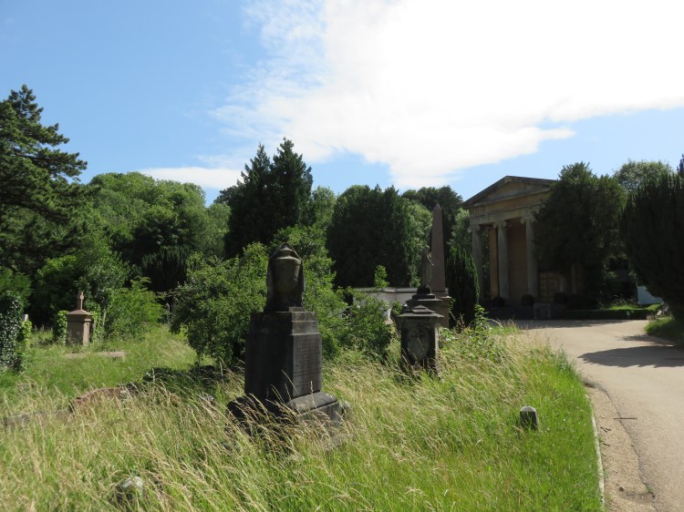
At length, the path emerges in the lower part of the cemetery, close to the elegant Anglican chapel.
Follow the driveway round to the left.
As you follow the driveway round towards the nonconformist chapel with its imposing colonnaded façade, you will notice that the cemetery has become neater and better tended. You will pass the Garden of Rest and, notably, the ornate tomb of Raja Rammohun Roy (11), the noted Indian social reformer, who died in Stapleton, Bristol in 1833 after contracting meningitis (see Walk Twenty ‘Stapleton and the Frome Valley’). His statue can be found on College Green (see Walk One ‘Introduction to Bristol’).
The nonconformist chapel is home to the Atrium Café, which may be a good opportunity to pause for a drink and a cake.
When you have finished exploring the cemetery, exit through the main gates onto the A4 Bath Road.
Busy Bath Road is, as the name would suggest, the main road between Bristol and Bath. There is a cluster of cemeteries here. St. Mary Redcliffe Cemetery can be seen through a pair of iron gates on the far side of the road, while Holy Souls Catholic Cemetery directly adjoins Arno’s Vale Cemetery to the right.
There are a couple of food options a bit further along Bath Road, including a decent curry house and a Burger King.
Turn right onto Bath Road, crossing at the traffic lights by the Bristol Blue Glass showroom, then turn left onto Edward Road.
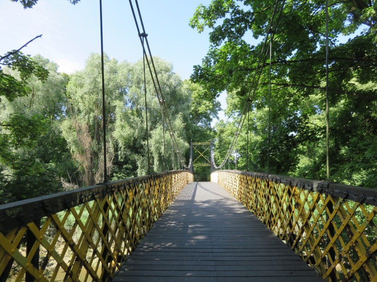
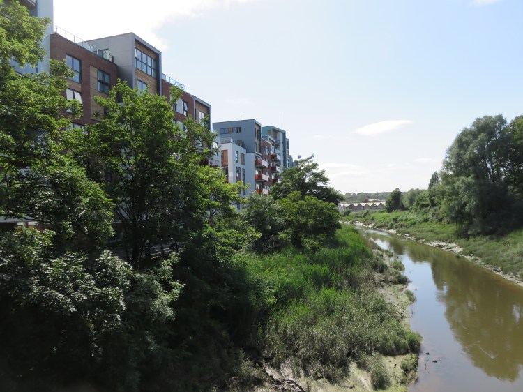
Edward Road is an ordinary terraced residential cul-de-sac, part of the small neighbourhood that shares its name with the cemetery, Arno’s Vale. At the end of the road is a footpath that will take you to the River Avon.
Just before you reach a yellow suspension bridge providing access over the river (12), turn left into the Paintworks development.
River Avon route extension
By now you may be feeling like you would like to start heading back towards Bedminster, in which case continue on the main route. However, if you would like to see more of the River Avon and don’t mind adding an extra climb to the walk, you can try this optional route extension.
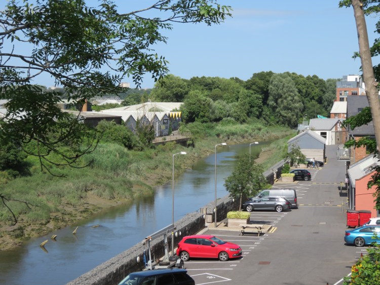
Instead of turning left into the Paintworks, cross the yellow suspension bridge (12) and turn left onto the path that runs along the river. Part of the Whitchurch Way cycle route, the path skirts the industrial area of St. Philip’s Marsh, following the tidal River Avon as it winds around the foot of Totterdown. Keep an eye out for birds on the water.
After a while you will pass under Totterdown Bridge, which carries traffic over to Bath Road. Keep going straight on. Before long, you will reach the back of the RSPCA’s Bristol Animal Rescue Centre. Look out for the dogs carved into the brickwork next to the path.
Take the steps next to the Animal Rescue Centre to climb up onto a walkway next to an imposing iron railway bridge painted Bristol blue. Cross the river and climb May Walk, a winding footpath that will return you to Bath Road next to the Three Lamps Junction, with its distinctive finger post pointing the way to Bath and Wells.
Turn left along busy Bath Road. Follow the footway, glimpsing views over St. Philip’s Marsh between the trees and noting the wildlflowers that grow in the verge. When you reach the traffic lights at the turning for Totterdown Bridge (13), rejoin the main walk.
The Paintworks is a new neighbourhood that has developed in recent years on the banks of the River Avon, on the site of a former trading estate. This first section is entirely new-build. As you walk along the pleasant riverside road, you will catch glimpses of a number of elevated residential ‘streets’ at the top of stairs on the left. Explore them, if you like, to find some unusual public art.
In due course, you will be able to walk along the whole river frontage of the Paintworks but, at the time of writing, part of the site is still being redeveloped. At the far end of the first section of the development, turn left to follow the road inland. At the end of the road, turn right into Central Road.
Central Road is the main spine of the Paintworks and takes its name from the site’s past life as the Central Trading Estate. You will soon find yourself among the older buildings on the site, former industrial and distribution buildings that have now been converted sensitively to new uses. The many alleys and courtyards are now home to a variety of workshops and galleries. Eventually you will emerge back on Bath Road opposite a forbidding row of tall terraced houses.
If you would like a drink or a bite to eat before climbing back up to Totterdown, the lively and welcoming Bocabar at the Paintworks is a great place to stop for a drink that also offers good food. Alternatively, you can get a drink at the Thunderbolt, a bit further down the road past the traffic lights.
Turn right along Bath Road.
Bath Road will afford you an interesting elevated view of the River Avon and the industrial buildings of St. Philip’s Marsh.
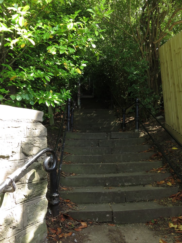
Continue along Bath Road until you reach the traffic lights at Totterdown Bridge (13) (the River Avon route extension rejoins the main walk here). Cross Bath Road at the lights and double back briefly until you reach the bottom of a steep flight of steps leading back up the hill.
Begin climbing the steep, leafy Thunderbolt Steps to return to Totterdown. It’s quite a long climb, so take it gently.
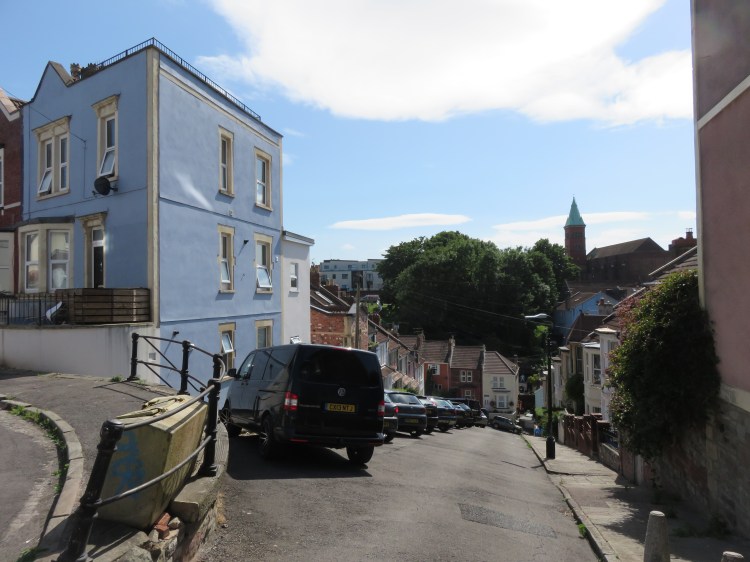
At length you will emerge on the incredibly steep Upper Street, where the terraced houses genuinely look like they are about to “totter down” the hill. Note how the residents have had to park their cars at an angle to the curb for safe keeping.
Alternative route
Walkers wishing to avoid the steps can take an alternative route via Summer Hill, Parliament Street, Park Street and Vale Street to rejoin the main route at the top of Upper Street (14), but be warned that the climb is still extremely steep.
You are now in a well-kept neighbourhood known locally as Upper Totterdown. At the top of Upper Street (14), pause for a look down Vale Street. Notice the differences in height between the eaves of the terraced houses. With a gradient of 1 in 3 at its steepest point, Vale Street is said to be the steepest residential street in England.
Continue straight on into Arno’s Street.
Arno’s Street will lead you to the confusing Victorian jumble that is Hillcrest School. From there, the street continues round the corner as School Road. Follow winding School Road, past a popular local playground (15), to return to Wells Road. There are good views back across to Vale Street as you pass the park.
Turn right onto Wells Road so that you are heading gently downhill.
Leafy Wells Road forms the boundary between Totterdown and Knowle. On the right, you will pass the red brick Church of the Holy Nativity with its green copper-roofed clock tower that you saw earlier, a key south Bristol landmark that is visible from many locations within central Bristol, including Temple Meads Station.
As you continue down Wells Road you will reach a small shopping area. Here, large green swathes to either side of the road and modern houses and flats signify how a large area of central Totterdown was needlessly demolished to make way for a multi-level road interchange that was never built. The finest building remaining in this stretch of Wells Road is probably the former Lloyds Bank on the corner of Bushy Park (16), a grand three-storey building in brick and Bath Stone. The ground floor is now home to the Banco Lounge bar.
This area offers your last chance for refreshments on this walk. Farrow’s sells some of the best fish and chips in Bristol. If you would like a sit-down meal or even just a drink, then you can’t go wrong with the Banco Lounge, which is part of a local chain that has now gone nationwide. If you prefer the idea of a more local pub, then try the Oxford on nearby Oxford Street. Other options for drinks include the New Found Out on Henry Street, the Shakespeare on William Street or the Star and Dove at the foot of the hill on St. Luke’s Road.
At the traffic lights, cross Wells Road and the end of St. John’s Lane then cut through to the left of the Tesco Express store on the corner to reach Oxford Street.
Oxford Street is frontier territory where the historic terraced housing still remains on one side of the street. You are now entering the area known locally as Lower Totterdown, which has a distinctly different feel to Upper Totterdown, partly due to the design of the houses, which lack the prominent front gables of Arno’s Street, but also due to the denser and more inner-city feel of the area.
Turn right along Oxford Street. Passing the Oxford, turn left onto Cheapside Street and right onto Henry Street.
Henry Street is another typical Lower Totterdown street. As you pass the turning for Windsor Terrace, you may recognise the house on the far corner from the BBC TV series Being Human.
As you descend Henry Street, the side turnings to the left offer views towards Victoria Park. On the corner of Green Street you will find the New Found Out, while at the far end of Henry Street you will find the Shakespeare.
Turn right past the Shakespeare onto William Street and then immediately left onto Cambridge Street.
Negotiating Cambridge Street requires another brief climb – don’t worry, it’s the last one.
At the end of the road, turn left onto Richmond Street.
Richmond Street crests the northernmost ridge of Totterdown and is visible from the Bedminster Bridge Roundabout, where this walk began. The terraced houses on the right hand side of the street are afforded tremendous views as a result.
At the far end of Richmond Street, you will find yourself at the top of another steep of steps (17).
Descend this route, known as St. Luke’s Steps, to reach St. Luke’s Road opposite Victoria Park.
On the way down St. Luke’s Steps note Clifton View, a small residential terrace on the right which distinguishes itself by having no road access at all.
Alternative route
Walkers wishing to avoid the steps can take a detour via Pylle Hill Crescent and Windsor Terrace. En route you will have the opportunity for a closer look at Bristol Jamia Mosque, occupying a converted church at the bottom of Green Street. Rejoin the main route via St. Luke’s Road (18).
Turn right along St. Luke’s Road (18).
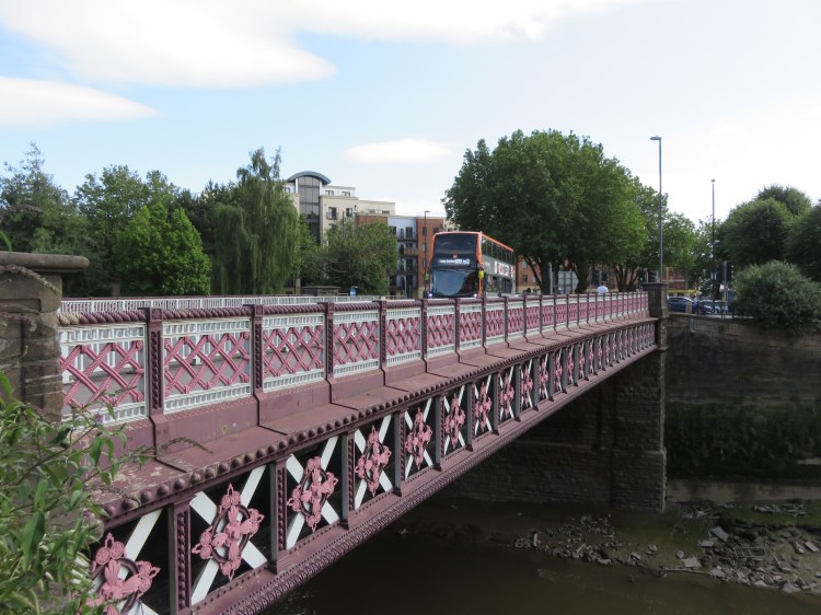
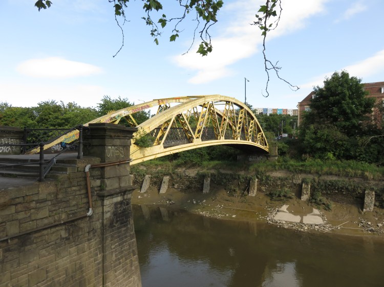
St. Luke’s Road provides a back route into Totterdown from the River Avon, past the edge of Victoria Park. After a short while you will pass through an echoing underpass under the Bristol and Exeter railway line. Then, after a few bends in the road, you will emerge on York Road opposite the Langton Street Bridge (known locally as the Banana Bridge due to its shape and colour) (19).
Cross the Banana Bridge and turn left along Clarence Road.
Clarence Road offers the best views of the River Avon New Cut and the terrace of Richmond Street on the hill behind you as you make the short return trip to the Bedminster Bridge Roundabout to complete Walk Eight.
Alternative route
If you wish to avoid the steps on the bridge, turn left instead and return to Bedminster Bridge Roundabout to complete the walk via York Road.
Coming Up
In Walk Nine ‘Knowle, Windmill Hill and the Northern Slopes’ we will explore a remarkable sequence of green spaces. We will return initially to Victoria Park before following the River Malago to the foot of Nover’s Hill. From there we will explore the diverse and panoramic spaces of the Northern Slopes, the best-kept secret of south Bristol.
